


Top 7 Highest Mountains in Turkey

Turkey is a country that spans both Europe and Asia, with 97 percent of the country located in Asia and the remaining 3 percent in Europe. Turkey has a diverse ... read more...geographical landscape shaped primarily by volcanic eruptions and frequent earthquakes. Mountains are among the most prominent natural features in the country. Greater Ararat, Gelyansin, Suphan, and Kackar Dagi are the highest mountains.
-
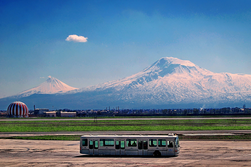
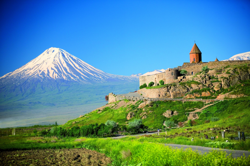
Mount Ararat is a dormant compound volcano in eastern Turkey. Mount Ararat is Turkey's highest point; it is located twenty miles south of Armenia and ten miles north of Azerbaijan and Iran. The mountain is 5,137 m above sea level and has two volcanic cones: Greater Ararat (5,137 m) and Little Ararat (3,896 m). Due to global warming, the snow on top of the mountain has significantly decreased, and it is now estimated to cover only 3.1 square miles, a 29 percent decrease in the last 35 years.
According to the Bible, Noah's ark landed in the Ararat Mountains. However, most scholars believe that Ararat referred to Armenia as a whole, rather than just the mountain. The peak of the mountain was under Persian control until 1828 when the Turmenchay Treaty was signed following a Russo-Persian war. Little Ararat became Turkey's, Russia's, and Persia's shared border. Another boundary change, the Tehran Convention, in 1932, favored Turkey because the mountain was now under her control. The Iran-Turkey border had now extended east of lower Ararat.
To this day, some Armenians claim a portion of this massive mountain. Armenians protested against the Turkish Prime Minister's visit to the country in November 2010. The Armenian government, on the other hand, has never made an official claim to the Turkish government regarding the mountain.
Height: 5,137 m
Location: Iğdır and Ağrı provinces, Turkey
penguintravel.com 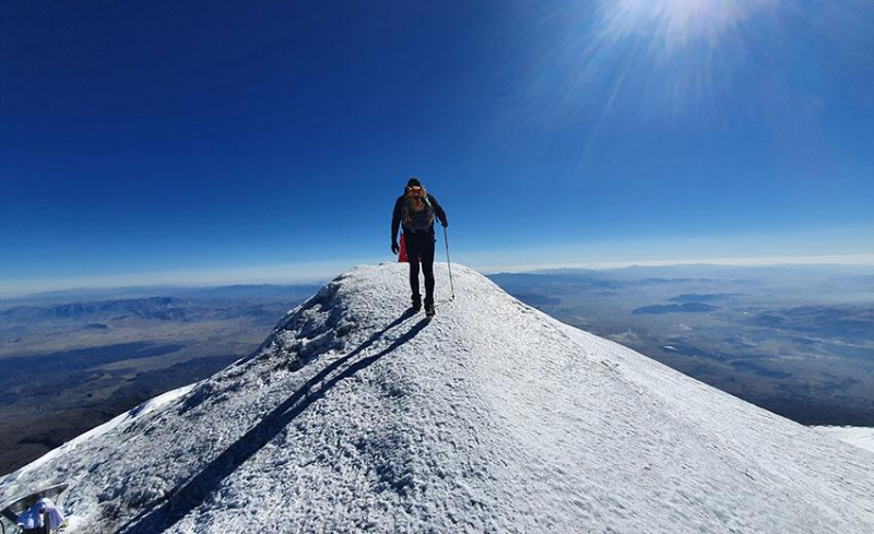
penguintravel.com -
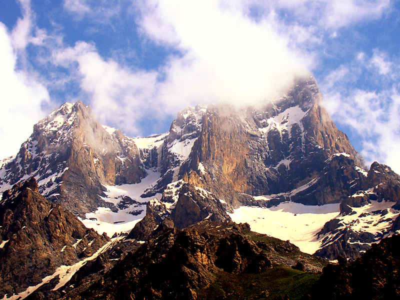
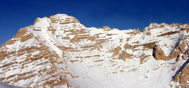
The Cilo-Sat mountains, located in Turkey's southeastern Hakkari province, are the eastern extension of the Toros (Taurus) mountain chain, which runs from west to east along the country's southern borders. The mountain range is located in the western part of the Himalayan mountain belt. The Uludoruk summit, at 4136 meters, is the highest in the Cilo mountains; Catalkaya (Samdi), at 3794 meters, is the highest in the Sat mountains.
The Cilo-Sat mountains, which resemble the Alps in general appearance and glacier topography, are the glacier-affected areas of Turkey. The mountains' high altitudes attest to the effects of glacial formation and water erosion. The largest of the ten glaciers, Izbirak, measures five kilometers in length and 500-600 meters in width. It has a depth of up to 100 meters.
A wide arid expanse stretches across the mountain range's southern base. The highlands, on the other hand, receive a lot of rain during the winter. Between crests and summits, fertile green valleys dotted with rural settlements enjoy a temperate climate ideal for wine and fruit agriculture. Alpine meadows cover the mountain slopes above the low valleys at altitudes ranging from 2000 to 3100 meters. Domestic animal herds graze on these pastures, which serve as the region's primary economic activity.
Height: 4,134 m
Location: Hakkari, Turkey
wowcappadocia.com 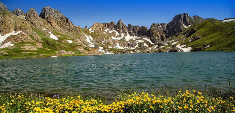
wowcappadocia.com -
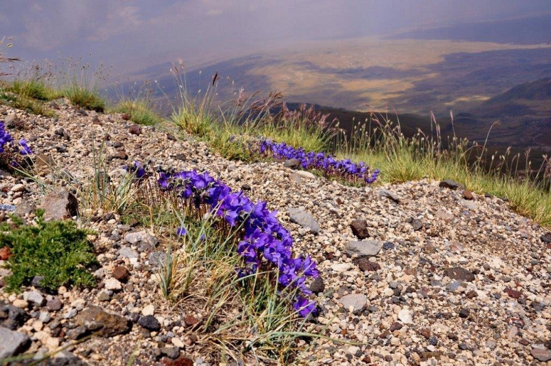
Suphan mountain's highest point is 4,058 m. At the top, one can see stunning views of Lake Van as well as Turkey, Iran, and Armenia. This mountain is popular among amateur mountaineers due to its ease of ascent. The mountain is covered in beautiful wildflowers and native birds, which are most visible in the summer. The Kurdish tribe lives on the mountain's slopes. It is home to the world's largest open-air museum.
Adilcevaz is the best place to start. You can get there from Tatvan by taking the Ahlat route or from Van by taking the Ercis route. The southern route begins in Harmantepe village, while the eastern route begins in Aydinlar. You can take a taxi or a dolmus (small bus) from Adilcevaz to Aydinlar or Harmantepe, or you can hitchhike.
Height: 4,058 m
Location: Bitlis Province, Turkey
tripadvisor.com 
tripadvisor.com -
Kackar Dagi, at an estimated height of 3,932 m, is the highest peak in the Kackar mountains. Mount Kaçkar is about 40 kilometers from the Black Sea Coast and 70 kilometers from Georgia's eastern border and the port city of Batumi. The Turkish coastal cities of Rize and Trabzon are approximately 70 and 120 kilometers west of the mountain, respectively.
The surrounding mountain ranges are approximately 400 kilometers long and comprise the eastern third of the Pontic Mountains. This stretches for about 1000 kilometers along the Black Sea and, with its numerous parallel chains reaching up to 200 kilometers inland, is part of the Alpine orogeny, meaning it formed at the same time as the Alps. The mountain is composed of granite and diorite rocks. Butterflies, wolves, Ibex, and wild boar can all be found here. The most well-known villages near the mountain's base are Cat, Ayder, Hevek, and Tekkale.Climbing the mountain in the winter is more difficult than in the summer. During the winter, snow covers the mountains and the high pastures, and the houses vanish completely. Avalanches are very common on the glacier slopes.
Height: 3,932 m
Location: The eastern Black Sea, parallel to the coast between Rize and Hopa
dreamofcampervan.blogspot.com 
dreamofcampervan.blogspot.com -
Little Ararat, also known as Mount Sis or Lesser Ararat, is a large satellite cone located on the massive Mount Ararat's eastern flank, less than 5 mi (8.0 km) west of Turkey's border with Iran. Despite being dwarfed by its larger and more famous neighbor, Little Ararat is an important volcano in its own right, with an almost perfectly symmetrical, conical form and smooth constructional slopes. Little Ararat rises approximately 1,296 meters above the Serdarbulak lava plateau, which forms a saddle that connects it to the main peak.
This mountain can be found in the Giresun Province. Mount Sis festival is a festival that takes place every year. This festival attracts a large number of people each year. Visitors to this festival are required to wear traditional attire. The very first festival took place in 1830. The mountain's average elevation is 2182 meters. There is also a Mount Sis plateau known as "Sis Dagi Yaylasi."
Height: 3,925 m
Location: Görele, Giresun Province, Turkey.
traveltriangle.com 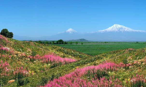
traveltriangle.com -
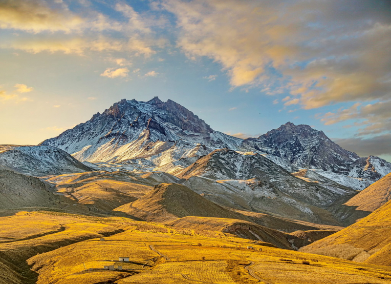
Mount Erciyes, also known as Argaeus, is a Turkish volcano. It is a large stratovolcano surrounded by numerous monogenetic vents and lava domes, as well as one maar. The majority of the volcano is made up of andesitic and dacitic lava flows. Part of the summit collapsed to the east at some point in the past. Mount Erciyes proper, along with a group of lava domes, grew inside the caldera during the Pleistocene. During the early Holocene, lateral eruptions of Erciyes may have produced ash layers in the Black Sea and the Mediterranean.
It is the highest peak in Central Anatolia and an inactive volcano. A 700m mountain glacier can be found on the northern slope, and the Tekir plateau, which is a winter sports center, can be found on the eastern slope at an elevation of 2100-2900 meters. In the winter, the hike from the ski lift to the Cobaninine campsite takes about 212 - 3 hours. The climb from Cobaninine to Mola tasi, at the head of Seytan Creek, takes about an hour and is popular on cross-country skis. It takes about 2-3 hours to reach the summit of the smaller peak from here. Avalanches are a risk in Seytan's Creek during the winter, and it is necessary to wear a helmet in the spring (May and June) due to falling rocks.
Height: 3,916 m
Location: Kayseri Province, Turkey
peakvisor.com 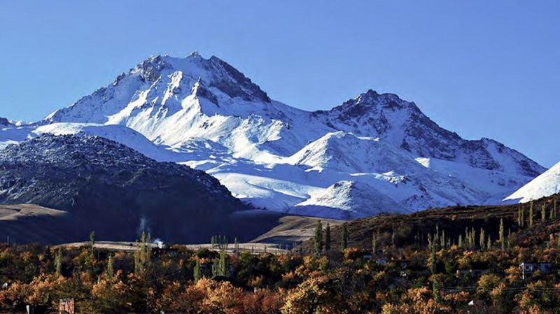
peakvisor.com -
The Aladaglar is a Turkish mountain range. They are home to the highest peaks of the Taurus mountains in the east. The Aladaglar Mountains, which stretch across the provinces of Nigde, Adana, and Kayseri, are popular destinations for mountaineering and rock climbing. Kizlkaya, the mountain range's highest peak. This mountain range is 25 kilometers wide and 40 kilometers long. This mountain range contains more than 60 peaks that rise above 3000 meters. All of these peaks have classic ascent routes as well as technical climbing routes. There are over 170 traditional climbing routes on these peaks.
Sector Kizilkaya is a fun south-facing sector with 7+ routes ranging in difficulty from 7+/8- to open projects. This cliff face has excellent vertical climbing with the occasional overhang. Strong fingers on small crimps is the winning combination for most cruxes. The bolting is simple, so bring plenty of quickdraws and be ready to have a good time.
Height: 3,767 m
Location: Aladağlar National Park between the provinces of Niğde and Kayseri, Turkey.
peakvisor.com 
peakvisor.com


