


Top 10 Highest Mountains in Vietnam

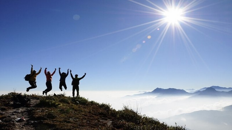
Have you ever lived your life to the fullest with passion when you were younger, have you ever broken down barriers and surpassed your own limits? By ... read more...conquering the towering peaks, you can marvel at nature's majestic beauty. Join Toplist to discover about the top 10 highest peaks in Vietnam.
-
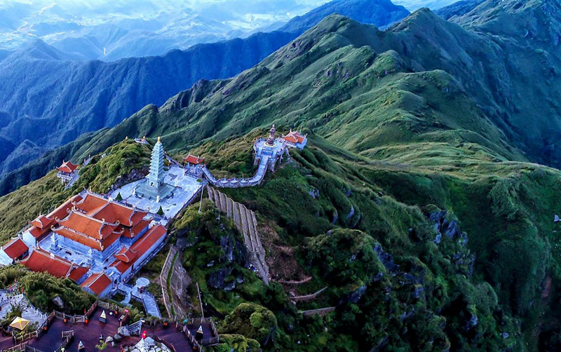
Fansipan Peak, located about 9 kilometers west of Sapa Town, belongs to the Hoang Lien Son Mountain Range and is the tallest mountain in Vietnam, standing at 3,143 meters. It has been dubbed "the Rooftop of Indochina." Fansipan translates to "Hua Si Pan" in the local language (aka Huge Rock).
Climbing the top of Fansipan, you will enjoy all the wonderful things that the nature of the mountains and forests here bestows such as: watching the scenery of clouds and wind mixed with grass and flowers in the forest, going through huge rocks, the deep holes, craggy cliffs, or forest of red Do Quyen flowers on the mountain, clouds cover the way.
Conquering Fansipan's summit is a challenge in and of itself because you must be physically fit and have extensive hiking and trekking experience. Hiring a local guide or porter to escort your groups is highly recommended because he can lead you on the right and safest trekking path; assist you with carrying some items, and prepare meals while on the journey.
Height: 3,143 m
Location: Fansipan Summit, Hoang Lien Mountain, Lao Cai Province.
bestprice.vn 
bestprice.vn -
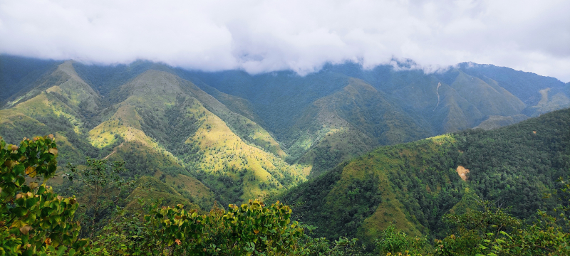
Pusilung Peak is located in Pa Ve Su commune, Muong Te district, Lai Chau province, which borders China. This is Vietnam's second-highest mountain after Fansipan. The 3-day 2-night climbing arc with a total length of more than 60 km is the dream destination for those with climbing experience because it is the longest and harshest arc in the Northwest. To reach the summit, climbers must pass through 11 large and small streams, pristine primeval forests, sections of reed forest, thatched grass, bamboo forest, chestnut, oak, and ancient golden rhododendron.
From the edge of the forest, you can see the white reeds, overlapping with the wind. The poetic scenery is extremely rare during the journey to conquer Pu Si Lung. In addition to those stunningly beautiful moments, there are countless difficulties waiting. The simple wooden bridge that hangs over a large stream with many slippery rocks and cold water are challenges you must overcome if you want to reach the majestic Pu Si Lung peak.
The best time to go to Pu Si Lung is in spring and summer. When the mountain rains began to subside. You should note that the higher you go, the air will become thinner, so you need to prepare mentally and prepare for any situation that may happen on the long way.
Height: 3,083 m
Location: Pa Ve Su Commune, Muong Te District, Lai Chau Province.
vnexpress.net 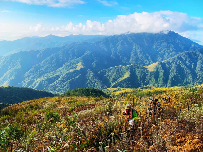
vnexpress.net -
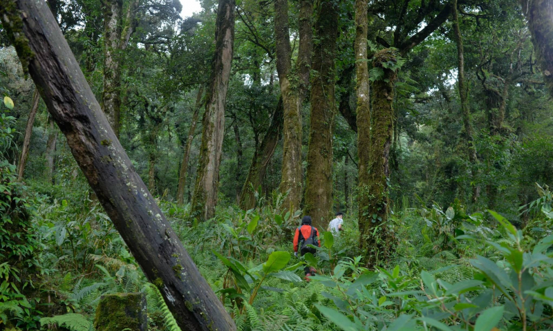
Mount Putaleng can be found in Ta Leng commune, Tam Duong district, Lai Chau province. The long climbing arc, steep mountain terrain, takes about 2 days and 1 night to complete, beginning in Pho village, Ho Thau commune, and ending in Ta Leng street, to see all of the beautiful scenery of the mountains and have different climbing experiences. The road to Putaleng winds through the gentle Thau stream, with large rocks forming small, fresh, and cool water reservoirs in many places.
Unlike Fansipan, which has developed the cable car system as well as provided many support services for climbing, tourism, and commercial purposes. In Putaleng is still literally a primeval old forest, possessing unspoiled beauty that anyone who has the opportunity to admire must be captivated. The road to conquer Pu Ta Leng peak is inherently beautiful, but seeing the colorful rhododendron flowers is really what makes the Northwest mountain scenery more poetic and romantic than ever.
Putaleng's "difficult" challenge consists of three steep mountains with no flat sections, many climbers having to swing up the branches of forest trees, and in some places having to crawl on four limbs... The path is mostly shaded by the forest canopy, allowing you to avoid the hot sun.
Height: 3,049 m
Location: Ta Leng Commune, Tam Duong District, Lai Chau Province.
dulichvietnam.com 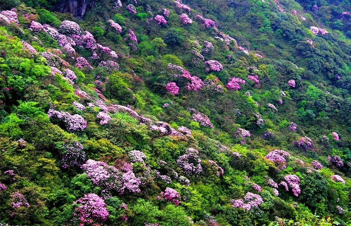
dulichvietnam.com -
Vietnam's fourth highest mountain at an altitude of 3046m, is the natural boundary of the two provinces of Lao Cai and Lai Chau. This is a mountain whose name is mistaken for another mountain, but due to its popularity, it is difficult to correct its name. Therefore, the name Bach Moc Luong Tu has been used as its official name up to this point.
To reach the top of Bach Moc, visitors have to climb a long distance of about 30km on the forest road. Not only that, you also have the experience of climbing through many different terrains such as bare hills, bamboo forests, large wooden forests, dwarf bamboo forests to moss-covered cliffs.
Visitors can choose to depart from either of the two provinces. The bow from Sang Ma Sao commune, Bat Xat district, Lao Cai, on the other hand, is the most popular. With its highest peak of over 3,000 meters, Muoi mountain in the Ky Quan San range is one of the most beautiful places in the northern mountainous region to watch clouds and sunrise. Visitors who climb Ky Quan San in May will be able to see the terraced fields of the Mong people during the pouring water season.
Height: 3,046 m
Location: Belongs to Ky Quan San range, located between Lai Chau and Lao Cai.
alongwalker.co 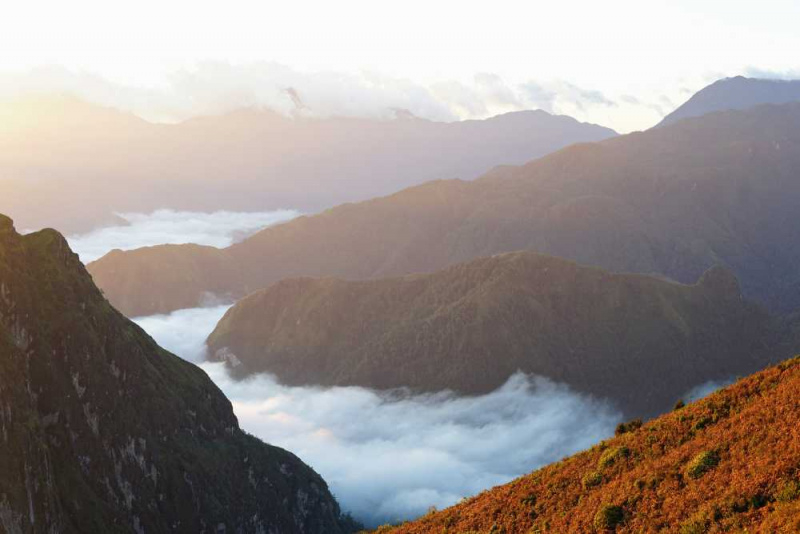
alongwalker.co -
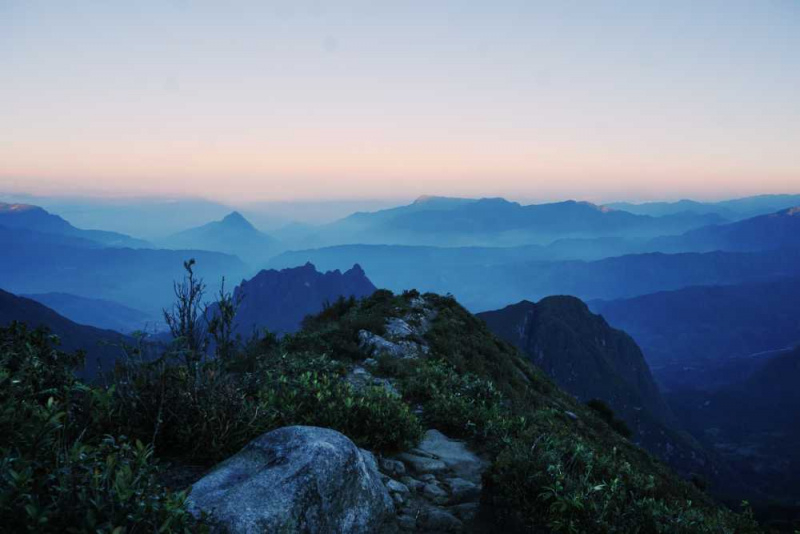
Khang Su Van is 3012m high above sea level, belongs to Pa Vai Su commune, Phong Tho district, Lai Chau province. The highest peak on the border of the country. This is a wild and charming peak among the high peaks of the Northwest. Khang Su Van peak ranks 5th in the top 10 highest mountains in Vietnam.
Conquering Khang Su Van is a difficult task. There are times when you feel like giving up after overcoming many steep mountain slopes, wading streams, and crossing forests. The difficulty is that once you reach the summit, you are extremely proud and happy because you have surpassed yourself, affirming your ability to conquer in the midst of vast nature.
The natural scenery along the way was breathtaking, poetic, charming, and wild. The wildflowers bloom proudly; the sound of birds chirping mixed with the murmur of streams in the fresh, pure atmosphere occasionally subtly emits the fragrance of the mountains and forests, making you feel at ease and at ease; Thousands of rhododendron trees of various ages are adorned in the old forests with carpets of white flowers, yellow flowers, red flowers, and so on, which cover the entire body with moss in the mist, making the natural scenery even more beautiful. become enigmatic The scenery is still unspoiled, and everything belongs to the original things created by mother nature's hands.
Height: 3,012 m
Location: Pa Vai Su Commune, Phong Tho District, Lai Chau Province.
hitfit.vn 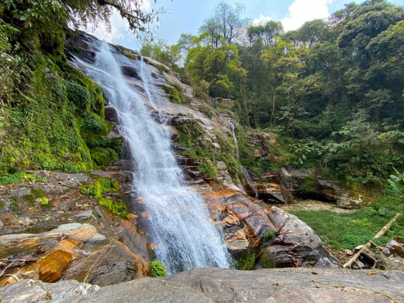
hitfit.vn -
Ta Lien Son also known as Co Trau, is the highest peak in Ta Leng commune, Tam Duong district, Lai Chau province. Ta Lien peak is usually reached in two days and one night. Ta Lien's forest is still very wild, with mossy and mysterious trees that are hundreds of years old. Climbing Ta Lien is not difficult; currently, a rest stop at an altitude of 2,400 m is available for rest. Make sure you have a thin coat, basic medical supplies, and two days' worth of water. Ta Lien is best climbed between April and May when the azaleas bloom, and September and October, when the maple forest turns color.
The locals and trekkers all refer to this location as the fairy forest, which has a diverse flora and fauna ecosystem and a plethora of blooming wildflowers. No one has fully explained this location until now, and the description of Lien Son remains a mystery. The scenery here is majestic, standing from various heights, you will have different views as well as the scenery on the lower side, changing hands according to the vision, making you overwhelmed and excited when the grandeur and beauty of the world are boldly depicted here.
Height: 2,996 m
Location: Ta Leng Commune, Tam Duong District, Lai Chau Province.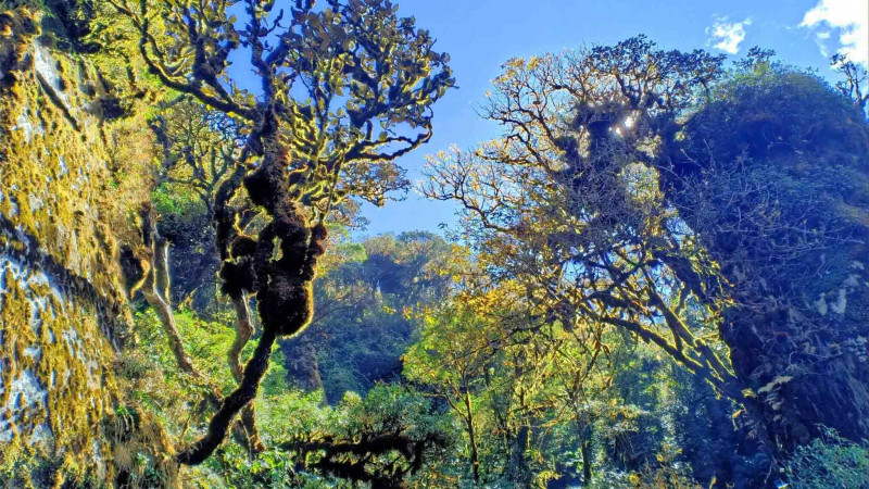
laichau.gov.vn 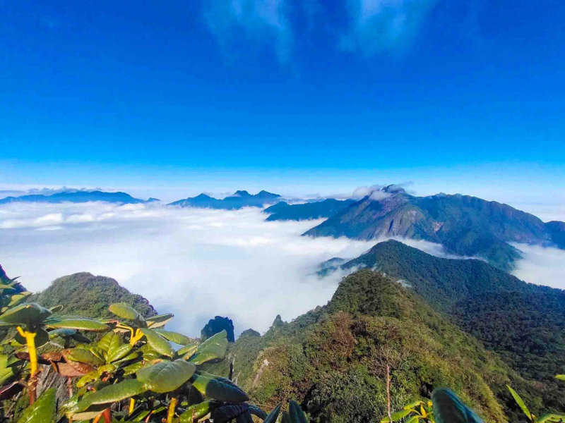
laichau.gov.vn -
Ta Chi Nhu also known as Phu Song Sung by Thais and Chung Chua Nha by Mongs, is located in the Pu Luong massif of the Hoang Lien Son range. The roof of Yen Bai province is known as the "cloud heaven on earth" and is located in Xa Ho commune, Tram Tau district. It was first visited by tourists in 2013 and is known as "cloud heaven on Earth." The purple flowers of chi pau continue to dominate the last days of autumn. "Chi pau" means "don't know, don't understand" in the local Hmong language, and refers to the pale purple flower that blooms for months on end along the mountainside, enticing many tourists.
The Chi Pau flower, with its distinctive purple color, is one of the "specialties" of the Ta Chi Nhu mountains and forests. When you visit Ta Chi Nhu between the end of October and the beginning of November, the scenery of the hills covered in extremely poetic purple will take your breath away.
You will reach the summit of Ta Chi Nhu after a somewhat difficult and arduous journey. Especially from the top of the hill, you can interact with the floating clouds. The clouds are gentle, drifting as if they were silk, smooth and floating. The mountains looming in the distance blend in with it. When you come here, you will undoubtedly feel very excited, as all of your difficulties and fatigue will have vanished.
Height: 2,979 m
Location: Tram Tau District, Yen Bai Province.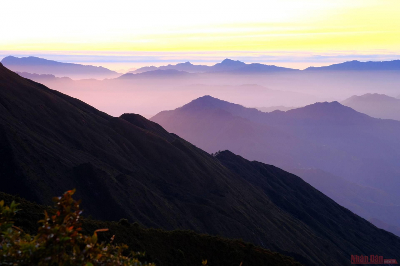
vnexpress.net 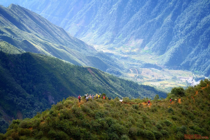
vnexpress.net -
Since 2017, travelers have been aware of the Po Ma Lung peak in Ban Lang commune, Phong Tho district, Lai Chau. Although it is only ranked eighth among Vietnam's top ten highest mountains, the altitude at which people climbing Po Ma Lung must pass is very high, nearly 2,200 m (from 800 m above sea level to nearly 3,000 m), a journey of more than 40 km of mountain roads in 3 days and 2 nights to successfully conquer Po Ma Lung peak and return to Ban Lang commune.
Po Ma Lung has been compared to a forgotten "garden of paradise" because of its wild beauty, which includes flower beds that stretch on both sides of the mountain, a system of majestic waterfalls, and a primeval forest that glows in the sunlight. At the end of the season, the maple trees turn the entire forest red in the morning. It will be a magical attraction for any trekker who enjoys exploring and experiencing new things.
Height: 2,967 m
Location: Ban Lang Commune, Phong Tho District, Lai Chau Province.
stour.vn 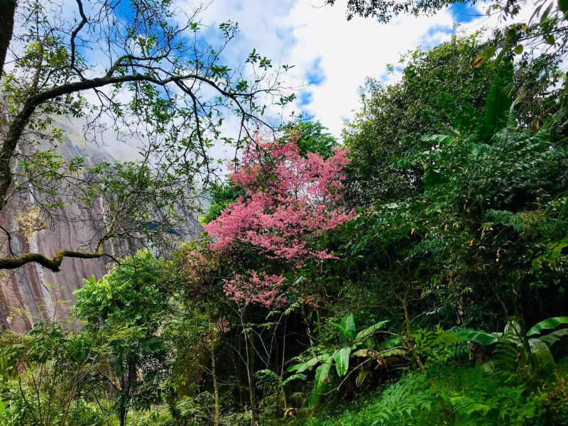
stour.vn -
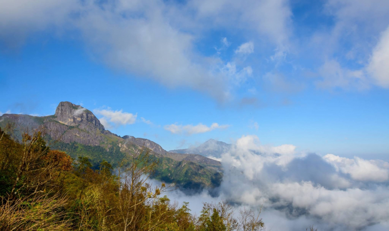
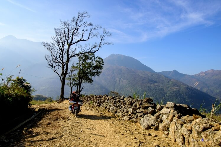
Nhiu Co San is located in Sang Ma Sao commune, Bat Xat district, Lao Cai province, and means Horn of Buffalo in the Mong ethnic group. The Nhiu Co San mountain range has two peaks that bend like a buffalo horn and point out into the sky. The top of Nhiu Co San mountain is immersed in red and purple colors during the azalea season in March and April, and it is frequently covered in snow in late December and early January. The climbing route also follows the ancient Pavi stone road, which was built during the French colonial period in the early twentieth century.
The climbing route is a continuous steep slope, passing through bamboo forests, primeval forests, overcoming cliffs, clinging along streams with slippery mossy wet rocks, but compensating for the wild and beautiful natural scenery. Both sides of the road are blooming with various flowers: myrtle flowers, purchased flowers, flowers, azaleas of various colors intertwined racing to bloom; beneath the canopy of forest trees are lush green cardamom fields with fresh and pure air. When you reach the top, you burst with joy because there is a sea of white clouds floating in front of your eyes, and the natural scenery is very vivid and poetic.
Height: 2,965 m
Location: Sang Ma Sao Commune, Bat Xat District, Lao Cai Province.
wecheckin.vn 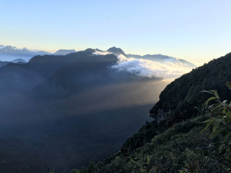
wecheckin.vn -
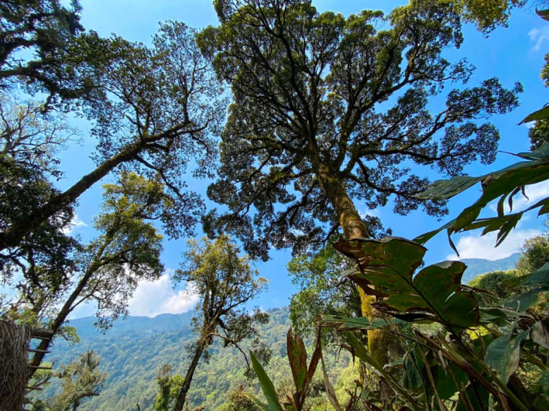
Chung Nhia Vu Peak in Nam Xe commune, Phong Tho district, Lai Chau, is a natural boundary on the Vietnam-China border, near landmarks 83 and 84; the mountain's foot is near landmark 85. Tourists travel from Hanoi to Sa Pa, then to Y Ty, and finally to Nam Xe. The road to Chung Nhia Vu is mostly along streams, through almost intact primeval forests with large trees reaching 50 meters in height. The mountain is quite remote from the population and serves as a natural barrier to China, attracting communities from three different regions to conquer it.
As one of the highest mountains in Vietnam with a short route and not too difficult to go, easy to move during the day. The terrain is mainly bamboo forest, bamboo forest, big stream, and cardamom forest. The climbing forest is blessed by mother nature with many natural specialties that you can enjoy.
Height: 2,918 m
Location: Nam Xe Commune, Phong Tho District, Lai Chau Province.
limtravelling.com 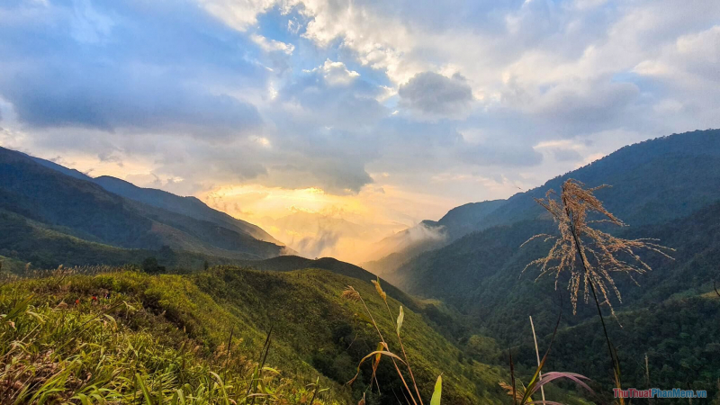
limtravelling.com


