


Top 10 Longest Rivers in Albania

Albania is a small European country with numerous rivers, streams, lakes, and springs. The state's inland waterway network includes 150 tributaries and 11 ... read more...major rivers. More than 200 springs feed the tributaries and provide safe drinking water. The Drin River in the north and the Seman and Shkumbin Rivers in the south are the most important rivers in the country. Rivers in the Albanian mountains carve deep gorges that provide water for hydroelectric power generation and irrigation of vast lands. The following are Albania's longest rivers.
-
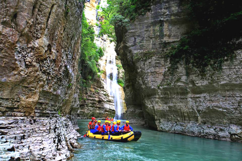
The first one in Top 10 Longest Rivers in Albania that Toplist would like to introduce to you is Drin. The Drin is a river in Southern and Southeastern Europe that has two tributaries, one of which flows into the Adriatic Sea and the other into the Buna River. It has a catchment area that includes Albania, Kosovo, Greece, Montenegro, and North Macedonia. The river and its tributaries form the Gulf of Drin, an ocean basin that encompasses the northern Adriatic Sea Coast of Albania.
The Drin is the longest river in Albania, stretching 335 kilometers (208 miles), 285 kilometers (177 miles) of which pass through Albania and the remainder through Kosovo and North Macedonia. It begins at the confluence of its two headwaters, the Black and White Drins. It rises in the mountainous northern mountain range, flows west through the Albanian Alps and Dukagjin Highlands, and eventually empties into the Adriatic Sea between Shëngjin and Durrës. The river creates or flows into numerous lakes and reservoirs, including Fierza Lake and Koman Lake.
The river basin's varied climate and topography have shaped a diverse range of flora and fauna in the Balkan Peninsula, at the crossroads of Europe and Asia. Furthermore, it has been identified as one of Europe's most important biodiversity hotspots. The Drin Delta has been designated as an Important Bird Area of International Importance by the BirdLife International Convention.
Length: 335 km (208 mi)
intoalbania.com 
elements.envato.com -
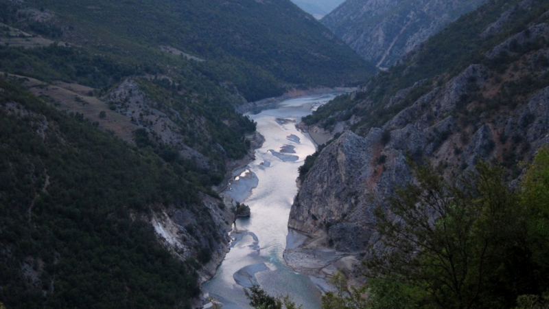
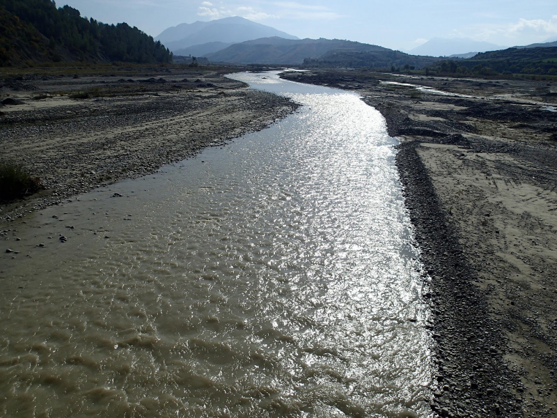
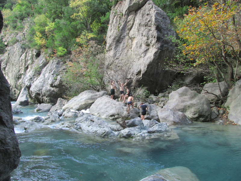
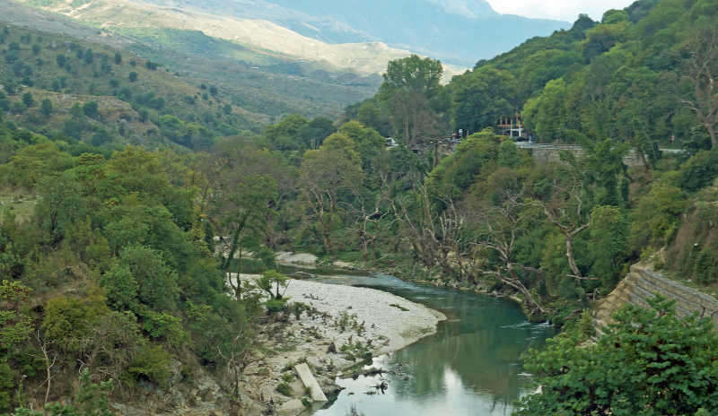
The second one in Top 10 Longest Rivers in Albania that Toplist would like to introduce to you is Vjosa. The Vjosa or Aoös is a river that flows through northwestern Greece and southwestern Albania and is the second longest river in Albania. It is approximately 272 kilometers (169 miles) long in total, with the first 80 kilometers (50 miles) in Greece and the remaining 192 kilometers (119 miles) in Albania. It has a drainage basin area of 6,706 km2 (2,589 sq mi) and an average discharge of 195 m3/s (6,900 cu ft/s). Voidomatis, Sarantaporos, Drino, and Shushicë are the major tributaries.
The river begins in the Pindus mountains of Epirus, Greece, and flows northwest. It flows into Albania near Çarshovë and empties into the Adriatic Sea north of Vlorë. The river is generally wild and unpolluted, and it is surrounded by Greece's Vikos–Aoös National Park and the Vjosa-Narta Protected Landscape near its mouth. The government designated the Albanian portion of the river as a "Managed Nature Reserve" in December 2020. Environmentalists are campaigning to make the entire Albanian section of the course a national park in order to protect it from potential hydroelectric projects.
Length: 272 km (169 mi)
wwf.mg 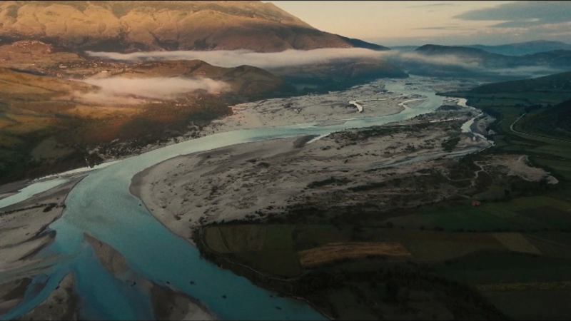
kcet.org -
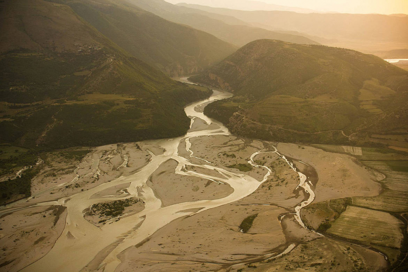
The third one in Top 10 Longest Rivers in Albania that Toplist would like to introduce to you is Devoll. Devoll is a river in southern Albania. It is one of Seman's tributaries. It has a length of 196 km (122 mi) and a drainage basin area of 3,130 km2 (1,210 sq mi). It has a discharge rate of 49.5 m3/s (1,750 cu ft/s). Its source is near the Greek border in the southwestern corner of the Devoll municipality. It flows northeast through Miras, then north through Bilisht, and northwest through Progër, Pojan (in the northern Korçë Plain, which was marshy until after World War II), Maliq, Moglicë, Kodovjat, Gramsh (where it is stowed in a large lake), and Gostimë. It merges with the Osum near Kuçovë to form the Seman. The Seman empties into a small delta in the Adriatic Sea south of the Karavasta lagoon.
A number of hydroelectric power plants are planned or under construction on the Devoll River. The Albanian company Devoll Hydropower, which is owned and operated by the Norwegian power company Statkraft, is building two hydroelectricity plants with a combined capacity of 242 MW near Banjë (Banjë Hydro Power Plant) and near Moglic (Moglic Hydro Power Plant). When the first two dams are completed, the decision on whether to build a third plant near Kokel will be made.
In the aftermath of the First Crusade, Bohemund of Taranto and the Byzantine Emperor Alexius I reached an agreement in an unspecified location in the valley of Devoll in 1108, at an unspecified location in the valley of Devoll. This treaty is named after the Byzantine fortress of Devol, which is located in modern Albania. Although the treaty was not immediately implemented, it was intended to make Antioch a vassal state of the Byzantine Empire.
Significant amounts of river water were diverted into the Small Prespa Lake in 1970 with the intention of using it for irrigation later in the summer. Significant siltation occurred on the Albanian side as a result of the high suspended solids in the river water. The practice was recently discontinued.
Length: 196 km (122 mi)
zogaris.blogspot.com 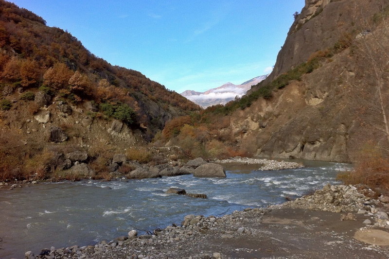
pinterest.co.uk -
The fourth one in Top 10 Longest Rivers in Albania that Toplist would like to introduce to you is Shkumbin. The Shkumbin River, also known as the Shkembi, is a river in Southern Europe. It has a length of 181 km (112 mi) and a drainage basin area of 2,444 km2 (944 sq mi). It has a discharge average of 61.5 m3/s (2,170 cu ft/s).
In Southeastern Albania, the river rises in the eastern Valamara Mountains between Maja e Valamarës (2,375 m (7,792 ft)) and Gur I Topit (2,120 m (6,960 ft)). After descending from the Valamaras, it flows north through Proptisht and Qukës, passing the Gora Mountains and passing through many deep gorges and canyons. Gur I Kamjës (1,481 m (4,859 ft)) southwest of Pogradec provides a significant inflow. It flows through a syncline formed by the Mokra and Shebenik Mountains in the east and the Polis Mountains in the west. The river turns 50 kilometers (31 miles) west of its origin near Librazhd and joins the Rapun stream. The river eventually crosses the Myzeqe Plain and forms a small delta in the Karavasta Lagoon, close to the Adriatic Sea.
Length: 181 km (112 mi)
en.wikipedia.org 
flickr.com -
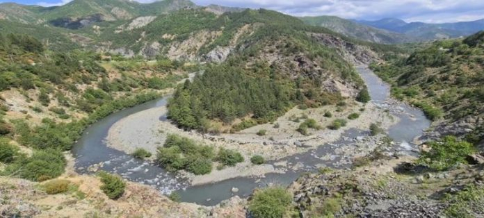
The fifth one in Top 10 Longest Rivers in Albania that Toplist would like to introduce to you is Osum. The Osum is a river in southern Albania that is one of the Seman's headwaters. It has a length of 161 kilometers (100 miles) and a drainage basin area of 2,073 kilometers (800 sq mi). It has a discharge rate of 32.5 m3/s (1,150 cu ft/s).
Its source is located in the southwestern part of Korçë County, near the village of Vithkuq, at an elevation of 1,050 meters (3,440 ft). It flows south to Kolonjë, then west to Çepan, and northwest through Çorovodë, where it passes through the famous Osum Canyon, Poliçan, Berat, and Urë Vajgurore. It merges with the Devoll near Kuçovë to form the Seman. The river's discharge has been reported to range between 5.11 m3 (180 cu ft)/s and 74.11 m3 (2,617 cu ft)/s.
The Apsus river was known as the Osum river in classical antiquity. The modern Albanian name Osum (definite form: Osumi) is used to indicate the river's upper course.
Length: 161 km (100 mi)
traditionandadventure.com 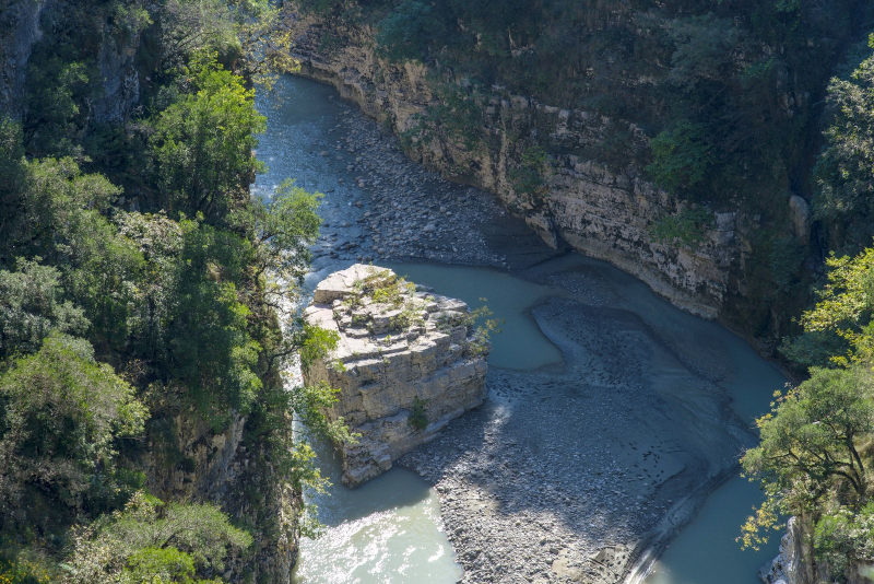
pinterest.com -
The Mat (Albanian spelling: Mati) is a river in north-central Albania. It has a total length of 115 km (71 mi) and a catchment area of 2,441 km2 (942 sq mi). It has a discharge rate of 103 m3/s (3,600 cu ft/s). The main tributary is the Fan, which flows from the northeast, while the Mat flows from the southwest down to the confluence with the Fan and then to the Adriatic Sea.
Mat is formed by the confluence of several streams within Martanesh's karstic mountains, where it forms deep gorges and canyons. The Mat begins in Martanesh and flows west to the municipality of Mat, then northwest through the towns of Klos and Burrel. It flows into a large reservoir (Liqeni I Ulzës – "Lake Ulëz") about 10 kilometers (6 miles) downstream from Burrel. It flows through a hydroelectric dam, then through another, smaller reservoir (Liqeni I Shkopetit – "Lake Shkopet") and forms a narrow gorge through the mountain range that separates Mat District from the coastal plains. It makes its way into the plains between Milot and Zejmen.
The Mat flows into the Adriatic Sea near Fushë-Kuqe, between the towns of Lezhë and Laç, after a total length of 115 km (71 mi).
Length: 115 km (71 mi)
en.wikipedia.org 
commons.wikimedia.org -
The Erzen (Erzeni in Albanian) is a river in central Albania. Erzen is 109 km (68 mi) long, with a catchment area of 760 km2 (290 sq mi) that includes the southern Tirana District and the eastern Durrës District.
The river begins in the Mali me Gropa at 1,200 meters (3,900 feet) above sea level, about 25 kilometers (16 miles) east of Tirana near Shëngjergj, and flows northwest through Petrelë and Sukth to the Adriatic Sea 12 kilometers (7.5 miles) north of Durrës. Lake Farkë, Korrë, Lanë, Murdhar, Shtërmen, and Zhëllimë are all significant Erzen tributaries.
The river flows through Tirana, only a few kilometers from its southern terminus. Only a small range of hills separates the Erzen river valley from the Lana, Tirana, Zeza, and Tërkuza rivers, which form the Ishem river. The transition from the plane to the Erzen valley is barely discernible on the southwestern outskirts of Yzberisht. The mouth is located in Lalzi bay, between Durres and the headland of Cape Rodon. The average discharge rate at the mouth is 18.1 m3/s, and the maximum discharge rate for the year exceeds the minimum eleven times. Its drainage area, which includes the entire Tirana District and a portion of the Durres area, is approximately 700 square kilometers.
On Enver Hoxha's orders, all twenty-two victims of the 1951 massacre were apparently dumped into the river, only to be discovered later wrapped tightly in barbed tape.
Length: 109 km (68 mi)
pellumbascave.weebly.com 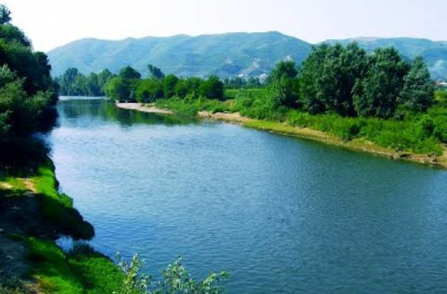
politiko.al -
The Fan River flows through northern Albania. It is formed by the confluence of two source rivers, the Great Fan and the Little Fan, which meet a few kilometers west of Rrëshen that is a small town and former municipality in Lezh County, Albania's northernmost region.
The Great Fan rises near the village of Kryezi in the Shkodër County's Qafë-Mali municipal unit. It generally flows southwest through Fushë-Arrëz and Gjegjan. The Little Fan rises near Thirrë in the municipal unit Fan, Mirditë municipality, Lezhë County. It runs through Reps (Orosh) and just north of Rrshen to the southwest. The two source rivers join west of Rrëshen, and the Fan flows west to Rubik, then south until it empties into the river Mat- a river is in northern-central Albania and has a total length of 115 km (71 mi) and a catchment area of 2,441 km2 (942 sq mi).
Length: 94 km (58 mi)
Photo: Radek Junga's Youtube Channel 
http://en.ata.gov.al/ -
The Seman is a significant river in western Albania. Seman River is formed by the confluence of the rivers Devoll and Osum, which is located a few kilometers west of Kuçov. It is 85 kilometers (53 miles) long (281 kilometers (175 miles) with its longest source river Devoll) and has a drainage basin of 5,649 kilometers (2,181 sq mi). It has a discharge average of 95.7 m3/s (3,380 cu ft/s). It generally meanders westward through a flat lowland. It receives Gjanica from the left near Fier. It empties into the Adriatic Sea near the Divjakë- Karavasta National Park's southern border.
The Seman River was known as the Apsus River in classical antiquity. Apsus, an Illyrian hydronym, corresponds to Apsias, a river name in southern Italy brought by Illyrian migrations (Iapygians). The modern Albanian name Seman/Semen (definite form: Semani/Semeni), which refers to the river's lower course.
Length: 85 km (53 mi)
en.ata.gov.al 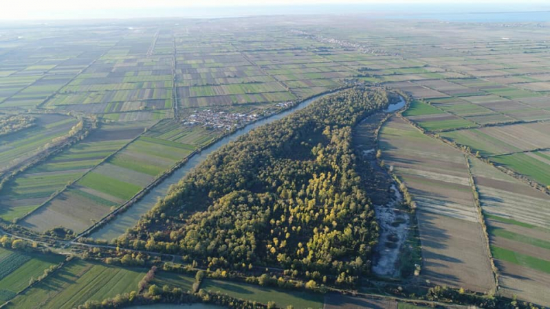
invest-in-albania.org -
The Drino, also known as the Drinos, is a river in southern Albania and northwestern Greece that is a tributary of the Vjosë- a river in northwestern Greece and southwestern Albania with a total length of about 272 km (169 mi), (the first 80 km (50 mi) in Greece and the remaining 192 km (119 mi) in Albania). Its source is near the village of Delvinaki in the northwestern part of the Ioannina regional unit. It flows southwest, then northwest before crossing the Albanian border near Ktismata. It flows northwest through Gjirokastër and into the Vjos near Tepelenë.
Drino is the Albanian name for the river, and Δρίνος, Drinos is the Greek name. The river's name contains the root Drin-, which is thought to be of Illyrian origin and is also found in the northern Albanian river Drin (cf. also Drina between Bosnia and Herzegovina and Serbia).
Length: 85 km (53 mi)
commons.wikimedia.org 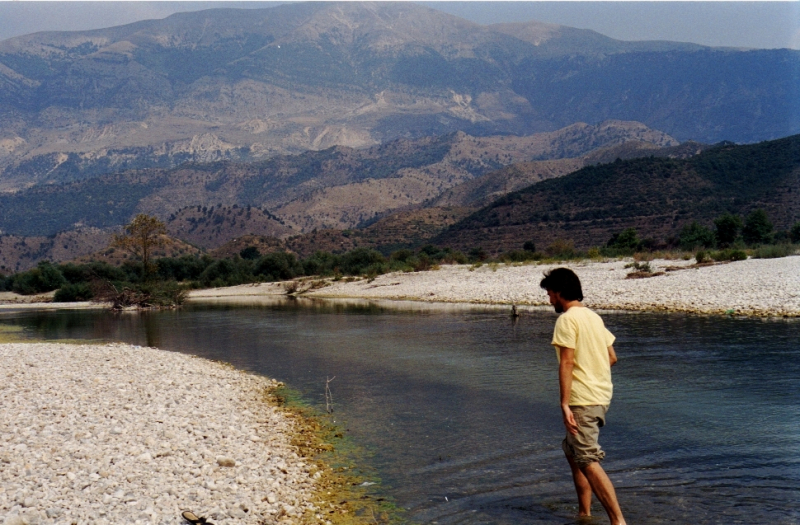
en.wikipedia.org


