Top 7 Longest Rivers In Georgia

Georgia is a state in the southeastern United States having mountains, farms, beaches, rivers, and a variety of other features. Several rivers run across the ... read more...state, draining into various basins such as the Atlantic Ocean and the Gulf of Mexico. While most of the rivers in the state flow into the aforementioned basins, two tiny rivers in the state have the name the fabled River Styx. Both of these tiny rivers flow into the Savannah River watershed for one, and the St. Mary's River watershed for the other. Here is the list of the longest rivers in Georgia.
-
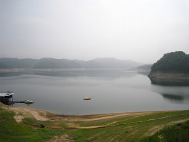
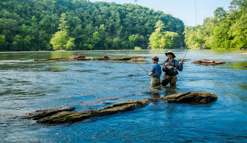
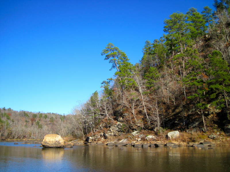
Chattahoochee River is one of the longest rivers in Georgia. This river, which is known in Florida as the Apalachicola River, forms part of the Alabama-Georgia border. The Apalachicola River is the river's principal tributary, and it begins at Jacks Knob in Union County. The Apalachicola–Chattahoochee–Flint River Basin includes the Apalachicola, Flint, and Apalachicola rivers. The Chattahoochee River forms the greatest portion of the basin. All of these rivers eventually pour their contents into the Gulf of Mexico. With the last significant storm in September 2009, flooding has not been a serious concern.
The Chattahoochee River's headwaters are at Jacks Gap, near the southeastern foot of Jacks Knob, in Union County's far southeast corner, in the southern Blue Ridge Mountains, a subrange of the Appalachian Mountains. The river's headwaters run south from the Tennessee Valley Divide's ridges. The Appalachian Trail runs through the river's upper reaches. Chattahoochee National Forest contains the Chattahoochee's headwaters and upper course. The Chattahoochee River runs southwesterly from its source in the Blue Ridge Mountains to Atlanta and its suburbs. It runs via Columbus, Georgia's third-largest city, and the Fort Benning Army post, passing through a succession of reservoirs and manmade lakes. It crosses the eastern United States' Fall Line in Columbus.
Length: 430 miles
wikipedia.org 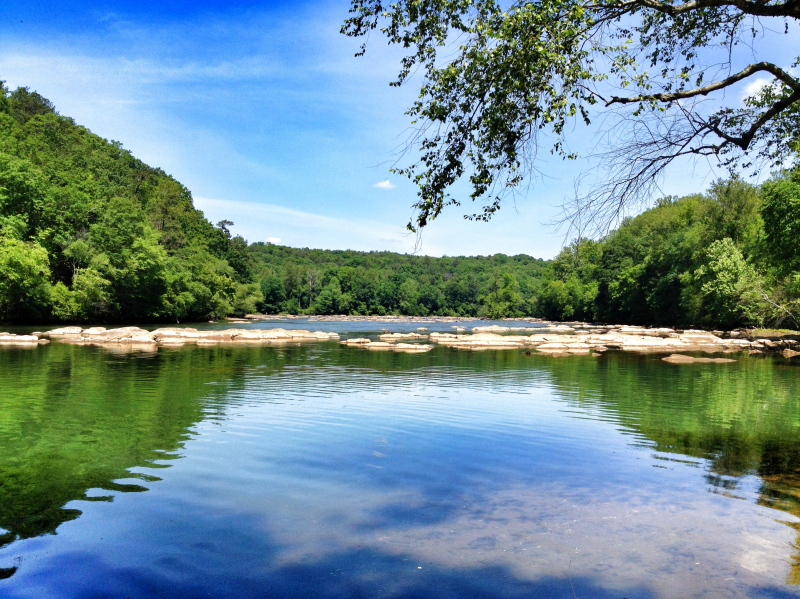
wikipedia.org -
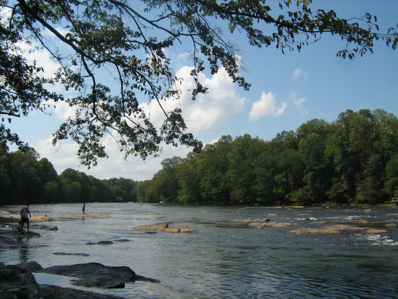
The Flint River is noteworthy not just for its high ranking on the list, but also because it is the longest river in Georgia, among all the rivers that begin and terminate there. The river, which starts in Atlanta's upper Piedmont area and flows into western Georgia, drains an area of around 8,460 square miles. The river, which is also part of the ACF basin, runs over a picturesque course with no obstructions for the first 200 miles of its 344-mile journey.
The Flint River begins as ground seepage near the city of East Point, Georgia, in southern Fulton County, on the fringes of the Atlanta metropolitan area. The precise beginning may be found between Plant Street, Willingham Drive, Elm Street, and Vesta Avenue in a field. It passes beneath the Hartsfield-Jackson Atlanta International Airport's runways. The river is supplied by Line Creek and Whitewater Creek in Fayette County and flows south through rural western Georgia. Sprewell Bluff State Park, about 10 miles west of Thomaston, is where the river flows. Further south, it is about 5 miles from Andersonville, the location of the Civil War's Andersonville jail.
Length: 344 miles
maconcountyga.gov 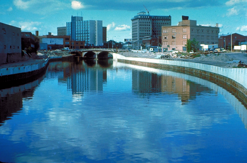
wikipedia.org -
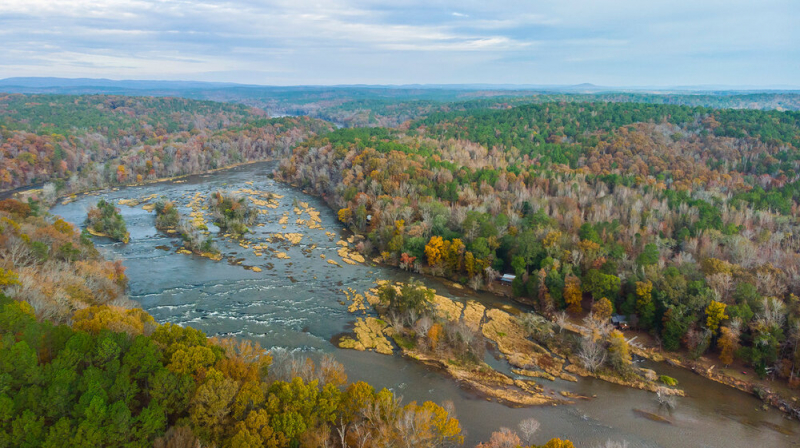
The Savannah River is a large river in the southeast United States that forms the majority of the boundary between South Carolina and Georgia. The Tugaloo River and the Chattooga River, both tributaries of the Savannah, constitute the northernmost section of the boundary. The Savannah River drainage basin is limited by the Eastern Continental Divide on the southeastern edge of the Appalachian Mountains, just within North Carolina. The river stretches for around 301 km. The confluence of the Tugaloo River and the Seneca River created the Savannah. Today, Lake Hartwell has drowned this confluence. The Tallulah Gorge lies on the Tallulah River, a tributary of the Tugaloo River that flows into the Savannah River's northwest branch.
During its journey, the Savannah River passes through a range of temperatures and habitats. It is classified as an alluvial river because it drains a drainage basin of 10,577 square miles (27,390 km2) and transports enormous volumes of debris to the ocean. The environment is relatively moderate near its headwaters in the Blue Ridge Mountains. In the winter, the river's tributaries get a minor quantity of snowmelt runoff. Large reservoirs control the majority of the river's flow through the Piedmont area. The river slows down beyond the Fall Line and is bordered by vast blackwater bald cypress swamps. A plethora of oxbow lakes represents the sites of historic river routes that have altered course due to earthquakes and silting.
Length: 301 miles
goldentrianglercd.org 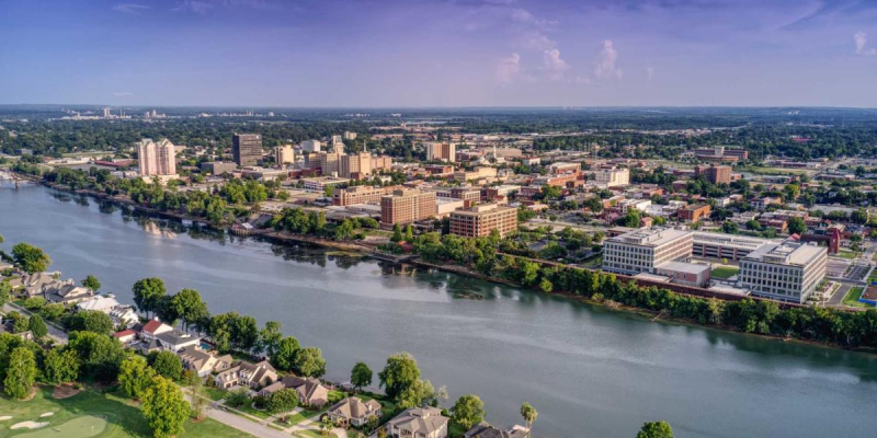
visitaugusta.com -
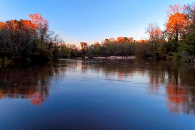
Ogeechee River is a 294-mile blackwater river in Georgia, United States. It begins about 2.5 miles south-southwest of Crawfordville, at the confluence of its North and South Forks, and flows southeast to Ossabaw Sound, about 16 miles south of Savannah. The Canoochee River, which drains around 1,400 square miles and is the basin's only other major river, is its main tributary. It has a 5,540-square-mile watershed. It's one of the few free-flowing streams in the state.In the Canoochee River, parts of the Piedmont and Coastal Plain physiographic provinces, which span across the southern United States, are found in the Ogeechee River basin. This line follows the contact between the Piedmont Province's older crystalline metamorphic rocks and the Coastal Plain Province's newer unconsolidated Cretaceous and Tertiary sediments. Metasedimentary rock, schists and phyllites, felsic and mafic metavolcanic rocks, and amphibolite are among the other rock types found in the basin. At the Fall Line, Coastal Plain sediments meet the igneous and metamorphic rocks of the Piedmont Province's southern boundary.
Length: 294 miles

trolleytours.com 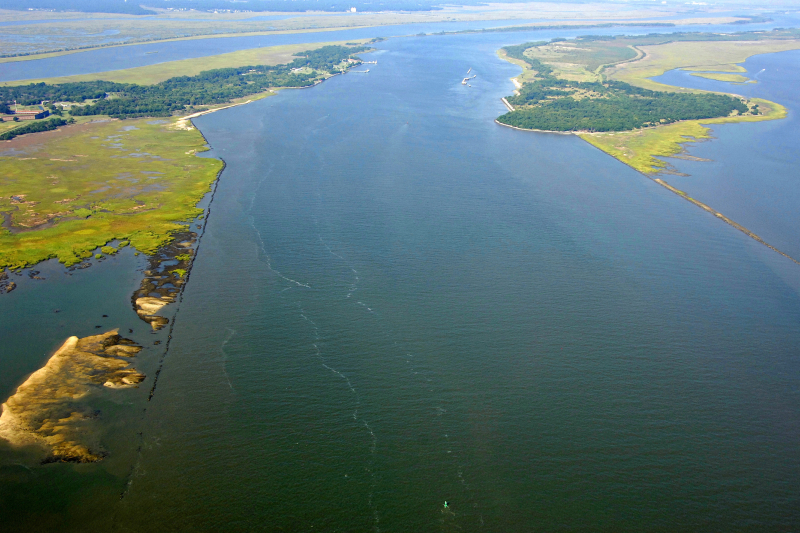
marinas.com -
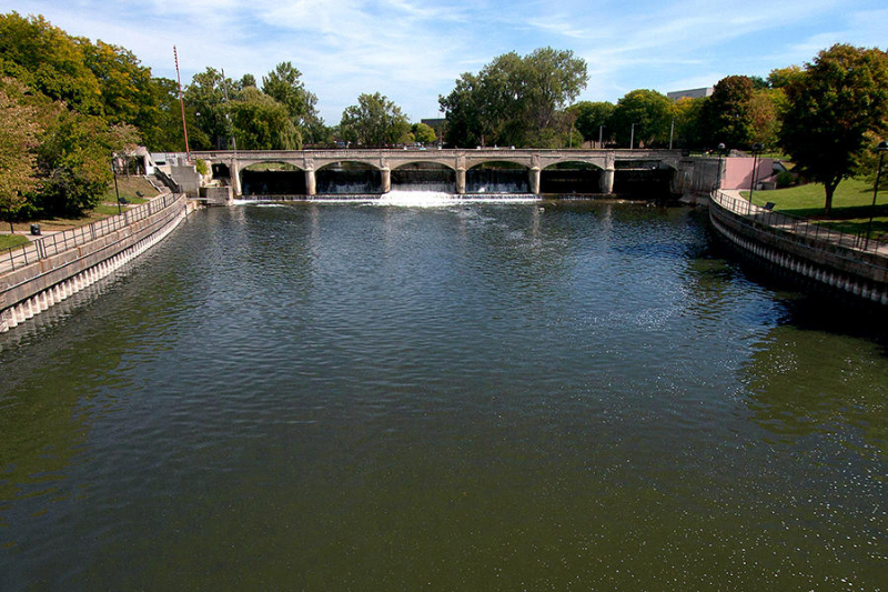
Coosa ranks 5th on the list of the longest rivers in Georgia. The Coosa River is a tributary of the Alabama River in Alabama and Georgia, United States. The river stretches for around 280 km. It starts in Rome, Georgia, at the junction of the Oostanaula and Etowah rivers, and finishes about northeast of Montgomery, Alabama, where it meets the Tallapoosa River to form the Alabama River just south of Wetumpka. The Coosa River runs through Alabama for almost 90% of its length.
One of Alabama's most developed rivers is the Coosa. The Coosa River has been dammed for the most part, with Alabama Power, a Southern Company subsidiary, holding seven dams and powerhouses on the river. The dams generate hydroelectric electricity, but they come at a cost to several Coosa River indigenous species. Until the early twentieth century, the Coosa River was an important transit route as a commercial waterway for riverboats along the upper stretch of the river for 200 miles south of Rome. Shoals and waterfalls, such as the Devil's Staircase along the river's lowest 65 miles, prevented riverboats from reaching the Alabama River and the Gulf of Mexico on the upper Coosa.
Length: 280 miles
visitsandysprings.org 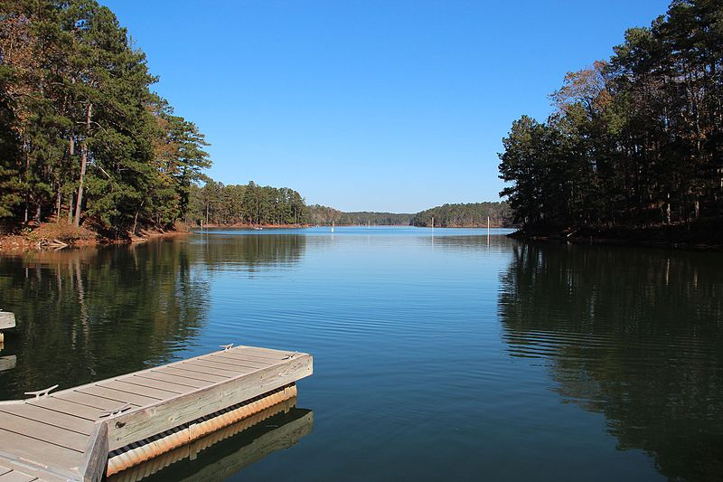
wikipedia.org -
The Tallapoosa River flows 265 miles from Georgia's southern end of the Appalachian Mountains southward and westward into Alabama's Appalachian foothills. A dam on the river has created Lake Martin near Alexander City, Alabama, which is a big and popular water recreation facility. The Alabama River is formed where the Tallapoosa River joins the Coosa River in Wetumpka, about 10 miles northeast of Montgomery. The Tallapoosa River has four hydroelectric dams: Yates, Thurlow, Martin, and Harris. They are key generators of power for Alabama Power as well as public leisure.
Before the early nineteenth century, the Tallapoosa River, particularly its lower course, was an important Creek Indian population center. The Creek words Talwa posa, which means "Grandmother Town," are the river's current name. The Tallapoosa branch of the Creek tribe is considered to be one of the oldest. The National Park Service manages Horseshoe Bend National Military Park, which is located along the banks of the Tallapoosa River immediately upstream from Lake Martin. It protects the location of a fight during the Creek War.
Length: 265 miles
nrdc.org 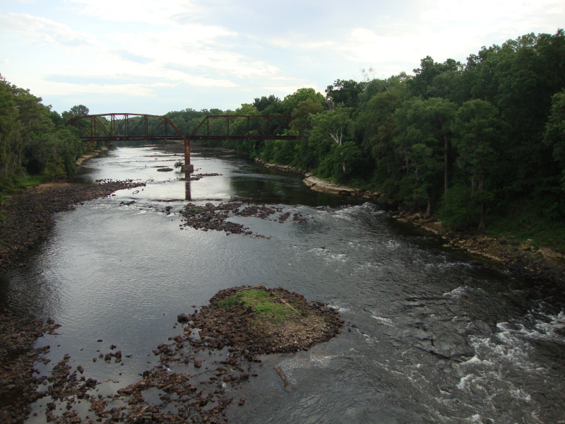
usgs.gov -
Oconee River ranks 7th on the list of the longest rivers in Georgia. With a length of 221 miles, The Oconee River is the shortest river on this list (356 kilometers). The river begins in Hall County, Georgia, and ends when it joins the Ocmulgee River. The Altamaha River is formed by the confluence of the two rivers, which flows into the gorgeous Atlantic Ocean. The river's route includes oxbow lakes and sandbars, among other geographical characteristics. Several microorganisms have invaded the water, causing significant contamination. Pollution has also been caused by human actions.
The Oconee River flows into Lake Oconee, a man-made lake near Madison and Greensboro off Interstate 20, after passing through the Oconee National Forest. The river flows from Lake Oconee to Lake Sinclair, a man-made lake in Milledgeville, Georgia's Fall Line town and old state capital. The river runs freely south of Milledgeville until it merges with the Ocmulgee River to form the Altamaha River. There are several sandbars and oxbow lakes along the river, and the wooded bottomland marsh that surrounds the Oconee for miles creates a very secluded location.
Length: 221 miles
georgiaencyclopedia.org 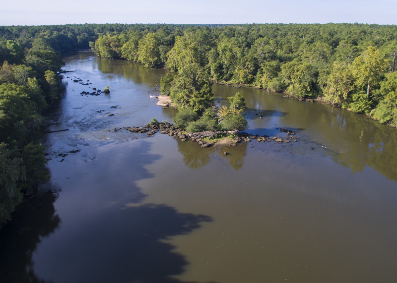
gacd.us