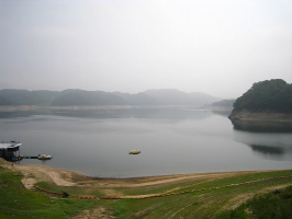
Top 10 Longest Rivers In Kazakhstan

Kazakhstan is a Central Asian republic that once belonged to the Soviet Union and shares borders with both China and Russia. Kazakhstan is not just the world's ... read more...ninth-biggest country, but also the world's largest landlocked country. The Turgai River is Kazakhstan's longest river entirely within the country, whereas the Irtysh River is Kazakhstan's longest partially across the country. Some of the longest rivers in Kazakhstan are listed here.
-
The Turgay is a river in Kazakhstan that travels through the Turgay Valley. The river runs over 825 kilometers (513 miles), and the drainage basin covers 157,000 square kilometers (61,000 sq mi). This is the longest river in Kazakhstan. The average water discharge rate is around 9 cubic meters per second. The Turgay vanishes in Shalkarteniz's endorheic basin. The Turgay Valley is a basin with active erosion and mineral deposits, notably iron ore. There are several rivers and lakes in the Turgay valley, but the Turgay River, with a length of 513 miles, is the longest to completely traverse through Kazakhstan.
The Turgay Plateau is located in northwestern Kazakhstan, between the Urals and Mugodzhar Hills in the west and the Kazakh Steppe in the east, in an erosion-tectonic basin. Dry steppes can be found in the north, whereas semi-steppes can be found in the south. The basin has iron ore and other mineral deposits.
The Turgay Valley runs from south to north through the Turgay Plateau. The Ubagan (a Tobol tributary) drains the valley to the north, while the Turgay drains it to the south. In the valley, there are numerous shallow, typically salty lakes. The Naurzumskyy reserve, located in the northern part of Kazakhstan's Turan lowland, connects the West Siberian Plain.
Length: 825 km (513 mi)
https://en.wikipedia.org/ 
https://www.rferl.org/ -
The Irtysh is a river that flows through Russia, China, and Kazakhstan, and is a major tributary of the Ob River, which also flows through Russia, China, and Kazakhstan. This is one of the longest rivers in Kazakhstan. The river's source is in the Mongolian Altai, near the Mongolian border in Dzungaria (the northern portion of Xinjiang, China). The Ishim and Tobol Rivers are the Irtysh River's principal tributaries. Three big hydroelectric facilities, the Shulbinsk, Bakhtarma, and Ust-Kamenogorsk, are located along a portion of the Irtysh River in Kazakhstan. In Russia, China, and Kazakhstan, some roadways have been built where the Irtysh River passes through.
The Irtysh River has been a source of contention since the dawn of mankind. The Russians began to construct towns and strongholds in the 1580s, including Tobolsk and Tara, among others. The Mongolians became a southern neighbor of Russia in the 17th century, controlling the upper Irtysh River, resulting in conflict with the Russians. The Mongolians were vanquished by the Qing Empire of China in the 1750s, prompting the Russians to beef up protection along their frontier. The Treaty of Saint Petersburg, signed in 1881, ended Russia's border dispute with the Qing Empire. With a length of 2,640 miles, the Irtysh River is the longest river in Kazakhstan.Some authors, particularly in Russia and Kazakhstan, refer to the upper course of the river, from its source to Lake Zaysan, as Black Irtysh (Kara-Irtysh in Kazakh, or Cherny Irtysh in Russian). In the past, the phrase White Irtysh was used to refer to the Irtysh below Lake Zaysan, in contrast to the Black Irtysh; however, this usage is now completely extinct. In the epilogue of Fyodor Dostoevsky's 1866 novel Crime and Punishment, the Irtysh River serves as a backdrop. The chapter "The White Kitten" in Aleksandr Solzhenitsyn's The GULAG Archipelago describes Georgi Tenno's escape from a camp beside this river.
Length: 4,248 km (2,640 mi)
https://www.trip.com/ 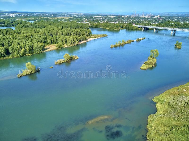
https://www.dreamstime.com/ -
The Ishim is a river in Kazakhstan and Russia that flows through both countries. It stretches for 2,450 kilometers (1,520 miles) and drains 177,000 square kilometers (68,000 sq mi). It has a discharge rate of 56.3 cubic metres per second (1,990 cubic feet per second). It is an Irtysh tributary on the left bank. In its lower reaches, the Ishim is partially navigable. The Ishim's upper course flows through Nur-Sultan, Kazakhstan's capital. The river flows through a huge marshland in Russia, with numerous bends and oxbow lakes along the way. From late November through early March, the river freezes.
From late November to early March, the river freezes over. A dam was built on the Ishim River in central Astana, a public beach, to manage water levels and floods. Kazakhstan plans to deepen the Ishim River so that small boats can navigate it. The Ishim River stretches for 1,522 kilometers.
According to Kazakhstan's President, Nur-Sultan was chosen as the capital in part because of the river. The city is also divided into two sections: the ancient town on the right bank of the Ishim, and the new town on the left bank, which includes the Ak Orda, the House of the Government, and the Supreme Court, as well as several prestigious apartment and dwelling complexes.
Since 1998, the Ishim in Nur-Sultan has been actively managed for flood control and water level maintenance in order to provide recreational opportunities and maintain the spectacular beauty. It is dammed downstream of center Nur-Sultan, keeping the river level higher than it would be otherwise most of the time, but the riverbed has been created deeper to allow floodwaters to pass through more quickly. There is currently a public beach and pedalo boat rental in central Nur-Sultan, near the city park; in the meantime, "residents would have been able to walk over it" if the river had not been dammed. For better flood control, another dam will be built upstream of the city.
Length: 2,450 km (1,520 mi)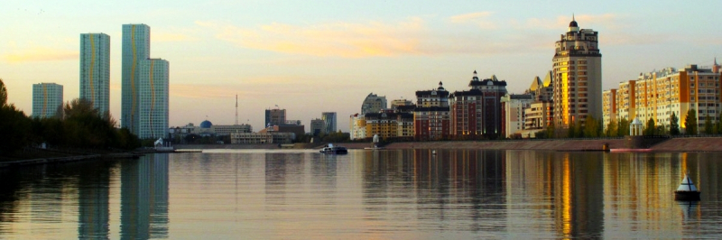
https://gody.vn/c 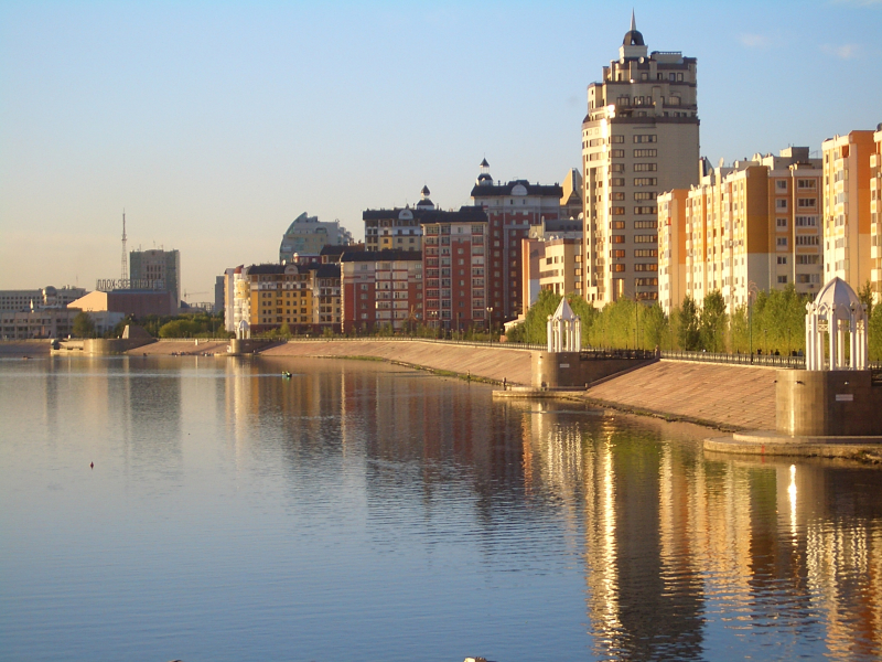
https://commons.wikimedia.org/ -
Before 1775, the Ural was a river that ran across Russia and Kazakhstan, forming the continental divide between Europe and Asia. It has its source in the southern Ural Mountains and empties into the Caspian Sea. It is Europe's third-longest river, after the Volga and the Danube, and Asia's 18th-longest river, at 2,428 kilometers (1,509 miles). The Ural is traditionally thought to be part of the continental divide between Europe and Asia.
The Ural River starts near Mount Kruglaya in the Ural Mountains, travels south parallel and west of the Tobol, past Magnitogorsk, and around the southern edge of the Urals, through Orsk, when it swings west for about 300 kilometers (190 miles), to Orenburg, where the river Sakmara joins. It continues west from Orenburg, passing through Kazakhstan, before turning south at Oral and meandering over a large flat plain till it reaches the Caspian a few miles south of Atyrau, where it produces a beautiful 'digitate' (tree-like) delta.
Some endangered species and migrating birds call the Ural river home. The Ural is also home to a variety of Caspian Sea fish that travel to the Ural River Delta to reproduce. The Ural River delta is also home to approximately 48 animal species, the majority of which are carnivores and rodents. The Ural provides water to iron and steel mills, a hydroelectric plant, and water reservoirs. Fishing is a popular pastime on the Ural River delta, which accounts for half of Kazakhstan's fish catch. Because it was a key commercial location on the Silk Road, the Ural River was hotly fought. Fishing became the principal activity after the Russian conquest of the Ural Basin.
Length: 2,428 km (1,509 mi)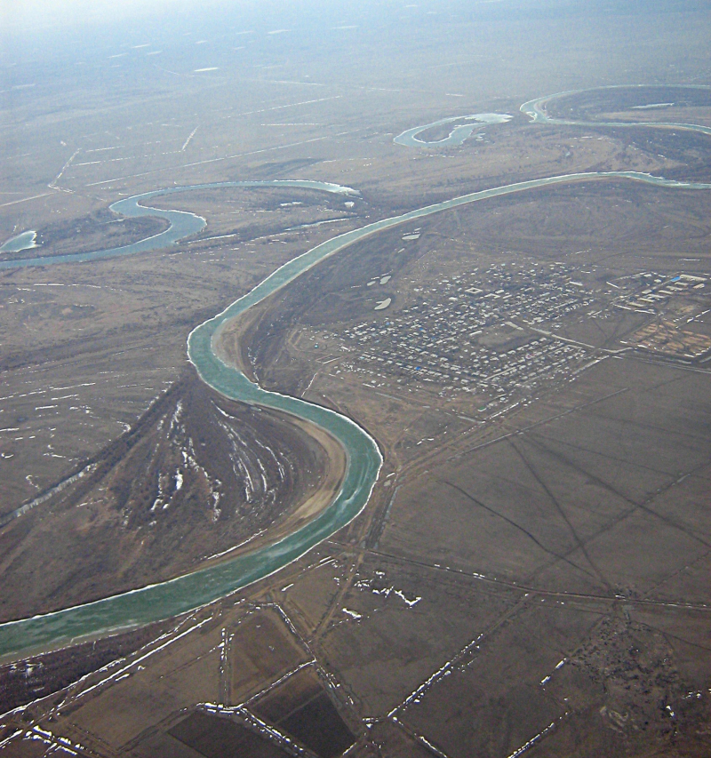
https://en.wikipedia.org/ 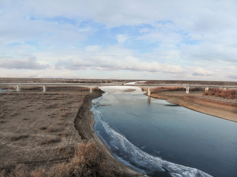
https://evrascon.com/ -
The Syr Darya is a Central Asian river. The name is a Persian derivation that literally means "Syr Sea" or "Syr River," and it is sometimes referred to as such. It rises in the Tian Shan Mountains of Kyrgyzstan and eastern Uzbekistan and runs west and north through Uzbekistan and southern Kazakhstan to the northern remnants of the Aral Sea, covering 2,256.25 kilometers (1,401.97 miles). It is the northern and eastern of the two major rivers that flow through the Aral Sea's endorheic basin, the other being the Amu Darya (Jayhun).
During the Soviet era, huge irrigation projects were built around both rivers, diverting their water into farmland and causing the Aral Sea, once the world's fourth-largest lake, to virtually vanish during the post-Soviet era. The lowest point in Tajikistan is 300 meters (980 feet) above sea level, where the river flows from Tajikistan into Uzbekistan.
The Naryn River and the Kara Darya, which meet in the Uzbek side of the Fergana Valley, start in the Tian Shan Mountains in Kyrgyzstan and eastern Uzbekistan, and flow for 2,212 kilometers (1,374 miles) west and north-west through Uzbekistan and southern Kazakhstan to the remains of the Aral Sea. The Syr Darya drains an area of nearly 800,000 square kilometers (310,000 square miles), although only around 200,000 square kilometers (77,000 square miles) contribute considerable flow to the river; in fact, two of the basin's main rivers, the Talas and the Chu, dry up before they reach it. Its yearly flow is half that of its sister river, the Amu Darya, at 37 cubic kilometers (30,000,000 acreft) per year.
The earliest known name was Jaxartes or Iaxartes in Ancient Greek, which consists of two morphemes, Iaxa and artes, and was mentioned in various sources, including those related to Alexander the Great. The Greek name Yakhsha Arta ("True Pearl") is derived from the Old Persian name Yakhsha Arta ("True Pearl"), which may relate to the color of the glacially-fed water. The river's Turkic name up until the Arab invasion, the Yinçü, or "Pearl river," from Middle Chinese, Tang Chinese also recorded this name as Yaosha River and afterwards Ye River, provides more evidence for the Persian derivation.
Length: 2,256.25 km (1,401.97 mi)
https://www.people-travels.com/ 
https://commons.wikimedia.org/ -
The Tobol River, also known as the Kazak Tobyl, is a left-bank tributary of the Irtysh (Ertis) River that flows from northern Kazakhstan to southern Russia. After rising in the Torghay Plateau's low mountains, it runs northeast through the West Siberian Plain, passing through the cities of Qostanay (Kazakhstan) and Kurgan (Russia), before entering the Irtysh River at Tobolsk after a 989-mile journey (1,591 km). The Ubagan River in the higher parts and the Iset, Tura, and Tavda rivers in the lower levels are its principal tributaries. It has a 164,500-square-mile drainage basin (426,000 square km). From November to April, the Tobol is frozen, and high water occurs in the spring. Its Karatamar Reservoir provides water to Kazakhstan's Rdnyy iron-ore sector.
The Tobol River was one of the Khanate of Siberia's four major rivers. At the Battle of Tobol in 1428, the khan was killed in a battle with Abu'l-Khayr Khan's soldiers. The Tobol was the eastern terminal of the portage route leading westward to the rivers Vishera and Kama in the 16th century.
Length: 1,591 km (989 mi)
https://en.wikipedia.org/wiki 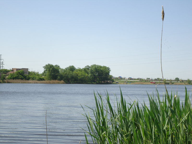
https://en.wikipedia.org/wiki -
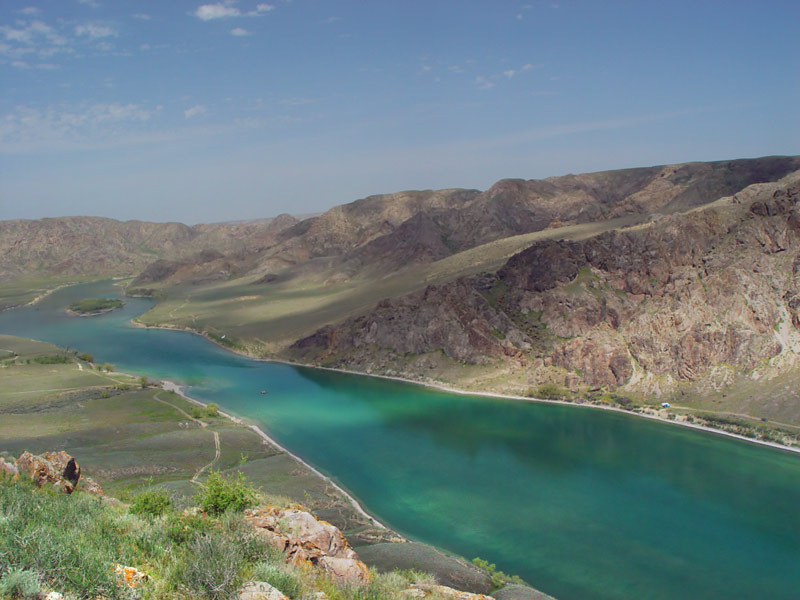
The Ili River flows through northwest China and southeast Kazakhstan. It flows from the Xinjiang Uighur Autonomous Region's Ili Kazakh Autonomous Prefecture to Kazakhstan's Almaty Region.
It stretches for 1,439 kilometers (894 miles) (including its source river Tekes), with 815 kilometers (506 miles) in Kazakhstan. The Tekes and Künes rivers in Eastern Tian Shan feed into the river. The Ili River flows between the Tian Shan and the Borohoro Mountains, draining the basin between them. The Ili produces a massive delta with enormous wetland regions including lakes, marshes, and flora as it flows into Lake Balkhash.
The Ili river was first mentioned in the lexicon of Turkic languages by Mahmud al-Kashgari. The following is how the author explains it in the book: "Ili is a river's name. On its banks live the Turkic tribes of Yaghma, Tokhsi, and Chiglig. The river is known in Turkey as the Amu Darya (Jayhoun)." The name may have come from the Uyghur term Il, which means hook, and refers to the river's topographical shape.
The Western Turkic Kaganate (552–638 AD) was divided into the Nushibi and the Dulu by the Ili River Treaty of 638 AD. The Ili River was also designated as the border between the two states. With the increasing demand for water in both China and Kazakhstan in the twenty-first century, environmentalists and politicians in Kazakhstan are concerned about the management of the cross-border Ili River (who feel that their country may not get enough water flowing in from China any more). In the summer, the amount of precipitation exceeds 150-250 cubic meters.
Length: 1,439 km (894 mi)
https://en.wikipedia.org/ 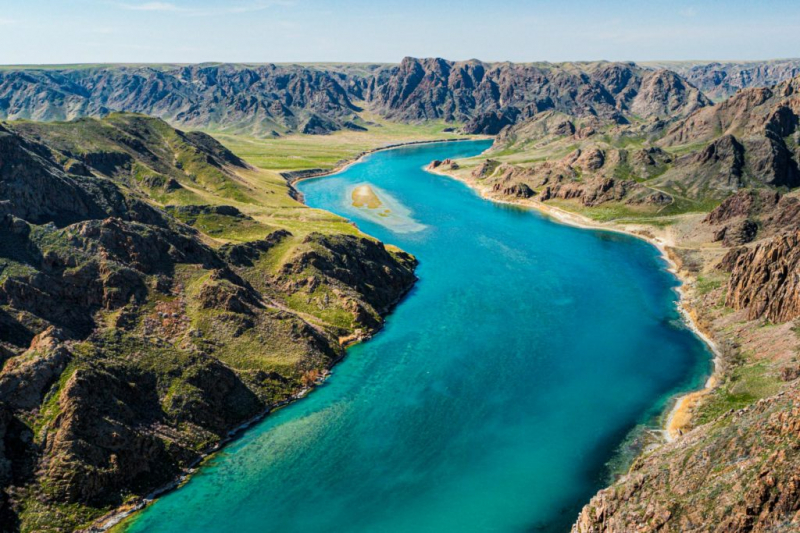
https://central-asia.guide/ -
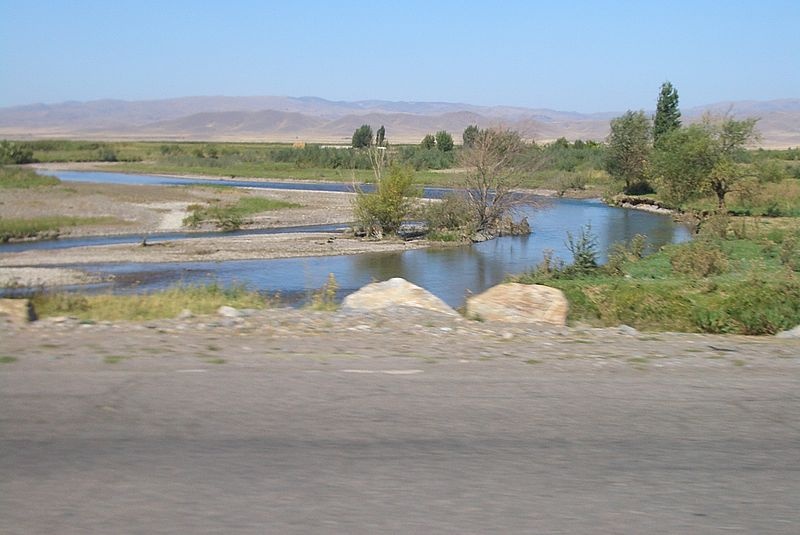
In Northern Kyrgyzstan and Southern Kazakhstan, the Chu is a river. The first 115 kilometers (663 miles) of the river are in Kyrgyzstan, then the river is the border between Kyrgyzstan and Kazakhstan for 221 kilometers, and the last 731 kilometers are in Kazakhstan. Its rank is among one of the longest rivers in Kazakhstan. It is one of Kyrgyzstan's and Kazakhstan's longest rivers. It has a 62,500-square-kilometer drainage basin (24,100 sq mi).
The river is called after the Chüy Region, Kyrgyzstan's northernmost and most populated administrative region, as well as Chüy Avenue, Bishkek's major street, and Shu, Kazakhstan's Jambyl Region.
The Iranian Sughds, who spoke Soghdian, an East Iranian language, used to live in this vicinity of the river. The area was strategically vital during the Middle Ages. Suayub, the capital of the Western Turkic Khaganate, and Balasagun, the capital of the Qara Khitai, were both located there (Western Liao dynasty).
The Chu River posed a threat of flooding to the Chu Valley's communities. An ice gorge created on the Chu River upstream from Tokmok, the administrative center of Semirechye Province, in the winter of 1878. After heavy flooding wreaked havoc on the town, the province's capital was relocated to Pishpek (Bishkek).Length: 1,067 km (663 mi)
https://en.wikipedia.org/ 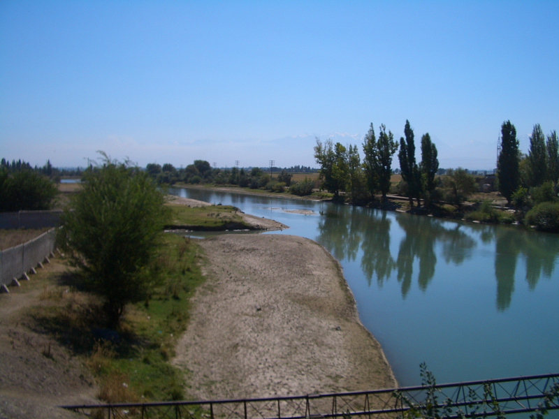
https://en-academic.com/ -
The Emba River starts in the Mugodzhar Mountains in western Kazakhstan and flows into the Caspian Sea. It stretches over 712 kilometers (442 miles) and drains 40,400 square kilometers (15,600 sq mi). It runs across the Ust-Urt plateau to the Caspian, passing via a series of small lagoons that were navigable in the 18th century. The lower route passes through a salt dome region and the Emba fields, which are rich in petroleum. It is occasionally used to define the natural border between Europe and Asia.
The Emba is a minor river in its upper reaches, with a valley just over 2,000 meters (6,600 feet) broad. Lower down, the Emba's valleys extend to almost 7 kilometers once the Temir River's waters flow into it (4 mi). The Emba flows in a single channel, with only a few little arms splitting off here and there. However, about 100 kilometers (62 miles) before entering the Caspian Sea, it splits into multiple lakes, which are connected by slender channels that only run during flooding. The Emba is a river that is fed by snow. In the winter, it freezes over, a process that starts in November and lasts until March.
Between the Mugodzhar Hills and the Volga is the Emba oil basin. Maily kiyan, which means "land blessed with miracle oil," was the name given to this place in the past. During his travels in the mid-17th century, the British merchant Gok stumbled across a spring near the Emba River that spewed oil instead of water. The Bolsheviks attempted to build the Algemba railway and pipeline from Alexandrov Gay between 1919 and 1921 in order to offer a means of transporting oil from the recently acquired oil field to the center of Russia. The initiative, however, failed due to logistical issues, resulting in a significant loss of life.
Length: 712 km (442 mi)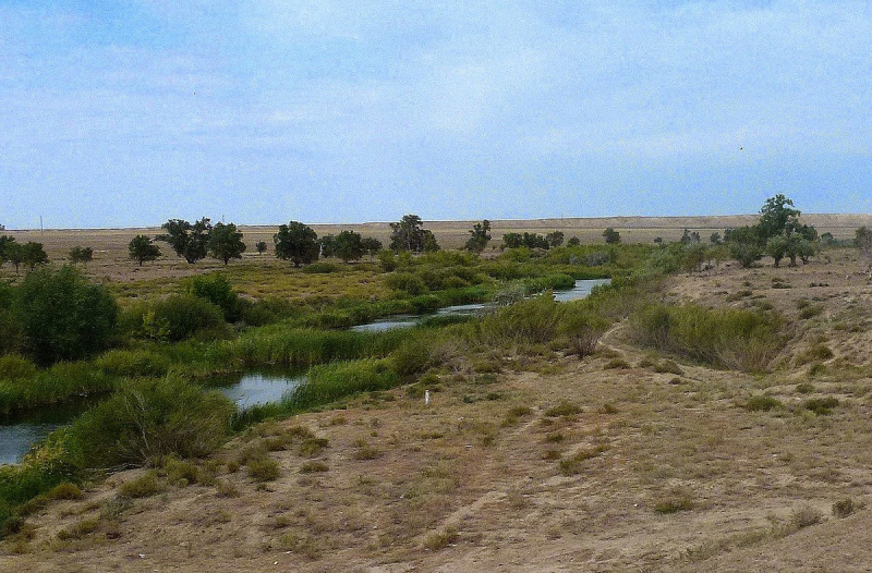
https://en.wikipedia.org/ 
https://wildticketasia.com/ -
The Sarysu is a river in Kazakhstan that flows through the Karaganda and Kyzylorda regions. It has a drainage basin of 81,600 square kilometers and is 671 kilometers (417 miles) long (31,500 sq mi). It is the 10th longest river among the longest rivers in Kazakhstan. It rises above Atasu and flows westward to Kzyl-Dzhar, then south-westward past Birlestik and Zhanabas before ending at a series of minor lakes (often dry).
It was once a tributary of the Syr Darya, and it may still contribute some subterranean flow, although the surface flow vanishes more than 100 kilometers downstream of the Syr Darya. In Turkic languages, the term sary su refers to golden water.
Length: 671 kilometers (417 miles)
https://en.wikipedia.org/ 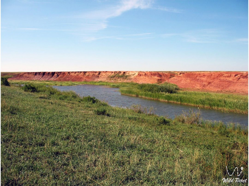
https://wildticketasia.com/346