Top 8 Longest Rivers in DR Congo

Several broad, deep, and lengthy rivers run through the Democratic Republic of the Congo. The majority of the nation enjoys a tropical rainforest climate. Its ... read more...geography is characterized by extensive grasslands in the south and high plateaus and savannas in the north, with hot and humid weather. In addition, the country contains a diverse range of natural resources, including gold, silver, diamonds, and copper, among others. It confronts environmental issues in the reserve, including water pollution, poaching, and deforestation. However, the longest rivers are examined here, as are those that contribute the most to the country's economy, ecology, and terrain.
-
The Nile River runs through 10 nations, including the Democratic Republic of the Congo, and is 4,528 kilometers long. It is fed by two large tributaries, the White Nile and the Blue Nile. It has been highlighted as a key source of revenue since it is utilized for transportation, agriculture production, and fishing for the local population.
Furthermore, the climate is equatorial-Mediterranean, with strong rainfall patterns causing flooding and, in certain cases, drought. Sadly, despite the economic power that a major river presence may provide, the people who live along it are characterized by growing poverty, instability, and significant environmental damage. Furthermore, territorial conflicts over the river have arisen between the nations that share it. However, in 2010, a water dispute resolution was reached that resulted in a shared vision of poverty alleviation that was endorsed by all countries.
Total Length: 4,258 miles
flickr.com 
flickr.com -
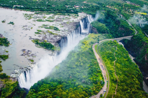
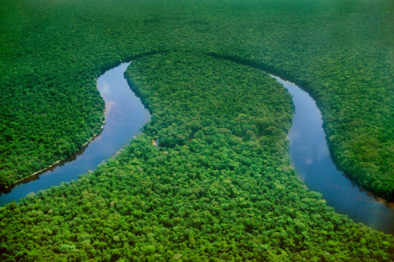
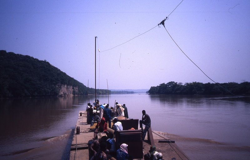
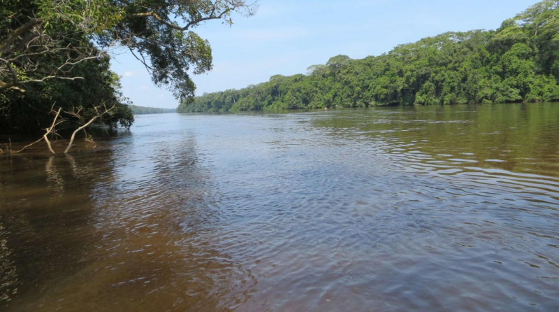
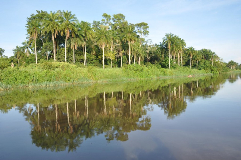
The Congo River is the world's deepest river, reaching nearly 750 feet to the bottom in certain places, and it is also 2,920 miles long. Because the Congo River is shared by nine nations, territorial conflicts are common. Historically, it was utilized for slave trading, but in recent times, the river's main economic activities include fishing, hunting, and farming. Its climate is generally rainforest, with lush trees that are home to wildlife, abundant rains, and hot and humid weather due to its location on the equator. Changes in the biological balance found over most of the African continent have a substantial influence on the Congo River.
The Congo Rainforest, the world's second-biggest rainforest region after the Amazon Rainforest in South America, is traversed by the river and its tributaries. The river also boasts the world's second-largest flow, trailing only the Amazon; the world's second-largest drainage basin, trailing only the Amazon; and is one of the world's deepest rivers, with depths exceeding 220 meters (720 ft). Because its drainage basin encompasses places both north and south of the equator, the river's flow is steady, as at least one section of the river is always having a rainy season.
Total Length: 2,920 miles
flickr.com 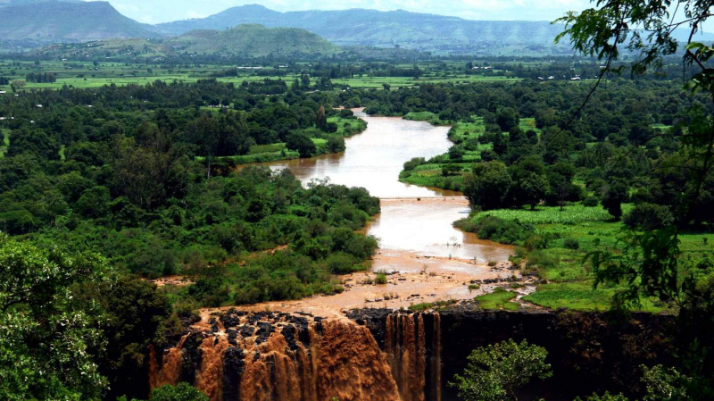
flickr.com -
The White Nile is a river in Africa that is one of the Nile's two primary tributaries, the other being the Blue Nile. The name derives from the coloration caused by clay transported in the water.
The term "White Nile" refers to the river generated by the confluence of the Bahr al Jabal and Bahr el Ghazal Rivers near Lake No. In a broader sense, the term "White Nile" refers to all stretches of river that drain from Lake Victoria to the Blue Nile; the "Victoria Nile" from Lake Victoria to Lake Albert via Lake Kyoga, then the "Albert Nile" to the South Sudan border, and finally the "Mountain Nile" or "Bahr-al-Jabal" down to Lake No. The term "White Nile" may also refer to the headwaters of Lake Victoria, the most remote of which is 3,700 kilometers (2,300 miles) from the Blue Nile. The hunt for the Nile's source by Europeans in the nineteenth century was mostly centered on the White Nile, which vanished into the depths of what was then regarded as "Darkest Africa."
Total Length: 2,299 miles
flickr.com 
flickr.com -
The River Kasai is a tributary of the Congo River that runs for 1,338 km. The river, which runs along the boundary between Angola and the Democratic Republic of the Congo, has been the site of serious territorial disputes between the two nations in the past. It is a wealthy river, as diamonds are mined nearby. Its wealth drew the attention of the Portuguese and the British during colonial times when they were not only mining but also transporting slaves down the river. It is still utilized for transportation in the present era.
Aside from that, it has a tropical climate with a mean temperature of 23 degrees Celsius and an annual rainfall of 1,400 millimeters to 1,700 millimeters in the northern sections and up to 2,000 millimeters in the Kasai's southern reaches. It also supports around 200 different fish species. A flooding regime exists, resulting in seasonal and permanent marshes.
Total Length: 1,338 miles
livescience.com 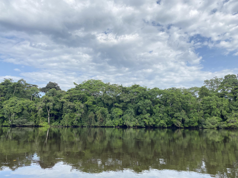
livescience.com -
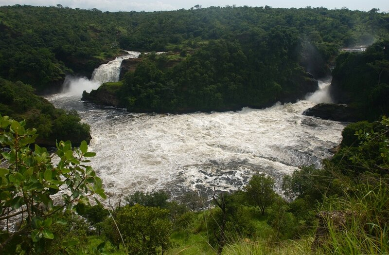
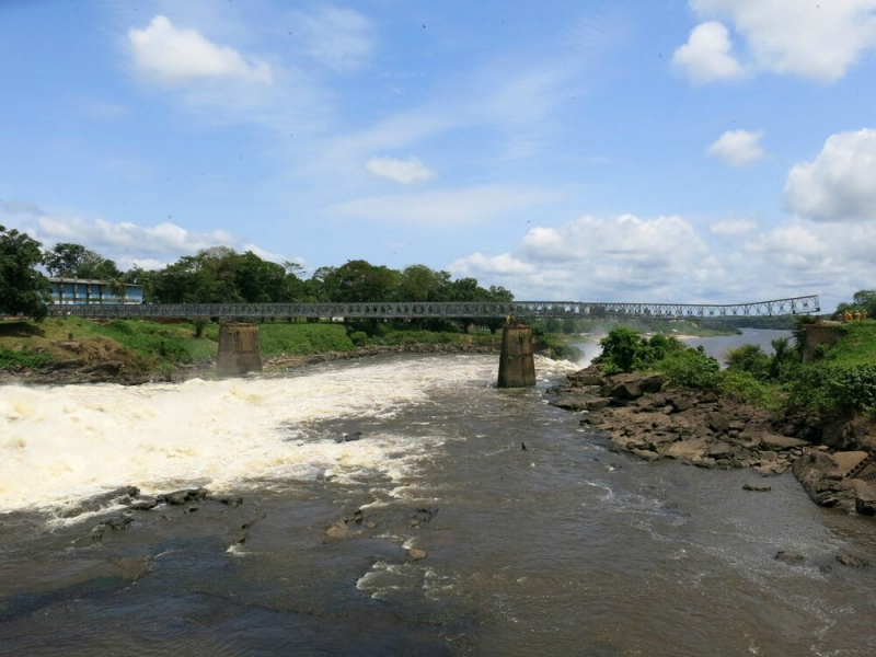
The length of the Lualaba River is 1,118 miles. It is surrounded by the Upemba National Park, which has protected ecosystems. The major economic activity is fishing, and various settlements are located along the river. At Nile Falls, there is a hydroelectric dam called the Nile Dam. The Lualaba River's headwaters are located in the Katanga Plateau, at an elevation of 1,400 meters (4,600 feet) above sea level. The river runs north until it reaches Kisangani, where the name Congo River is officially given.
It lowers from the Katanga Plateau to the Manika Plateau, with waterfalls and rapids marking the way. It falls 457 meters (1,499 feet) in 72 kilometers across the upper Upemba Depression (Kamalondo Trough) (45 mi). The Nzilo Dam, located near Nzilo Falls, is dammed for hydroelectric power. The river becomes navigable for nearly 640 kilometers (400 miles) through a succession of marshy lakes in the lower Upemba Depression, including Lake Upemba and Lake Kisale, at Bukama in Haut-Lomami District. Ankoro is located on the west bank of the Lualaba River, directly across from its confluence with the Luvua River to the east. The merged river below this point is referred to as the "Upper Congo" by some geographers.
Total Length: 1,118 miles
livescience.com 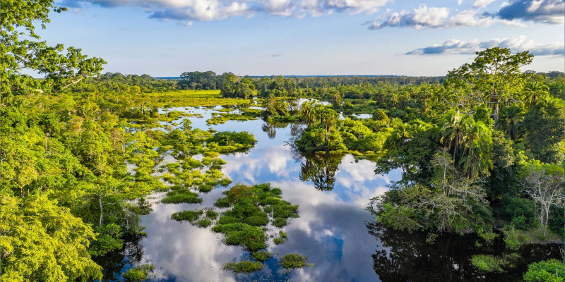
livescience.com -
In the Democratic Republic of the Congo, the Lomami River is a significant tributary of the Congo River. The river is around 1,280 kilometers (800 miles) long. It runs north, west, and parallel to the Congo River. The Lomami River rises in the country's south, between Kamina and the Congo–Zambezi split. It runs through Lubao, Tshofa, Kombe, Bolaiti, Opala, and Irema before entering the Congo at Isangi.
On January 6, 1877, Henry Morton Stanley arrived at the junction of the two rivers, "the affluent Lumami, which Livingstone called 'Young's river,' entered the mainstream, via a mouth 600 yards wide, between low banks heavily covered with trees." M. Janssen, Governor-General of the Congo State, investigated the Lomani river upstream from Isangi on the Ville de Bruxelles in October 1889. He was halted by rapids at a latitude of 4°27'2" S after steaming for 116 hours. A number of biological species have been named after the river, including the monkey Cercopithecus lomamiensis and the flowering plant Pavetta lomamiensis.
Total Length: 794 miles
livescience.com -
The Uele River is a river in the Democratic Republic of the Congo. It is also known by the phonetically similar names Uélé, Ouélé, and Welle River. The Uele River originates in the highlands near Lake Albert, at the junction of the Dungu and Kibali rivers. These rivers travel west for approximately 1,210 kilometers (750 miles) until the Uele River joins the Mbomou River at Yakoma.
The Uele River's main tributaries are the Bomokandi River (on the left bank) and the Uere River (right side). The confluence of the Uele and Mbomou rivers in Yakoma is the source of the Ubangi River, which flows into the Congo River. The Uele is the Ubangi's longest tributary. The total length of Ubangi and Uele is approximately 2,270 kilometers (1,410 mi).Total Length: 752 miles
livescience.com 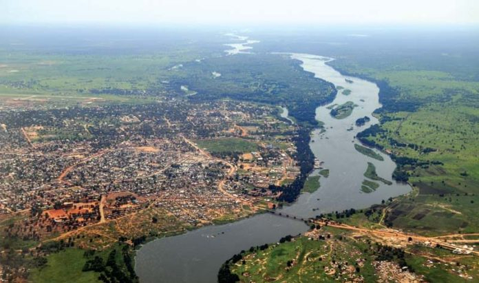
livescience.com -
The Sankuru River is the principal tributary of the Kasai River, which is a tributary of the Congo River in Congo (Kinshasa), central Africa. It is approximately 750 miles (1,200 km) long and originates in the western highlands of Katanga (Shaba) as the Lubilash River and travels 285 miles (460 km) north and northwest, when it becomes the Sankuru proper and flows northward and then virtually straight westward to the Kasai. The Sankuru is navigable for 365 miles (590 kilometers) below Pamia-Mutombo and north of Mbuji-Mayi. It is the longest tributary of the Kasai River. It is also known as Lubilash above the confluence with its tributary Mbuji-Mayi. It runs north and then west, passing through a few settlements, the most notable of which being Lusambo.
The Sankuru River is the principal tributary of the Kasai River, which is a tributary of the Congo River in Congo (Kinshasa), central Africa. It is approximately 750 miles (1,200 km) long and originates in the western highlands of Katanga (Shaba) as the Lubilash River and travels 285 miles (460 km) north and northwest, when it becomes the Sankuru proper and flows northward and then virtually straight westward to the Kasai. The Sankuru is navigable for 365 miles (590 kilometers) below Pamia-Mutombo and north of Mbuji-Mayi.
Total Length: 746 miles

livescience.com 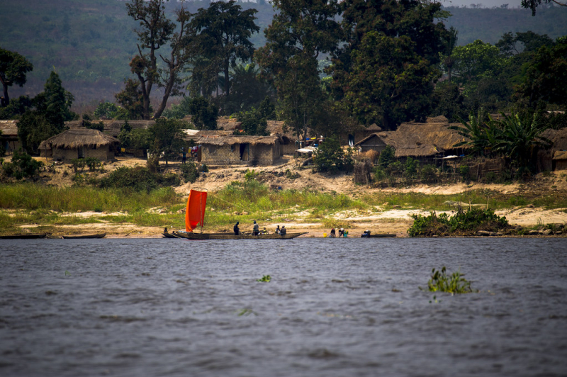
livescience.com