


Top 10 Longest Rivers in Austria

Austria is a small central European country with a land area of 32,386 square miles. Austria has a rugged landscape, with just 32% of its area below 1,640 feet ... read more...in elevation. The country's highest peak is roughly 12,461 feet above sea level. The Danube and the Alps are the two most prominent elements of Austrian terrain. The Alps cover more than 60% of Austria's total land area. Austria is home to some of Europe's longest rivers, including the Danube. Austria's rivers all run into the Black Sea or the North Sea. Here Toplist brings to you the list of 10 the longest rivers in Austria.
-
The Danube River is 1,777 miles long, making it Central and Western Europe's largest river. It is the longest river in Germany and the second longest in Europe (following the Volga in Russia). It rises in the Black Forest in Donaueschingen, Germany, and flows into the Black Sea through Ukraine and Romania's Danube Delta.
The Danube passes through or along the boundaries of ten nations, more than any other river on the planet: Germany, Austria, Slovakia, Hungary, Croatia, Serbia, Romania, Bulgaria, Moldova, and Ukraine, to name a few.
The Danube played an important role in the settlement and development of Central and Southeast Europe. Its water functioned as a crossroads for trade between countries. It also serves as a source of water for millions of people. Zander, pike, Wels catfish, tench, huchen, burbot, carp, sturgeon, salmon, trout, European seabass, mullet, and eel are among the fish found in the Danube River basin.
Length: 2850 km
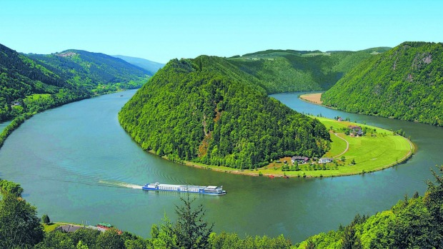
Photo: traveller 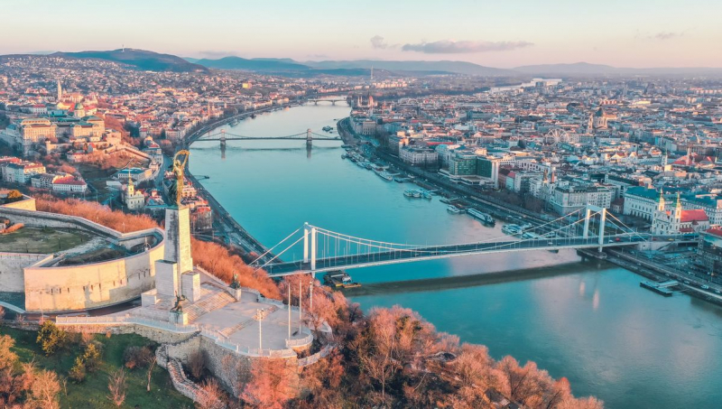
Photo: mundycruising -
The Rhine is one of Europe's major rivers. The river starts in the Swiss canton of Graubünden in the southeastern Swiss Alps, passes across the Swiss-Liechtenstein, Swiss-Austrian, Swiss-German, and then Franco-German borders, then flows largely north through the German Rhineland and the Netherlands until emptying into the North Sea. With a length of around 1,230 km (760 mi) and an average discharge of about 2,900 m3/s (100,000 cu ft/s), it is the second-longest river in Central and Western Europe (after the Danube).
The Rhine and the Danube formed a large part of the Roman Empire's northern inland border, and the Rhine has long been a major navigable waterway for moving trade and supplies deep inland. Its importance as a waterway in the Holy Roman Empire is evidenced by the numerous castles and fortifications built along it. Cologne, Düsseldorf, Rotterdam, Strasbourg, and Basel are among the Rhine's largest and most important cities.
The Rhine has served as a classic illustration of major rivers' alternating roles as political and cultural unifiers and political and cultural boundary lines. The Rhine became a key axis of industrial production because of its low-cost water transportation, which helped to keep raw material prices low: one-fifth of the world's chemical businesses currently manufacture along the Rhine. The Rhine has long been a source of political strife in Europe, but as pollution levels have risen, international concern for environmental safeguards has grown; over 6,000 hazardous chemicals have been identified in Rhine waters.
Length: 1230 km
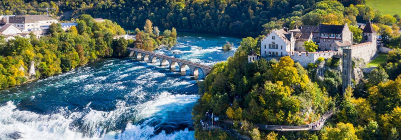
Photo: viator 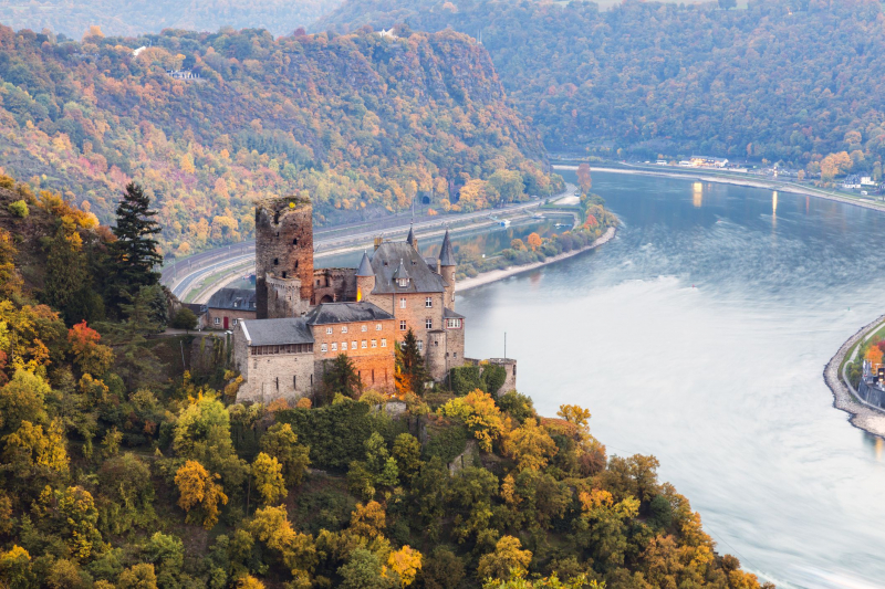
Photo: tripsavvy -
The Drava, often known as the Drave, is a river that flows through southern Central Europe. It is the Danube's fifth or sixth-longest tributary, after the Tisza, Sava, Prut, Mureș, and maybe Siret, with a length of 710 kilometers (440 miles) and 724 kilometers (450 miles) including the Sextner Bach source. And it is one of the longest rivers in Austria. The Drava drains around 40,154 km2 of land (15,504 sq mi). Its yearly discharge ranges from 500 m3/s (18,000 cu ft/s) to 670 m3/s (24,000 cu ft/s) depending on the season. Its source is in the Puster Valley of South Tyrol/Alto Adige, Italy, near the market town of Innichen/San Candido. The river runs eastward from Austria's East Tirol and Carinthia into Slovenia's Styria region. It then turns southeast, passing through Croatia and, after merging with its main tributary Mur, forms most of the border between Croatia and Hungary, before it joins the Danube near Osijek.
Hydroelectric power stations in Austria, Slovenia, and Croatia have exploited the Drava's natural fast path. Only tiny boats can navigate its upper sections, and larger craft may navigate it downstream from Donji Miholjac, Croatia. Invaders from the east, such as the Huns and Slavs, used the Drava valley as their main route into the Alpine kingdoms. Klagenfurt and Graz in Austria, Maribor and Ptuj in Slovenia, and Varadin and Osijek in Croatia are the principal towns along the Drava and its tributaries.
Length: 710 km
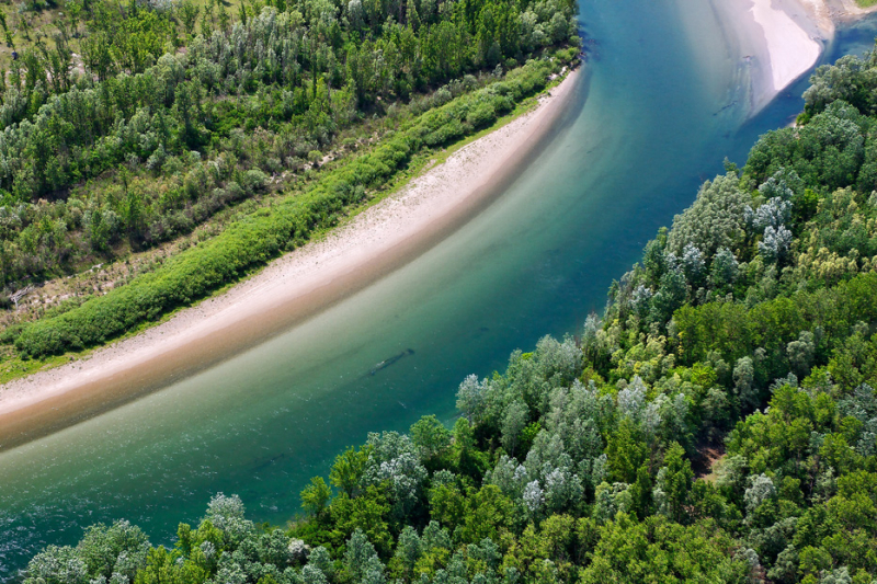
Photo: wwf 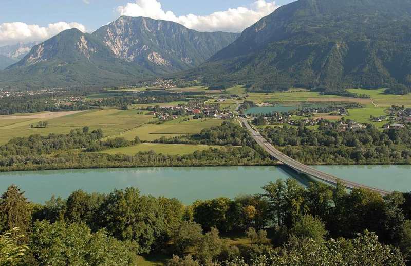
Photo: themayor.eu -
A large right- (south-) bank tributary of the Danube River, the Inn River is a major right- (south-) bank tributary of the Danube River. The Inn River stretches for 317 miles (510 kilometers). It begins in Switzerland's Lake Lughino and runs northeast through western Austria and southern Germany. The Engadin is the name of the river's Swiss part (q.v.). In Austria, the river flows through the Oberinntal (upper Inn Valley), which is located above Zirl, and then into the Unterinntal (lower Inn Valley), which encompasses Innsbruck. Except at Kufstein, where it cuts between the Bavarian Alps on the west and the Kaisergebirge on the east, the Unterinntal is a wide river. The Inn travels north and then east as it enters Bavaria, Germany, before meeting its biggest tributary, the Salzach River. It forms part of the Austro-German border until it meets the Danube at Passau, Germany, a short distance downstream. Agricultural regions run along the river's middle and lower sections, which are tapped for hydroelectric power at various spots.
Length: 510 km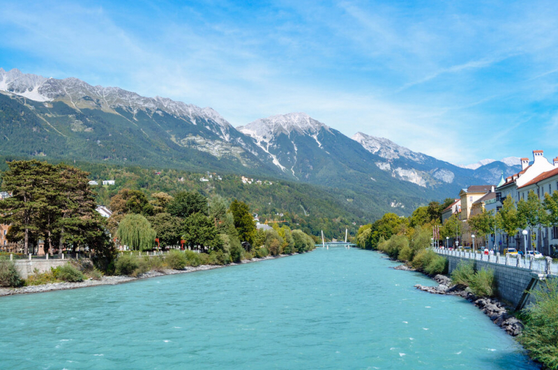
Photo: barrettish 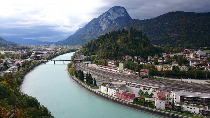
Photo: needpix -
The Mur is a river in Central Europe that originates at 1,898 meters (6,227 feet) above sea level in the Hohe Tauern national park of the Central Eastern Alps in Austria. It is a tributary of the Drava, which then flows into the Danube. The Mur is 464 kilometers long in total (288 mi). About 326 km run through Austria's interior; 95 km flow through and around Slovenia (67 km along the Austrian-Croatian border, 28 km inside Slovenia), and the rest forms the Croatian-Hungarian boundary. Graz, Austria, is the river's major city. Its drainage basin is 14,109 square kilometers (5,448 sq mi). Tributaries of the Mur include the Mürz, the Sulm, the Ščavnica, the Ledava and the Trnava.
The river has a very long history with industries and mining. It has a very strong current due to which the water has been used frequently to power the mills near the river. Apart from this, the river is believed to carry small amounts of Gold. A lot of times, locals gather and hunt for the Gold. You can also see bigger agencies coming down to collect Gold.
Length: 464 km
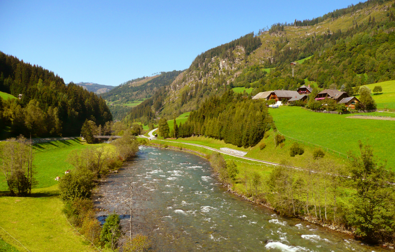
Photo: wikipedia 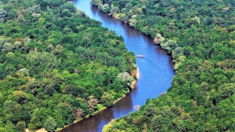
Photo: riverwatch.eu -
Morava River, German March, tributary of the Danube that rises in eastern Czech Republic and divides the Czech Republic from Slovakia and then Slovakia from Austria in its lower course. It is named after Moravia, a historic region that encompasses the majority of the river's drainage basin, which spans 15,000 square miles (38,900 square kilometers). Its western tributaries originate in the Bohemian-Moravian Highlands, while its eastern tributaries, of which the Beva is the most important, originate in the Carpathians' westernmost ranges.
The Morava River starts on the southern slope of Králick Snnk in the Nzk and Hrub Jesenk mountains, then flows south for 227 miles before joining the Danube River right above Bratislava, Slovakia. Historically, the river valley has served as one of Europe's natural passageways. The Moravian Gate, a low crossing in the north between the Beva and Oder rivers, connects the Danube countries with the Silesian Plain and Poland's Central Plain.
The river has been supplying the fields in the area for over 30,000 years. The black water is one feature that distinguishes the Morava River from others. It is Europe's only river with black water. The river has a very constant water flow, and the riverbed is relatively shallow.
Length: 365km
Photo: wikipedia 
Photo: commons.wikimedia -
The Rába is a right tributary of the Danube that flows through southeastern Austria and western Hungary. Its source is in Austria, below Heubodenhöhe Hill, a few kilometers east of Bruck a der Mur. It runs across the Austrian states of Styria and Burgenland, as well as Hungary's Vas and Gyr-Moson-Sopron counties. It is 298.2 kilometers long, with around 100 kilometers in Austria. It empties into a tributary of the Danube (Mosoni-Duna) in Gyr, Hungary, in northern Hungary. It has a basin size of 10,401 square kilometers (4,016 sq mi). Gleisdorf, Feldbach (both in Austria), Szentgotthárd, and Körmend are among the towns along the Rába (in Hungary). The river used to flow in the opposite direction in the early Cenozoic, but tectonic uplift changed that.
Length: 298.2 km
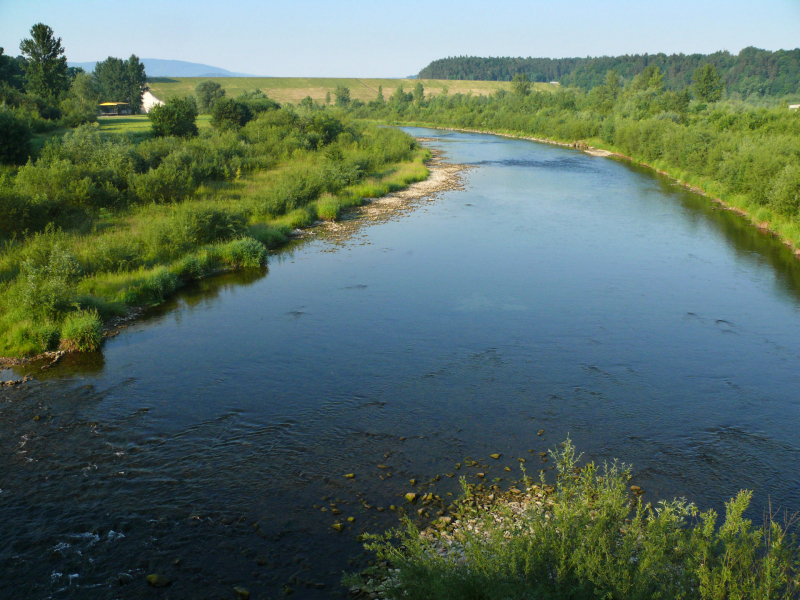
Photo: wikipedia 
Photo: flickr -
The Isar is a river in Tyrol, Austria, and Bavaria, Germany, that can only be navigated by rafts. The Isar begins in the Karwendelgebirge, about northeast of Innsbruck, Austria, at a height of 5,741 feet (1,750 m), and flows west until crossing into Germany at Scharnitz Pass. The river flows through a deep valley known as Porta Claudia, which was used by the ancient Romans. The gorge is presently traversed by a rail line and a road. Turning east and north again, the Isar emerges on the Bavarian plain, flowing past Munich before joining the Danube downstream of Regensburg. The river is rapid and too shallow for navigation for much of its length of 183 miles (295 kilometers). Principal tributaries of the Isar are the Loisach, Würm, and Amper.
Length: 295 km
Photo: muenchen.de 
Photo: freepik -
The Lech is a river that flows between Austria and Germany. It is a 255-kilometer-long (158-mile) right tributary of the Danube with a drainage basin of 3,919 square kilometers (1,513 sq mi). Its typical mouth outflow is 115 m3/s (4,100 cu ft/s). Its source is in the Austrian state of Vorarlberg, where the river rises at an altitude of 1,870 meters from the Formarinsee lake in the Alps (6,120 ft). It flows north-northeasterly till it reaches the German border, where it forms the Lechfall, a 12-meter-high (39-foot) waterfall; then it enters a small canyon (the Lechschlucht). It leaves the Alps and reaches the Allgäu plains in Füssen, in the German state of Bavaria, at an elevation of 790 meters (2,580 feet), where it used to be the border with Swabia. The river flows through Füssen and the Forggensee, a man-made lake that is drained during the winter. It creates rapids and a waterfall here.
The Lech continues north through the Lechrain region, passing past the cities of Schongau, Landsberg, Augsburg (where it gets the Wertach), and Rain before joining the Danube close before Donauwörth at an elevation of 410 meters (1,330 ft). Because of its torrential nature and the gravel banks that clog its channel, it is impassable. From Neuschwanstein Castle, in Füssen, there are panoramic views of the Lech valley.
Length: 255.3 km
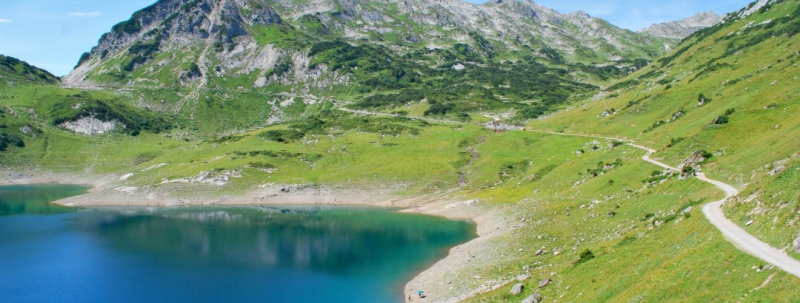
Photo: outdooractive 
Photo: checkyeti -
The Enns is a tributary of the Danube that joins the Danube northward in Enns, Austria. The Enns is a flat-J-shaped river that stretches for 253 kilometers (157 miles). It flows from its source in the village of Flachau eastward via Radstadt, Schladming, and Liezen, then turns north around Hieflau, passing through Weyer and Ternberg on its way to the Danube at Enns.
The Radstädter Tauern mountains in the Austrian state of Salzburg are the source of the Enns. It flows on an eastern trajectory through Styria, passing the Dachstein range on its southern side, along the border between the Northern Limestone Alps and the Central Eastern Alps, in a valley that emerged during the ice period. Between Admont and Hieflau, it turns north and travels through the Gesäuse, a 15-kilometer (9.3-mile) ravine that cuts through the limestone of the Ennstaler Alpen. From there, it flows north till it reaches the state of Upper Austria at the Laussabach's mouth. It constitutes the border between Upper and Lower Austria north of Steyr (formerly also known as Austria above the Enns and Austria below the Enns). At Mauthausen and the city of Enns, it finally reaches the Danube. It is the longest river in Austria alone.
On the Enns, there are now 15 hydroelectric power stations.Length: 253.4 km
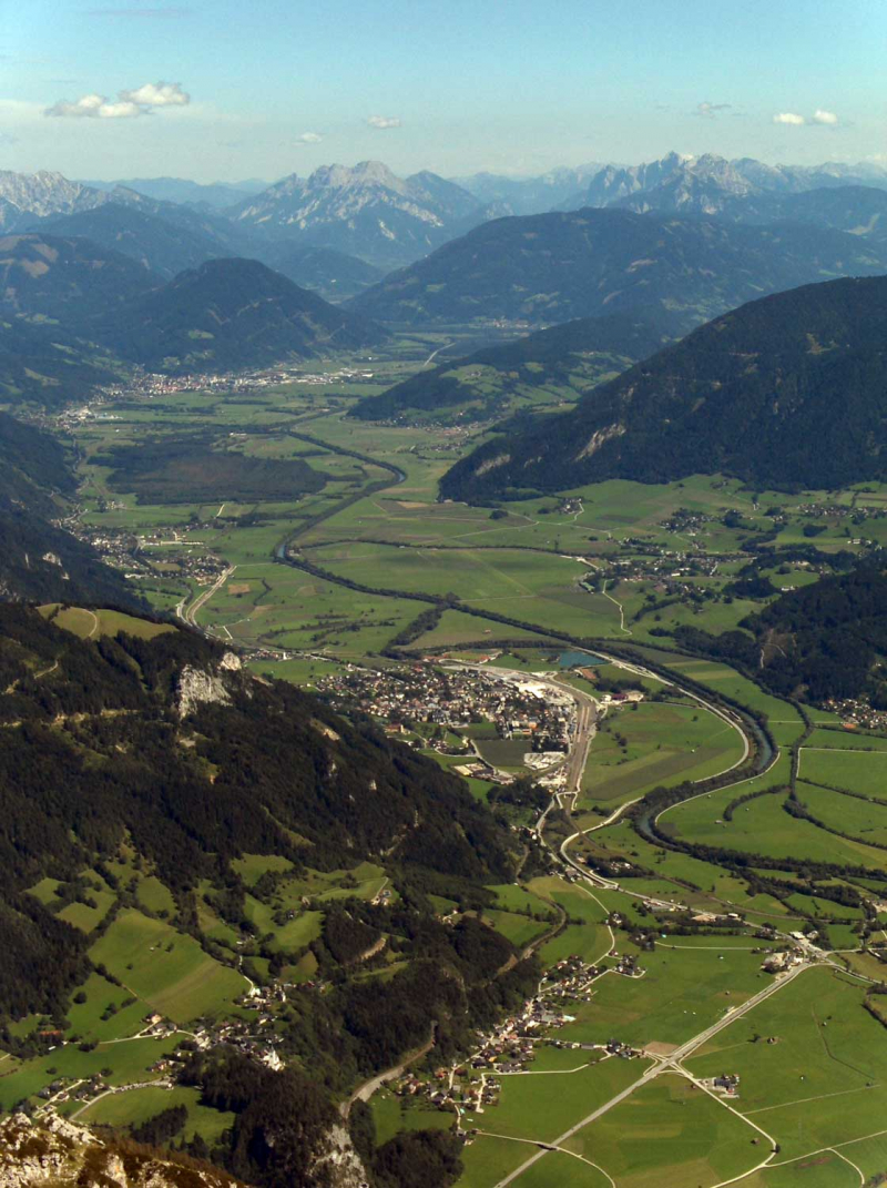
Photo: wikipedia 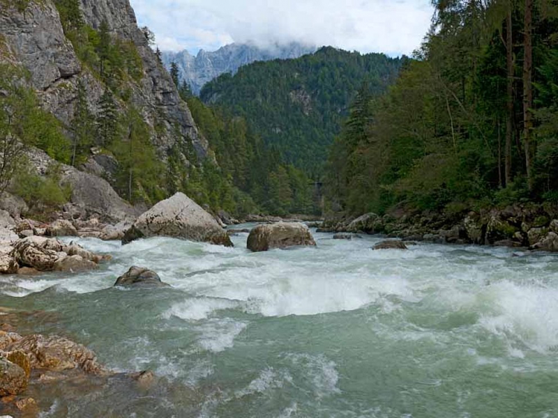
Photo: radurlaub


