


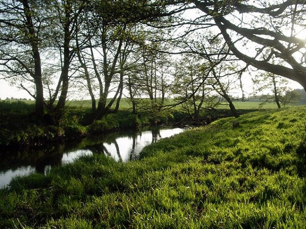
Top 10 Longest Rivers in Belarus

Belarus is a landlocked country in Eastern Europe with a large number of water bodies, including over 20,000 rivers. Belarus shares its major rivers with its ... read more...neighbors, while others serve as tributaries to these rivers. The majority of these rivers flow into the Baltic and Black Sea basins. Furthermore, these rivers support a diverse range of water biodiversity, which is important to Belarus' cultural and national heritage. These rivers are also important for the water needs of the communities that surround them. Toplist has compiled the top 10 Longest Rivers in Belarus in this article.
-
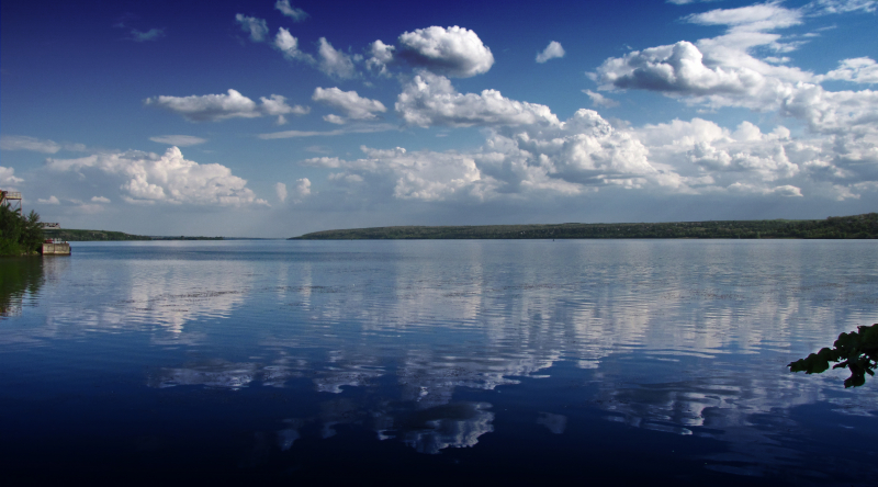
The first one in Top 10 Longest Rivers in Belarus that Toplist would like to introduce to you is Dnieper. The Dnieper is a major European river that begins in the Valdai Hills near Smolensk, Russia, and flows through Belarus and Ukraine to the Black Sea. It is the longest river in Ukraine and Belarus, as well as the fourth-longest river in Europe, after the Volga, Danube, and Ural. The total length is about 2,201 km (1,368 mi), with a drainage basin of 504,000 square kilometers (195,000 sq mi).
The river was once a part of the Amber Road trade routes. During The Ruin, the area was contested by the Polish–Lithuanian Commonwealth and Russia, dividing Ukraine into right and left bank areas. During the Soviet era, the river was known for its large hydroelectric dams and reservoirs. The 1986 Chernobyl disaster occurred on the Pripyat, just above its confluence with the Dnieper. The Dnieper is an important navigable waterway for Ukraine's economy, and it is linked to other waterways in Europe by the Dnieper–Bug Canal.
The river's total length is variously given as 2,145 km (1,333 mi) or 2,201 km (1,368 mi) of which 485 km (301 mi) are in Russia, 700 km (430 mi) in Belarus, and 1,095 km (680 mi) in Ukraine. Its basin spans 504,000 square kilometers (195,000 square miles), with 289,000 km2 (112,000 sq mi) in Ukraine and 118,360 km2 (45,700 sq mi) in Belarus.
The Dnieper River's headwaters are the sedge bogs (Akseninsky Mokh) of the Valdai Hills in central Russia, at an elevation of 220 meters (720 ft). It forms the border between Belarus and Ukraine for 115 kilometers (71 miles). Its estuary, or liman, was once guarded by the powerful fortress of Ochakiv.
Belarus's southernmost point is Brahin Raion on the Dnieper, south of Kamaryn.
Length: 2,201 km (1,368 mi)
https://ko.wikipedia.org/ 
https://uk.wikipedia.org/ -
The second one in Top 10 Longest Rivers in Belarus that Toplist would like to introduce to you is Daugava. The Daugava River rises in Russia's Valdai Hills and flows through Belarus and Latvia into the Baltic Sea's Gulf of Riga. It rises near the Volga's headwaters. It is 1,020 km (630 mi) long, with 325 km (202 mi) in Russia. It is a westward-flowing river that forms a large curve to the south, passing through northern Belarus.
Riga, Latvia's capital, spans the estuary four times, lying on both banks, with the city center 15 kilometers (9.3 miles) from the mouth and serving as a significant port. The river's total catchment area is 87,900 km2 (33,900 sq mi), of which 33,150 km2 (12,800 sq mi) is within Belarus.
The river's environment began to deteriorate during the era of Soviet collective agriculture (which produced significant adverse water pollution runoff) and a wave of hydroelectric power projects. The Daugava River is considered moderately polluted in Belarus, with the main sources being treated wastewater, fish farming, and agricultural chemical runoff (e.g. herbicides, pesticides, nitrate and phosphate).
Length: 1,020 km (630 mi)
wikidata.org 
https://it.wikipedia.org/ -
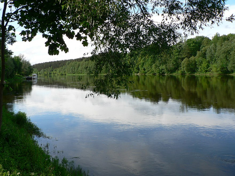
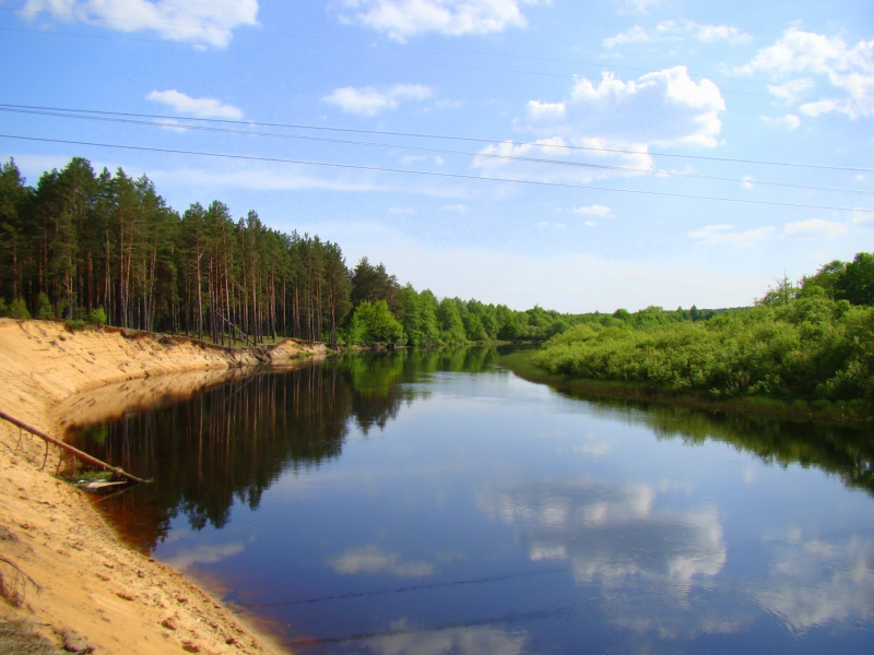
The third one in Top 10 Longest Rivers in Belarus that Toplist would like to introduce to you is Neman. The Nemunas, also known as the Nioman, Neman, or Memel, is a river in Europe that originates in central Belarus and flows through Lithuania before forming the northern border of Kaliningrad Oblast, Russia's western exclave, which specifically follows its southern channel. It drains into the Curonian Lagoon, which is only tenuously connected to the Baltic Sea. It has a length of 937 kilometers (582 miles) and is considered a major Eastern European river. It flows generally west to Grodno, about 12 kilometers (7.5 miles) from the Polish border, then north to Kaunas and west again to the sea.
Perch, pike, zander, roach, tench, bream, rudd, ruffe, and bleak have all been caught. Stone loach, three-spined stickleback, minnows, trout, sculpins, gudgeon, dace, and chub have been caught in its tributaries.
Atlantic salmon migrated upstream to spawn, but dams on the river, the majority of which were built in the twentieth century, depleted them. There are no fish ladders on the Kaunas dam. The spawning season occurred in the fall. According to ethnographic studies conducted prior to the dams, night fishing with torches and harpoons was a common technique.
Length: 937 km (582 mi)
thereaderwiki.com 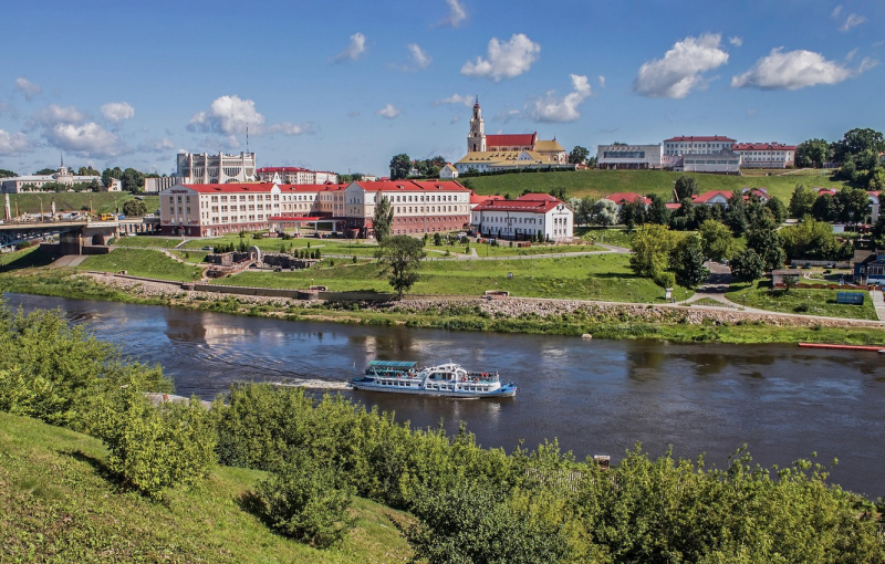
goodfon.com -
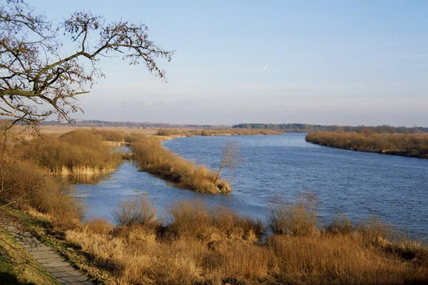
The fourth one in Top 10 Longest Rivers in Belarus that Toplist would like to introduce to you is Bug. The Bug is a major river in Eastern Europe that flows through Belarus, Poland, and Ukraine. It is 774 kilometers long (481 mi). The Bug, a tributary of the Narew, forms part of the Belarus–Poland border as well as part of the Poland–Ukraine border between Ukraine and Poland for 185 kilometers (115 miles), and between Belarus and Poland for 178 kilometers (111 miles),, and is the fourth longest Polish river.
The Bug is a Narew tributary to the left. It flows from the Lviv Oblast in western Ukraine northwards into the Volyn Oblast, then into Poland, where it follows part of the border between the Masovian and Podlaskie Voivodeships. It merges with the Narew at Serock, a few kilometers upstream of the man-made Zegrze Lake.
This section of the Narew between the confluence and the Vistula is sometimes referred to as the Bugo-Narew, but on December 27, 1962, the Prime Minister of Poland's act abolished the name "Bugo-Narew," shortly after the completion of Zegrze Lake.
The westernmost point of Belarus is located on the Bug, a few kilometers from Vysokaye in the Kamenets District of the Brest Region. The Dnieper-Bug Canal connects it to the Dnieper via the Mukhavets, a right-bank tributary.
Length: 774 km (481 mi)
en.wikipedia.org 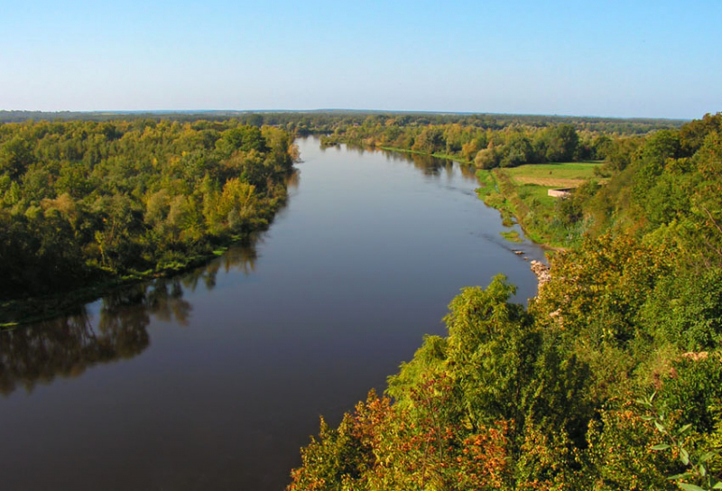
simple.wikipedia.org -
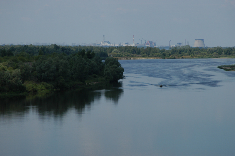
The fifth one in Top 10 Longest Rivers in Belarus that Toplist would like to introduce to you is Pripyat. Pripyat or Prypiat is a river in Eastern Europe that runs for approximately 761 kilometers (473 miles). It flows east through Ukraine, Belarus, and back into Ukraine before emptying into the Dnieper. The Pripyat River flows through the exclusion zone established around the Chernobyl nuclear disaster site. Following the Chernobyl disaster, the city of Pripyat, Ukraine (population 45,000), was completely evacuated. The Pripyat River flows through the exclusion zone established around the Chernobyl nuclear disaster site. Following the Chernobyl disaster, the city of Pripyat, Ukraine (population 45,000), was completely evacuated.
Pripyat's catchment area is 121,000 km2 (47,000 sq mi), of which 50,900 km2 (19,700 sq mi) is in Belarus. Belarus accounts for 495 km (308 mi) of the river's total length.
The river runs for 775 kilometers. The pool covers an area of 114,300 km2. The Pripyat valley is murky in the upper reaches, but clearer in the lower reaches. The cave is developed all the way through, with two super-floodplain terraces. In some years, the upper course of the floodplain is flooded for several months, with a width of 2–4 km or more. The floodplain reaches a width of 10–15 km in the lower reaches. The channel in the upper canalized; below - winding, forms meanders, elders, many ducts (one of which is combined with the Nobel Lake); sandy islands The river has a width of up to 40 m in the upper reaches, an average of 50–70 m in the middle reaches, and a width of 100–250 m in the lower reaches, with the entrance to the Kyiv reservoir being 4–5 km away. The bottom is sandy and spruce-sandy. The river has a slope of 0.08 m/km.
Length: 761 km (473 mi)
simple.wikipedia.org 
savepolesia.org -
The Sozh, also known as the Sož, is a river that flows through Russia, Belarus, and Ukraine. It is a Dnieper tributary on the left bank. The Sozh River runs through Gomel, Belarus's second largest city. The river is crossed by the Sozh Floating Bridge in Korma and an elegant steel arch in Gomel, which is featured on a 300 ruble national stamp.
The Sozh River rises in Russia and is mostly fed by snow. Between November and early January, the river freezes over. The ice begins to melt in late March or early April. Its main tributaries are the Vikhra and Pronia on the right, and the Ostyor, Besed, Iput, and Uts on the left. It is one of six 500-kilometer-long tributaries that join the Dnieper, Europe's third-longest river (2,201 km).
In its upper reaches, where it is navigable from Krichev, the river is equipped with navigational locks. The river is flooded with timber.
The river's mouth is 150m wide and swampy. The river's catchment area is 42,140 square kilometers (16,270 square miles) along its 648-kilometer (403-mile) length, 21,700 square kilometers (8,400 square miles), and 493 kilometers (306 miles) within Belarus. The average discharge measured at Gomel, 100 kilometers (62 miles) upstream of the mouth, is 207 m3/s.
Krichev, Cherikov, Slavgorod, Gomel, and Vetka are historic towns on the banks of the main river and its tributaries.
The Sozh River in Russia originates in Smolensky District and flows through Pochinkovsky and Khislavichsky Districts of Smolensk Oblast. Khislavichi is a city-like settlement on the banks of the Sozh River. It flows further south, forming the border between Smolensk Oblast's Khislavichsky and Shumyachsky District in the east and Belarus's Mogilev Region in the west.
Length: 648 km (403 mi)
en.wikipedia.org 
flickr.com -
The Berezina, also known as the Biarezina, is a river in Belarus that is a right tributary of the Dnieper. The Berezinsky Biosphere Reserve serves as the river's headwaters. The Berezina is about 561 kilometers long. The river is 15-20 m wide at its widest point, with a maximum width of 60 m. The banks are low (up to 0.5 m), steep (up to 1.5 m in some places), sandy, and the floodplain is swampy. Berezina usually freezes in the first half of December.
Bobr, Klyava, Ol'sa, and Ala are its main tributaries on the left, and Hayna and Svislach on the right.
The riverside Berezina Biosphere Preserve is on the UNESCO list of Biosphere Preserves. Peat bogs cover 430 km2 and thus make up a significant portion of the reserve. These open peat zones, which are among Europe's largest bogs, have remained virtually untouched.
Cities and towns on the Berezina from north to south: Dokshytsy, the village Studzionka, Barysau, Babruysk and Svietlahorsk
Length: 561 km (349 mi)
vi.wikipedia.org 
Photo: Max Prohorov's Youtube Channel -
The Neris River originates in northern Belarus. It flows westward, passing through Vilnius (Lithuania's capital), and as its main tributary, it flows into the Nemunas (Neman) at Kaunas in the country's south-central region. It is 510 kilometers long (320 mi). The river flows through Lithuania for 235 kilometers (146 miles) after passing through Belarus for 276 kilometers (171 miles). It is the eighth longest river in Belarus.
The Neris River connects the Lithuanian capitals of Kernav and Vilnius. Along its banks are pagan Lithuanian burial grounds. Karmazinai's old burial mounds, with many mythological stones and a sacred oak, are located 25 kilometers (16 miles) from Vilnius.
Neris is a Baltic name, a cognate of the Lithuanian nerti, which means "to dive, swim downstream" as well as "to net, crochet." In the beginning, the name most likely had a more general meaning of "flow" or, more specifically, "swift and swirling flow".
The name is etymologically related to a class of hydronyms found throughout the modern and prehistoric Baltic ranges, such as Lithuanian Narotis, Narasa (rivers), Narutis (lake), Old Prussian Narus, and Nara near Moscow. These are related to the Lithuanian words narus, which means "deep," and nerti, which means "to dive."
Length: 510 km (320 mi)
en.wikipedia.org 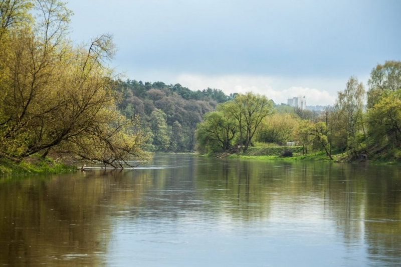
delfi.lt -
The Ptsich, also known as the Pcič (Belarusian: Пціч, [ptsʲitʂ]), is a river in Eastern Europe. Ptsich is the ninth longest river in Belarus.
It flows south through Belarus, beginning near Minsk and draining into the Pripyat River, which is its left tributary. Minsk is Belarus' capital and largest city, located on the Svislach and now-subterranean Niamiha rivers. Minsk has special administrative status in Belarus as the capital, and it serves as the administrative center for Minsk Region (voblasć) and Minsk District (rajon). Minsk is the administrative capital of the Commonwealth of Independent States (CIS) and the home of the organization's Executive Secretary. The Pripyat is a 761 km (473 mi) long river in Eastern Europe. It flows east through Ukraine, Belarus, and back into Ukraine before emptying into the Dnieper.
Ptsich stretches for 421 kilometers (262 miles) and has a drainage basin of 9,470 square kilometers (3,660 sq mi). The Aresa is its main tributary.
Length: 421 km (262 mi)
en.wikipedia.org 
commons.wikimedia.org -
The Shchara (Belarusian: Шчара, Ščara, pronounced [ˈʂtʂara]; Russian: Щара) is a river in Belarus that is a tributary of the Neman. Neman is a European river that originates in central Belarus and flows through Lithuania before forming the northern border of Kaliningrad Oblast, Russia's western exclave, which follows its southern channel. Neman drains into the Curonian Lagoon, which is only tenuously connected to the Baltic Sea. Neman has a length of 937 kilometers (582 miles) and is considered a major Eastern European river. It flows generally west to Grodno, about 12 kilometers (7.5 miles) from the Polish border, then north to Kaunas and west again to the sea.
It has a length of 300 km (190 mi) and a catchment area of 6,730 km2 (2,600 sq mi). The Shchara is Belarus's fifth-longest river. It flows through Slonim.
Main tributaries:
- Right: Lipnyanka, Myshanka, Lakhazva, Isa, Padyavarka.
- Left: Vedma, Grivda, Lukonitsa, Sipa.
Length: 300 km (190 mi)
grodnovisafree.by 
https://en.wikipedia.org/


