


Top 10 Longest Rivers in Belgium

Belgium is located in Western Europe, bordering France, Luxembourg, the Netherlands, Germany, and the North Sea. It has a total area of 11,787 square miles. ... read more...There are three major geographical regions within this area. The coastal plains, which are made up of sand dunes, the central plateau, which is made up of valleys and gorges, and the Ardennes, which is made up of a rocky and forested plateau, are among these regions. Rivers and other waterways traverse large swaths of these areas. This article looks at some of Belgium's longest rivers in greater detail.
-
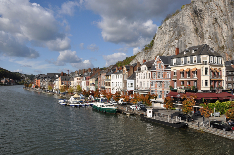
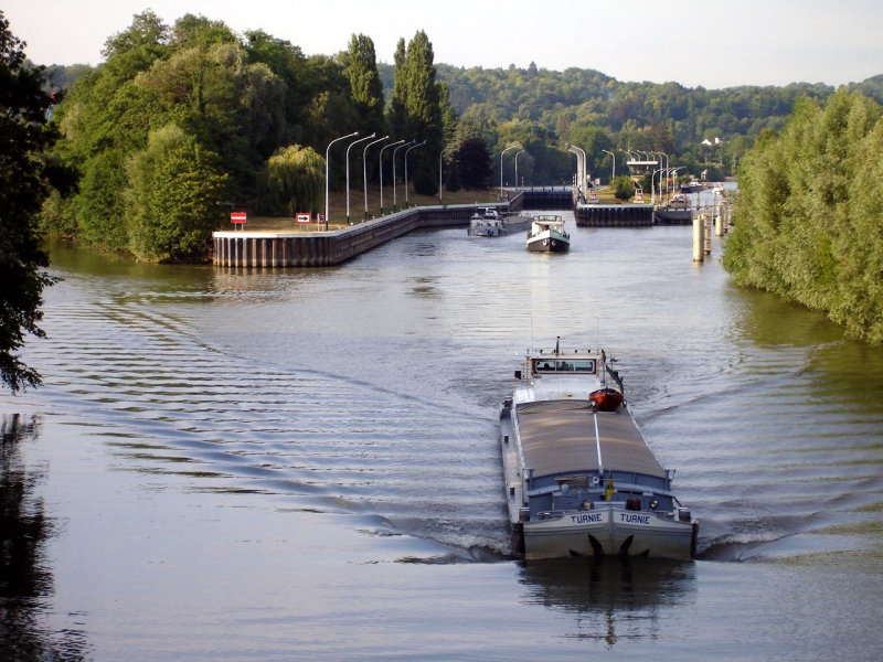
The first longest river in Top 10 Longest Rivers in Belgium that Toplist wants to introduce to you is Meuse. The Meuse, also known as the Maas, is a major European river that originates in France and flows through Belgium and the Netherlands before emptying into the North Sea via the Rhine–Meuse–Scheldt delta. It is 925 kilometers long in total (575 miles).
The Meuse rises in Pouilly-en-Bassigny, commune of Le Châtelet-sur-Meuse on the Langres plateau in France, and flows north past Sedan (the navigation head) and Charleville-Mézières into Belgium.
The Sambre joins it at Namur. The Meuse flows eastward beyond Namur, skirting the Ardennes and passing Liège before turning north. The river then forms part of the Belgian-Dutch border, though the border is further west at Maastricht. In the Netherlands, it flows north through Venlo, close to the border with Germany, then turns west, running parallel to the Waal and forming part of the extensive Rhine–Meuse–Scheldt delta, along with the Scheldt to the south and the Rhine to the north. Near Heusden, the river is divided into the Afgedamde Maas on the right and the Bergse Maas on the left. Amer, which is part of De Bergse Maas, continues the Bergse Maas. The Bergse Maas is still known as Amer, and it is part of De Biesbosch. At Woudrichem, the Afgedamde Maas joins the Waal, the main stem of the Rhine, and flows as the Boven Merwede to Hardinxveld-Giessendam, where it splits into the Nieuwe Merwede and the Beneden Merwede. The Nieuwe Merwede joins the Amer near Lage Zwaluwe, forming the Hollands Diep, which splits into Grevelingen and Haringvliet before emptying into the North Sea.
Length: 925 km (575 mi- shared with France and the Netherlands)
en.wikipedia.org 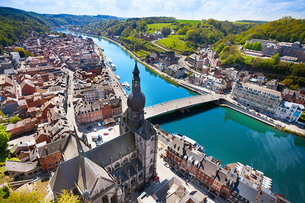
cruisecritic.com -
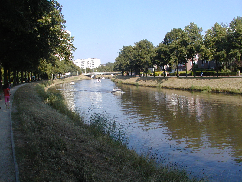
The second one in Top 10 Longest Rivers in Belgium that Toplist wants to introduce to you is Scheldt. The Scheldt is a 360 kilometer (220 mile) river that flows through northern France, western Belgium, and the southwestern Netherlands, eventually emptying into the North Sea.
The Scheldt's headwaters are in Gouy, in the northern French department of Aisne. It runs through Cambrai and Valenciennes before entering Belgium near Tournai. Ghent grew up at the confluence of the Lys, one of its main tributaries, and the Scheldt, which flows east. The Scheldt flows west into the Netherlands toward the North Sea near Antwerp, the largest city on its banks.
From that point, there were two branches: the Oosterschelde (Eastern Scheldt) and the Westerschelde (Western Scheldt). However, in the nineteenth century, the Dutch constructed a dyke that separates the river from its eastern (northern) branch and connects Zuid-Beveland to the mainland (North Brabant). The river now only flows into the Westerschelde estuary, passing through Terneuzen on its way to the North Sea between Breskens in Zeelandic Flanders and Vlissingen (Flushing) on Walcheren.
The Scheldt is a significant waterway that has been made navigable from its mouth to Cambrai. The Canal de Saint-Quentin follows its course above Cambrai. Antwerp's port, Europe's second-largest, grew up on its banks. Several canals (including the Albert Canal) connect the Scheldt to the Rhine, Meuse, and Seine river basins, as well as the industrial areas of Brussels, Liège, Lille, Dunkirk, and Mons.
Length: 360 km (220 mi- shared with France and the Netherlands)
commons.wikimedia.org 
commons.wikimedia.org -
The third one in Top 10 Longest Rivers in Belgium that Toplist wants to introduce to you is Oise. The Oise is a Belgian and French river that flows for 341 kilometers (212 miles) from its headwaters in the Belgian province of Hainaut, south of Chimay. After about 20 kilometers, it crosses the border into France (12 mi). It empties into the Seine at Conflans-Sainte-Honorine, a northwestern Paris suburb. The Aisne is its main tributary. It was the inspiration for the French departments of Oise and Val-d'Oise.
The Oise has played an important role as an inland shipping waterway connecting the Seine (and thus Paris) with the coastal regions of northern France, Belgium, and the Netherlands over the centuries. The Oise will be linked at Janville, north of Compiègne, to the high-capacity Canal Dunkerque-Escaut, east of Arleux, with the planned construction of the Seine-Nord Europe Canal, a high-capacity water transport system. The Seine-Nord Europe Canal will replace the old Canal de Saint-Quentin and the current Canal du Nord, both of which have far insufficient capacity. When the new Seine-Nord connection is completed, large vessels will be able to transport goods from the Seine, and thus Paris and its surroundings, to the ports of Dunkirk, Antwerp, and Rotterdam.
Part of the overall project involves upgrading the river Oise between Creil and Compiègne, a project known as MAGEO (Mise au gabarit européen de l'Oise), which was put out to public consultation in 2013. To meet the requirements of a class Vb inland waterway, some bends must be eased and bridges must be raised.
Length: 341 km (212 mi- shared with France)
mapcarta.com 
en-academic.com -
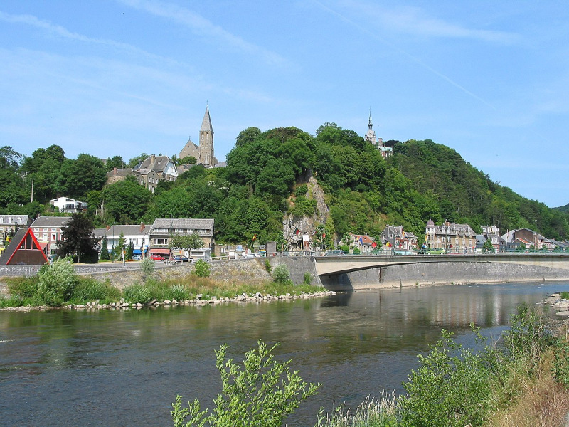
The fourth one in Top 10 Longest Rivers in Belgium that Toplist wants to introduce to you is Semois. The Semois is a river that flows from the Ardennes uplands of Belgium and France to the Meuse. The Semois originates in Arlon, Wallonia, in the Belgian province of Luxembourg, near the Grand Duchy of Luxembourg. It flows roughly westward and enters France after passing through the Belgian village of Bohan-sur-Semois, forming about 2 kilometers (1.2 miles) of the Belgian–French border. In Monthermé, it joins the Meuse 24 kilometers (15 miles) downstream. The river's total length is 210 kilometers (130 mi).
Chiny, Florenville, Herbeumont, Bouillon (including the towns of Dohan and Poupehan), and Vresse-sur-Semois are also on the Semois's banks (all in Belgium).
The name SESMARA first appears in writing in the 2nd century AD. That was before the region was heavily influenced by Germanic immigration. Sesomirs (664), Sesmarus (950), Sesmoys (1104), and Semoir are medieval forms (1244).
A type of tobacco grown in the area bears the river's name.
Length: 210 km (130 mi- shared with France)
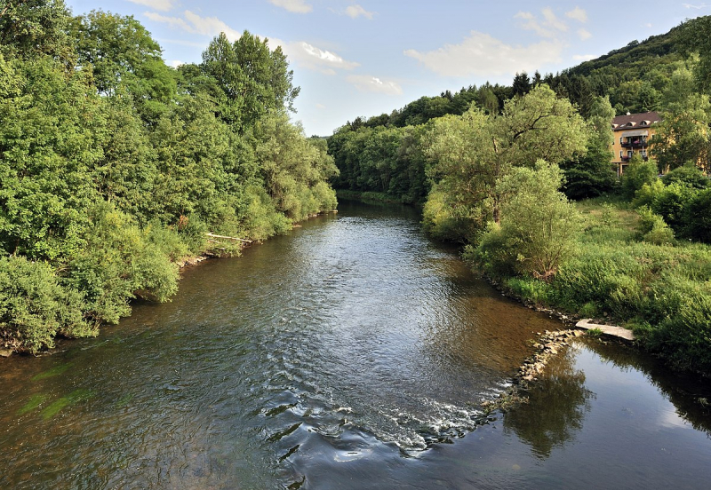
en.wikipedia.org 
packtolife.com -
The fifth one in Top 10 Longest Rivers in Belgium that Toplist wants to introduce to you is Lys. The Lys or Leie is a river in France and Belgium that is a tributary of the Scheldt on its left bank. Its headwaters are in Pas-de-Calais, France, and it flows into the Scheldt River in Ghent, Belgium. It is 202 kilometers long in total (126 mi).
Historically a heavily polluted river due to high population density and industrialisation in both Northern France and Belgium, it has seen significant improvements in recent years, thanks in part to the decline of the main industry, flax spinning and weaving. The Leie region (between Deinze and Ghent) was a favorite haunt of many painters in the first half of the twentieth century.
The Lys's source is in the French department of Pas-de-Calais, in the village of Lisbourg, east of Fruges. It flows northeast through the departments of France, provinces of Belgium, and towns and municipalities listed below:
- Pas-de-Calais (F): Thérouanne, Aire-sur-la-Lys
- Nord (F): Merville, Armentières, Halluin
- Hainaut (B): Comines-Warneton
- West Flanders (B): Menen, Wevelgem, Kortrijk, Waregem, Wervik
- East Flanders (B): Zulte, Deinze, Ghent
From source to mouth, the main tributaries of the Leie are: Laquette, Clarence, Lawe, Deûle, Gaverbeek, Heulebeek and Mandel.
Three battles took place on the river between the Allies and the German Army. During World War I, the location was the site of the First Battle of the Lys, which was part of the German Spring Offensive, and the Second Battle of the Lys, which was part of the Allies' Hundred Days Offensive later that year. During WWII, the Battle of the Lys was part of the German offensive in Flanders towards the English Channel in 1940.
Length: 202 km (126 mi- shared with France)
en.wikipedia.org 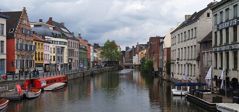
diff.wikimedia.org -
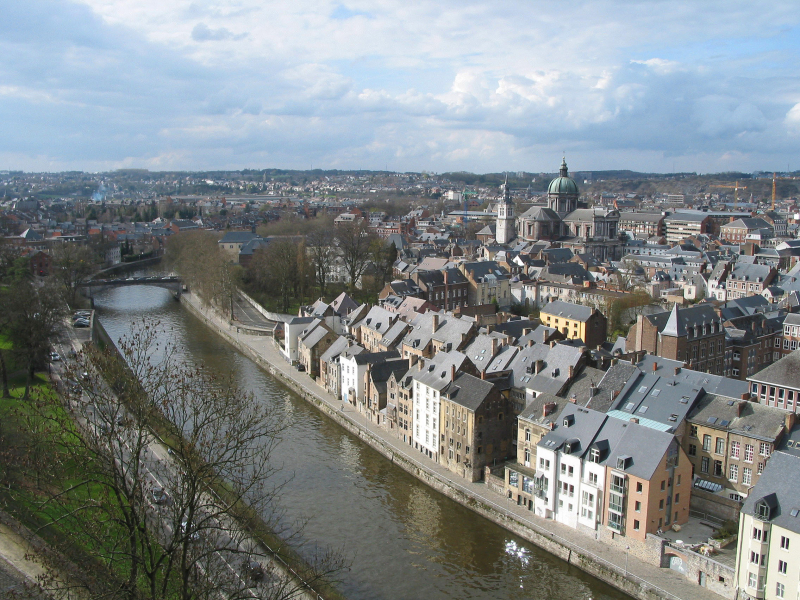
The Sambre is a river that flows through northern France and Wallonia, Belgium. It is a left-bank tributary of the Meuse, which it joins in Namur, Wallonia.
The Sambre's headwaters are near Le Nouvion-en-Thiérache in the département of Aisne. It runs through the Franco-Belgian coal basin, which was once a major industrial district. The navigable route begins in Landrecies at the Canal de la Sambre à l'Oise, which connects to the central French waterway network (or did, until navigation was interrupted in 2006 following structural failures). It runs 54 kilometers with 9 locks that are 38.50 meters long and 5.20 meters wide down to the Belgian border at Jeumont. The river is canalised in two distinct sections from the border over a distance of 88 km, with 17 locks. The Haute-Sambre is 39 kilometers long and includes ten locks with the same dimensions as those in France, all the way down to the industrial town of Charleroi. In the immediate post-World War II period, the rest of the Belgian Sambre was upgraded to European Class IV dimensions (1350-tonne barges). It is located at the western end of the sillon industriel, which, despite the cessation of all coal mining and the decline of the steel industry, remains Wallonia's industrial backbone. At Namur, Belgium, the river empties into the Meuse.
Voies Navigables de France manages the navigable waterway in France, and the Service Public Wallon - Direction générale opérationnelle de la Mobilité et des Voies hydrauliques manages it in Belgium (Operational Directorate of Mobility and Inland Waterways).
Length: 193 km (120 mi- shared with France)
en.wikipedia.org 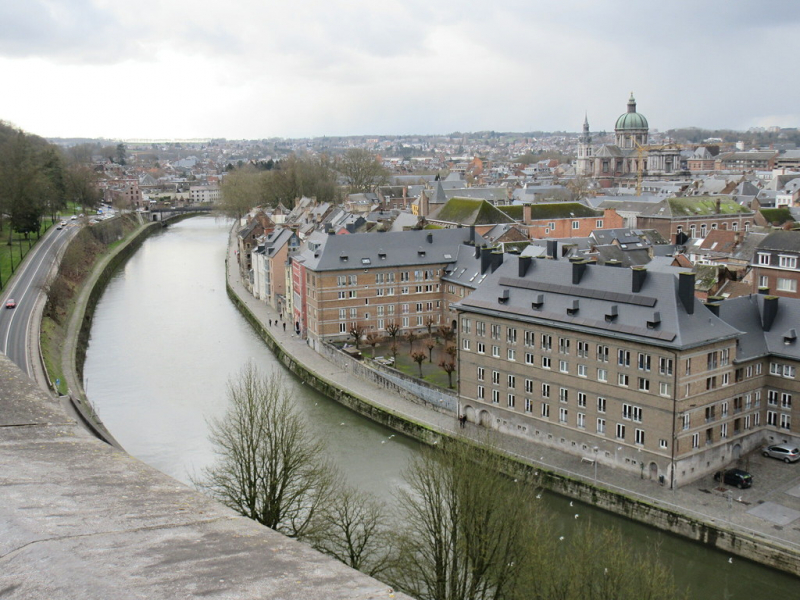
flickr.com -
The Rur, also known as the Roer, is a major river that flows through Belgium, Germany, and the Netherlands. It is a tributary of the Meuse on the right (eastern) bank (Dutch: Maas). Approximately 90% of the river's course is in Germany.
The Rur rises in Belgium's High Fens near the 696-metre (2,283-foot) Signal de Botrange at an elevation of 660 metres (2,170 feet). It flows into Germany through North Rhine-Westphalia south of Monschau. It first flows through the Eifel mountains in the north.
After 39 kilometers (24 miles), it arrives at the Rur Reservoir, Germany's second-largest artificial lake. It enters the Netherlands after approximately 160 kilometers (99 mi) and flows into the Meuse River in the town of Roermond after 170-kilometers (110 mi).
The Rur's major tributaries include the Inde and the Wurm. Monschau, Heimbach, Nideggen, Düren, Jülich, Linnich, Hückelhoven, Heinsberg (all in Germany) and Roermond are the towns along the Rur (Netherlands).
The northern part of the Rur was heavily polluted by tailings from many German coal mines in the 1960s and 1970s. There were no fish or other organisms to be found, and swimming in the river was dangerous. Foam flakes flooded parts of Roermond on a regular basis. After the mines were closed, waste water treatment in Germany and the Netherlands significantly improved. Only the lower reaches of the river remain contaminated. The water in the upper reaches of the river is so clean that trout and more than 30 other fish species have returned. Salmon returned to the Rur after a 125-year absence in 2004.
Length: 177 km (110 mi- shared with Germany and the Netherlands)
dw.com 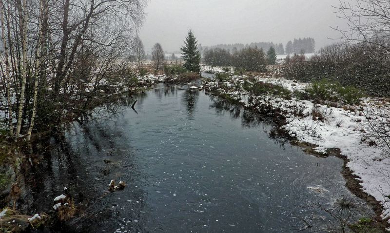
flickr.com -
The Sauer or Sûre is a river that flows through Belgium, Luxembourg, and Germany. It is a left tributary of the Moselle with a total length of 173 kilometers (107 mi).
The Sauer River rises near Vaux-sur-Sûre in the Ardennes region of southeastern Belgium, flows eastward, and forms the border with Luxembourg near Martelange. It runs for 13 kilometers (8 miles) north of Martelange, forming the border between Belgium and Luxembourg. It flows west of Esch-sur-Sûre into the Upper Sûre Lake, which was created by the Esch-sur-Sûre Dam and gives its (French) name to the Luxembourgian commune of Lac de la Haute-Sûre. Following Ettelbruck and Diekirch, the Sauer forms the border between Luxembourg and Germany for the final 50 kilometers (31 miles), passing Echternach before emptying into the Moselle in Wasserbillig. Tributaries include the rivers Wiltz, Alzette, White Ernz, Black Ernz, Our, and Prüm.
Length: 173 km (107 mi- shared with Germany and Luxembourg)
simple.wikipedia.org 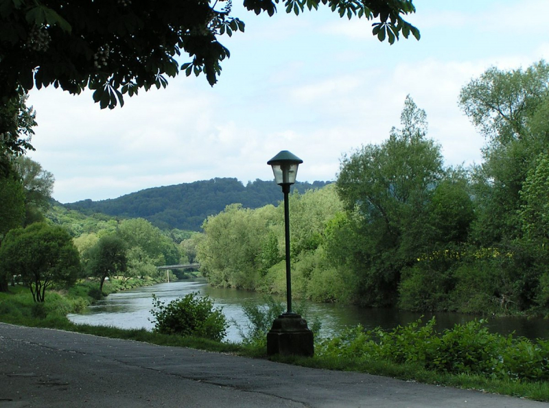
en.wikipedia.org -
The Ourthe is a 166 kilometer (103 mile) long river in Wallonia's Ardennes (Belgium). It is a right tributary of the Meuse River. West of Houffalize, the Ourthe is formed by the confluence of the Ourthe Occidentale (Western Ourthe) and the Ourthe Orientale (Eastern Ourthe).
The source of the Ourthe Occidentale is in the Belgian province of Luxembourg, near Libramont-Chevigny. The Ourthe Orientale's source is near Gouvy, also in the Belgian province of Luxembourg, close to the Luxembourg border.
Following the confluence of the two Ourthes at Lake Nisramont, the Ourthe flows roughly north-west, then north-northeast. It flows for a short distance through the Namur province near Noiseux. It flows into Liège Province after passing through the municipality of Durbuy. It eventually flows into the Meuse River in the city of Liège. The Amblève and Vesdre are the two most important tributaries of the Ourthe. Houffalize (Ourthe Orientale), La Roche-en-Ardenne, Hotton, Durbuy, Hamoir, and Esneux are towns along the Ourthe.
Length: 166 km (103 mi)
en.wikipedia.org 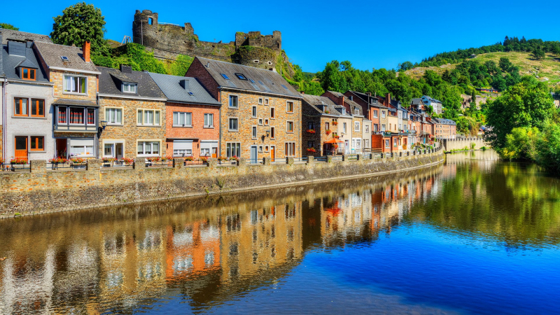
windows10spotlight.com -
The Dommel is a small river in Belgium and the Netherlands that is a tributary of the Dieze on the left bank. It is 120 kilometers long, with 85 kilometers in the Netherlands. The Dommel receives water from the Keersop, Tongelreep, Run, Gender, and Kleine Dommel streams before joining the Aa at's-Hertogenbosch to form the Dieze, which flows into the Meuse. Peer, Neerpelt, Valkenswaard, Dommelen, Eindhoven, Son en Breugel, Sint-Oedenrode, Boxtel, Sint-Michielsgestel, and 's-Hertogenbosch are the main cities and towns along the Dommel's course.
Nowadays, the Dommel appears to be a brook, but it has many geographical features that only larger rivers have. These are the valley widths and large meanders left over from the Last Glacial Period. There was once talk of the Romans navigating the Dommel. Later, as the nearby forests were cut down, the river became shallower and began to meander.
A water board (Waterschap) for the Dommel was established in 1863. It was in charge of all municipalities along the Dommel's course. One of its initial goals was to prevent flooding, particularly between 's-Hertogenbosch and Boxtel. It hoped to canalize the same stretch and improve its navigability if possible, but this would necessitate the construction of a lock. Around 1865, the water board diverted the Dommel through the western city moat of 's-Hertogenbosch and installed a sluice in the Dieze's left dyke.
Length: 120 km (75 mi- shared with the Netherlands)
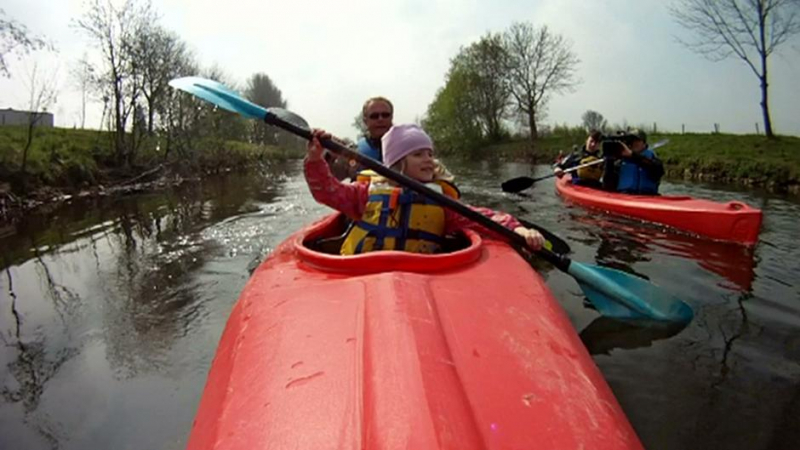
seakayakbelgium.eu 
wikiwand.com


