


Top 4 Longest Rivers in Benin

Benin, formerly known as Dahomey, is a small country on the West African coast between Togo and Nigeria. The Niger River borders it on the north, and the Bight ... read more...of Benin, which is part of the Gulf of Guinea, borders it on the south. The majority of Benin's rivers flow north-south. Toplist has compiled the longest rivers in Benin.
-
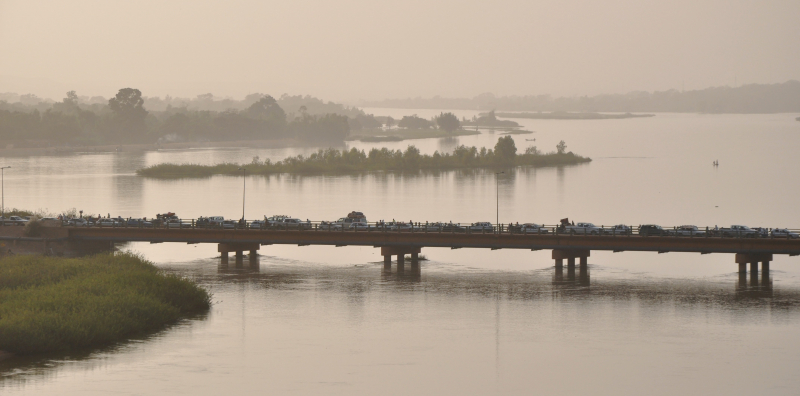
The Niger River is West Africa's main river, stretching 4,180 kilometers (2,600 mi). Its drainage basin covers an area of 2,117,700 km2 (817,600 sq mi). Its source is in the Guinea Highlands, near the Sierra Leone border in southeastern Guinea. It flows in a crescent through Mali, Niger, on the border with Benin, and then through Nigeria, discharging into the Gulf of Guinea in the Atlantic Ocean through a massive delta known as the Niger Delta (or the Oil Rivers). The Niger River is Africa's third-longest river, trailing only the Nile and the Congo River (also known as the Zare River). The Benue River is its main tributary.
The Niger follows one of the most unusual routes of any major river, forming a boomerang shape that has perplexed geographers for two centuries. The river's headwaters (Tembakounda) are 240 kilometers (150 miles) inland from the Atlantic Ocean, but it flows directly away from the sea into the Sahara Desert, then takes a sharp right turn near the ancient city of Timbuktu (Tombouctou) and heads southeast to the Gulf of Guinea. This unusual geography is thought to have resulted from the Niger River's union of two ancient rivers. The upper Niger, from its headwaters west of Timbuktu to the current river's bend near Timbuktu, once flowed into a now-dry lake to the east northeast of Timbuktu, whereas the lower Niger began to the south of Timbuktu and flowed south into the Gulf of Guinea. The lower Niger's upstream erosion resulted in stream capture of the upper Niger by the lower Niger over time.
The northern section of the river, known as the Niger bend, is significant because it is the main river and source of water in that region of the Sahara. As a result, it became the focal point of trade across the Western Sahara, as well as the center of the Sahelian kingdoms of Mali and Gao. The surrounding Niger River Basin is one of the Sudan province's distinct physiographic sections, which is part of the larger African massive physiographic division.
Length: 4,184 km (2,600 mi- shared with Niger, Nigeria, Mali and Guinea)
duhoctrungquoc.vn 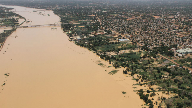
innovationnewsnetwork.com -
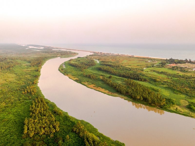
The Ouémé River, also known as the Weme River in Benin, is a river. It begins in the Atakora Mountains and runs for about 510 kilometers (320 miles). It flows through Carnotville and Ouémé before reaching a large delta on the Gulf of Guinea near the seaport city of Cotonou. The Okpara River and the Alpouro River are the two largest tributaries.
The Ouémé River is the Benin Republic's largest river. It is situated between 6° 30° and 10° north latitude, and between 0° 52' and 3° 05' east longitude (Oba S. Alain 2018). It passes through several agro-ecological zones before feeding the lagoon system "Lake Nokoué-lagoon of Porto-Novo'' through a Delta zone. The lower Delta of Ouémé is situated between latitudes 6° 33'N and 8° 15', as well as meridians 1° 50' and 2° 00'. (Zinsou et al., 2016). The lower Delta of Ouémé begins after the municipality of Adjohoun in the department of Ouémé and ends at the south facade, where the river flows into the "Nokoué-Porto-Novo'' lagoon complex (Lalèyè et al., 2004).
The subequatorial climate is distinguished by two rainy seasons and two dry seasons. However, its hydrological regime is influenced by the Sudanian climate (north-Benin), with a low water period lasting seven months (November to June) and a flood period lasting seven months (July to October) (Lalèyè, 1995). Swamps are inhabited by floating plants dominated by water hyacinth (Eichornia crassipes), water lily (Nymphaea lotus), water lettuce (Pistoia stratiotes), and lemna (Lemna pairciostata). There are also undeveloped marshy forests dominated by the Raphia palm (Raphia hookeri) and the oil palm (Raphia oleifera) (Elaeis guineensis). Water covers a large portion of the valley, which is very productive in terms of fish (Zinsou et al., 2016).
Length: 510 km (320 mi)
pbase.com 
en.wikipedia.org -
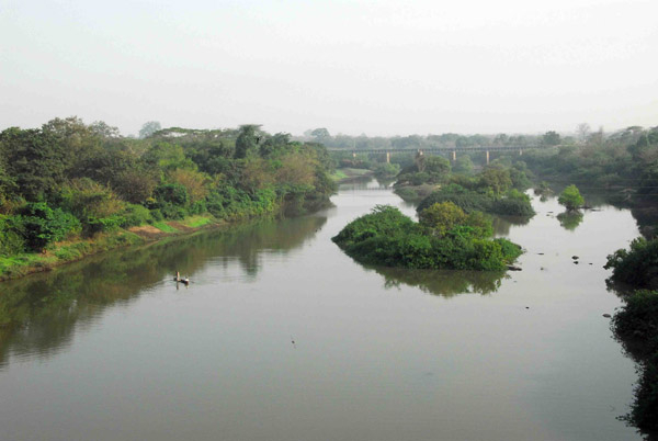
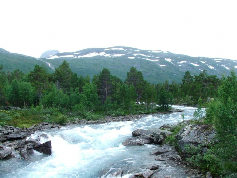
Mono River rises between the town of Sokodé and the border with Benin, and flows south. It is about 400 km (250 mi) long and drains a basin of about 20,000 km2 (7,700 sq mi). The river forms the international border between Togo and Benin along its southern course, all the way to its mouth. The river flows into the Bight of Benin via a vast network of brackish water lagoons and lakes, including Lake Togo. Only the section of the river closest to the mouth is navigable. The upper tableland of the river's basin is primarily cultivated for maize, yams, rice, cotton, and cassava.
The Nangbeto Dam, built in collaboration between Benin and Togo and completed in 1987, dams the river 160 kilometers (99 miles) from its mouth. According to studies, the dam has economic benefits such as tourism and fishing in the lake behind it. The dam's construction, on the other hand, displaced between 7,600 and 10,000 people, and studies show that it has significantly altered the ecology of the lagoon system at the river's mouth by reducing the natural seasonal fluctuations in river flow. Adjarala Dam, a second dam project proposed for the river between Nangbeto and the river's mouth in the 1990s, did not receive funding until 2017, when the China-Africa Development Fund agreed to support the project. The dam's construction is part of the government's plan to increase Benin's domestic power generation capacity from 20% to 70%, as most of Togo and Benin's electricity is currently imported from Ghana's Akosombo Dam.
There are six rapids about 35 kilometers (22 miles) from its mouth. Below this point, the river slows and flows over a swampy floodplain, with a large area of contiguous wetland in both Togo and Benin. The river is home to manatees, crocodiles, and hippopotamus, as well as a dense growth of reeds, sedges, and grasses.
Length: 400 km (248 mi- shared with Togo)
en.wikipedia.org 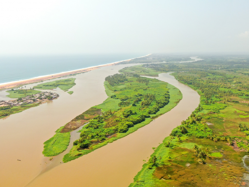
commons.wikimedia.org -
The Sota River flows through the departments of Borgou and Alibori in northern Benin. It is a tributary of the Niger River, and one of its tributaries is the Tassiné River. The river runs for about 250 kilometers and has a basin area of 13,650 square kilometers.
The Sota River rises northeast of the town of Ndali in Benin's Borgou Department. The river flows north-northeast before emptying into the Niger River at Malanville.
Annual precipitation has been measured at several stations in the Sota basin:
- Segbana (near the Nigerian border, in the basin's center-east): 1177.4 mm spread over 53 days.
- Kandi (in the basin's center-west): 1055.1 mm spread over 80 days
- Malanville (at the basin's northern end, near the confluence with Niger): 919.9 mm in 53 days
From July to September (boreal summer), there is a large surplus of rainfall everywhere, resulting in violent floods, but the deficit is a severe dry season from December to April.
Length: 250 km (160 mi)
walkaboutgourmet.com 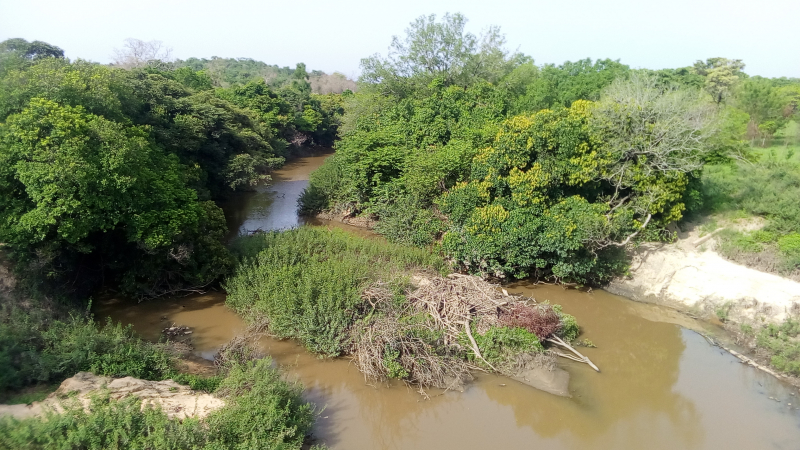
commons.wikimedia.org


