


Top 9 Longest Rivers in Bulgaria

Bulgaria is a country in Southeast Europe with a total size of 110,993.6 km2 and a population of 7,050,034 people. The country's topography is abundant in ... read more...water resources, with over 300 rivers. The majority of Bulgaria's rivers are tributaries of the Danube River, while those in the east are short and empty into the Black Sea. Except for the Iskar, which flows into the Danube, all the rivers in southern Bulgaria flow into the Aegean Sea. This is the list of 9 longest rivers in Bulgaria.
-
The Danube (also known as the Danube in other languages) is Europe's second-longest river, behind the Volga in Russia. From the Black Forest to the Black Sea, it runs through much of Central and Southeastern Europe. Breg, the river's longest headstream, rises in Furtwangen im Schwarzwald, while the river takes its name from Donaueschingen onwards.
The Danube was formerly a long-standing Roman Empire frontier and is now the world's longest river, passing through the most countries (10; the Nile is second with 9). The Danube runs southeast from Germany for 2,850 kilometers (1,770 miles), passing through or bordering Austria, Slovakia, Hungary, Croatia, Serbia, Romania, Bulgaria, Moldova, and Ukraine before emptying into the Black Sea.
Its drainage basin extends into nine additional countries. Vienna, Budapest, Belgrade, and Bratislava, all capitals of their own nations, are the river's major cities. Bucharest, Sofia, Zagreb, Ljubljana, and Sarajevo are five more capital cities in the Danube's basin. Munich, the capital of Bavaria, is the basin's fourth-largest city, located on the Isar River.
Fish species such as pike, zander, huchen, Wels catfish, burbot, and tench can be found in the Danube river basin. It also supports a diverse population of carp, sturgeon, salmon, and trout. The Danube Delta and the lower stretch of the river are home to a few species of euryhaline fish, including European seabass, mullet, and eel.Length: 2,850 km
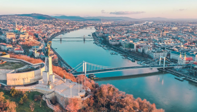
Photo: Mundycruising 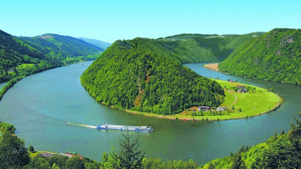
Photo: Traveller -
Maritsa is a river in Southeast Europe that travels through the Balkans. It is the longest river in the Balkan peninsula, with a length of 480 kilometers (300 miles), and one of the greatest in Europe by discharge. In its upper and middle reaches, it runs through Bulgaria, while its lower course forms much of the border between Greece and Turkey. It has a drainage area of around 53,000 km2 (20,000 sq mi), 66.2 percent of which is in Bulgaria, 27.5 percent in Turkey, and 6.3 percent in Greece. It is the primary river of Thrace's historical region, with the majority of its drainage basin.
Its source is in Western Bulgaria's Rila Mountains, and it flows east-southeast between the Balkan and Rhodope Mountains, past Plovdiv and Dimitrovgrad to Edirne in Turkey. The river flows eastwards east of Svilengrad, Bulgaria, forming the border between Bulgaria (on the north bank) and Greece (on the south bank), and then between Turkey and Greece. The river meets its two main tributaries, the Tundzha and the Arda, at Edirne, and runs within Turkish territory on both sides. It then bends south, forming a river delta between Greece on the west bank and Turkey on the east bank all the way to the Aegean Sea, which it reaches near Enez. In Bulgaria, the upper Maritsa valley is a major east–west highway.
Length: 480 kmVideo: Youtube GoMyDrone 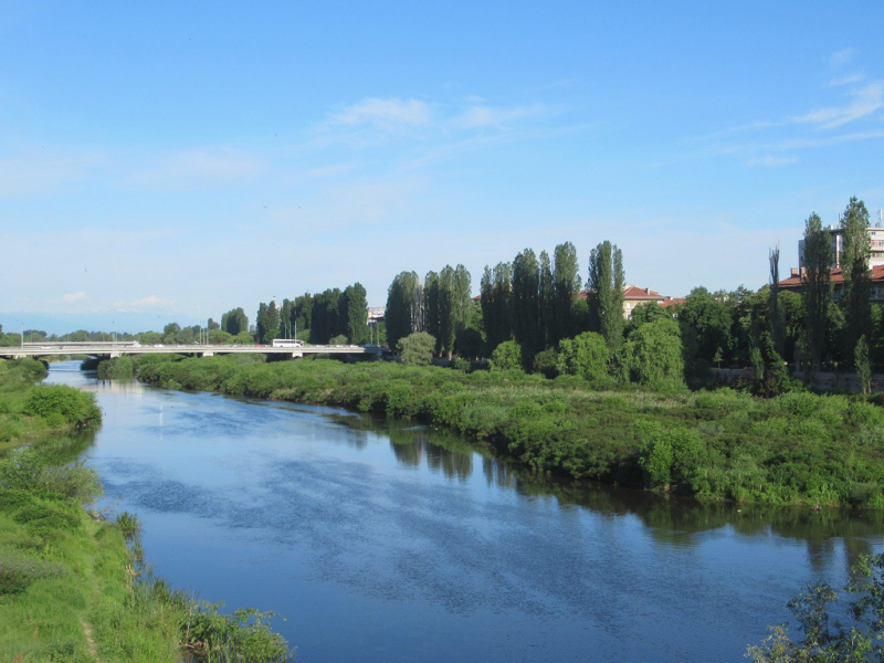
Photo: flickr -
The Struma, also known as the Strymónas, is a river that flows through Bulgaria and Greece. Strymn was its old name. It covers a total area of 17,330 km2 (6,690 sq mi), with 8,670 km2 (3,350 sq mi) in Bulgaria, 6,295 km2 (2,431 sq mi) in Greece, and 2,365 km2 (913 sq mi) in North Macedonia. It rises in Bulgaria's Vitosha Mountain, flows westward, then southward, forming a series of canyons before entering Greek territory at Kula village. Likewise, it is the principal river feeding and departing Lake Kerkini, a significant migratory wildfowl center in Greece. The river empties into the Aegean Sea's Strymonian Gulf at Amphipolis, in the Serres regional unit. The river is 415 kilometers long (258 miles), with 290 kilometers (180 miles) in Bulgaria.
Parts of the river valley are part of a coal-producing area in Bulgaria (Pirin Macedonia), which was once more important than it is now; the southern half of the Bulgarian section is an important wine region. The Greek half is a large agricultural valley that is Greece's fourth-largest valley. The Konska River, Dragovishtitsa River, Rilska River, Blagoevgradska Bistritsa, Sandanska Bistritsa, Strumitsa, Pirinska Bistritsa, and Angitis are among the tributaries.
Length: 415 km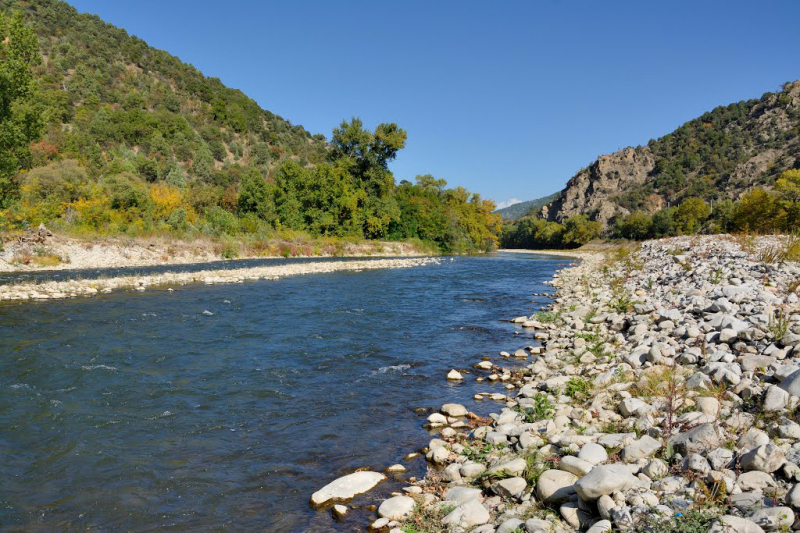
Photo: wikimediacommon 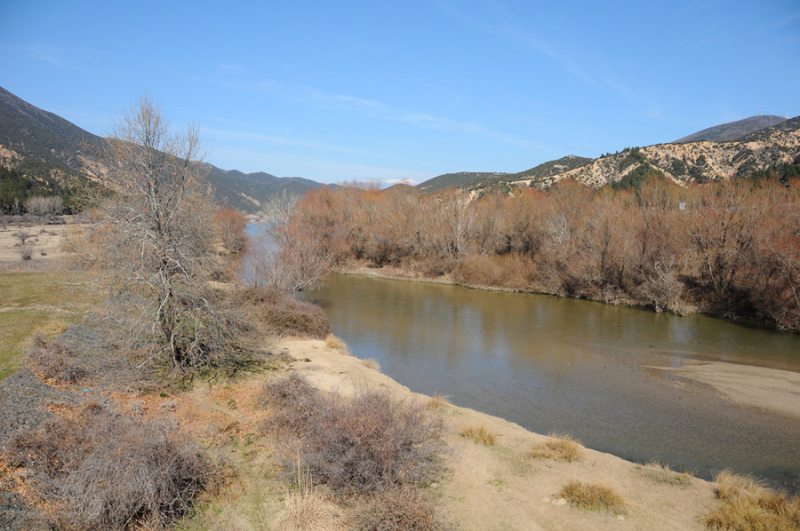
Photo: alaturka.info -
The Tundzha (also known as the Tonsus) is a river in Bulgaria and Turkey that is the largest tributary of the Maritsa, draining into it ear Edirne on Turkish territory.
The river originates in the middle regions of Stara Planina north of Kalofer, flows east, then turns sharply south before Yambol, and continues in this direction until it joins the Maritsa. The Tundzha is around 365 kilometers long, with 328 kilometers on Bulgarian soil (including the border). It has about 50 tributaries, with Mochuritsa, Popovska, and Sinapovska being the most important.
Kalofer, Yambol, and Elhovo are among the towns along the river's banks.Length: 365 km
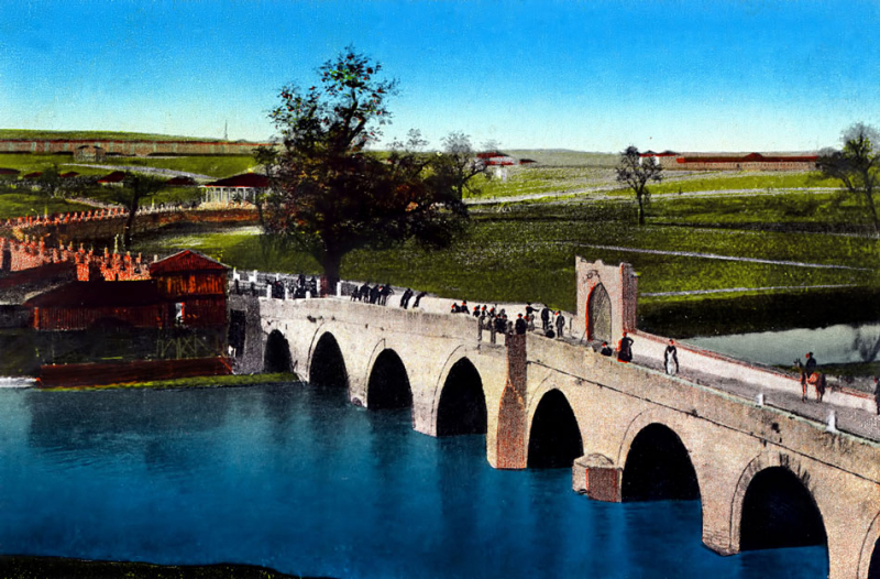
Photo: project-haskovo-edirne. 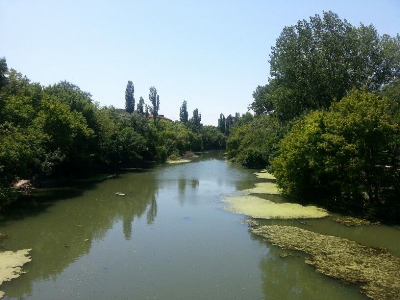
Photo: pinterest -
The Iskar is a Danube tributary on the right bank. It is the longest river fully within Bulgaria, with a length of 368 kilometers. It begins as three forks in the highest mountain range in the Balkans, Rila, and runs north till it meets the Danube River. Furthermore, it forms the divide between the Vitosha and Plana Mountains in the west and the Sredna Gora mountain range in the east as it flows northwards, feeding the country's largest artificial lake, the Iskar Reservoir, before entering the Sofia Valley, which contains the country's capital Sofia. From there, the Iskar flows through the Balkan Mountains, forming the 84-kilometer-long Iskar Gorge, before turning north-eastern at Lakatnik. The river falls into the Danube between the settlements of Baykal and Gigen after crossing the Danubian Plain north of the Balkan Mountains. Iskar is the oldest river in the Balkan Peninsula in terms of geology.
In the provinces of Sofia, Sofia City, Vratsa, Lovech, and Pleven, its watershed drains 8,617 km2. The Iskar passes through nine towns and countless villages on its way to the sea. More than 50 fish species live in the Iskar river basin, including Cottus haemusi, which is only found in the upper Iskar and Vit drainages.The Iskar is economically significant because it supplies water to the capital and a lot of manufacturing plants. Its waters are also used for agriculture and the generation of electricity, and its picturesque canyons and rock formations give good recreational opportunities. Despite the fact that the Iskar is not navigable, its valley is vital for transportation, particularly along the Iskar Gorge, which is one of only three railway passes in the Balkan Mountains.
Length: 368 km
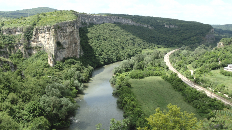
Photo: wikipedia 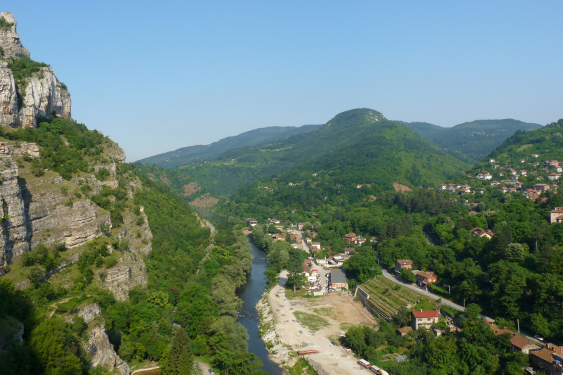
Photo: wikipediacommon -
The Osam is a river that flows across northern Bulgaria. Its drainage basin is sandwiched between the Vit River's west bank and the Yantra system's east bank. In its upper course, the river has two main tributaries: the Black Osam originates at the foot of Levski Peak in the Balkan Mountains, at an elevation of 1,821 m (5,974 ft), and the White Osam originates on the northern slopes of the Kozya Stena peak.
The black and white Osam unite in Troyan. It flows north towards Lovech, then north-east until Letnitsa and Levski, then north-west until it meets the Danube 5 kilometers west of Nikopol. The river was once known as Assamus.
Length: 314 km
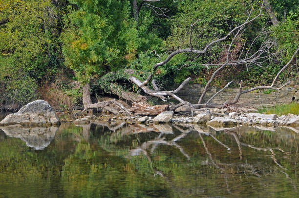
Photo: istock 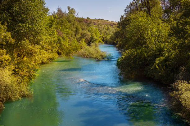
Photo: istock -
The Yantra is a right tributary of the Danube that flows across northern Bulgaria. It has a watershed of 7,862 km2 and is 285 km (177 mi) long (the third-longest Bulgarian tributary of the Danube after Iskar and Osam) (3,036 sq mi). Its typical mouth discharge is 47 m3/s (1,700 cu ft/s). The Yantra originates at the northern foot of Hadzhi Dimitar Peak (1,340 m) in Central Stara Planina (4,400 ft). It is also known by its earlier name, Etar, in its upper course. Close to Svishtov, the river empties into the Danube.
As it travels northward through the Stara Planina slopes, the river is known for forming a series of gorges. The most famous and longest one is 7 kilometers (4 miles) long and is located near Veliko Tărnovo, the capital of the Second Bulgarian Empire. Gabrovo, Veliko Tărnovo, Gorna Oryahovitsa, Polski Trambesh, and Byala are the major cities along the river, with the historic Belenski bridge nearby.
Length: 285 km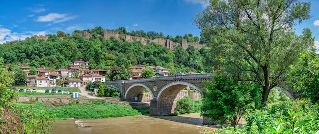
Photo: freepik 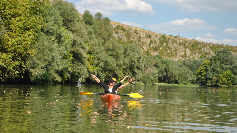
Photo: outdoor-bulgaria -
The Nisava is a right tributary of the South Morava in Bulgaria and Serbia, and with a length of 218 km, it is also the longest. The Nisava originates in western Bulgaria, near the town of Gintsi, in the Stara Planina mountains (east of Kom Peak). It has a source near the Serbian border. After 67 kilometers of flow through Bulgaria, it reaches Serbia without encountering any important tributaries.
The upper channel of the river is called as Ginska since it passes through Gintsi. It flows south at first, then bends sharply west into the Godech Kettle, passing past Razboishte before becoming a gorge. It reaches Kalotina, a major border crossing on the Bulgarian-Serbian border (Kalotina-Gradina), after emerging from the gorge, and continues west into Serbia.
The Black Sea drainage basin includes the river. Its own drainage area is 4,086 km2, with approximately 73 percent in Serbia and the remainder in Bulgaria. The Nisava is impassable. It is not only the Juna Morava's longest tributary, but also the greatest in terms of discharge (36 m3/s). The Temtica (or Sukovska reka), Crvena reka, Koritnika reka, and Kutinska reka are the most important tributaries on the right, and the Jerma (or Sukovska reka), Crvena reka, Koritnika reka, and Kutinska reka on the left.
The Nisava valley is part of a great natural route that has connected Europe and Asia since ancient times: the route traverses the Morava, Nisava, and Maritsa valleys and continues on to Constantinople, present-day Istanbul. This route is followed by both the road and the train from Belgrade to Sofia to Istanbul.
Length: 218 km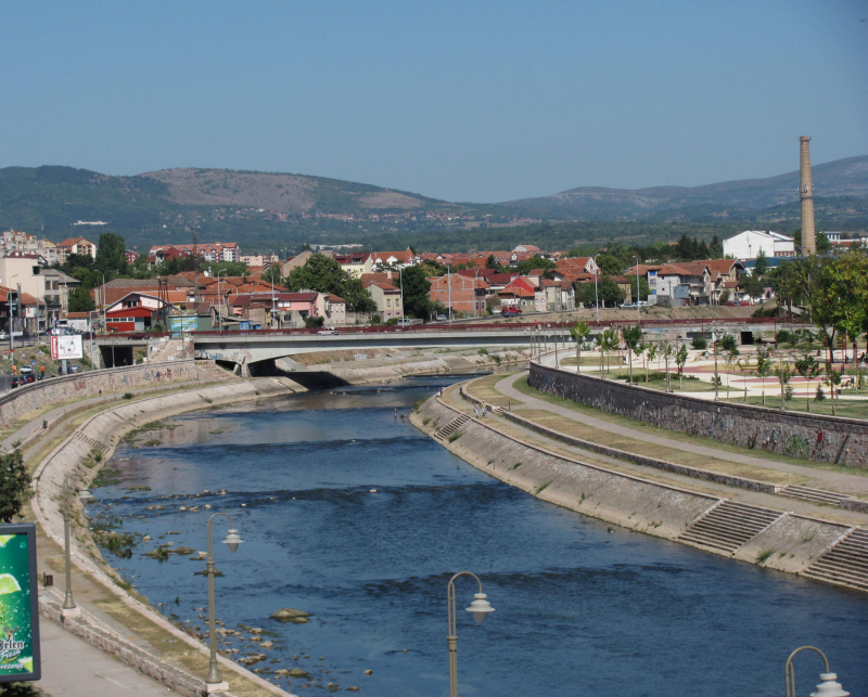
Photo: wikimediacommon 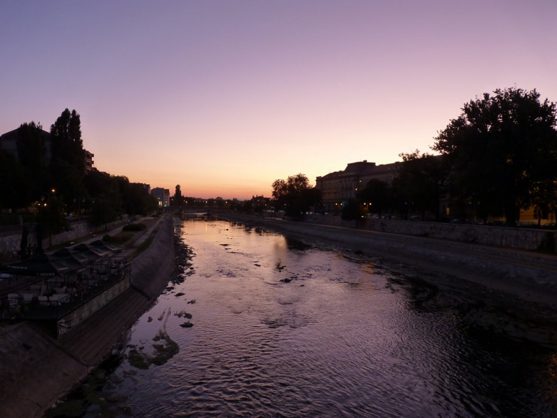
Photo: flickr -
The Timok, often known as the Great Timok, is a right tributary of the Danube that flows through Serbia and Bulgaria.
It's a branching system of numerous smaller rivers, many of which share the same name (Timok) but are differentiated by adjectives. The Timok is 202 kilometers long from its farthest source, the Svrljiki Timok, to its confluence (as Veliki Timok). The river basin covers 4,626 square kilometers (1,786 sq mi). Its typical mouth discharge is 31 m3/s (1,100 cu ft/s). The Timok Valley is home to Eastern Serbia's largest Romanian-speaking community.
Its name dates back to antiquity, when it was known as Timacus in Latin and Timachos in Ancient Greek."Length: 202 km
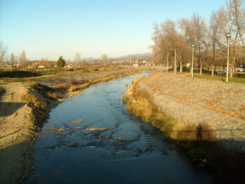
Photo: wikipedia 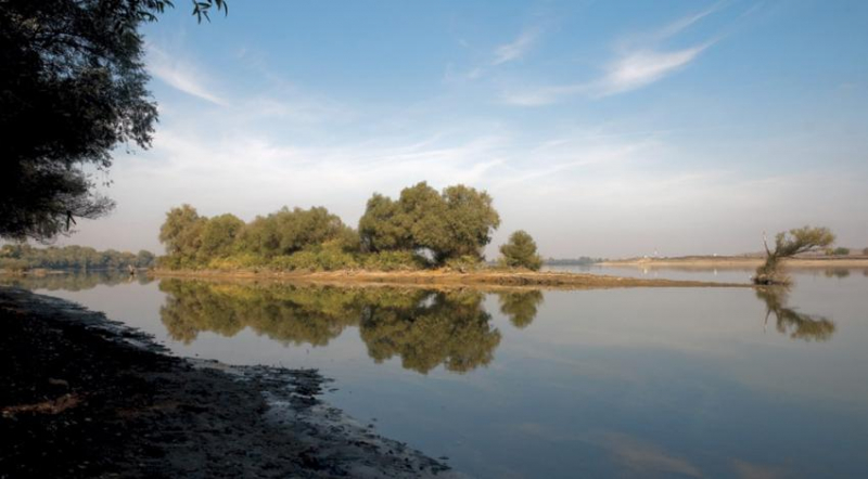
Photo: vagabond.bg


