


Top 7 Longest Rivers in Cambodia

Cambodia, officially the Kingdom of Cambodia, is a Southeast Asian country located in the southern part of the Indochinese Peninsula. It has an area of 181,035 ... read more...square kilometers (69,898 square miles), with Thailand to the northwest, Laos to the north, Vietnam to the east, and the Gulf of Thailand to the southwest. Toplist has compiled the list of 7 longest rivers in Cambodia.
-
The Mekong, also known as the Mekong River, is a trans-boundary river in East and Southeast Asia. It is the world's twelfth-longest river and Asia's third-longest. It has an estimated length of 4,909 km (3,050 mi) and drains an area of 795,000 km2 (307,000 sq mi), discharging 475 km3 (114 cu mi) of water per year. The river flows from the Tibetan Plateau through China, Myanmar, Laos, Thailand, Cambodia, and Vietnam. The Mekong's extreme seasonal variations in flow, as well as the presence of rapids and waterfalls, make navigation difficult. Nonetheless, the river serves as a vital trade route between western China and Southeast Asia.
The Mekong Basin is divided into two sections: the "upper Mekong basin" in Tibet and the "lower Mekong basin" from Yunnan to the South China Sea. The most precipitous drop in the Mekong occurs in the upper Mekong basin, a stretch of approximately 2,200 kilometers from where it rises to its mouth (1,400 mi). It drops 4,500 meters (14,800 feet) here before entering the lower basin, where the borders of Thailand, Laos, China, and Myanmar form the Golden Triangle. The river flows for another 2,600 km (1,600 mi) downstream from the Golden Triangle, through Laos, Thailand, and Cambodia, before entering the South China Sea via a complex delta system in Vietnam.
Length: 4,350 km (2,700 mi)
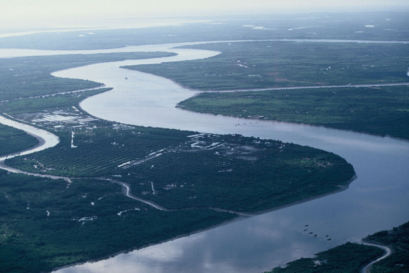
Photo: WWF 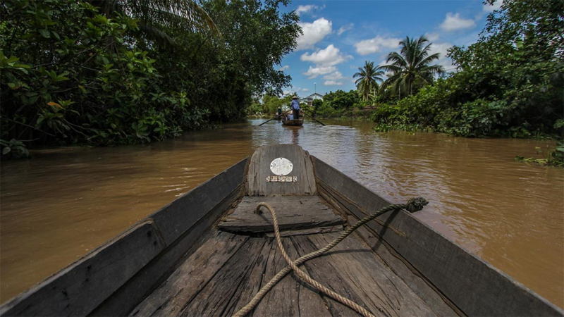
Photo: Siem Reap -
The Steung Saen River, also known as the Steung Sen River, is a river in Cambodia. It is a major tributary of the Tonlé Sap, a lake in northwest Cambodia that is part of the Mekong River system, the largest freshwater lake in Southeast Asia, and one of the world's most diverse and productive ecosystems, designated as a Biosphere Reserve by UNESCO in 1997 due to its high biodiversity. With a catchment area of 16,344 km2, the Stung Sen River Basin is the largest of the 11 major tributaries surrounding Tonlé Sap (1,634,400 ha). Each year, the basin receives approximately 1,500 mm (59 in) of rain.
The river flows through Preah Vihear and Kampong Thom provinces. The river basin's northern extent corresponds to Thailand's border, as in 1904, Siam and the French colonial authorities ruling Cambodia formed a joint commission to demarcate their mutual border, which largely follows the watershed line of the Dângrêk mountain range.
In Khmer, Steung Saen means "river of soldiers." Steung means "river" in Khmer, whereas Saen is derived from the Sanskrit word Sena, which means "soldier."
Length: 520 km (320 mi)
Photo: Your Cambodia 
Photo: TripAdvisor -
The Kong River is a river in Southeast Asia that is also known as the Xe Kong or the Se Kong. The river begins in Central Vietnam's Thừa Thiên–Huế Province and flows 480 kilometers (300 miles) through southern Laos and eastern Cambodia. It flows into the Mekong River near the Cambodian town of Stung Treng. A portion of its path forms the international border between Laos and Cambodia.
The Xe Kaman River is its tributary that flows through southeastern Laos. It runs through Attapeu Province's Dong Ampham National Biodiversity Conservation Area. Dolphin populations are known to exist in the river. A dam being built on the river is destroying the area. The village of Ban Hin Dam is located on the river and serves as the starting point for boat trips.
Length: 480 km (298 mi)
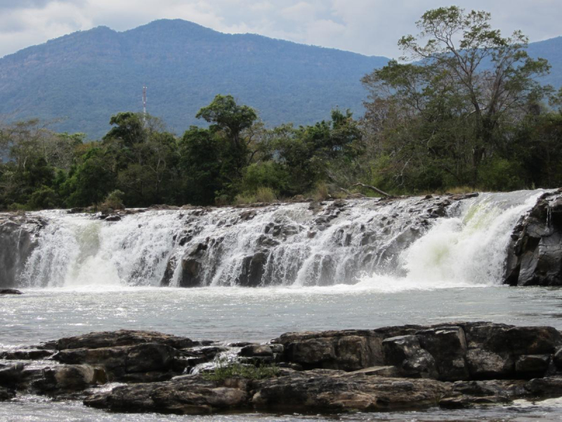
Photo: International Union for Conservation of Nature - IUCN 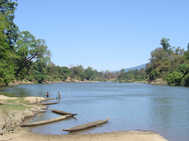
Photo: WWF -
The Chinit River is a Cambodian river. It is a major tributary of the Tonlé Sap Lake, which joins the Tonlé Sap River at its downstream end in the larger Mekong basin. It is located in Kampong Thom Province. The river is unusual in that it loops back into the same river system, accounting for its 264 km (164 mi) length, leaving Tonlé Sap lake and entering its river again downstream. On the riverbank is the prehistoric archaeological site of Samrong Sen. Water resource projects began in 1971 and ended in 2003, with varying degrees of success. The river serves as a vital trade route.
The Chinit River, also known as the Stung Chinit River, is a major tributary of the Tonlé Sap River, which flows northeast from the great lake of the same name at 12°31′38′′N 104°27′31′′E in central Cambodia. It rejoins the Tonlé Sap system at 13°32′N 105°47′E in the river. The river is about 264 kilometers (164 miles) long and loops out and into the Tonlé Sap rsystem. Its width varies between 60 and 90 meters (200 and 300 feet) over a 110-kilometer stretch of river (68 mi).
The river drains a catchment area of 5,649 km2 (2,181 sq mi), including the catchment area of its tributary, the Stung Tang Krasaing, of 1,145 km2 (442 sq mi), up to its outflow into Tonlé Sap Lake. The river flows through Laos' Bolaven Plateau, reaching its highest elevation point of 288 meters (945 feet) at Phumi Chrach and ending at Tonlé Sap Lake at an elevation of 5 meters (16 ft). There are gentler slopes visible further downstream. Bung Real Lake is its main body of water.
Santuk District Capital is the main city along the river. On its right bank is Samrong Sen, a Neolithic prehistoric archaeological site.
Length: 264 km (164 mi)
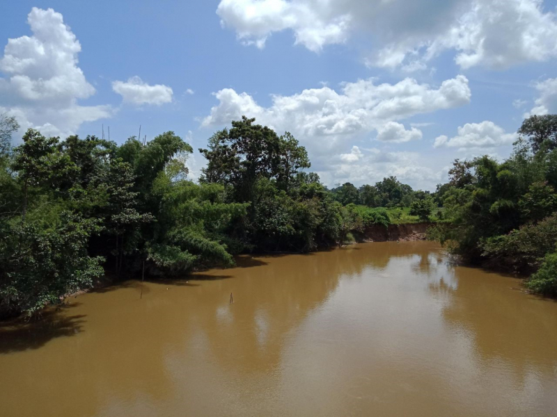
Photo: Stockholm Environment Institute 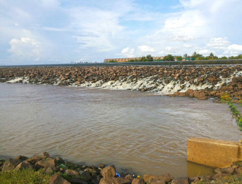
Photo: Guidetrip.info -
The Sangkae River (Khmer: ស្ទឹងសង្កែ, Stung Sangkae; sometimes written Stung Sangké or Stung Sangkhae) is a major river in Battambang Province, Cambodia's northwestern province.
The Sangkae River stretches for around 250 kilometers (160 miles). Before flowing into the Tonlé Sap lake, it passes through six districts and 27 communes in Battambang province.
According to raw data supplied by Battambang's Department of Water Resource (2013), the river's average depth is 2.35 meters (7.7 feet) during the dry season and 6.79 meters during the rainy season (22.3 ft).
Length: 250 km (160 mi)
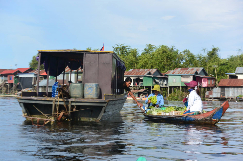
Photo: Indochine Exploration's FB Video: សមាគមកីឡា តុង ហ្គីល ម៉ូដូ ខេត្តបាត់ដំបង -
The Saigon River is a river in southern Vietnam that begins near Phum Daung in southeastern Cambodia, flows south and south-southeast for about 225 kilometers (140 miles), and empties into the Soài Rạp, which empties into the East Sea about 20 kilometers (12 miles) northeast of the Mekong Delta.
The Saigon River is joined by the Đồng Nai river 29 kilometers (18 miles) northeast of Ho Chi Minh City (formerly named Saigon), and the Bến Cát River just above Ho Chi Minh City. The Saigon River is vital to Ho Chi Minh City because it serves as the city's primary water supply as well as the location of Saigon Port, which handled more than 35 million metric tons of cargo in 2006.
The Bình Quới Tourist Village is located in Ho Chi Minh City's Bình Thạnh District on the Thanh Da peninsula on the Saigon River.
On November 20, 2011, the Thủ Thiêm Tunnel, an underwater tunnel that runs beneath the Saigon River, opened to traffic. It has been the longest cross-river tunnel in Southeast Asia since its completion.
Length: 225 km (140 mi)
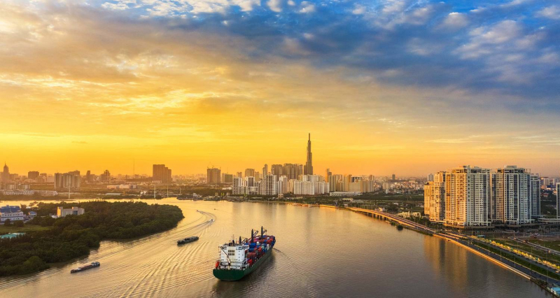
Photo: TourRadar 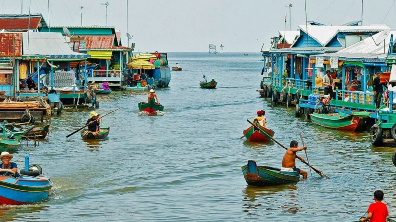
Photo: Grantourismo Travels -
Tonlé Sap is a lake in Cambodia's northwest. It is part of the Mekong River system. It is Southeast Asia's largest freshwater lake and one of the world's most diverse and productive ecosystems, having been designated as a Biosphere Reserve by UNESCO in 1997 due to its high biodiversity. As the twenty-first century begins, the lake and its surrounding ecosystems are increasingly threatened by deforestation, infrastructure development, and climate change.
Tonle Sap Lake is located northwest of the lower Mekong plain, which was formed by the collision and collapse of the Indian and Eurasian plates. The lower Mekong plain was once a bay, and at the end of the last glacial period, sea level rose rapidly. Cores from this period found near Angkor are about 4.5 meters high and contain tidal deposits, salt marshes, and mangrove swamp deposits deposited in caves around 7,900-7,300 years ago. Lake Sa's sediments also show signs of marine influence. The current Mekong Delta river morphology evolved over the last 6000 years, while the remaining waters in the northwest corner of the lower Mekong plain formed the Tonle Sap.
The Cardamom Mountains, with an elevation of more than 1700 meters, are to the southwest of the Tonle Sap basin, and the Piandan Mountains, with an elevation of 500 meters, are to the north. The basin is 86,000 square kilometers in size. The 120-kilometer-long Tonle Sap River connects Tonle Sap Lake to the Mekong River and accounts for 9% of the Mekong River's flow. The lake's size and volume vary greatly throughout the year, with a minimum area of about 2,500–3,000 km2 and a volume of about 1 km3 in the dry season and the water body expands in the rainy season, increasing the average water depth to 6–9 km feet, the maximum water depth is 11.5 meters, the maximum area is 16,000 square kilometers, and the volume is about 80 cubic kilometers.
Length: 112 km (70 mi)
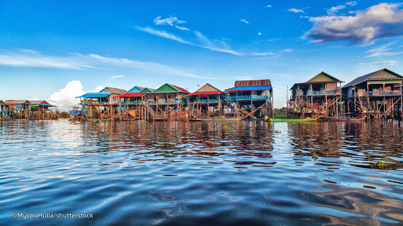
Photo: Shutterstock 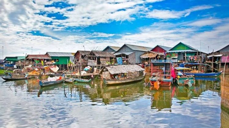
Photo: Bazan Travel


