


Top 10 Longest Rivers In Cameroon

Cameroon is a central African republic bordering six countries: the Central African Republic, the Republic of Congo, Chad, Equatorial Guinea, Nigeria, and ... read more...Gabon. Within its different and numerous climatic regions, the country contains a wide network of rivers. These rivers are part of the world's freshwater streams, and they are important to local people because of their biodiversity. Depending on the direction of river flow, the country has four distinct drainage patterns. The waters of most rivers are used for irrigation, especially during the dry season, because they run through rich territory. Because of their enormous potential, some rivers, such as the Congo, have been used to generate hydroelectric power. In this article, top ten longest rivers in Cameroon have been complied by Toplist with useful information.
-
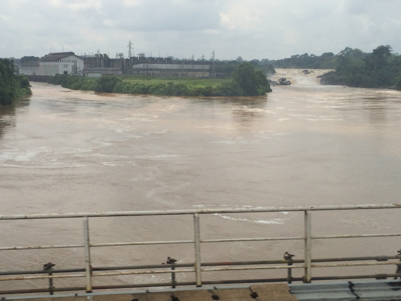
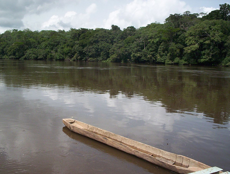
The Congo River is the world's second largest river in terms of water output, behind the Amazon River, as well as the deepest and ninth longest river in the world. This is also the longest rivers in Cameroon. The Congo River stretches about 2920 kilometers. The name Congo/Kongo river comes from the Kingdom of Kongo, which was previously located on the river's southern bank. The kingdom was called after the local Bantu Kongo people, who were known as "Esikongo" in the 17th century. The Kakongo kingdom, described in 1535, was located south of the Kingdom of Kongo proper. The city at the river's mouth was called "Manicongo" by Abraham Ortelius in his world map of 1564.
The Congo River's current course was established between 1.5 and 2 million years ago, during the Pleistocene epoch. Many upper Congo tributaries were likely acquired from neighbouring river basins during this time, including the Chari system's Uele and upper Ubangi, as well as the Chambeshi River and a number of upper Kasai River tributaries from the Zambezi system
.
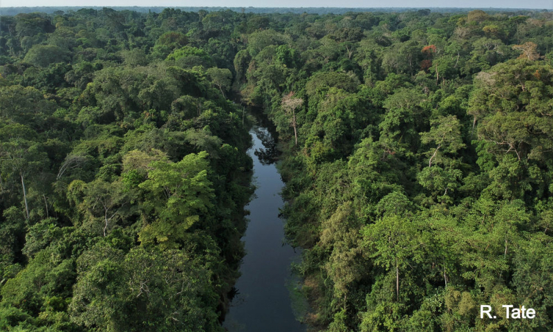
Cameroon's rainforests, as well as those of Angola, Burundi, Tanzania, Rwanda, Central African Republic, Gabon, Congo-Kinshasa, Congo-Brazzaville, and Zambia, are crossed by the river. The Congo basin covers 13 percent of the African continent's land mass. The river's source is in the East African rift's rocky highlands, and it finally drains into the Atlantic Ocean. Within its many eco-regions, the river supports over 700 kinds of fish, many of which are indigenous. Local communities have used the river for transportation, fishing, and irrigation. Hydroelectric dams have been built along the river's path, raising concerns about the river's indigenous fishes, frogs, and snails.
Length: 4,700 km (2,900 mi)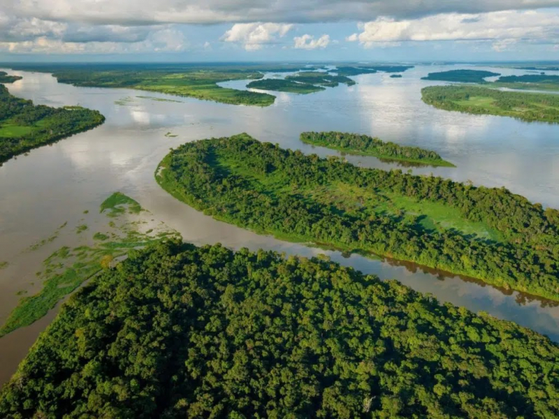
https://www.tourcounsel.com/ 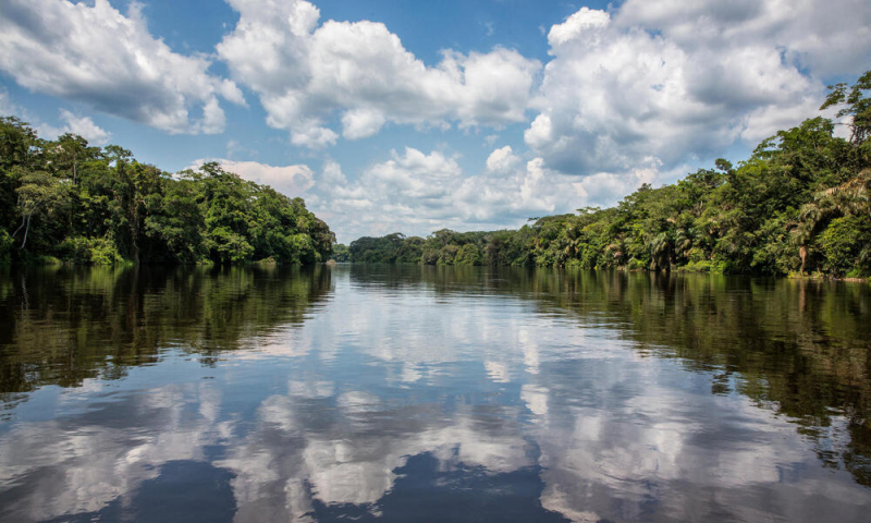
https://www.worldwildlife.org/ -
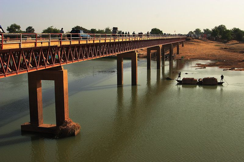
The Benue River is a major tributary of the Niger River. It was historically known as the Chadda River or Tchadda. The river stretches for over 1,400 kilometers (870 miles) and is virtually totally navigable during the summer. It has a basin area of 319,000 km2 (123,000 sq mi). As a result, it serves as a vital transportation corridor in the areas through which it passes. The river originates on Cameroon's Adamawa plateau, flowing west then south until discharging into the Niger River at Lokaja. For many years, the river has provided fish and water to the riverine settlements for domestic, irrigation, and transportation purposes. However, due to the river's current state, the water level has reduced, resulting in a decline in fish populations and making the river difficult to cross during the dry season.
It begins in northern Cameroon's Adamawa Plateau and flows west via Garoua and the Lagdo Reservoir before entering Nigeria south of the Mandara Mountains and passing through Jimeta, Ibi, and Makurdi before meeting the Niger River at Lokoja. The Faro River, the Gongola River, and the Mayo Kébbi are major tributaries, with the Mayo Kébbi connecting it to the Logone River (part of the Lake Chad basin) during floods. Taraba River and River Katsina Ala are two further tributaries.Length: 1,400 kilometers (870 miles)
https://www.skyscrapercity.com/ 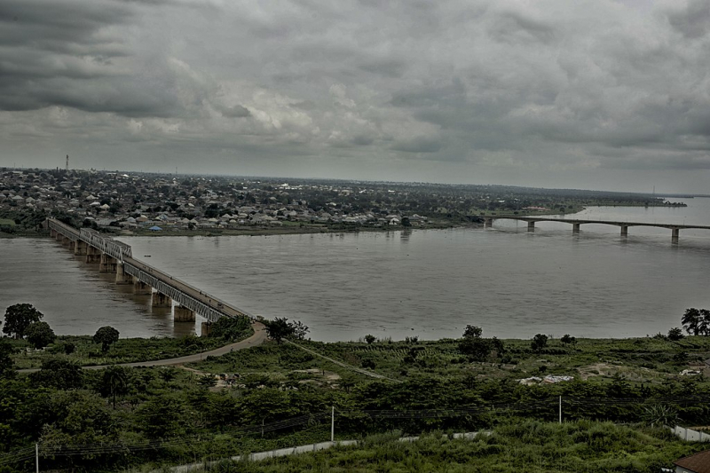
https://commons.wikimedia.org/ -
The Logon or Logone River is a major tributary of the Chari River that runs for 621 kilometers. The Logone's sources are in western CAR, northern Cameroon, and southern Chad. It has two significant tributaries: the Pendé River (Eastern Logone) in the Central African Republic's prefecture of Ouham-Pendé and the Mbéré River (Western Logone) in Cameroon's east. The river is surrounded by bogs and wetlands.
Kousseri, Cameroon's northernmost city, and N'Djaména, Chad's capital city, are both located on the river, at the confluence of the Logone and the Chari River. The Logone is part of Chad's and Cameroon's international boundary. The Logone Oriental and Logone Occidental administrative regions in Chad are named after the river. Ober-Logone was a German colony of Cameroon's administrative district.
For the local communities, the river is an important fishing spot. During the dry season, Logone faces threats as the water volume decreases, resulting in less water for agricultural and home consumption.Length: 1,000 km (620 mi)
https://www.pinterest.com/ 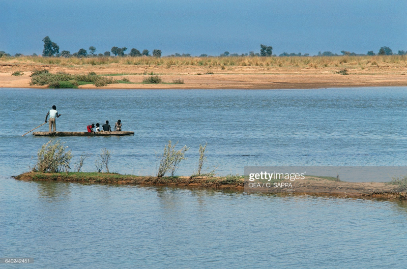
https://www.gettyimages.com/ -
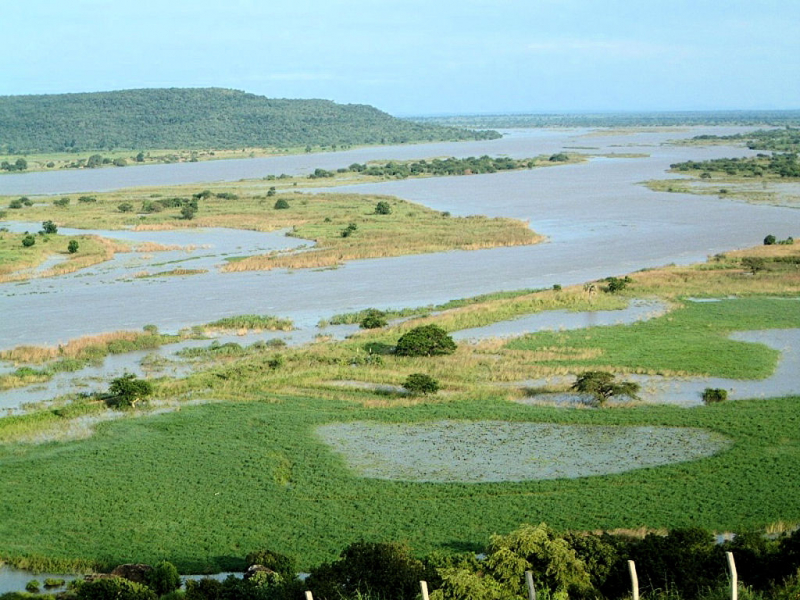
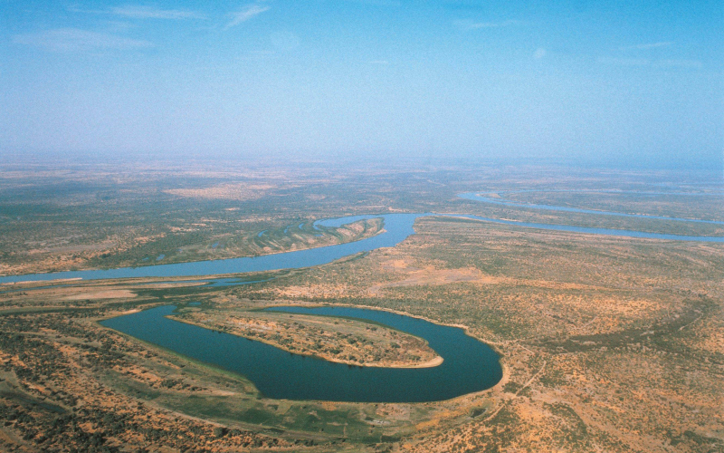
The Chari River, sometimes known as the Shari River, is a 1,400 km (870 mi) long river in Central Africa. It is the main source of water for Lake Chad. This river is reported to have been home to the Sao people. It is home to a large portion of Chad's population, including Sarh and the capital, N'Djamena. It ranks 4th among the longest rivers in Cameroon.
The Chari River travels from the Central African Republic to Lake Chad, following the Cameroon border from N'Djamena, where it is joined by the Logone River, its western and main tributary. It supplies 90% of the water that flows into Lake Chad. The river's catchment spans 548,747 square kilometers (211,872 sq mi). The Logone River is the main tributary, with lesser tributaries including the Bahr Salamat, Bahr Sah), Bahr Aouk, and Bahr Kéita.
The river is home to a thriving local fishing business. Chari is a major fishing ground for many local populations since it provides excellent habitat for various fish species such as nile and perch. The Nile perch is one of the most desirable local fish. There have been plans since the 1960s to move water from the Ubangi River to the Chari in order to resuscitate Lake Chad, which would represent a reversal of the Congo's acquisition of the upper Ubangi from the Chari in the early Pleistocene.Length: 1,400 km (870 mi)
https://www.delonexenergy.com/ 
https://en.wikipedia.org/ -
The Sanaga River (previously German: Zannaga) is Cameroon's greatest river, flowing through the East, Centre, and Littoral regions. From the junction of the Djérem and Lom Rivers, it is around 603 kilometers (375 mi) long. The Sanaga-Djérem River system has a total length of approximately 1,067.5 kilometers (663.3 mi). With a total length of 464.5 kilometers, Djerem is the Sanaga River's longest source.
The Adamawa Plateau is the source of the Sanaga River. In the north of the East Region, it is formed by the confluence of the Djérem River and the Lom River. The Djérem River is 464.5 kilometers long (288.6 miles) and the Lom River is 424.2 kilometers long (263.6 mi). Apart from the originating rivers, the Mbam River is the greatest tributary of Sanaga, having a total length of 548 kilometers (341 mi).
Between two tropical moist forest ecoregions, the Sanaga River serves as a dividing line. The Atlantic Equatorial coastal forests extend south of the river through southwestern Cameroon and Equatorial Guinea, Gabon, the Republic of the Congo, Cabinda, and the Democratic Republic of the Congo, and the Cross-Sanaga-Bioko coastal forests lie to the north between the Sanaga River and the Cross River of Nigeria.Length: 1,067.5 kilometers (663.3 mi)
https://en.wikipedia.org/ 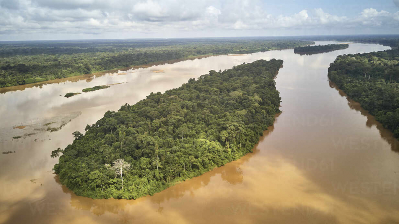
https://www.westend61.de/ -
In Central Africa, the Sangha River is a tributary of the Congo River. The Ngoko River is one of the Sangha River's tributaries (Dja river). Its mouth and confluence with the Sangha are located near Ouésso, Republic of Congo. 1°39′5′′N 16°3′25′′E The Sangha River is located in Africa's Freshwater Ecoregion. It has safeguarded Ramsar sites in the Central African Republic, Cameroon, and Congo.
The Sangha River flows 140 miles (225 kilometers) south from Cameroon's border with the Central African Republic and Congo to Ouesso in Congo (Brazzaville). The river then flows 225 miles (362 kilometers) south-southeast and southwest to its mouth on the Congo River, south of Bobaka. Below Ouesso and periodically up to Nola, the Sangha River is navigable by riverboat all year. Its lower, swampy course breaks into multiple mouths and is linked to the Likouala aux Herbes, Likouala, and Ubangi (Oubangui) rivers via divergent tributaries.
At Nola in the western Central African Republic, the Sangha River is produced by the confluence of the Mambéré and Kadé rivers.
Length: 491 miles
https://www.flickr.com/ 
https://www.grida.no/ -
In west-central Africa, the Dja River (also known as the Ngoko River) is a stream. It runs for approximately 720 kilometers along the Cameroon–Republic of Congo border (450 mi).
The Dja Faunal Reserve, which was proclaimed a UNESCO World Heritage Site in 1987 and rises southeast of the southeastern Cameroon town of Abong-Mbang, sits along the upper course of the river. It safeguards one of Africa's greatest swaths of tropical rainforest. Cliffs run along the path of the river in the south part of the reserve for 60 km, almost completely surrounding the reserve (save to the south-west). They are related with a segment of the river that is broken by rapids and waterfalls. The Dja flows southeast past Moloundou, below which small boats can navigate, following its course in the reserve. It empties into the Sangha River at Ouesso, Republic of Congo.
Poachers travel up the Dja every year in search of elephant ivory in central Nki National Park. For half of the year, the river's strong currents act as a deterrent, but after that, according to freelance writer Jemini Pandya, the fauna becomes easy prey.Length: 720 kilometres (450 mi)
https://en.wikipedia.org/ 
https://www.pinterest.es/ -
Cameroon's Nyong (previously German: Yong) is a river. The river travels 690 kilometers (430 miles) before emptying into the Gulf of Guinea. The river's flow in m3/s as measured at Déhané. On the north side of the river is the town of Mbalmayo, which has a railhead. It also includes the towns of Akonolinga and Abong-Mbang.
The Nyong begins 40 kilometers (25 miles) east of Abong-Mbang, where it is fed by the northern rain forest. The river's length is nearly parallel to the Sanaga River's lower sections. Its mouth is 60 kilometers (40 miles) south-southwest of Edéa in Petit Batanga. The river includes big rapids in two spots, Mbalmayo and Déhané. From April to November, the first 400 kilometers (250 miles) of the river, between Abong-Mbang and Mbalmayo, are passable for small boats.
Length: 690 kilometers (430 miles)
https://en.wikipedia.org/ 
https://www.flickr.com/ -
The Cross River (Oyono) is the main river in southeastern Nigeria, and the state of Cross River is named for it. It is named after the Manyu River in Cameroon, where it originates. Despite being short by African standards, its catchment receives a lot of rain and spreads out quite a bit. It flows through swampy rainforest with numerous creeks for the final 80 kilometers (50 miles) to the sea, forming an inland delta near its confluence with the Calabar River, about 20 kilometers (12 miles) wide and 50 kilometers (31 miles) long between Oron on the west bank and Calabar on the east bank, more than 30 kilometers (19 miles) from the open sea. The delta empties into a large estuary with a few smaller rivers. The estuary is 24 kilometers (15 miles) wide at its mouth in the Atlantic Ocean. The estuary's eastern bank is in Cameroon, a neighboring country.
The river Aloma, which originates in Benue State and flows into the Cross River in Cross River State, is a major tributary of the Cross River. A large roadway connects Cross River State to its sister state, Akwa Ibom. By boat, the distance between Oron and Calabar is 21 kilometers (13 miles), and by road, it is around 200 kilometers (120 miles). The people of the lower Cross River have traditionally relied on water transportation, and Calabar has long had a large seaport on the Calabar River, about 10 kilometers (6 miles) from the Cross River's confluence and about 55 kilometers (34 miles) from the sea. When it was constructed in 1975, the Itu bridge on the Cross River, which runs along the Itu-Calabar route, was hailed as one of the Gowon administration's crowning achievements.The Cross River divides two tropical wet forest ecoregions: the Cross-Niger transition woods west of the river between the Cross and Niger Rivers, and the Cross-Sanaga-Bioko coastal forests east of the river between the Cross and Cameroon's Sanaga River. The average annual rainfall in the state ranges from 1,760 mm in the north to 3,100 mm in the south. Cross River is both the name of a national park and a language family.
Length: 304 miles
https://www.aquaecoafrica.com/ 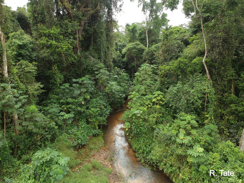
https://www.aquaecoafrica.com/ -
The Wouri (sometimes spelled Vouri or Vuri) is a Cameroonian river. This river is in the top longest rivers in Cameroon. Cameroon has two significant rivers: the Sanaga, which is around 525 kilometers (325 miles) long, and the Wouri, which is about 500 kilometers (325 miles) long. The Wouri is formed at the junction of the Nkam and Makombé rivers, 32 kilometers (20 miles) northeast of Yabassi. It then runs southeast for about 160 kilometers (99 miles) to the Wouri estuary in Douala, Cameroon's main port and industrial metropolis on the Gulf of Guinea. About 64 kilometers (40 miles) upriver from Douala, the river is navigable.
Around the year 1472, the Portuguese navigator and explorer Ferno do Pó or Fernando Poo is thought to have been the first European to explore the Wouri estuary. The mud lobster Lepidophthalmus turneranus was abundant in the Wouri River, thus the explorers named it "Rio dos Camares," Portuguese for "River of Prawns," and the phrase from which Cameroon was derived. When the Spanish arrived in the area, the phrase "Rio dos Camares" became Camarones. The country's name was changed to Kamerun during the German protectorate, which began in 1884, until the Treaty of Versailles placed the country under French and British sovereignty in 1919, leading to the ultimate name "Cameroon."
Length: 525 kilometers (325 miles)
https://en.wikipedia.org/ 
https://en.wikipedia.org/


