


Top 10 Longest Rivers in Greece

The Haliacmon is Greece's longest river, stretching 185 miles between the Pindus Range and the Aegean Sea. Some of the country's rivers cross international ... read more...borders, passing through Bulgaria, Turkey, Macedonia, and Albania. In Greece, rivers are mostly used for agriculture, water supply, and hydroelectric power generation. Important ecosystems have developed in the river basins, which are well protected across the country. Here Toplist brings to you top 10 longest rivers in Greece.
-
Maritsa is a river in Southeast Europe that travels through the Balkans. It is the longest river in the Balkan peninsula, with a length of 480 kilometers (300 miles), and one of the greatest in Europe by discharge. In its upper and middle reaches, it runs through Bulgaria, while its lower course forms much of the border between Greece and Turkey. It has a drainage area of around 53,000 km2 (20,000 sq mi), 66.2 percent of which is in Bulgaria, 27.5 percent in Turkey, and 6.3 percent in Greece. It is the primary river of Thrace's historical region, with the majority of its drainage basin.
Its source is in Western Bulgaria's Rila Mountains, and it flows east-southeast between the Balkan and Rhodope Mountains, past Plovdiv and Dimitrovgrad to Edirne in Turkey. The river flows eastwards east of Svilengrad, Bulgaria, forming the border between Bulgaria (on the north bank) and Greece (on the south bank), and then between Turkey and Greece. The river meets its two main tributaries, the Tundzha and the Arda, at Edirne, and runs within Turkish territory on both sides. It then bends south, forming a river delta between Greece on the west bank and Turkey on the east bank all the way to the Aegean Sea, which it reaches near Enez. The upper Maritsa valley is a principal east–west route in Bulgaria. The unnavigable river is used for power production and irrigation.
The lower course of the river Maritsa, which forms the Greek-Turkish border, is particularly prone to floods. Every year, the lowlands around the river are inundated for nearly four months. This has a huge economic impact (loss of agricultural production and infrastructural damage), estimated to be in the hundreds of millions of euros.
Large floods occurred in 2006, 2007, and 2014, with the greatest flood occurring in 2021. More rainfall owing to climate change, deforestation in the Bulgarian part of the catchment area, increased land usage in flood plains, and limited communication between the three nations have all been suggested as possible causes.
Length: 480 km (300 mi)
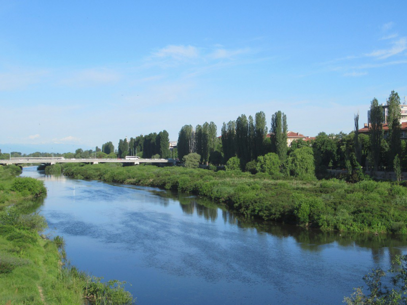
Photo: flickr 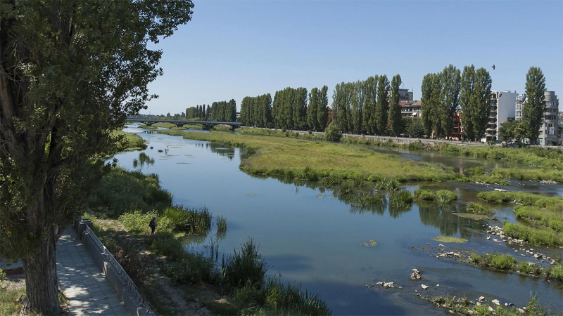
Photo: plovdivcitycard -
The Struma is a Bulgarian and Greek river. Strymn was its old name. It has a total area of 17,330 km2, including 8,670 km2 in Bulgaria, 6,295 km2 in Greece, and 2,365 km2 in North Macedonia. It rises in Bulgaria's Vitosha Mountain, flows westward, then southward, forming a series of canyons before entering Greek territory at Kula village. It is the principal river feeding and departing Lake Kerkini, a significant migratory wildfowl center in Greece. The river empties into the Aegean Sea's Strymonian Gulf at Amphipolis, in the Serres regional unit. The length of the river is 415 kilometers (258 miles), with 290 kilometers (180 miles) in Bulgaria.
Parts of the river valley are part of a coal-producing area in Bulgaria (Pirin Macedonia), which was once more important than it is now; the southern half of the Bulgarian section is an important wine region. The Greek half is a large agricultural valley that is Greece's fourth-largest valley. The Konska River, Dragovishtitsa River, Rilska River, Blagoevgradska Bistritsa, Sandanska Bistritsa, Strumitsa, Pirinska Bistritsa, and Angitis are among the tributaries.
Length: 415 km (258 mi)
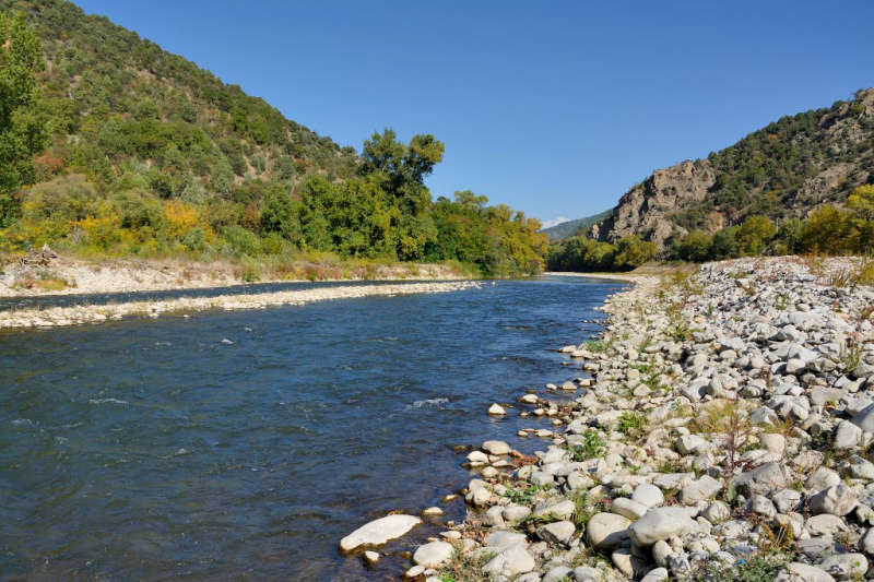
Photo: commons.wikimedia 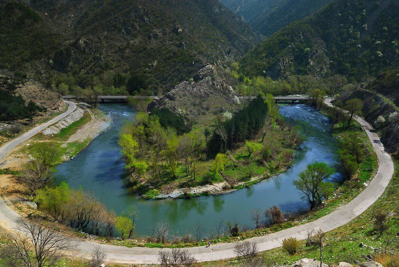
Photo: pinterest -
The Vardar is the river flowing from Thessaloniki to the Aegean Sea. It's 388 kilometers (241 miles) long, including 76 kilometers (47 miles) in Greece, and it drains a 25,000-square-kilometer region (9,653 sq mi). With this length, it belongs to the top 3 longest rivers in Greece. The river's highest depth is 4 meters (13 ft). Vrutok, a few kilometers southwest of Gostivar in North Macedonia, is where the river begins. It flows through Gostivar, Skopje, and Veles before draining into the Aegean Sea near Gevgelija, Polykastro, and Axioupoli ("town on the Axiós") in Central Macedonia, west of Thessaloniki in northern Greece.
The Vardar basin covers two-thirds of North Macedonia's land area. In the Polog region, around Gevgelija, and in the Thessaloniki regional unit, there are fertile farmland. Mountains surround the river on all sides. Within the valley, the superhighways Greek National Road 1 in Greece, as well as M1 and E75, travel the length of the river until near Skopje.
The river was well-known under the Ottoman Empire and is still well-known in modern-day Turkey as the source of many folk songs, the most renowned of which is Vardar Ovasi. It is also depicted on Skopje's coat of arms, which is then incorporated into the city's flag.
The river is particularly useful for irrigation in the rich plains surrounding Thessaloniki. Agricultural operations, on the other hand, have had detrimental consequences, such as sedimentation. To control water flow, certain irrigation and reservoirs have been built along the river's path. For ecological reasons, a major portion of the river's basin is protected in Greece.
Length: 388 km (241 mi)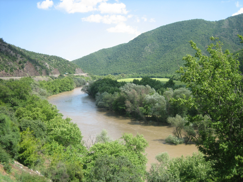
Photo: commons.wikimedia 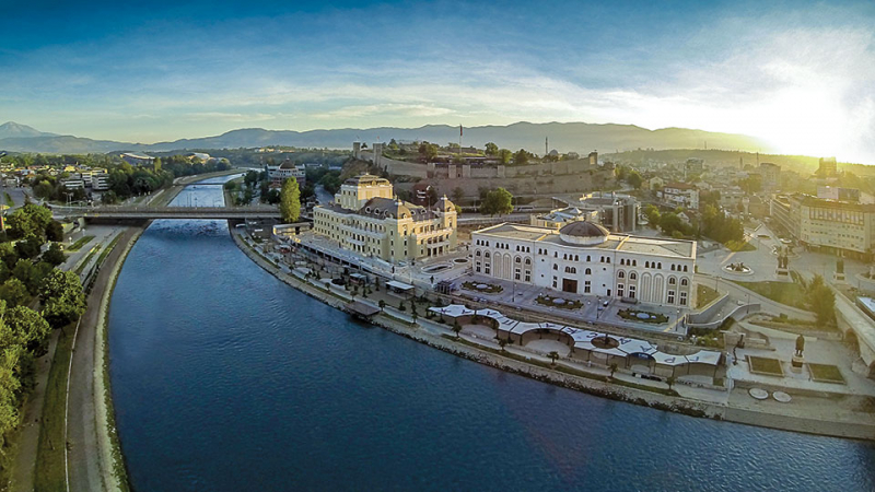
Photo: macedonia-timeless -
With a total length of 297 kilometers, the Haliacmon is one of the Greece's longest river (185 mi). There are three rivers in Greece that are longer than Haliakmon: Maritsa, Struma (Strymónas), and Vardar, all of which originate in Bulgaria, but their length in Greek territory is smaller than Haliakmon's, which flows wholly through Greece. The old English name for the river is Haliacmon, while many sources use Aliákmon, the formerly official Katharevousa name. The demotic Aliákmonas is the only official variant nowadays. It runs through West Macedonia (Kastoria, Grevena, and Kozani regional units) and Central Macedonia (Kastoria, Grevena, and Kozani regional units) (Imathia and Pieria regional units). It has an 8,813-square-kilometer drainage basin (3,403 sq mi). Haliakmon's tributaries include Gramos, Ladopotamos, Pramoritsa, Grevenitikos, Venetikos and Tripotamos.
Aliakmonas or Aliakmon is another name for the river. Carp, eel, tuna, salmon, brown trout, Mediterranean sand smelt, dogfish, and school shark are among the aqua fauna found in the river. The river's basin is a popular birding destination for purple herons, curlews, and pelicans. Historically, the river has served as a natural barrier against northern incursions.
Length: 297 km (185 mi)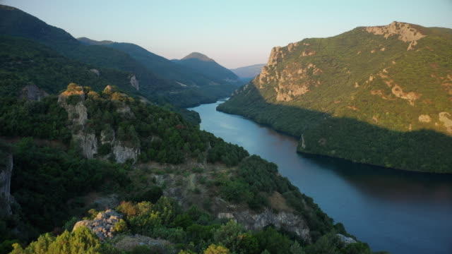
Photo: gettyimages.ae Youtube: Aris Fan -
The Arda is a 290-kilometer (180-mile) river that runs through Bulgaria and Greece. It is a branch of the Maritsa River. Its source is near the village of Arda in the Bulgarian Rhodope Mountains, which is part of the municipality of Smolyan. It runs east across Rudozem, Kardzhali, and Ivaylovgrad before entering Greece in the Evros regional unit's northern portion. It runs into the Maritsa between the Greek village of Kastanies and the Turkish city of Edirne, on the Greek-Turkish border. The Arda is the longest river in the Rhodopes, with a Bulgarian portion of 229 kilometers (142 miles). The medieval Dyavolski most arch bridge crosses the river 10 kilometres (6 mi) from Ardino.
Since ancient times, the Arda valley and its tributary valleys have been a desirable location for population. During building in the Kardzhali area, a settlement dating back to 6,000 BC was unearthed. The famous Thracian cult complexes Perperek, known as Perperikon for the last 20 years, and the sacred site of Tatul were among the many ancient sites uncovered in the region. Several stone bridges were built on the river to traverse the old roadways to the Aegean, with magnificent architecture. The Devil's Bridge in the Dyadovtsi area is one of the few entirely preserved bridges (Ardino municipality). Bridge ruins can be found in various locations throughout the region, including near the settlements of Suhovo and Borovitsa, as well as three others that have been submerged by the dams' waters.
The three floods of February 18, 2005, when the water level was 4.8 meters (16 feet), March 1, 2005, and March 7, 2005, flooded low-lying areas, particularly in the Kastanies area, turning it into a lagoon. The Maritsa's waters merged, flooding streets and structures, including homes, and leaving people stranded in their homes.
Length: 290 km (180 mi)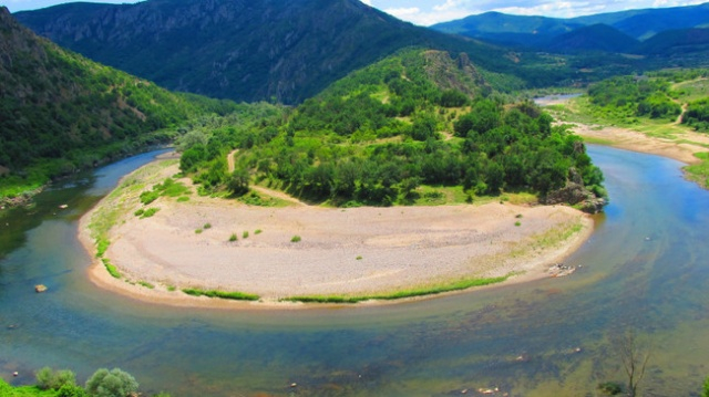
Photo: novinite 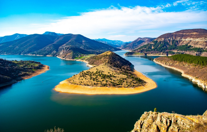
Photo: goodfon -
The Aoös is a river that flows through northwest Greece and southwest Albania. It is around 272 kilometers long (169 miles), with the first 80 kilometers (50 miles) in Greece and the last 192 kilometers (119 miles) in Albania. It has a drainage basin of 6,706 km2 (2,589 sq mi) with a discharge of 195 m3/s (6,900 cu ft/s) on average. Voidomatis, Sarantaporos, Drino, and Shushic are the primary tributaries.
The river originates in Epirus, Greece's Pindus mountains, and flows northwest. It flows through Albania near Arshov and into the Adriatic Sea just north of Vlor. The river is surrounded by the Vikos–Aoös National Park in Greece and the Vjosa-Narta Protected Landscape near its mouth, and is mostly wild and unpolluted. The government declared the Albanian section of the river as a "Managed Nature Reserve" in December 2020. Environmentalists are attempting to declare the entire Albanian section of the route as a national park in order to protect it from potential hydroelectric developments.
Length: 272 km (169 mi)
Photo: flickr 
Photo: flickr -
Nestos is a river that flows through Bulgaria and Greece. It flows into the Aegean Sea near the island of Thasos after rising in the Rila Mountains. Through primarily metamorphic strata, it plunges down towering canyons, reaching the Aegean Sea. The main stream eventually stretches across Chrysoupolis' coastal plain, forming the Nestos delta as a deltaic system with freshwater lakes and ponds. The river is 230 kilometers long (140 miles), with 126 kilometers (78 miles) flowing through Bulgaria and the rest through Greece. It has a drainage area of 5,184 km2 (2,002 sq mi), 66 percent of which is in Bulgaria. In Rila and Pirin, it forms gorges.
The Dospat is the Mesta's longest tributary (or Despatis). The river's banks are mostly covered in deciduous trees that reach halfway between Bulgaria and Greece, where it defines the contemporary border between Greek Macedonia and Thrace, as well as the border between the Kavala and Xanthi regional units, after passing through the Drama regional unit. Except in the east, the river eventually forms a delta to the north, where swamplands, wetlands, and a lagoon once existed.
Length: 230 km (140 mi)
Photo: tripadvisor 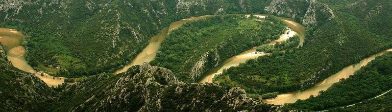
Photo: greecediscovery -
The Achelous, sometimes known as the Acheloos, is a river located in western Greece. It stretches for 220 kilometers (137 miles). The river flows southward, forming part of the border between the regional units of Arta and Trikala, as well as the border between Epirus and Thessaly. It defines the border between Arta and Karditsa, as well as Aetolia-Acarnania and Evrytania, lower downstream. The Agrafiotis and Megdovas rivers feed the Kremasta reservoir, which is also fed by the river.
The river runs southwest into Aetolia-Acarnania after emptying the Kremasta reservoir, supplying the Kastraki reservoir west of the Panaitoliko mountain. It drains into the Stratos reservoir 10 to 15 kilometers (6.2 to 9.3 miles) downstream from this lake. It flows across the lowlands west of Agrinio further downstream. It flows into the Ionian Sea 29 kilometers (18 miles) west of Missolonghi. It was the ancient boundary between Acarnania and Aetolia. The Ionian Sea is where it empties. Its soul was worshipped as the river god Achelous in ancient times.
Length: 220 km (137 mi)
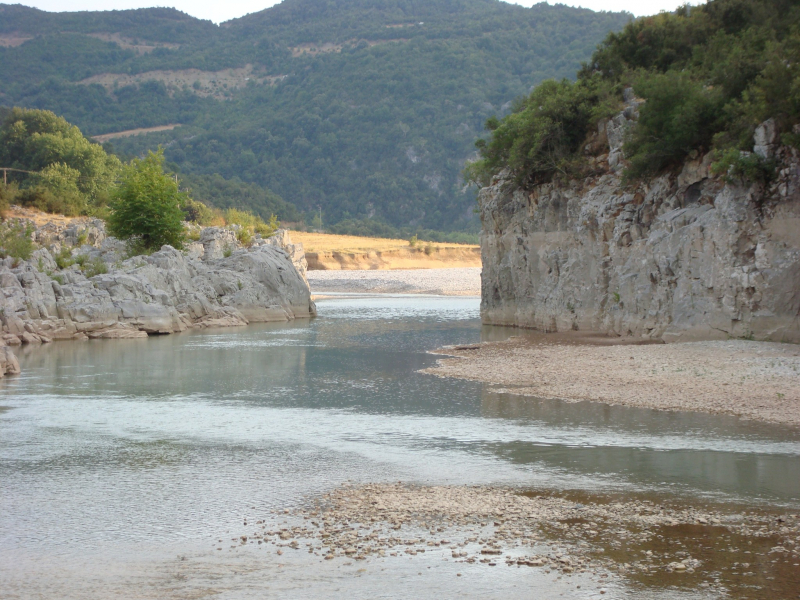
Photo: wikipedia 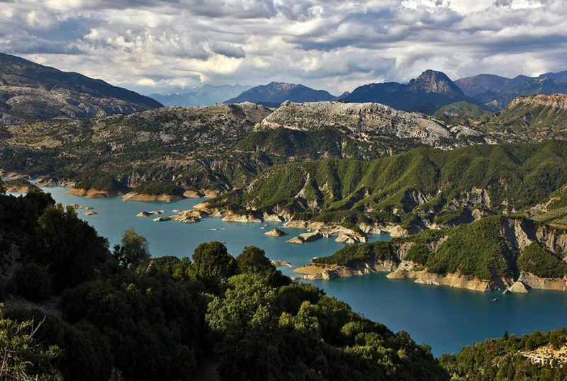
Photo: greenfromgreece -
The Pineios is a river in Greece's Thessaly. The river bears the name of the Greek god Peneus. It was also known as the Salamvrias or Salavrias in the late Middle Ages. It flows northeast of the Vale of Tempe, near Stomio, from the Pindus mountains through the Thessalian plain and into the Aegean Sea. It forms a huge delta that is well-known for its beauty and many animal species, all of which are protected by international environmental laws. It has a total length of 205 kilometers. It has a drainage basin of 9,500 square kilometers (3,700 sq mi). Its source lies near the town of Malakasi, east of Metsovo, on the eastern slope of the Pindus main range.
Along the Pineios, the Meteora region and the city of Larissa are located. A freeway between Athens and Thessaloniki was built through part of the Vale of Tempe in the 1960s. From the source downstream, the Pineios flows through Malakasi, Kalampaka, Megarchi, Megala Kalyvia, Farkadona, Larissa, Evangelismos, and Omolio.
Length: 205 km (127 mi)
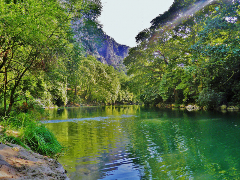
Photo: allovergreece 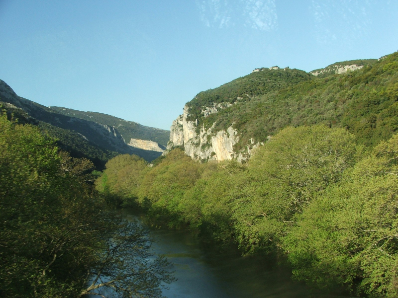
Photo: mapcarta -
The Alfeiós is the main stream of the Alpheios Valley drainage system, a dendritic type, which originates on the north slopes of Mount Taygetus in the Peloponnesus of Greece and flows northwest to Olympia, where it turns west and empties into the Gulf of Kyparissia of the Ionian Sea south of Pyrgos after being impounded by the Flokas Dam, a hydroelectric facility. The entry to the gulf, which passes through an agricultural area and through an unpopulated, sandy beach partially blocked by a spit, is hydrologically unremarkable, with the water being too shallow for all but the smallest craft to navigate.
The modern Alpheios has little similarity to the ancient Alpheios. Many sections have been dammed; large sections have been straightened by embankments; flood control works have been built; water for municipal use and irrigation has been diverted all along the course; some sections have been used for gravel mining; and waste water, fertilizer, and pesticides have polluted it from one end to the other. It was vital for the government to establish frequent monitoring and construct substructure in order to make significant judgments about the river's fate.
Length: 112 km (70 mi)
Photo: xtremegreece 
Photo: xtremegreece


