


Top 7 Longest Rivers In Honduras

Honduras, formally the Republic of Honduras, is a Central American country. Honduras is bounded on the west by Guatemala, on the southwest by El Salvador, on ... read more...the southeast by Nicaragua, on the south by the Pacific Ocean at the Gulf of Fonseca, and on the north by the Gulf of Honduras, a huge Caribbean Sea inlet. Tegucigalpa is the country's capital and largest city. Besides, there many famous rivers in this beautiful nation. These are top 7 longest rivers in Honduras.
-
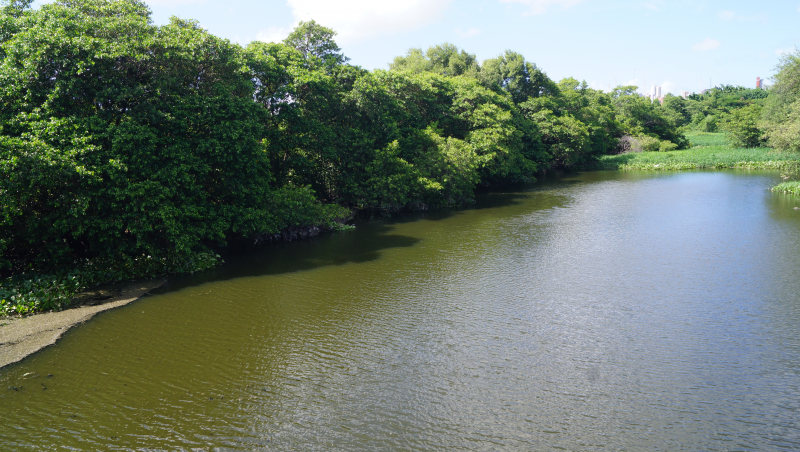
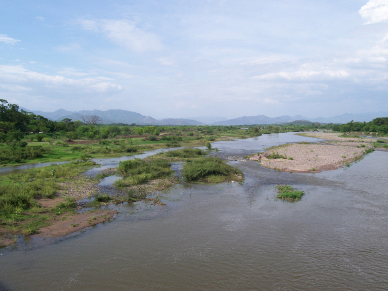
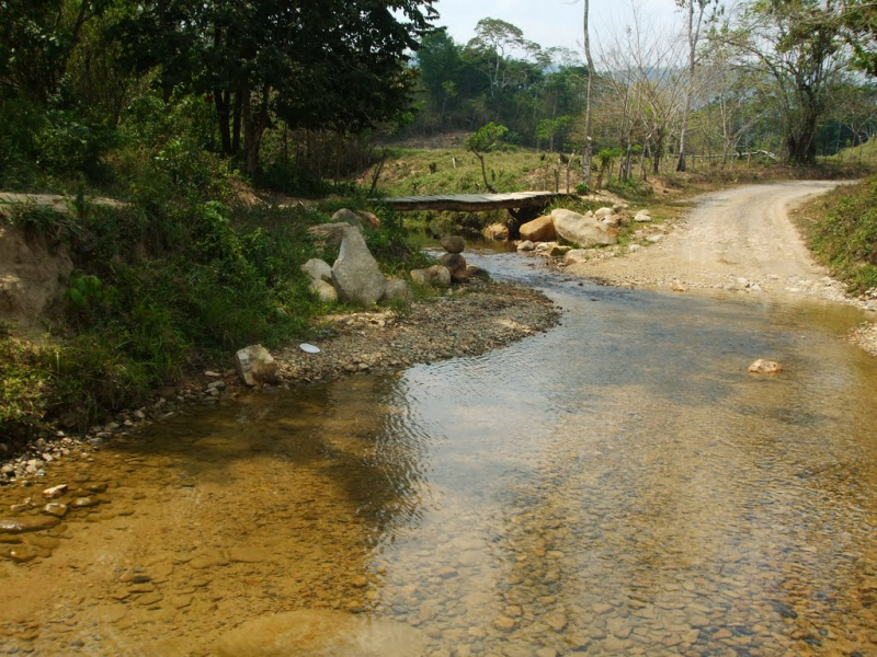
River Wangki in Miskitu or Coco River in Spanish, historically known as the Ro Segovia, Cape River, or Yara River, is a river on the border of Nicaragua and Honduras. This river ranks 1st on the list of longest rivers in Honduras. With a total length of 841 kilometers, it is the longest river that travels wholly within the Central American isthmus (523 mi).
The river begins in the Somoto Canyon National Monument, near where the Pan American Highway enters Nicaragua, and flows 841 kilometers (523 miles) through low hilly terrain into the Caribbean Sea in Cabo Gracias a Dios; the middle and lower sections form the Honduras-Nicaragua border.
In addition, on September 7, 2007, major international news wires reported that the Coco River was more than 11 metres (36 feet) above the normal stage, just two days after category 5 Hurricane Felix made landfall.
Length: 841 km (523 mi)
commons.wikimedia.org 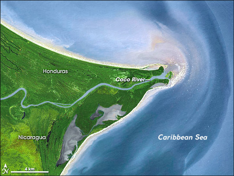
stringfixer.com -
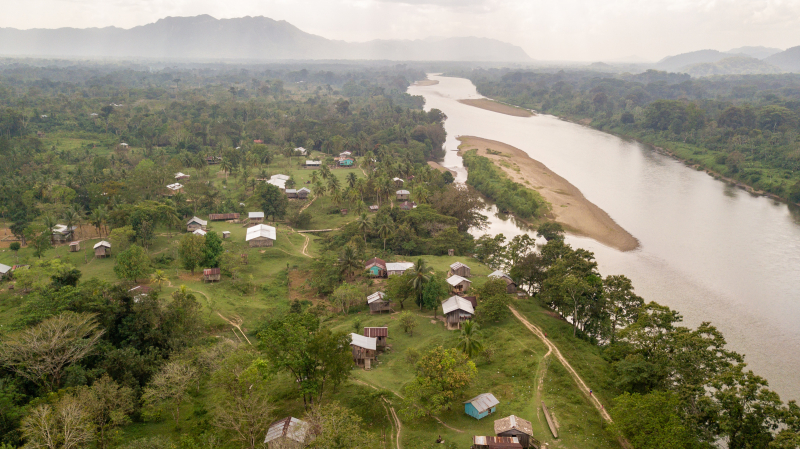
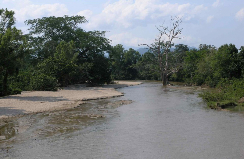
The Patuca, which is in 2nd place on the list of longest rivers in Honduras, is a river in northeastern Honduras formed by the confluence of the Guayape and Guayambre rivers southeast of Juticalpa. It is Central America's second-largest river. The river travels northeast for about ten miles before crossing the Mosquito Coast and entering the Caribbean Sea at Patuca Point.
It was the intended location for a large hydroelectric power project. However, due to environmental concerns, the hydroelectric project was put on hold indefinitely in May 1999. The proposed development involves flooding 42 kilometers of the undisturbed rainforest, all of which were on track to become part of the Patuca National Park or the Tawahka Biosphere Reserve "Asagni."
The Patuca is famed in Honduras for a section of rapids known as "El Portal del Infierno" or "The Gates of Hell," which have claimed the lives of many daring river-goers. At its widest point, the Patuca can stretch for several kilometers. Indeed, its tributary Guayape has been recorded to reach 2 miles in width virtually every year in spots that may be traversed waist deep during the dry season. The Patuca is also known for its lawless nether parts, where tiny heavily armed groups of men dig large placer gold discoveries upstream from the Mosquitia jungle.
Length: 500 kilometres (310 mi)
ihsmn.org 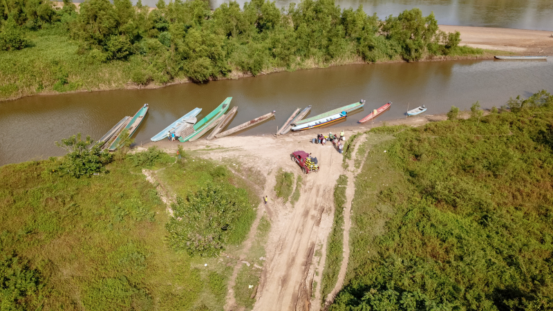
ihsmn.org -
The 3rd place on the list of longest rivers in Honduras is Choluteca River (Ro Grande o Choluteca in Spanish). This is a river in southern Honduras. Its headwaters are in the department of Francisco Morazán, near Lepaterique (southwest Tegucigalpa), and it runs north through the city of Tegucigalpa, then south through the departments of El Paraso and Choluteca. The river's mouth, lying among wetlands, is near the coastal town of Cedeo on the Gulf of Fonseca.
According to FAO, the Choluteca River stretches 349 kilometers from its headwaters to its mouth. Its hydrographic basin covers 7,681 km2. It increases his volume from May to October, along with the wet season. Its basin is affected by extreme drought and the El Nio phenomenon, which is generally accompanied by major bush fires.
This river's flooding was a major cause of devastation during Hurricane Mitch in 1998. It swept out large communities in Tegucigalpa and grew to six times its normal size in Choluteca. It obliterated neighborhoods and a portion of the commercial area there. It also ravaged the tiny hamlet of Morolica, where it not only destroyed the entire village but also killed or disappeared practically all of its people.Length: 349 km (217 mi)
wikipedia.org -
The Ulua River (Spanish pronunciation: [ri.o ulu.a]) is a river in western Honduras. It begins in the central hilly region of the country around La Paz and goes approximately 240 kilometers (150 miles) north to the east end of the Gulf of Honduras at 15°55′N 87°43′W. It is joined along the way by the Sulaco River, Jicatuyo River, Otoro River, and Chamelecón River. The Ula River region is well-known for its exquisite calcite vessels from Mayan times. One of them is in the collection of the British Museum.
The Ulua River has the most volume of whitewater in Honduras, however, it is not difficult. It makes for a beautiful scenic float excursion because it flows through mountain valleys with little riverfront development and is home to species like the huge Roseate Spoonbills and Wood Storks. The route is designated with intermittent bridges that can be used to shorten the route if required. Alternatively, the Ulua can be connected with the Otoro or Jicatuyo flows upstream to form a (much) longer route. Within an hour of any point, you can find a camping spot.
Length: 240 kilometers (150 miles)
astelus.com -
The Aguán River (Spanish pronunciation: [awan]; sometimes known as Rio Aguán in Spanish) is a river in Honduras. It begins in the Yoro region to the west of San Lorenzo and travels south for a short time before turning east-northeast, passing through San Lorenzo, Olanchito, and Tocoa before entering the Caribbean Sea east of Puerto Castilla.
The river runs for 240 kilometers (150 miles). Hurricane Mitch caused the river's banks to overflow at many spots along its length in 1998. Sabá's maximum discharge was estimated to be almost 20,000 cubic metres per second (710,000 cu ft/s). The river wiped away the village of Santa Rosa de Aguán, killing scores of people.
The watershed of the Aguán River is one of seven in Honduras, covering over 1 million hectares (3,900 sq mi), of which around 200,000 are in the Aguán River Valley. The Aguán River Valley contains the majority of Bajo Aguán's agricultural land.
Length: 240 km (150 mi)
flickr.com -
The Nakunta River flows through the Honduran department of Gracias a Dios and empties into the Caratasca Lagoon a few kilometers south of Puerto Lempira. It is 115 kilometers ( which is 71 miles) long. In particular, the river begins in the Department's La Mosquitia district, which is known for its quantity of lizards.
When the Sandinistas compelled Miskito and Panamahka to relocate to Nicaragua in the early 1980s, many fled to Honduras, winding up in refugee camps around the Nakunta river or in settlements such as Mocorón. As part of oil prospecting activities, discussions of constructing a bridge across the river near the settlement of Tapanlaya were ongoing in 2019.Although this river is not the longest river in Honduras, it is the natural place of intact wealth and also the food source for many Miskito communities.
Length: 115 km (71 mi)
wikipedia.org -
The Guayape River (Spanish: Ro Guayape) is a large river that drains much of Olancho and central Honduras. The main tributary of the Guayape is the Rio Jalán, which also joins it near Juticalpa at El Plomo. The river then flows through it with a number of tiny settlements, including El Esquilinchuche. Guayape is split among three vast areas.
The Puente del Burro, a contemporary cement construction that replaced the massive steel suspension bridge that had stood for decades after being built by the US Army Corps of Engineers and was destroyed by Hurricane Mitch in 1998, is the largest bridge over the Guayape. The Guayape River joins the Guayambre River further down the coast from the bridge, and the stream is thereafter known as the Ro Patuca.
Guayape boasts stunning landscapes and infinite waterfalls while being a little-known even among Hondurans. It also boasts some of Honduras' best and most fertile land.
Length: 80,47 km (50 mi)
mapio.net


