


Top 7 Longest Rivers In Italy

Italy is a semi-presidential unitary state with a population of 60,674,003 people and a population density of 521.5 persons per square mile. Rome is both the ... read more...country's capital and its largest city. Italy is one of the top-ranked countries in terms of green energy generation. It is the fourth biggest installed solar energy capacity holder. National parks account for 5% of the total land area in the United States. The state is situated at the point where the Eurasian and African plates intersect, resulting in a high degree of seismic and volcanic activity. Volcanic activity has resulted in the formation of several islands and highlands. Here is the list of 7 longest rivers in Italy.
-
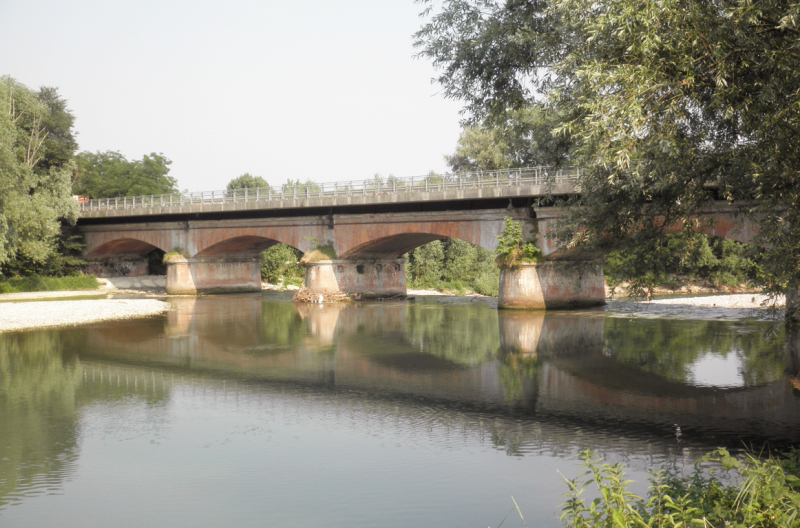
The Po River is Italy's longest river, extending 405 miles and draining a basin area of 28,572 square kilometers. The Po's typical course is from west to east, and it runs in the northern portions of the nation. It runs through a number of significant cities, including Milan, Torino, Cremona, Piacenza, and Ferrara. The river is fed by 141 tributaries and has a maximum width of 1,650 feet. River Po runs in a low gradient area, which, combined with its large flow, makes it prone to major floods; as a result, half of its flow is regulated by dikes.
Turin and Milan, two of the country's largest industrial hubs, utilize river water for industrial reasons. Agriculture is also frequently conducted on a huge scale along the river. Until 2002, there was no wastewater treatment facility in Milan, and raw sewage ran directly into the river. The river was discovered to be poisoned by massive levels of benzoylecgonine, a substance present in the urine of cocaine users, in 2005. The most recent contamination occurred in 2010 when oil flowed into the river from a refinery in Villasanta. Po River is frequently mistaken for the Eridanus river of Greek mythology.
Length: 405 miles
tripsavvy.com 
insideclimatenews.org -
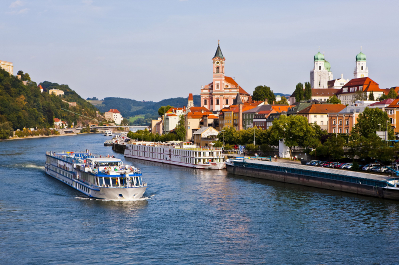
The Adige River, also known as the Italian Fiume Adige, the Latin Athesis, and the German Etsch, is Italy's second-longest watercourse after the Po River. The Adige runs fast through the Venosta Valley south and east via Merano and Bolzano, rising in the north from two Alpine alpine lakes below Resia Pass. After receiving the waters of the Isarco River in Bolzano, the Adige flows south through the Trentino-Alto Adige area, known as the Lagarina Valley, in its middle course. It enters the Po plain at Verona, then turns southeast and, after numerous long meanders, enters the Adriatic Sea just south of Chioggia and north of the Po River delta after a 255-mile journey (410 km). It drains a 4,710-square-mile basin (12,200 square km).
The river's flow was probably several miles farther north in early Christian times until, in AD 589, the river burst through its banks and created its current route. The dikes built over the ages have had to be raised multiple times, and the last 50 miles (80 km) or so of the river's path is totally man-made. In its higher Alpine part, the Adige provides hydroelectric power and irrigation for the Veneto. Floods, such as those that occurred in 1951 and 1966, cause significant damage and need continual riverbank maintenance.
Length: 255 miles
guidaturisticaverona.it 
flickr.com -
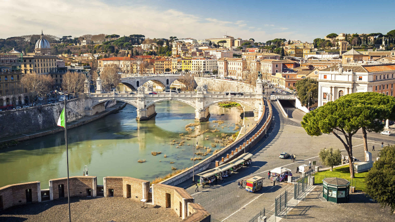
The Tiber flows 242 kilometers from Mount Fumaaiolo to the Tyrrhenian Sea. It runs across Umbria and Lazio and is the city of Rome's principal supply of water. The river's headwaters are two springs that are barely 33 feet apart and are known as Le Vene. Benito Mussolini erected an ancient marble Roman column where the river begins.
Several theories explain the derivation of the name Tiber, the most frequent of which being that it was derived from a mythological monarch named Tiberius. He is supposed to have perished in the river, and his name was afterward given to him. The river was vital in early Roman trade because ships could travel up to 50 miles upstream. In ancient Rome, the river was also used to dispose of executed prisoners. The Tiber River is associated with Rome, and Protestants use the phrase "swimming the Tiber" to describe someone who has converted to Roman Catholicism. The river is noted for its spectacular new bridges as well as a few historic bridges that are currently solely for pedestrians.
Length: 252 miles
getyourguide.fr 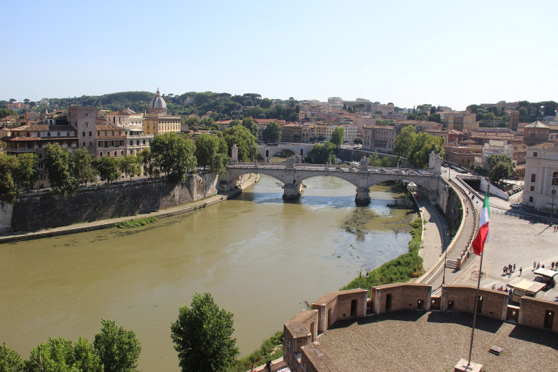
commons.wikimedia.org -
The Adda River, Italian Fiume Adda, is a river in northern Italy's Lombardia (Lombardy) region that flows from tiny lakes in the Rhaetian Alps at 7,660 feet (2,335 m). The Adda runs south from Bormio to Tirano, then west via Sondrio to reach Lake Como towards its northern end after a 194-mile journey (313 km). The upper stream of the river is known as the Valtellina. After leaving Lake Como near Lecco, it flows over the Lombardy Plain, via Lodi, and forms the Milan–Cremona provincial boundary until entering the Po River slightly upstream from Cremona city.
The Adda's drainage basin spans 3,000 square miles (7,800 square kilometers), and the river's average flow in its lower course, which is navigable for 50 miles (80 kilometers), is roughly 8,800 cubic feet (250 cubic meters) per second, varied between 600 and 28,000. The river is heavily used for hydroelectric power generation in the Valtellina as well as irrigation in the Lombardy Plain. The Adda (Addua) was a strategic defense line in several conflicts dating back to the Roman period.
Length: 194 miles
flickr.com 
pinterest.com -
The Green Way of the Oglio grows in a fluvial and plain setting along the Oglio river and some of its canals (also known as seriole), mostly using rural roads and trails. Beginning from the Paratico / Sarnico station, follow the provincial route to Iseo up to the first roundabout, then through XXV Aprile. Shortly after, turn right into Della Santa, which leads to Don Giacomo Moioli, which becomes via S. Pietro.
Take the road downward after a few hundred meters. A modest bridge spans the Palazzolo-Partico tourist train and, shortly after, the Fusia canal's mouth. The trail from here to Palazzolo follows the right orographic embankment of the Fusia, with a gate at the entry allowing only pedestrian access. You will pass the railway twice before getting to the old cotton mill NK in Capriolo. After passing the cotton mill, cross a tiny creek that lowers and continues on the right side of the Roggia Fusia.
Length: 174 miles
wikipedia.org 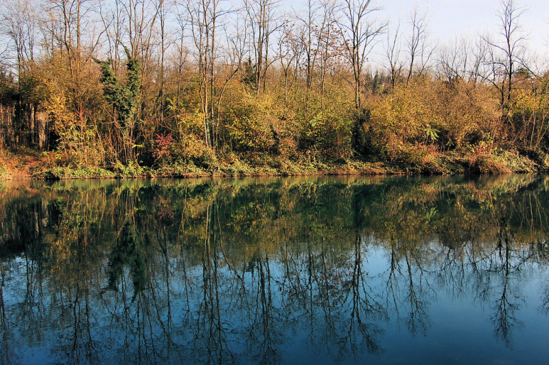
flickr.com -
The Tanaro is a large tributary of the Po River that travels 171 kilometers from the Ligurian Alps to the slopes of Monte Saccarello. The river is fed by four major tributaries: the Stura di Demonte, Borgore, Bormida, and the Belbo. The river starts in the Ligurian Alps near the French border and is the major right-side tributary of the Po in terms of length, drainage basin area, and flow.
The Tanaro is 276 kilometers long and drains an area of approximately 8,000 square kilometers. It springs in the Maritime Alps and runs across the Monferrato highlands. The lower route runs through the western portion of the Po-Venetian Plain. The river is prone to flooding, having been flooded 136 times in the last 200 years. The biggest flooding occurred in 1994, when the whole river valley, including Alessandria, was badly inundated. The Battle of Pollentia took place in 941 on the left bank of the Tanaro River.
Length: 171 miles
wikipedia.org 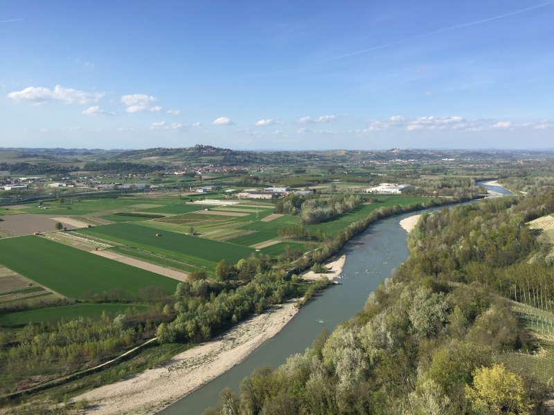
italymagazine.com -
Ticino River, old (Latin) Ticinus, river, a tributary of the Po River, beginning at around 8,000 feet in the Swiss section of the Alpilepoutine mountains near Novena Pass, Switzerland, and draining an area of 2,790 square miles, largely in Italy. The river is 154 miles long, running southeast through the Leventina valley, then west to Lake Maggiore, Italy, where it is joined by the Toce River via road and rail from the St. Gotthard Pass. It then runs southeast into the Po River 4 miles southeast of Pavia in a floodplain 1–2 miles wide and 30–50 feet below the surrounding North Italian lowland.
Ticino is at its highest in May and November, and at its lowest in September and late winter. The river and its tributaries above Lake Maggiore in the Swiss Ticino canton are an important source of hydroelectric power for Switzerland; the Toce River and its tributaries also feed Italy. The Ticino River is impassable by boat. The river's two main towns are Bellinzona and Pavia.
Length: 154 miles
pinterest.com 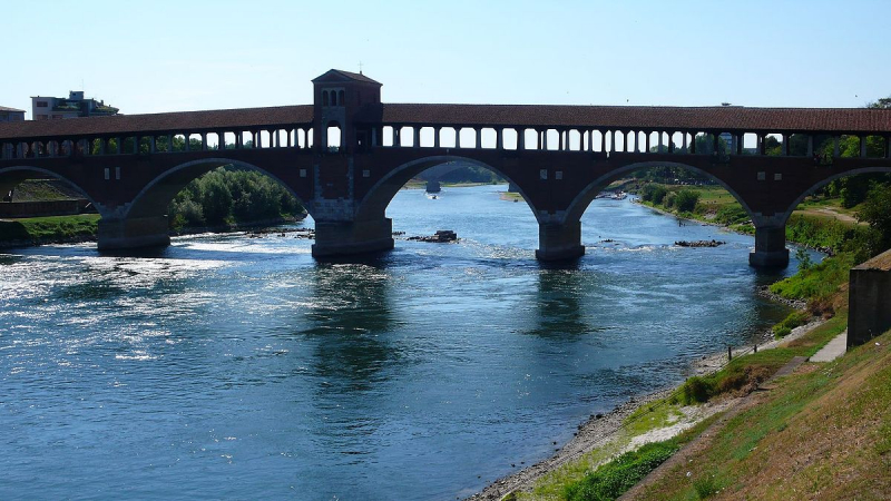
wikipedia.org


