


Top 5 Longest Rivers In Madagascar

Madagascar, officially known as the Republic of Madagascar, is a large island republic off the southeast coast of Africa, around 200 miles away. With a ... read more...population of 21.2 million, it is the world's fourth largest island and 47th largest country. From 1895 to 1957, the island was controlled by the French, and French, along with Malagasy, is one of the official languages. Let's take a look at Madagascar's longest rivers.
-
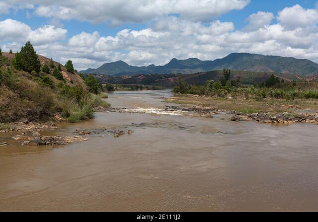
In Madagascar's Atsimo-Andrefana and Anosy regions, the Mangoky River is a 564-kilometer-long (350-mile) river. It is made up of the Mananantanana and Matsiatra rivers. The Zomandao River is another key affluent. Its rank as one of the longest rivers in Madagascar.
It rises in Madagascar's Central Highlands, about east of the city of Fianarantsoa. The river runs westward from the highlands, through the southern portion of the Bemaraha Plateau, reaching the coastal plain and delta, and entering the Mozambique Channel north of Morombe at 21.316667°S 43.533333°EC. 21.316667°S 43.533333°E are the coordinates.
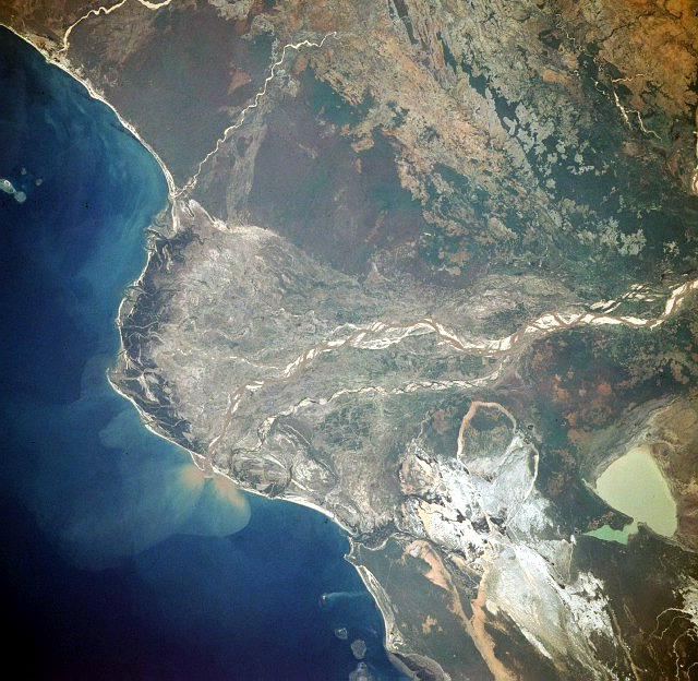
The majority of Madagascar has been severely deforested in the previous 40 years, primarily as a result of indigenous peoples' slash-and-burn practices. The loss of forest in the Mangoky River basin has resulted in severe soil erosion, as indicated by the numerous sandbars found inside the river channel. South of the river, the silt-laden, greenish-tan Lake Ihotry may be seen clearly. A wide, pale sand expanse between the lake and the coast is studded by silt-laden ponds. The delta's southern reaches are characterized by a series of barrier islands and spits. Tidal passages and mangrove swamps, on the other hand, dominate the delta's northern, protected region.
Length: 564 kilometers
https://en.wikipedia.org/wiki/Mangoky_River 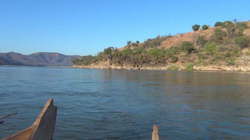
https://www.youtube.com/ -
The Onilahy River is Madagascar's second longest river, beginning on a hill near Betroka in Toliara Province in southern Madagascar. It has a length of 326 miles and is home to two endemic cichlid species, Ptychochromis onilahy and Ptychochromoides betsileanus. This is one of the longest rivers in Madagascar. It empties into the bay of Saint-Augustin on Madagascar's south-western coast. Two cichlid species are indigenous to the river basin, however Ptychochromis onilahy is likely extinct, while Ptychochromoides betsileanus' remaining range is fewer than 10 square kilometers (3.9 sq mi).
Near Beadabo are the Onilahy river's sources. It flows from Ankilimary to Benenitra, Ehara, Bezaha, and Antanimena via Benenitra, Ehara, Bezaha, and Antanimena. Near Tameantsoa, it is bridged by the RN 10. The mouth of the Onilahy river is 35 kilometers south of Toliara (Tuléar) in the Indian Ocean in Saint Augustin, Madagascar.
Sakamena river, Evasy, Ianapera river, Isoanala river, and Ihazofotsy are its primary affluents from the south. Sakondry, Taheza, Sakamare, and the Imatoto river are all to the north.
Length: 525 km (326 mi)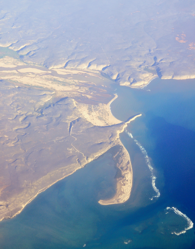
https://en.wikipedia.org/wiki/Onilahy_River 
https://wwf.panda.org/ -
In central-north Madagascar, the Betsiboka River is a 525-kilometer (326-mile) long river. it ranks 3rd among the longest rivers in Madagascar. It runs northwest to Bombetoka Bay, where it empties into a vast delta. Its source is located east of Antananarivo. Mangroves border the river on all sides. The river is known for its unusual reddish-brown water, which is caused by river sediments. The river transports a large quantity of reddish-orange sediment to the sea. The majority of the silt is deposited at the river's mouth or in the bay.
It's a stark example of northwestern Madagascar's disastrous erosion. Over the last 50 years, the removal of native forest for farming and pastureland has resulted in huge yearly soil losses of up to 250 metric tons per hectare (112 tons per acre) in some areas of the island, the highest quantity ever recorded anywhere on the planet. Several fish species, including the three cichlids Paretroplus petiti, P. tsimoly, and P. maculatus, are indigenous to the river basin.
The Ikopa River, the Betsiboka's main tributary, drains Antananarivo's capital city.
Length: 525 km (326 mi)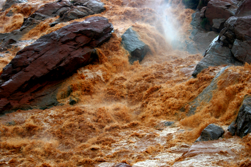
https://en.wikipedia.org/ 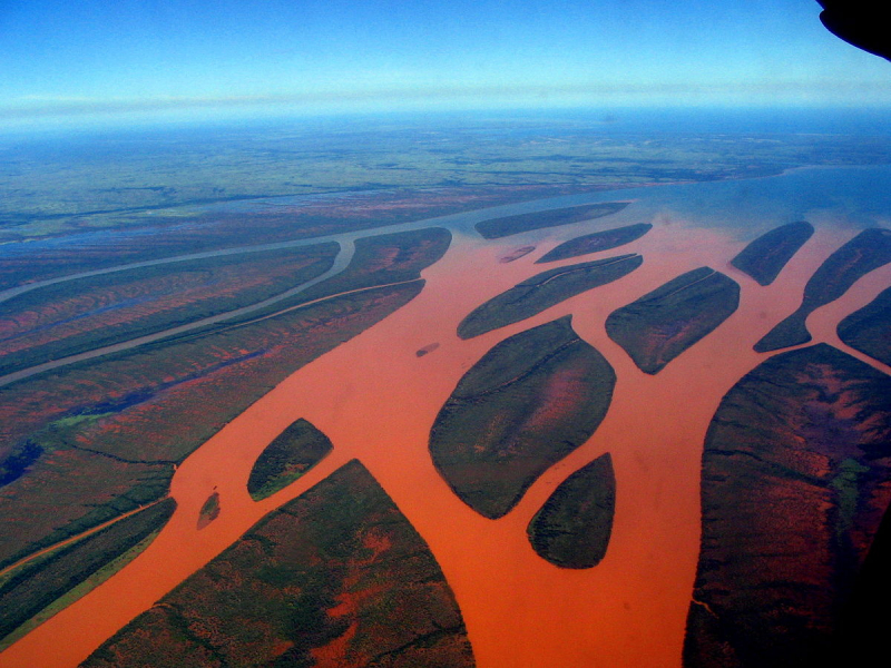
https://www.wikidata.org/ -
The Sofia is a river in Madagascar's northwest. The Sofia Region is traversed by it. The source is located at an elevation of 1784 meters in the Tsaratanana Massif. It stretches over 328 kilometers (204 mi). Antsohihy is the administrative capital. It is also one of the longest rivers in Madagascar.
The Sofia River flows for 220 kilometers from the Tsaratanana Massif region, which is the highest point on the island at 5,853 feet. The river travels through the Sofia region and is located in the northern part of the island. In the Boriziny-Vaovao District, it empties into the Indian Ocean. For the areas it passes through, this river has produced fertile alluvium.
Length: 328 kilometers (204 mi)
https://www.alamy.com/ 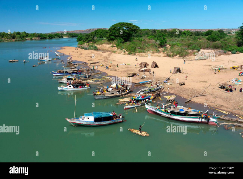
https://www.alamy.com/ -
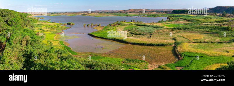
At about 1,100 meters, the Mangoro begins northeast of the village of Anjozorobe in the Analamanga region. Mangoro is also one of the longest rivers in Madagascar. The Onive River (which joins on the right bank 200 kilometers from the river source) and the Nosivolo River are its main tributaries. Its mouth is near the village of Ambodiharina, in the Indian Ocean. Mangoro is one of the longest rivers in Madagascar.
The Mangoro maintains a good flow year-round because to its numerous tributaries, making it a great river for rafting. Crocodiles can be found in small numbers in the river's calmer areas, but their numbers are declining.
Sherritt International Corporation proposed to use the Mangoro River as a water source for a slurry pipeline conveying ore for the Ambatovy project mines as of 2012, causing environmental concerns.
Length: 300 km (190 mi)
https://www.alamy.com/ 
https://mapio.net/


