


Top 3 Longest Rivers in Montenegro

Montenegro is a country with a large hydro-potential, a land with roughly 30 rivers and 30 natural and artificial lakes, and, of course, the Adriatic Sea, ... read more...which covers 4.800 km2. Montenegro is especially rich in rivers that flow through untouched natural areas. They are distinguished by their naturally clear and unpolluted waters. Toplist has compiled a list of the top 3 longest rivers in the country.
-
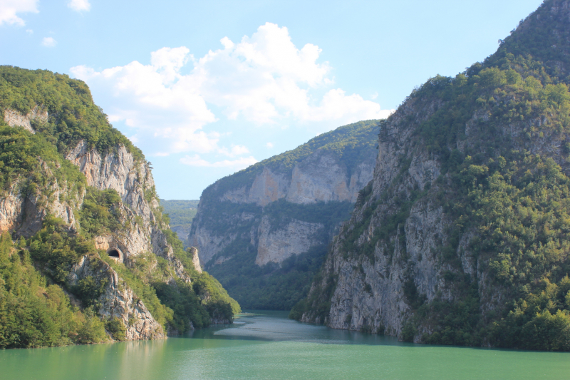
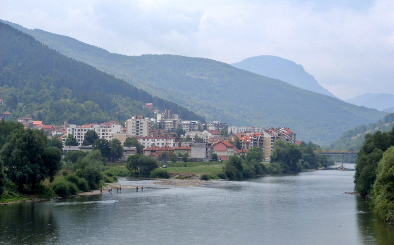
The Lim is a 219 km (136 mi) long river that flows through Montenegro, Serbia, and Bosnia and Herzegovina. It is also the Drina's right and longest tributary.
The Lim rises below Maglić peak in the Kuči area of eastern Montenegro, close to the Albanian border, and is known as Vrmoša. Its source is only a few kilometers away from the Tara river, but the two rivers flow in opposite directions: the Tara to the north-west and the Vrmoša to the east, and it crosses into Albania after only a few kilometers (Albanian: Lumi I Vermoshit). It returned to Montenegro under the name Grnčar after passing through the Prokletije mountains and the village of Vermosh. Receiving the Vruje stream from Ali Pasha's Wellsprings on the right at Gusinje, it continues as Ljuča for a few kilometers before emptying into Lake Plav, forming a small delta. It flows north from the lake, next to the high mountain Visitor, under the name Lim for the remaining 193 kilometers (120 mi).
Lim is part of the Black Sea drainage basin, which includes the Drina, Sava, and Danube rivers. Its drainage basin is 5,968 km2 (2,304 sq mi) and the river is impassable.
It receives many smaller streams in Montenegro and Bosnia and Herzegovina, but its two most important tributaries in Serbia are the Uvac and the Mileševa river.
Length: 219 km (136 mi- shared with Serbia, Bosnia and Herzegovina)
en.wikipedia.org 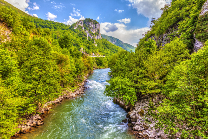
itinari.com -
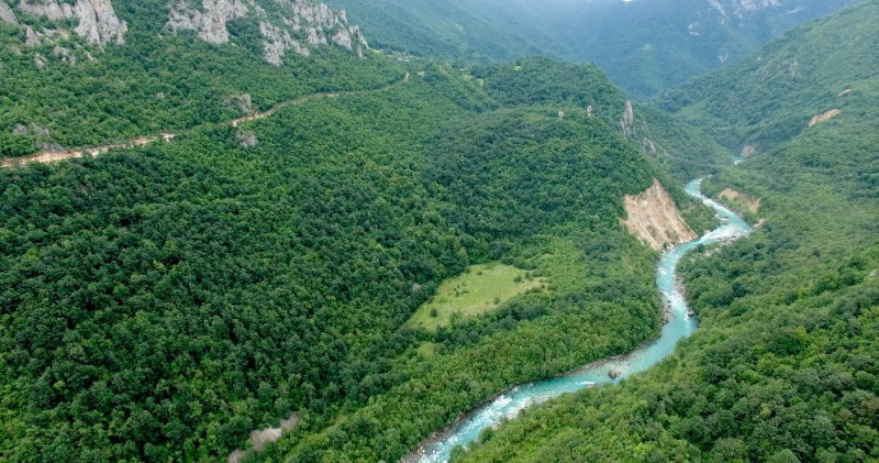
The Tara is a river that flows through Montenegro and Bosnia and Herzegovina. It flows from the confluence of the Opasnica and Veruša rivers in Montenegro's Komovi Mountains, which are part of the Dinaric Alps. The total length is 146 kilometers, of which 141 kilometers are in or near Montenegro's border; it also forms the border between the two countries in several places. The Tara flows from south to north - north-west and joins the Piva at the border between Bosnia and Herzegovina and Montenegro, between the villages of Šćepan Polje (Montenegro) and Hum (Bosnia and Herzegovina), to form the Drina river (a branch of the Danube watershed).
The Tara River carves the Tara River Canyon, which is 78 kilometers long and 1,300 meters deep at its deepest point, and is the longest canyon in Montenegro and Europe, as well as the second longest in the world after the Grand Canyon. The canyon has been designated a UNESCO World Heritage Site. Durmitor National Park is located in the canyon. The river was named after the Illyrian Autariatae tribe, whose territory included the river valley in classical antiquity.
The Tara river is rich in endemic salmonid fish species, huchen (Latin: Hucho hucho), which are otherwise globally endangered, and, along with the Drina river and most of its tributaries, such as the Piva river before damming, the Bistrica, Ćehotina, Lim, Prača, Drinjača, Sutjeska, it is still Europe's prime habitats and spawning grounds.
Length: 146 km (91 mi- Bosnia and Herzegovina)
tarasportrafting.com 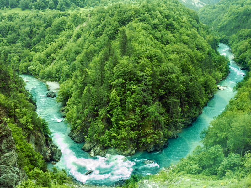
lonelyplanet.com -
The Ćehotina, also known as the Ćeotina, Ćotina or Čehotina, is a 125-kilometer-long river that runs through Montenegro and Bosnia and Herzegovina. It is a Drina river tributary on the right bank.
The Ćehotina flows from two streams in the Montenegrin region of Donji Kolašin, near the Serbian border. As it flows through the high mountain region, it bends and curves to the northwest. Before passing the eastern slopes of the Korijeni mountain and entering the Pljevaljska kotlina, the river has almost no settlements (except for the village of Vrulje). It flows through the Pljevlja coal basin and the city of Pljevlja before entering the Podgora region, passing through the villages of Radosavec, Židovići, Donja Brvenica, and Gradac. The river flows between the Bukovica region to the north and the northern tip of the Ljubišnja mountain, forming the border between Serbia and Montenegro and Bosnia and Herzegovina for a few kilometers. It flows past the villages of Vikoč, Falovići, Godijeno, and Brusina before emptying into the Drina. At its confluence, the city of Foča is built.
The Ćehotina flows for 100 kilometers in Montenegro and 25 kilometers in Bosnia and Herzegovina.
Length: 125 km (78 mi- Bosnia and Herzegovina)
en.wikipedia.org 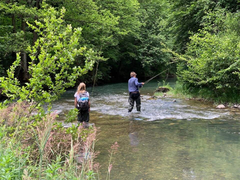
montenegroadventure.travel


