


Top 8 Longest Rivers in Peru

Peru shares the majority of its rivers with its neighbors, notably the Amazon River, which is one of the world's longest and most diverse rivers. The majority ... read more...of Peruvian rivers originate in the Andes and flow into three basins. Through this article, you can find the longest rivers in Peru.
-
Amazon River in South America is the world's largest river by discharge volume of water and, in comparison to the Nile, the world's disputed longest river. The headwaters of the Apurmac River on Nevado Mismi had been thought to be the Amazon's most distant source for nearly a century until a 2014 study discovered that it was the headwaters of the Mantaro River on Peru's Cordillera Rumi Cruz. The Ucayali River is formed when the Mantaro and Apurmac rivers unite to produce the Ucayali River, which meets the Maraón River upstream of Iquitos, Peru, to form the primary stem of the Amazon for countries other than Brazil. The Solimes River runs above its confluence with the Rio Negro, producing what Brazilians call the Amazon at the Meeting of Waters in Manaus, the river's main city.
The Amazon River has an average discharge of around 209,000 m3/s, or 6,591 km3 per year, which is larger than the total discharge of the next seven greatest independent rivers. Two of the top 10 rivers in terms of discharge are Amazon tributaries. The Amazon accounts for 20% of worldwide riverine flow into the oceans. With an extent of approximately 7,000,000 km2, the Amazon basin is the world's largest drainage basin. The drainage basin of the river in Brazil alone is larger than that of any other river. Although the Amazon only has one-fifth of the flow it eventually empties into the Atlantic Ocean when it enters Brazil, it already has a bigger flow than any other river at this stage.
Total Length: 4,345 miles (shared with Brazil, Colombia, and Ecuador)
https://www.gcrmag.com/ 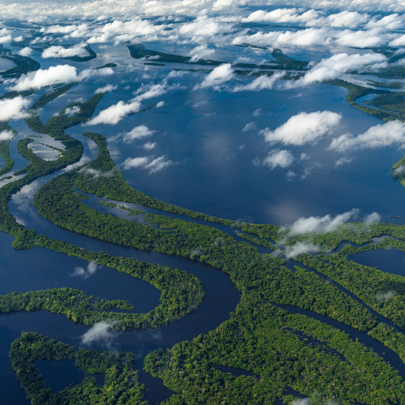
https://www.cntraveler.com/ -
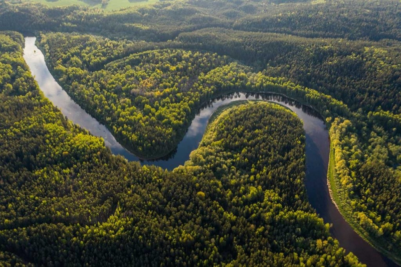
In South America, the Purus River is a tributary of the Amazon River. It has a drainage basin of 371,042 km2 and an annual discharge of 11,207 m3/s on average. The river shares its name with the Alto Purs National Park and the Purs Province, one of Peru's four Ucayali Region provinces.
In Peru, the Purus River rises. After being joined by the Santa Rosa River, it defines the border between Peru and Brazil in the heart of the state of Acre, then runs for a short distance along the boundaries of the 231,555-hectare Santa Rosa do Purus National Forest, a sustainable use conservation unit established in 2001. It then flows into Manoel Urbano to the north-east. Between the Madeira River, which lines the edge of the Brazilian sandstone plateau, and the Ucayali River, which hugs the base of the Andes, it runs through a continuous forest at the bottom of the enormous depression.
The Purs red howler (Alouatta puruensis) is a howler monkey species native to Brazil, Peru, and Bolivia's northwestern region. The catfish Peckoltia brevis can be found in the Purus river basin in the middle and upper Amazon.
The Purus várzea ecoregion is home to the majority of the river's center and lower parts. The river passes through the 233,864-hectare Abufari Biological Reserve, a severely protected region in the municipality of Tapauá, Amazonas.Total Length: 1,839 miles (shared with Brazil)
https://www.instagram.com/biaaancaaa.nemus/ 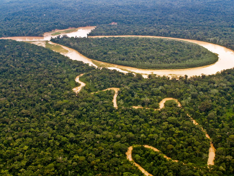
https://invisibleperu.com/ -
The Juruá River is a southern affluent of the Amazon River, west of the Purus River, that shares the bottom of the vast inland Amazon depression with the Purus and shares all of the Purus' characteristics in terms of curvature, sluggishness, and general characteristics of the low, half-flooded forest country it traverses.
The river flows in the Purus várzea ecoregion for the majority of its length. The Juruá-Purus damp woods ecoregion surrounds it. It rises in the Ucayali highlands and is navigable and uninterrupted for 1,133 kilometers above the Amazon River's confluence. It is one of the Amazon's longest tributaries, with a total length of around 1,500 miles.
The Médio Juruá Extractive Reserve, which was established in 1997, is located on the left bank of the river as it meanders northeast through the municipality of Carauari. The western boundary of the 187,982 hectares Baixo Juruá Extractive Reserve, established in 2001, is formed by the lower Juruá River. The lower section of the river in Brazil has been recognized as a Ramsar site since 2018.
Total Length: 1,926 miles (shared with Brazil)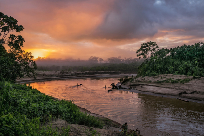
https://www.nationalgeographic.com/ 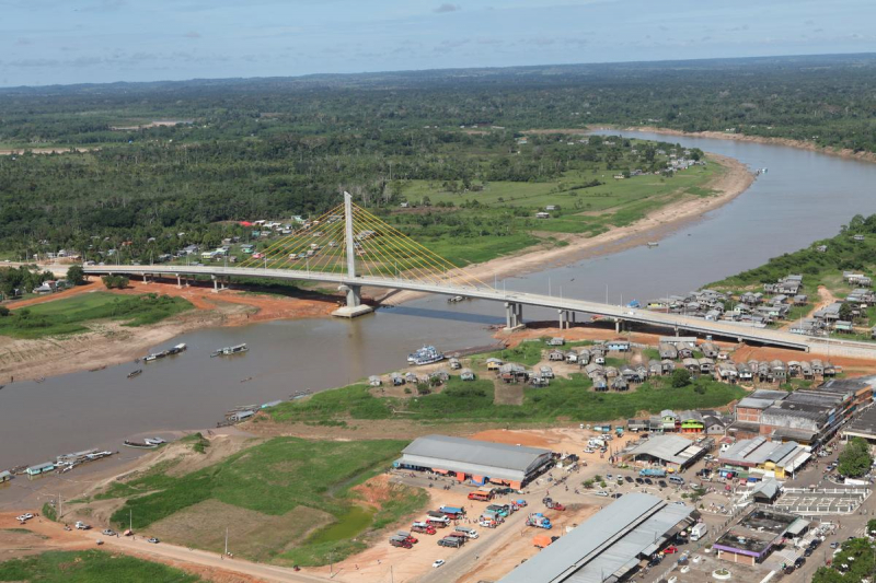
https://structurae.net/ -
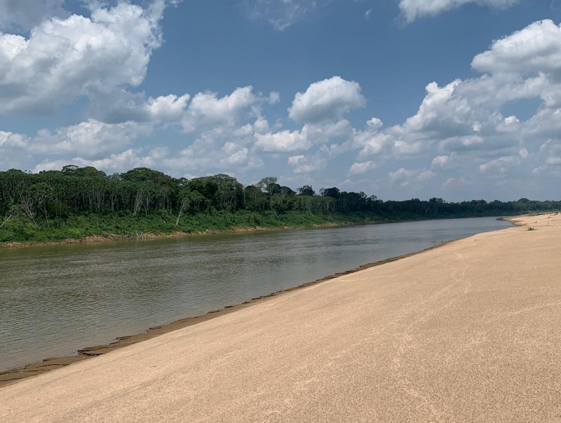
Marañón River is the primary or mainstem source of the Amazon River, rising about 160 kilometers northeast of Lima, Peru, and flowing northwesterly through a deeply eroded Andean valley, along the eastern base of the Cordillera de los Andes, until it reaches the Pongo de Manseriche, where it flows into the flat Amazon basin. Although the term "Marañon River" was once used to refer to the river all the way to the Atlantic Ocean, most cartographers today consider the Maraon River to cease at the confluence with the Ucayali River, after which the resulting waterway is known as the Amazon River.
The Marañón River is expected to supply 20 hydroelectric megadams planned in the Andes, with the majority of the power expected to be exported to Brazil, Chile, or Ecuador. Dam survey crews have developed construction designs, and environmental impact statements for the Veracruz and Chadin2 dams have been available since November 2009 and November 2011, respectively. The energy is to supply mines in the Cajamarca Region, La Libertad, Ancash Region, and Piura Region, according to a 2011 law. In 2013, Peruvian President Ollanta Humala explicitly made a connection with mining, saying that the energy is to supply mines in the Cajamarca Region, La Libertad, Ancash Region, and Piura Region. In 2012, work on the 406 MW dam in Chaglla District began.
Total Length: 1,079 miles (shared with Ecuador)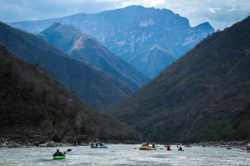
https://www.chimuadventures.com/ 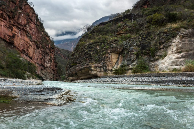
https://www.actualidadambiental.pe/ -
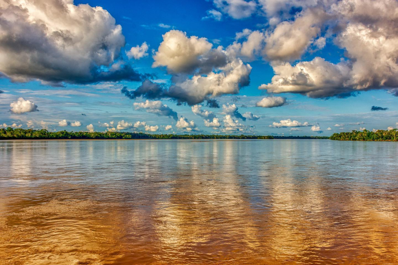
Putumayo River, also known as the Içá River, is a tributary of the Amazon River that flows west of and parallel to the Japurá River. The Putumayo River runs across Colombia, forming part of the country's border with Ecuador as well as the majority of its border with Peru. In the previous three countries, it is known as the Putumayo; however, when it enters Brazil, it is known as the Içá. The Putumayo is a Colombian river that originates in the Andes Mountains east of Pasto. It flows into the Solimes near the Brazilian municipality of Santo Antônio do Icá. The Guamués River, as well as the San Miguel, Güepp, Cumpuya, Algodón, Igara-Paraná, Yaguas, Cotuhé, and Paraná de Jacurapá rivers, are major tributaries. The river runs through the ecoregion of Solimes-Japurá damp woods.
The river is now a significant transportation corridor. Boats navigate almost the whole length of the river. Cattle farming, like the rubber trade, is an important activity along the Icá's banks. Rubber and balatá are supplied from the Içá region to Manaus, Brazil.
In November 2019, Field Museum scientists collaborated with Colombian and Peruvian colleagues to conduct a three-week "rapid inventory" of over 7 million acres surrounding the Putumayo, one of the few Amazonian rivers that have remained undamaged, cataloging 1706 species. The purpose of these quick assessments of distant places is to bring together local stakeholders in order to maintain wilderness in a cooperative manner.
Total Length: 1,000 miles (shared with Brazil, Colombia, and Ecuador)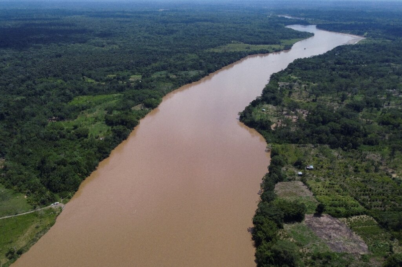
https://phys.org/ 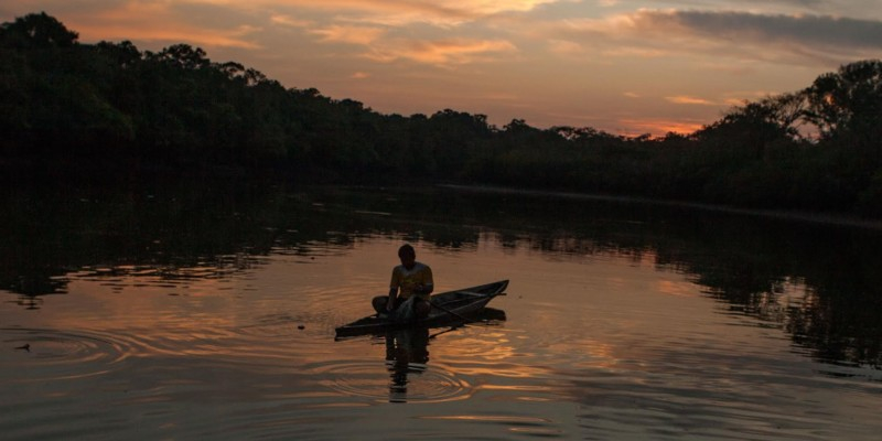
http://amazonwaters.org/ -
Amazon River's main headwater is the Ucayali River. It rises around 110 kilometers north of Lake Titicaca in Peru's Arequipa area and merges into the Amazon near Nauta city at the confluence with the Maraón. The city of Pucallpa is situated on the Ucayali River's banks.
The Ucayali River, along with the Apurmac, Ene, and Tambo Rivers, is now considered the main headwater of the Amazon River, stretching 2,669.9 kilometers from the Apurmac's source at Nevado Mismi to the junction of the Ucayali and Maraón Rivers.
San Miguel was the first name given to the Ucayali, which was followed by Ucayali, Ucayare, Poro, Apu-Poro, Cocama, and Rio de Cuzco. Peru has organized a number of expensive and well-run tours to explore the country. One of them (1867) claimed to have come within 380 kilometers of Lima, and the little steamboat "Napo" sailed 124 kilometers beyond the Pachitea River's confluence with the Amazon and as far as the Tambo River, 1,240 kilometers from the Ucayali's confluence with the Amazon. The "Napo" then made it 56 kilometers upstream from the Tambo River's confluence to a position 320 kilometers north of Cuzco.
Total Length: 994 miles (wholly within Peru)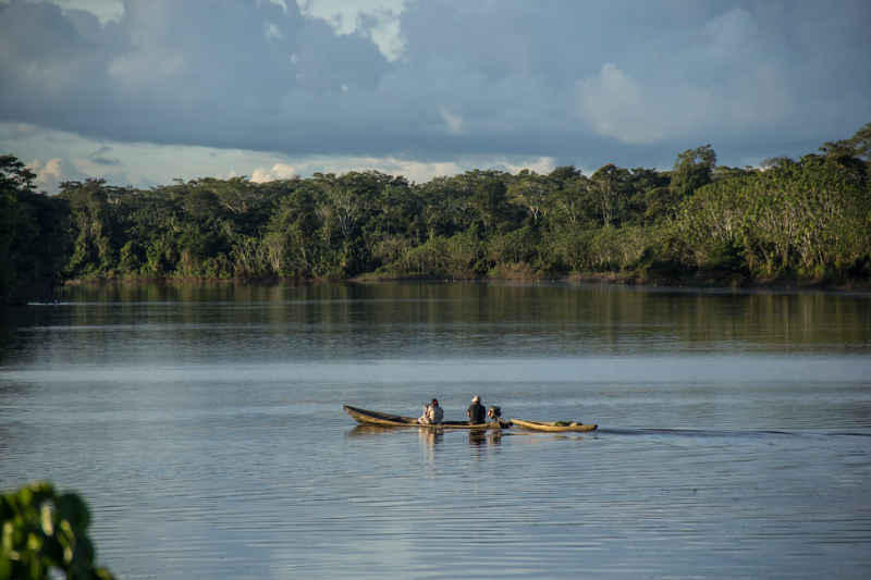
https://www.cifor.org/ -
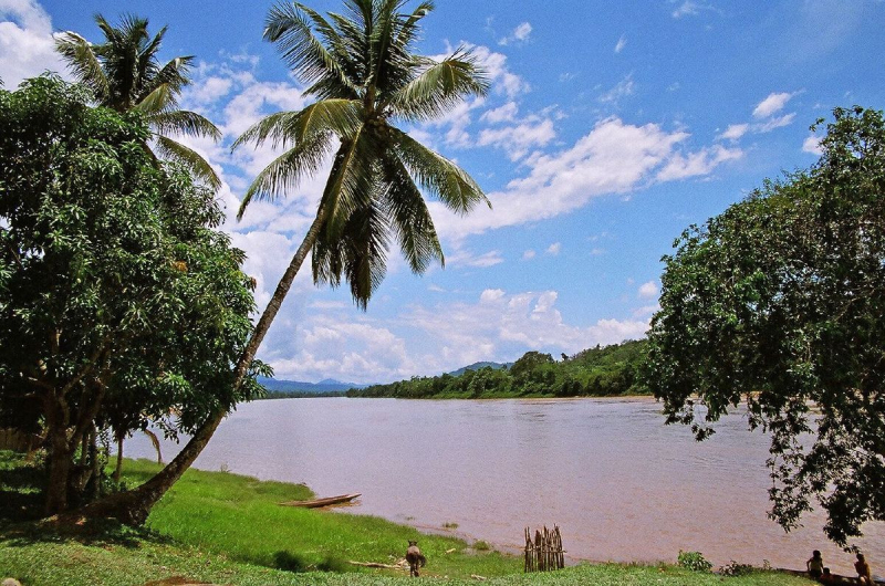
Huallaga river is one of the longest rivers in Peru. It is a tributary of the Amazon Basin's Marañón River. Guallaga and Rio de los Motilones were two old names for this river. The Huallaga flows from the Andes in central Peru and merges with the Marañón before joining the Ucayali River to form the Amazon. The Monzón, Mayo, Biabo, Abiseo, and Tocache rivers are its primary tributaries. Coca is grown in the majority of those valleys, which are also subject to floods on a regular basis. Despite its length of 1,100 kilometers, it is mostly impassable. The Huallaga is a raging torrent that runs through a series of canyons for nearly its entire length. The river includes 42 rapids and forms the Pongo de Aguirre gorge as it enters the Andes. The Huallaga can be ascended by larger riverboats from this point, 140 miles from the Amazon, to the port city of Yurimaguas, Loreto.
The river is frequently divided into two or three portions, despite the lack of fixed limits. The Upper Huallaga is the section of the river that runs from Tocache, San Martin, to the river's source. The river's upper and lower reaches are referred to as the middle and lower Huallaga, respectively. These divisions are for reference only and are unrelated to the Amazon Rainforest's "highland" and "lowland" jungle zones.Total Length: 671 miles (wholly within Peru)
en.wikipedia.org/wiki/Huallaga_River 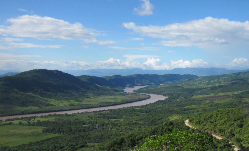
commons.wikimedia.org -
Napo River is a tributary of the Amazon River that rises in Ecuador on the sides of the Antisana, Sincholagua, and Cotopaxi volcanoes in the eastern Andes.
Before reaching the plains, it gets a large number of little streams from impassable, soaked, and heavily fractured hilly zones, where dense and varied vegetation appears to battle for every square inch of land. It receives a minor tributary from the west, the Curaray, which originates in the Andean foothills between Cotopaxi and the Tungurahua volcano.
The Napo is full of snags and shelving sandbanks from its Coca branch to the mouth of the Curaray, and it casts out innumerable canoes among jungle-tangled islands, which are flooded during the wet season, giving the river an enormous width. It travels over a wooded plain from the Coca to the Amazon, with no hills visible from the river and only swamps and lagoons interrupting its uniformly level banks.
The Napo is navigable for river craft up to its Curaray branch, a distance of about 348 km and possibly a little further; from there, its upper waters can be ascended as far as Santa Rosa.Total Length: 702 miles (shared with Ecuador)
https://www.instagram.com/dllanham/ 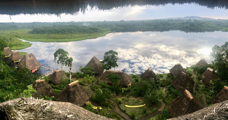
https://www.instagram.com/inazumarina_travels/


