


Top 10 Longest Rivers in Portugal

Portugal is a country in western Europe that shares borders with Spain and the Atlantic Ocean. The country's terrain is diversified, ranging from mountains ... read more...that encircle a wide coastal plain to a plethora of lakes and rivers that run through it. There are at least ten main rivers in Portugal, five of which originate in Spain. Toplist has compiled the top 10 longest rivers in Portugal in this article.
-
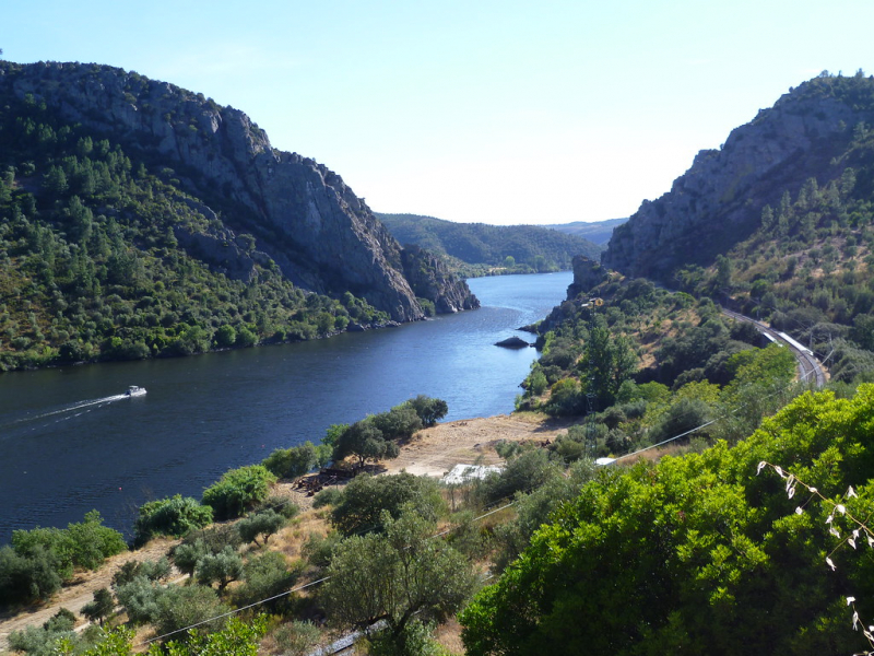
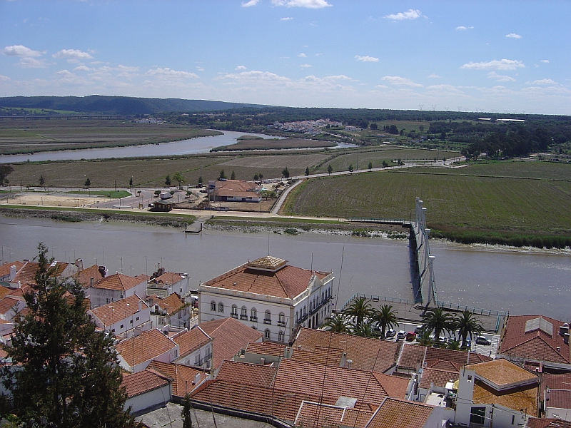
The first one in Top 10 Longest Rivers in Portugal that Toplist would like to introduce to you is Tagus. The Tagus is the Iberian Peninsula's longest river. The river begins in the Montes Universales in central-eastern Spain and travels 1,007 kilometers (626 miles) west, with two major south-west parts, until emptying into the Atlantic Ocean near Lisbon. Its drainage basin is 80,100 km2 (30,927 sq mi), second only to the Douro in the peninsula. The river receives a lot of traffic. Several dams and diversions provide potable water to central Spain and Portugal's major population centers, while dozens of hydroelectric units provide electricity. It has a very constrained path between dams, but after Almourol, Portugal, it has a vast alluvial valley that is prone to floods. Its outlet is a wide estuary that leads to Lisbon, Portugal's principal port and city.
All of the major tributaries are on the right bank, which lies to the north in this area. The river flows 716 kilometers (445 miles) through Spain, 47 kilometers (29 miles) along the border between the two countries, and 275 kilometers (171 miles) through Portugal.
Tagus river runs through Aranjuez, Toledo, and Talavera de la Reina in Spain, and Abrantes, Santarém, Almada, and Lisbon in Portugal, in that order. Madrid, Spain's capital, is located in the upper drainage basin.
Length: 1,007 km (626 mi- shared with Spain)
flickr.com 
istockphoto.com -
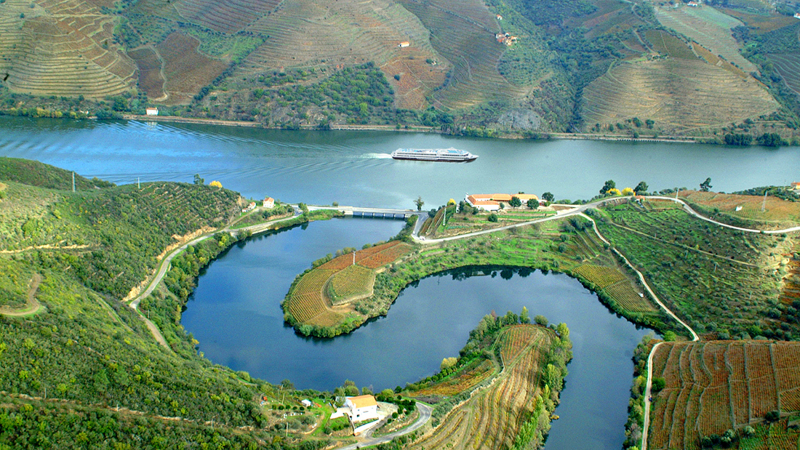
The second one in Top 10 Longest Rivers in Portugal that Toplist would like to introduce to you is Douro. The Douro is the Iberian Peninsula's highest-flowing river. It springs near Duruelo de la Sierra in the province of Soria in central Spain, meanders south briefly, then flows west across northern Spain and northern Portugal to its mouth at Porto, Portugal's second largest city. It meets the Atlantic Ocean at its mouth.
The scenic Douro railway line, tourism in general, and – relatedly – the creation and production of port – a mildly fortified wine –, grapes, conventional wines, and other agricultural produce are all notable. The Côa Valley Paleolithic Art site, a UNESCO World Heritage Site, is located on a minor branch of the river and is deemed important to the archaeological prehistoric patrimony. It runs across the centre of the autonomous community of Castile and León in Spain, with the basin comprising the northern half of the Meseta Central. Wine-producing regions such as the Ribera del Duero DOP are included in this category.
After the Tagus and the Ebro, it is the third-longest river in the Iberian Peninsula. It has a total length of 897 kilometers (557 miles), of which only sections of the Portuguese section are naturally navigable by small rivercraft because they are below a fall/rapids line.
Length: 897 km (557 mi- shared with Spain)
cnn.com 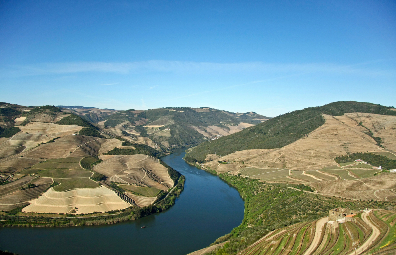
en.wikipedia.org -
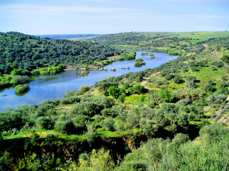
The third one in Top 10 Longest Rivers in Portugal that Toplist would like to introduce to you is Guadiana. The Guadiana River, sometimes known as the Odiana, is a lengthy section of the Portugal-Spain border that separates Extremadura and Andalusia (Spain) from Alentejo and Algarve (Portugal) (Portugal). The river and its tributaries run from east to west, then south through Portugal to the border towns of Vila Real de Santo António (Portugal) and Ayamonte (Spain), where they pour into the Gulf of Cádiz. It is the fourth-longest river in the Iberian Peninsula, covering 829 kilometers (515 miles), and its hydrological basin encompasses around 68,000 square kilometers (26,000 square miles) (the majority of which lies within Spain).
Between Vila Real de Santo António (Portugal) and Ayamonte (Portugal), the Guadiana flows east to west through Spain and south through Portugal, forming the Spanish-Portuguese border. It then flows into the Gulf of Cádiz, which is part of the Atlantic Ocean (Spain). It stretches for 818 kilometers (508 miles), with 578 kilometers (359 miles) within Spanish territory, 140 kilometers (87 miles) within Portuguese territory, and 100 kilometers (62 miles) shared by the two countries. Roughly 82 percent of its basin, or 55,444 square kilometers (21,407 square miles), is in Spain, while about 17 percent, or 11,560 square kilometers (4,460 square miles), is in Portugal.
Length: 818 km (508 mi- shared with Spain)
en.wikipedia.org 
portugaltravelguide.com -
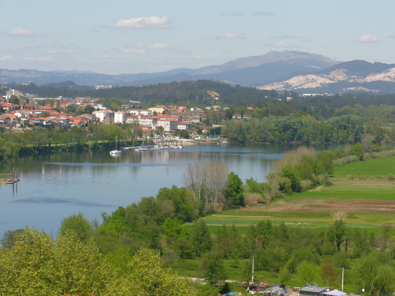
The fourth one in Top 10 Longest Rivers in Portugal that Toplist would like to introduce to you is Minho. With a length of 340 kilometers and a border with Portugal, the Minho or Miño is Galicia's longest river (210 mi). After the Douro, Ebro, and Tagus, it is the fourth river in the Iberian peninsula in terms of discharge.
The Minho is a river that supplies water to vineyards and fields, as well as producing hydroelectric power and defining a stretch of the Spanish–Portuguese boundary. It is known as Minno in old English maps.
The Minho, which has a flow of 102 m3/s, receives the waters of its largest tributary, the Sil, which has a discharge of 184 m3/s, around 20 kilometers (12 miles) north of Ourense at Os Peares. Passing through Ourense, one significant dam is located near Frieira, near Ribadavia, which is known for its Ribeiro DOP wine (called after the name of the region). The Minho has an average discharge of 316 m3/s. Later in its course, the river travels southwest till it reaches the Portuguese border near Melgaço.
After passing through Galicia for 260 kilometers (160 miles), the Minho forms the border with Portugal for another 80 kilometers (50 miles), mostly to the west. The valley is a lush, green agricultural area where the land is used to produce corn, potatoes, cabbage, even kiwi fruit, or just grass, depending on the time of year, and where the vines that produce the light, slightly sparkling "Vinho Verde" and the Ribeiro wine, both unique to this area, are planted everywhere edging the fields, rivers, and gardens, wherever there is space. The best of these wines, known as Albariño in Portuguese and Albario in Spanish and Galician, are made in the Monção, Arbo, and Melgaço areas.
The Minho divides the Spanish Tui and Portuguese Valença do Minho, passing through the medieval villages of Melgaço and Monção and guarding an important road and rail bridge. Both cities are national monuments with fortifications. With an average discharge of 420 m3/s, the Minho reaches the Atlantic between the Galician A Guarda and the Portuguese Caminha.
Length: 350 km (220 mi- shared with Spain)
en.wikipedia.org 
istockphoto.com -
The fifth one in Top 10 Longest Rivers in Portugal that Toplist would like to introduce to you is Mondego River. The Rio Mondego, often known as the Mondego River, is Portugal's longest river. Its source is the Serra da Estrela, mainland Portugal's tallest mountain range (i.e. excluding the Portuguese islands). It travels 234 kilometers (145 miles) from the Gouveia municipality in Serra da Estrela, at 1,425 meters (4,675 feet) above sea level, to its mouth in the Atlantic Ocean in Figueira do Foz.
Its etymology is thought to be derived from the pre-Roman Hispano-Celtic voice Munda or Monda, which was Latinized into Mundicus Mondcus before evolving into the current name. It runs through the Centro Region districts of Guarda, Viseu, and Coimbra.
Before crossing the town of Penacova, it flows near the towns of Celorico da Beira, Fornos de Algodres, Nelas, Tabua, Carregal do Sal, Mortagua, and Montemor-o-Velho, as well as the cities of Seia, Gouveia, Guarda, Oliveira do Hospital, Mangualde, and Santa Comba Dao. It is narrow, then widens by the city of Co
Along the Mondego, there are two dams: Aguieira and Raiva.
The Rio Dão is one of its tributaries, and the Dão DOC wine area is named for it. The River Alva, which enters the Mondego right before Penacova, is another. Just south of Coimbra, along NH 17, the Ceira River enters the Mondego.
Length: 234 km (145 mi)
travel-in-portugal.com 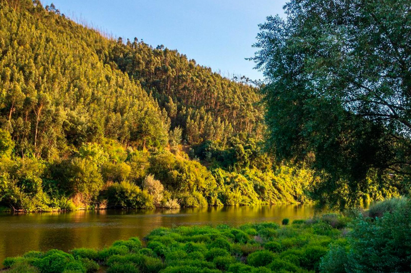
passadicosdomondego.net -
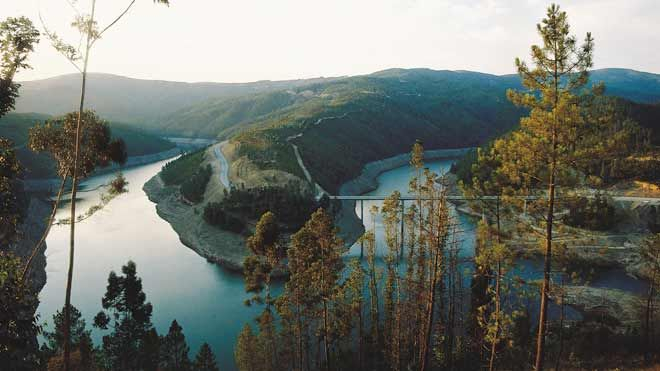
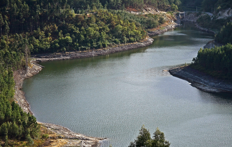
The Zêzere is a tributary of the Tagus River in Portugal. It rises near the Torre, the highest point in continental Portugal, in the Serra da Estrela. The Zêzere flows through Manteigas, Belmonte, Covilhã, and Pedrogão Grande, passing south of Covilhã and east of Pedrogão Grande. In Constância, it empties into the Tagus. It is Portugal's second-longest river wholly within its borders (the Mondego being the longest). Cabril, Bouçã, and Castelo de Bode hydroelectric power stations are located on its slope.
On the Zêzere, there are three dams starting at the headwaters:
- Cabril is a concrete double-curvature arch dam on the Zêzere River that separates the districts of Castelo Branco and Leiria. It is situated in the municipality of Sertã, in the district of Castelo Branco, Portugal.
- Bouçã is a concrete double-curvature arch dam on the Zêzere River, which separates the districts of Castelo Branco and Leiria. It lies in the municipality of Pedrógão Grande, in the district of Leiria, Portugal.
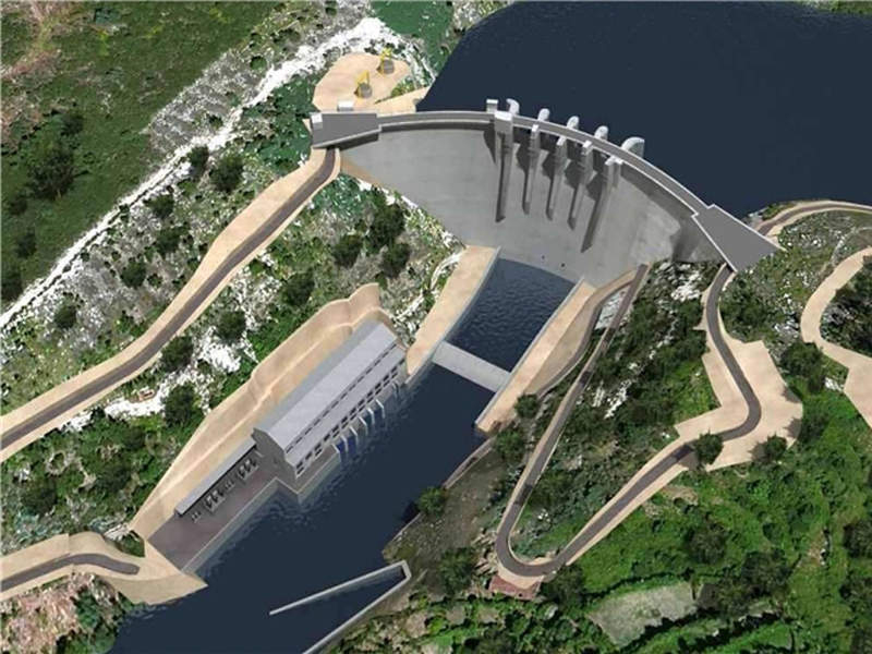
- Castelo de Bode is a concrete arch-gravity dam on the Zêzere River, a tributary of the Tagus River, in the Santarém District of Portugal, located southwest of Tomar and north of Constância. It is one of Portugal's tallest skyscrapers. Between 1945 and 1951, the dam was built. It also houses a 138-megawatt hydroelectric power plant that was built between 1951 and 1952.
Length: 214 km (133 mi)
visitportugal.com 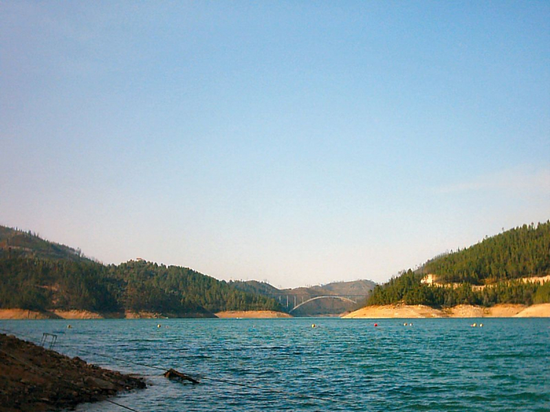
en.wikipedia.org -
The Sado is a river in southern Portugal that is one of the country's major rivers. It flows in a northerly direction (the only major Portuguese river to do so) for 175 kilometers (109 miles) from its headwaters in the Ourique highlands to an estuary in Setúbal, where it enters the Atlantic Ocean. With an area of approximately 106,460,000 km2, the Atlantic Ocean is the world's second-largest of the five oceans (41,100,000 sq mi). It covers about 20% of the Earth's surface and about 29% of its water surface area. In the European perception of the World, it is known to separate the "Old World" of Africa, Europe, and Asia from the "New World" of the Americas.
The estuary is home to a huge group of bottlenose dolphins; the pod consists of 31 individuals, each of them has been given a name (2007). Several dams have been built along the river, mostly to provide irrigation for rice, maize, and other crops. The river passes through Alcácer do Sal on its way to the sea.
Length: 175 km (109 mi)
en.wikipedia.org 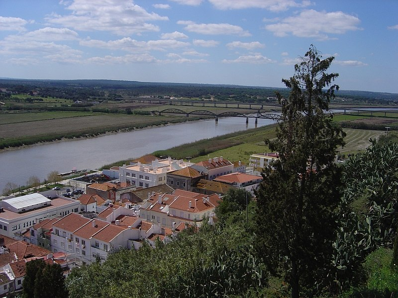
mapcarta.com -
The Vouga River is a river in Portugal's Centro Region. Chafariz da Lapa, at an elevation of 864 meters (2,835 feet), in the parish of Quintela, municipality of Sernancelhe, Viseu District, is the source of the Vouga. The river's path culminates in a ria, the Ria de Aveiro, in the Atlantic Ocean. With an area of approximately 106,460,000 km2, the Atlantic Ocean is the world's second-largest of the five oceans (41,100,000 sq mi). It covers about 20% of the Earth's surface and about 29% of its water surface area. In the European perception of the World, it is known to separate the "Old World" of Africa, Europe, and Asia from the "New World" of the Americas.
On the Vouga River, there are four tributaries:
- Águeda (left bank)
- Caima (right bank)
- Sul (right bank)
- Teixeira (right bank)
Cacia pulp and paper mill effluent is discharged into the Aveiro coastal area, making it one of the most polluting sources of the Vouga River and Aveiro Lagoon. Because of the wastewater, the area has an awful odor.
Length: 148 km (92 mi)
commons.wikimedia.org 
en.wikipedia.org -
The Tâmega or Támega is a river that flows through Galicia, Portugal, and Spain. Its journey begins near Verín, Galicia, Spain, and ends in the provinces of Trás-os-Montes and Douro Litoral, Portugal.
The Tâmega River is a Douro River tributary. It flows south from Verín to Chaves, Portugal, and then through the Veiga Valley, a rich valley. The river narrows below Chaves as it passes through mountains and valleys. It is not navigable due to low water levels and numerous tiny dams, going through the cities of Amarante and Marco de Canaveses and falling in the Douro River near Entre-os-Rios: Entre-os-Rios literally means "between the rivers."
The Tâmega is historically more significant than economically. It has long functioned as an invasion route for foreign armies seeking to invade Portugal's wealthier southern provinces. Battles and invading armies have been particularly common in the valley around Chaves.
The Tâmega, like many other rivers, is polluted and ravaged by sand and gravel extraction firms. The water's quality has significantly degraded. Flooding is another issue that occurs on a regular basis.
The Tâmega has been steadily recuperating from the impacts of pollution since the Torrão dam was completed in 1988, less than 1 kilometer above the Douro river and the village of Entre-os-Rios in the municipality of Marco de Canaveses. Sand mining has been banned, and several cities upstream have erected modern sewage treatment plants. Between the cities of Amarante and Mondim de Basto, a new dam is being built. The project will include a flood control system that will channel water flow to the smaller Olo River, in addition to producing energy. A pumped-storage hydroelectric power plant with an output of 880 MW is currently being built.
Length: 145 km (90 mi- shared with Spain)
nsenergybusiness.com 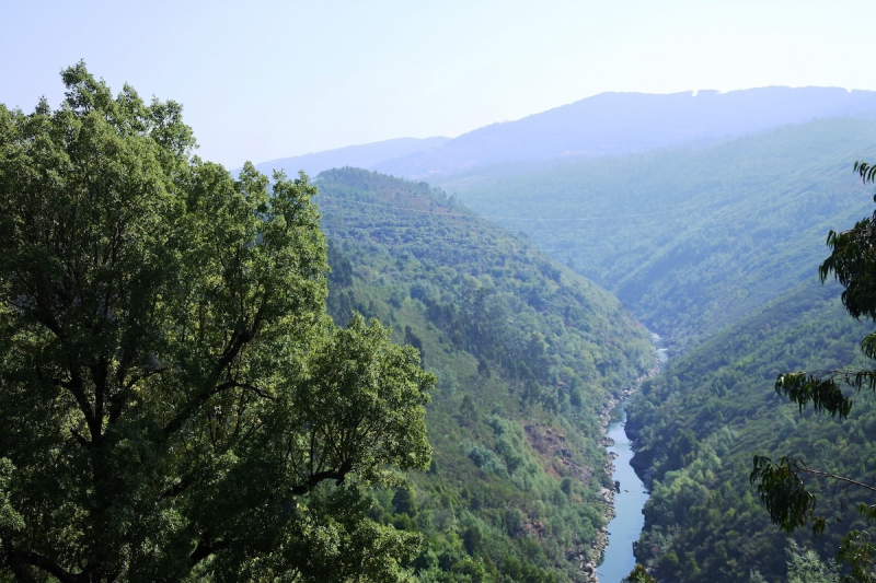
portugalsportholidays.com -
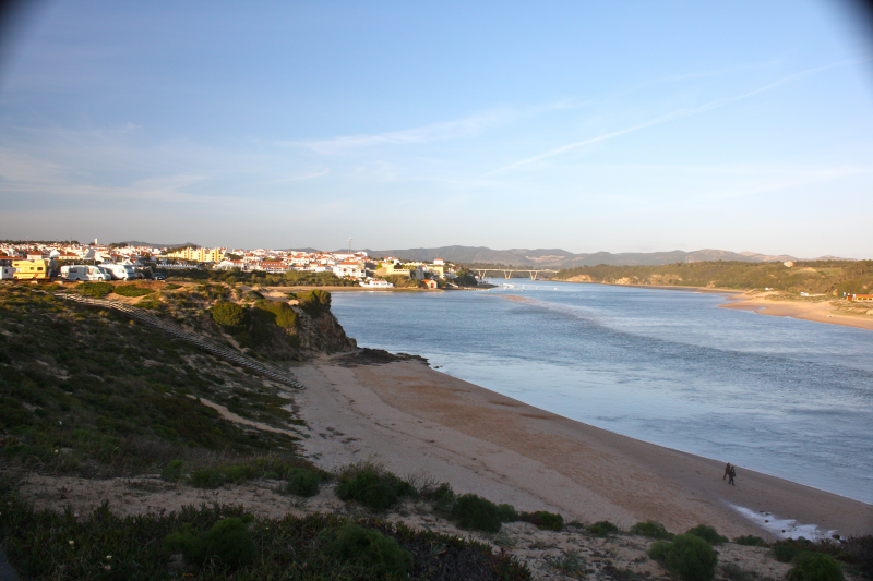
The Mira River flows through southwestern Alentejo, Portugal. It stretches for 145 kilometers (90 miles).
It rises on the northern slopes of the Serra do Caldeirão and flows southeast–northwest with a typically mild inclination to the Atlantic Ocean, where it empties into a small calm delta near Vila Nova de Milfontes, some 115 kilometers (71 miles) south of Lisbon. It is one of only two rivers in Portugal with a mostly south–north inclination (the other being its neighbor Sado), as well as one of the few in Europe. Mira basin is bordered on the north by the Sado River basin and on the east by the Guadiana River basin.
Torgal Rivulet, Luzianes River, and Perna Seca River are the main tributaries on the right bank. Rivers Macheira, Guilherme, and Telhares are major tributaries on the left bank.
Distributary streamlines follow the shoreline perpendicularly and discharge directly into the Atlantic Ocean.
Because the name Mira predates Roman authority in the area, it is thought to have the same Celtic or pre-Celtic origin as the old city of Miróbriga (cradle of the contemporary city of Santiago do Cacém), whose remains are 32 kilometers (20 miles) to the north. It is known that there was a god named Mirobieus in the pantheon of the indigenous tribes (called Celtici by the Romans) who was worshipped to protect the rivers.
Length: 145 km (90 mi)
en.wikipedia.org 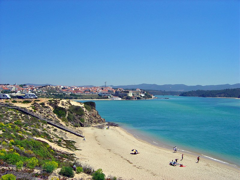
mapcarta.com


