


Top 10 Longest Rivers in Serbia

Rivers are one of Serbia's greatest treasures, and tourism has been focusing more and more on them recently. Rivers in Serbia are one of the best options for a ... read more...short, refreshing vacation away from the concrete and noise of the city. You can take a short break and walk along the banks of the plain rivers, or you can engage in extreme sports and attempt to tame the mountain rapids. Toplist has compiled the longest rivers in Serbia.
-
The Danube is Europe's second-longest river, after Russia's Volga. From the Black Forest to the Black Sea, it runs through much of Central and Southeastern Europe. Breg, the river's longest headstream, rises in Furtwangen im Schwarzwald, while the river bears its name from its source confluence in Donaueschingen onward.
The Danube was once a long-standing Roman Empire frontier and is now the world's longest river, passing through the most countries (10; the Nile is second with 9). The Danube flows southeast for 2,850 km (1,770 mi) from its source in Germany, passing through or bordering Austria, Slovakia, Hungary, Croatia, Serbia, Romania, Bulgaria, Moldova, and Ukraine before emptying into the Black Sea. Its drainage basin stretches into nine additional countries. The river's largest cities are Vienna, Budapest, Belgrade, and Bratislava, which are all capitals of their respective countries. The Danube basin contains five more capital cities: Bucharest, Sofia, Zagreb, Ljubljana, and Sarajevo. Munich, the capital of Bavaria, is the fourth-largest city in its basin, located on the Isar River.
Fish species found in the Danube river basin include pike, zander, huchen, Wels catfish, burbot, and tench. It also supports a diverse range of carp and sturgeon, as well as salmon and trout. The Danube Delta and the lower portion of the river are home to a few species of euryhaline fish, including European seabass, mullet, and eel.
The Danube has been a traditional trade route in Europe since antiquity. Today, it is navigable for 2,415 km (1,501 mi) of its total length. The Rhine–Main–Danube Canal, which connects the Danube at Kelheim with the Main at Bamberg, connects the Danube to the North Sea. The river also serves as a significant source of hydropower and drinking water. Many European borders, particularly in the Balkans, are also defined by the Danube's flow.
Length: 2,850 km (1,770 mi)
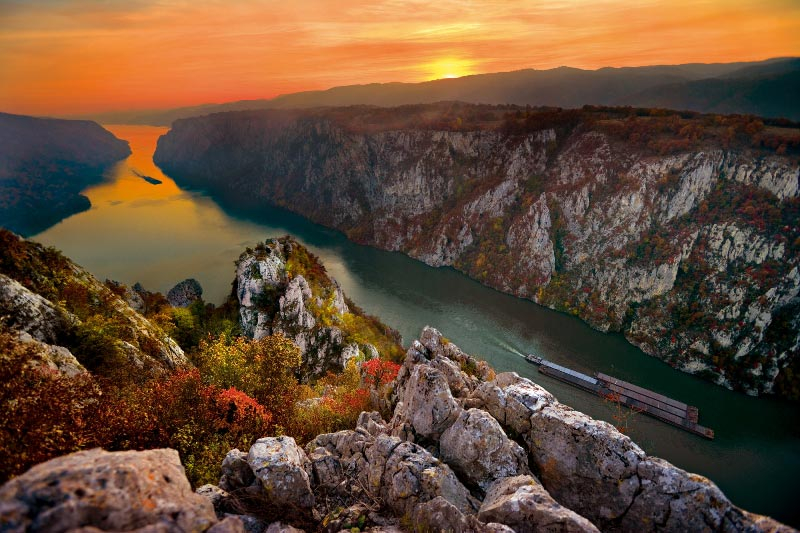
Photo: Serbia.com 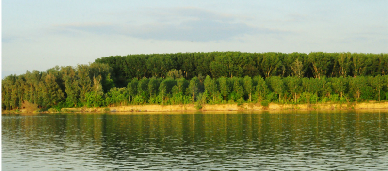
Photo: Serbia.com -
The Sava is a river in Central and Southeast Europe, and the Danube's right and longest tributary. It flows through Slovenia, Croatia, and along its border with Bosnia and Herzegovina before entering the Danube in Serbia's capital, Belgrade. The Sava serves as the main northern limit of the Balkan Peninsula and the southern boundary of the Pannonian Plain.
The Sava River runs for 990 kilometers (615 miles), including the 45-kilometer (28-mile) Sava Dolinka headwaters in Zelenci, Slovenia. It is the Danube's largest tributary in terms of volume of water and, after the Tisza, the second-largest in terms of catchment area (97,713 square kilometers (37,727 square miles)) and length. It drains a large part of the Dinaric Alps region via the major tributaries Drina, Bosna, Kupa, Una, Vrbas, Lonja, Kolubara, Bosut, and Krka. The Sava is one of Europe's longest rivers and one of the longest tributaries of another river.
The Sava River basin has an estimated population of 8,176,000 people, which is shared by three capital cities: Ljubljana, Zagreb, and Belgrade. The Sava is navigable by larger vessels for about 23 kilometers, beginning at the confluence of the Kupa in Sisak, a few kilometers below Zagreb.
Length: 992 km (616 mi)
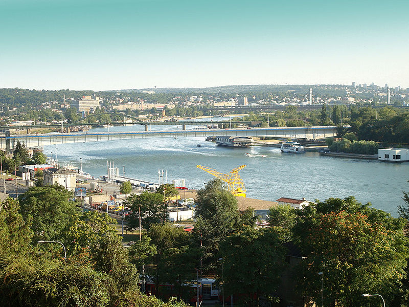
Photo: Wikipedia 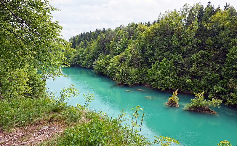
Photo: Wikimedia Commons -
The Tisza, also known as the Tysa or Tisa, is a major river in Central and Eastern Europe. It was once known as "the most Hungarian river" because it flowed entirely within the borders of the Kingdom of Hungary. It now spans several national borders.
The Tisza River begins near Rakhiv, Ukraine, at the confluence of the White Tisa and the Black Tisa, at coordinates 48.07465560782065, 24.24443465360461. (the former springs in the Chornohora mountains; the latter in the Gorgany range). The Tisza flows west from there, roughly following Ukraine's borders with Romania and Hungary, then briefly following the border between Slovakia and Hungary, later into Hungary, and finally into Serbia. Tiszabecs is the point at which it enters Hungary. It runs from north to south through Hungary. It enters Serbia a few kilometers south of the Hungarian city of Szeged. Finally, it joins the Danube near the village of Stari Slankamen in the Serbian province of Vojvodina.
The Tisza has a length of 966 kilometers and drains an area of approximately 156,087 km2 (60,266 sq mi) (600 mi). Its average annual discharge ranges from 792 m3/s (28,000 cu ft/s) to 1,050 m3/s (37,000 cu ft/s) seasonally. It accounts for approximately 13% of total Danube runoff.
Attila the Hun is said to have been buried beneath a section of the Tisza River that had been diverted.
Length: 966 km (600 mi)
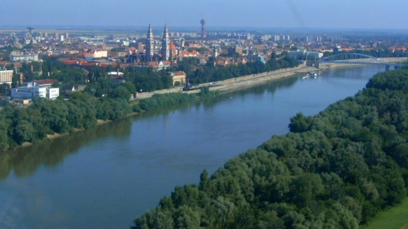
Photo: Wikipedia 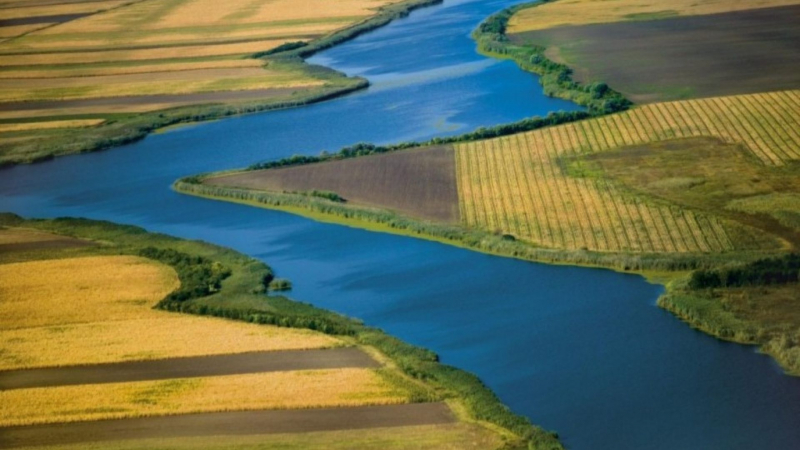
Photo: Serbia.com -
The Timiş or Tamiš is a 359 km (223 mi) long river that flows through Romania and Serbia's Banat region before joining the Danube near Pančevo in northern Serbia. It has been dubbed the "spine of the Banat" due to its location in the region.
The river is regulated in its lower course, and it is navigable for the last 53 kilometers (33 miles).
When the Ottoman Turks occupied Pančevo in the 17th century, it already had a busy port. Later, during the Habsburg period, it became a hub of the Banat region's river routes. The grain was transported to the capital Vienna, and later, as Pančevo industrialized, shipping of beer, silk, salt, bricks, and timber developed. Over time, a row of halls, warehouses, and storage structures were constructed along the river bank. With the advent of steam power, passenger transportation expanded as well, connecting Pančevo to Serbia's capital, Belgrade. As Pančevo grew into a developed industrial center, the traffic on Timiș became so heavy that the river had to be rerouted and straightened, with numerous canals cut through it by the early twentieth century.
Length: 359 km (223 mi)
Photo: Wikipedia 
Photo: Flickr -
The Drina is a 346 km (215 mi) long Balkans river that forms much of the border between Bosnia and Herzegovina and Serbia. It is the longest tributary of the Sava River, as well as the longest karst river in the Dinaric Alps, and is part of the Danube River watershed. It gets its name from the Roman name for the river (Latin: Drinus), which is derived from Greek (Ancient Greek: Dreinos).
The Drina flows from the confluence of the rivers Tara and Piva in the glen between the Maglić, Hum, and Pivska Planina mountains, near the villages of Šćepan Polje (Montenegro) and Hum (Bosnia and Herzegovina).
The Drina is part of a rafting route that also includes the Tara. There are a variety of rafting routes available, ranging from 18 kilometers (11 miles) to one-day runs from Brstnovica to Šćepan Polje.
Since 1994, the Drina Regatta has been an annual tourist and recreational event organized by S.T.C. "Bajina Bašta" and the municipality of Bajina Bašta. The regatta is the most popular event in Western Serbia, as well as the region's main summer event on the water.
The Šargan Eight is a narrow-gauge heritage railway in Serbia that runs from Mokra Gora to Šargan Vitasi station, with an extension to Višegrad in Bosnia and Herzegovina that was completed on August 28, 2010. Passengers will be transferred to a boating tour along Perućac Lake as part of the route.
Length: 346 km (215 mi)
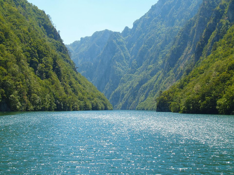
Photo: Panacomp 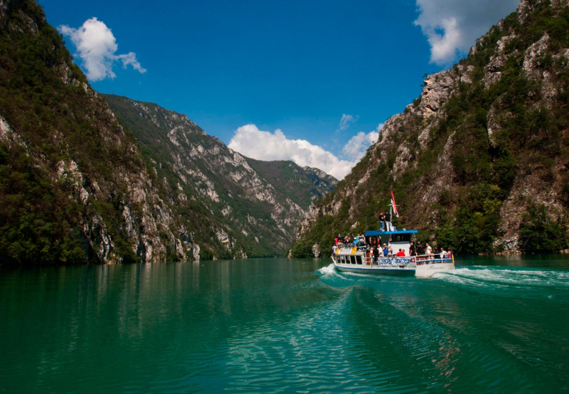
Photo: Panacomp -
The South Morava is a river in eastern Kosovo and southern Serbia that serves as the Great Morava's shorter headwater. It is now 295 kilometers long, including its source river, the Binačka Morava. It flows generally south to north, from the Macedonian border to Kosovo and on to Central Serbia, where it joins West Morava at Stalać to form Great Morava.
The river originates in the Skopska Crna Gora mountain range in North Macedonia, north of Skopje. The streams Kljuevska reka and Slatinska reka merge to form the river Golema, which is known as the Binačka Morava after crossing the Macedonian-Serbian border. After 49 kilometers, it meets the Moravica (called Preševska Moravica further upstream) at Bujanovac, and for the remaining 246 kilometers, it flows as the South Morava.
There are 157 tributaries to the South Morava. Jablanica, Veternica, Pusta reka, and Toplica are the most important left tributaries. Vrla, Vlasina, Nišava (the longest), and Sokobanjska Moravica are the right tributaries.
Length: 295 km (183 mi)
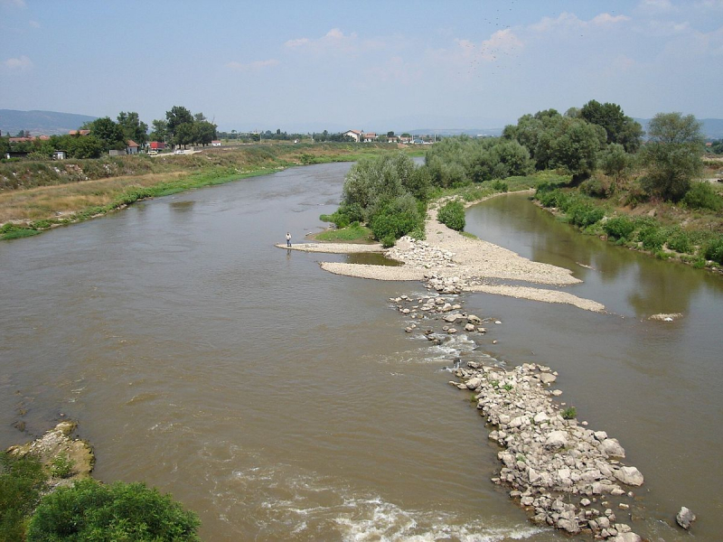
Photo: Wikipedia 
Photo: Wikimedia Commons -
The Bega, also known as the Begej, is a 244-kilometer-long (152-mile) river that flows through Romania (169 km; 105 mi.) and Serbia (75 km; 47 mi). It originates in Romania's Poiana Ruscă Mountains, which are part of the Carpathian Mountains, and flows into the Tisa river near Titel, Vojvodina, Serbia. Its drainage basin spans 4,458 km2 (1,721 sq mi), with 2,362 km2 (912 sq mi) in Romania.
The Begej joins the large Danube–Tisa–Danube Canal (or DTD) near Klek and turns south, receiving water from the Stari Begej. It is then separated from the DTD route, which turns west and leads to Zrenjanin. From there, it heads south along the Tisa's old riverbed, passing through Ečka, Stajićevo, and Perlez. It flows through marshlands in this section, some of which are transformed into the Ečka fish pond, Serbia's largest with a 25 km2 area (10 sq. mi.). The remaining wetlands form Carska bara (11 km2; 414 sq. mi.), Serbia's largest swamp, after which the Begej empties into the Tisa.
Length: 244 km (152 mi)
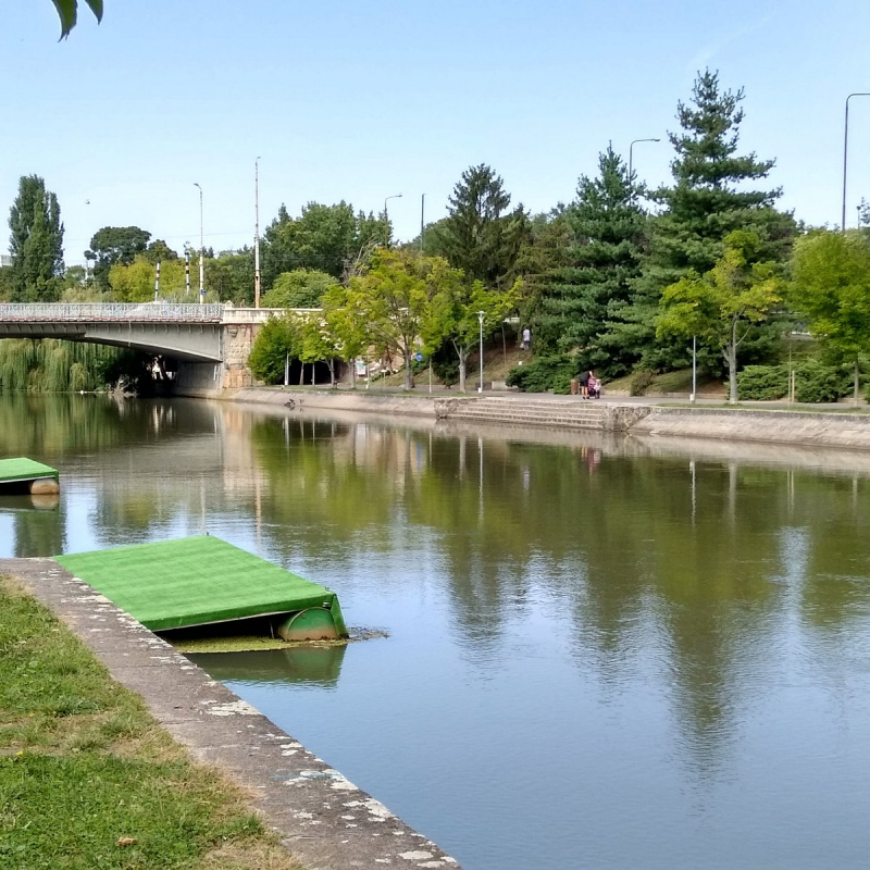
Photo: Tripadvisor 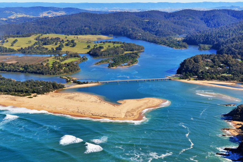
Photo: Chilby Photography -
The Lim is a 219 km (136 mi) long river that runs through Montenegro, Serbia, and Bosnia and Herzegovina. It is also the right and longest tributary of the Drina.
Lim is a part of the Black Sea drainage basin, which includes the Drina, Sava, and Danube rivers. Its drainage basin is 5,968 km2 (2,304 sq mi) and the river is not navigable.
It receives many smaller streams in Montenegro and Bosnia and Herzegovina, but the two most important are its major right tributaries in Serbia, the Uvac and the Mileševa river.
There are three possible explanations for the name's etymology:
- Latin origin derived from the word limes, which means border;
- Celtic origin derived from the root llyn or llym, which means water or lake. Miloš Crnjanski supported this version in the section Celts in our rivers of his book British-Balkan connections: Prehistory Connections;
- Albanian origin from the root lymë, which means "river".
Length: 219 km (136 mi)
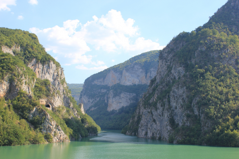
Photo: Wikipedia 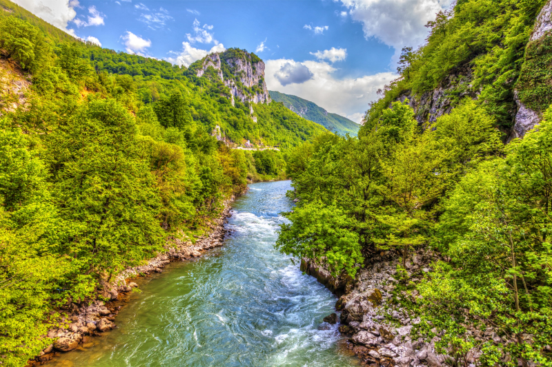
Photo: Itinari.com -
The Nišava, also known as the Nishava, is a river in Bulgaria and Serbia that is a right tributary of the South Morava and has a length of 218 km.
Flowing generally west for the remaining 151 km, it passes near Dimitrovgrad, Pirot, Bela Palanka, Niška Banja, and Niš, one of Serbia's largest cities, 10 km before emptying into the Južna Morava. However, due to Niš's rapid growth in previous decades and its still-growing suburbs, the Nišava's banks are urbanized almost to its mouth.
The Nišava District (with Niš as the administrative center) was named after the river after it was divided into districts in 1992.
The river is part of the drainage basin of the Black Sea. Its own drainage area spans 4,086 km2, with roughly 73% of it in Serbia and the remainder in Bulgaria. Nišava is impassable. It is not only the Južna Morava's longest tributary, but also its largest in terms of discharge (36 m3/s). It has many smaller tributaries, the most significant of which are the Temštica on the right and the Jerma (or Sukovska reka), Crvena reka, Koritnička reka, and Kutinska reka on the left.
Length: 218 km (135 mi)
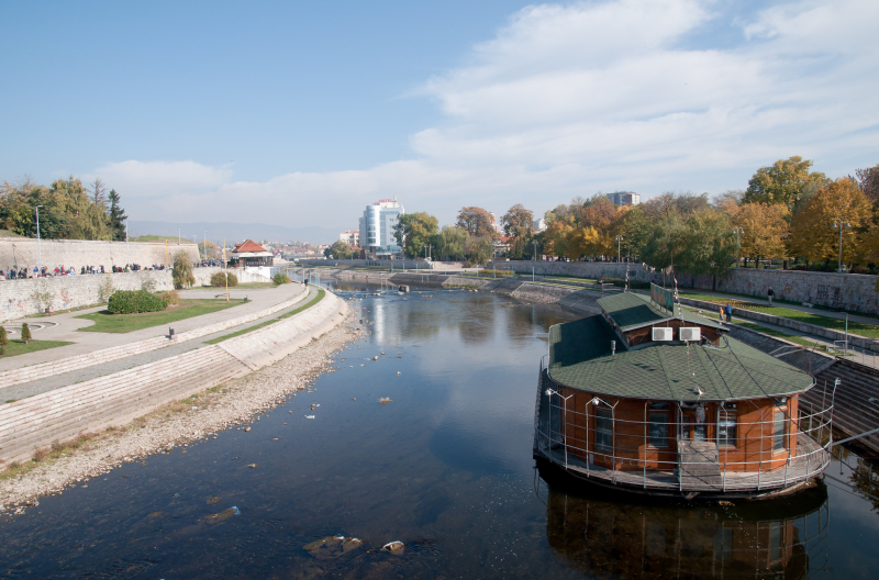
Photo: Wikipedia 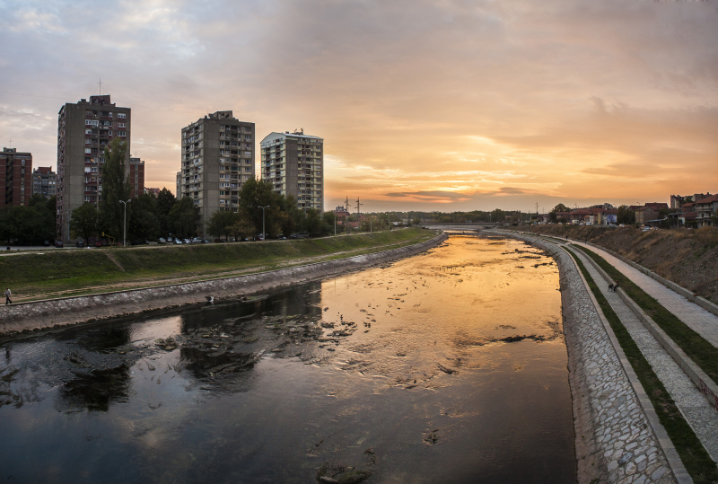
Photo: Wikimedia Commons -
The Timok, also known as the Great Timok, is a river in eastern Serbia. It forms a border between eastern Serbia and western Bulgaria for the last 15 kilometers of its route.
It is a branching system of many smaller rivers, many of which share the same name (Timok) but are differentiated by adjectives. The Timok is 202 kilometers long from its farthest source in the system, the Svrljiški Timok, to its confluence (as Veliki Timok). The river basin covers an area of 4,626 km2 (1,786 sq mi). It has an average discharge of 31 m3/s (1,100 cu ft/s) at the mouth. The Timok Valley has the largest Romanian-speaking population in Eastern Serbia.
After its formation at Zaječar, the Timok flows north-west, passing through the villages of Vražogrnac, Trnavac, Čokonjar, and Brusnik. It leaves the Timok Valley and enters the Negotin Valley after passing between the last two.
On the Serbian side of the Timok's lower course, there are no major settlements (though flowing only 7 km from Negotin). The Timok becomes a border river about 15 kilometers before it empties into the Danube as its right tributary, passing next to the Bulgarian towns of Bregovo and Baley. The river's mouth is the most northern point of Bulgaria and is only 28 meters above sea level, making it the lowest point in Serbia. The Timok's average discharge is 24 m3/s, but it can reach 40 m3/s, and it is part of the Black Sea drainage basin. Crna reka, Salaška reka, Sikolska reka, and Čubarska reka are the main (right) tributaries in this section.
Aside from the Timok Valley, the Timok gave its name to the Timočka Rebellion, a rebellion against Serbian King Milan Obrenović IV in 1883.
Length: 202 km (126 mi)
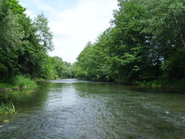
Photo: Timok River's FB 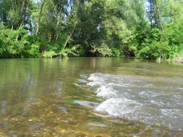
Photo: Timok River's FB


