


Top 9 Longest Rivers in Switzerland

Despite its relatively small size of 15,940 square miles, Switzerland is home to a diverse range of rivers, lakes, and mountain ranges. Water accounts for ... read more...slightly more than 4% of the country's total surface area. Although this landlocked country is well known for its picturesque Alps and mountainous terrain, it also has a number of rivers. Toplist has compiled the longest rivers in Switzerland.
-
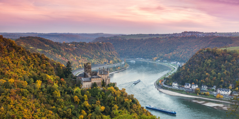
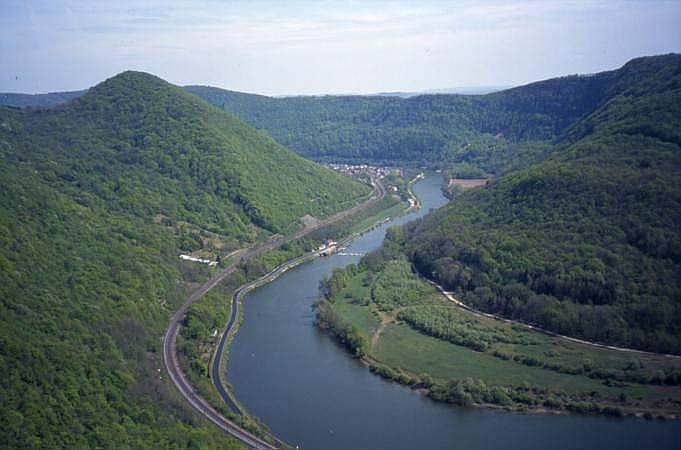
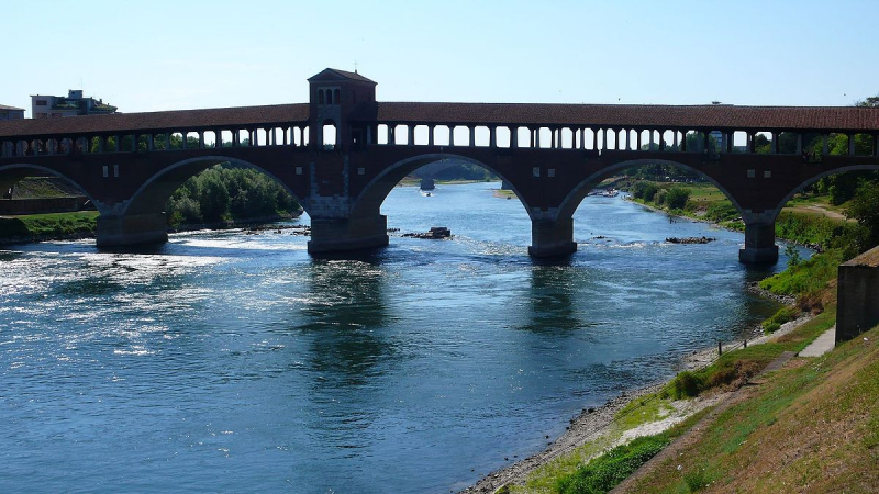
The first one in Top 9 Longest Rivers in Switzerland that Toplist would like to introduce to you is Rhine. The Rhine is one of Europe's major rivers. The river begins in the Swiss canton of Graubünden in the southeastern Swiss Alps, flows through the German Rhineland and the Netherlands, and eventually empties into the North Sea.
It is the second-longest river in Central and Western Europe (after the Danube), stretching approximately 1,230 km (760 mi), with an average discharge of approximately 2,900 m3/s (100,000 cu ft/s).
The Rhine and the Danube formed much of the Roman Empire's northern inland boundary, and the Rhine has long been an important navigable waterway bringing trade and goods deep inland. The numerous castles and fortifications built along it attest to its importance as a waterway in the Holy Roman Empire. Cologne, Düsseldorf, Rotterdam, Strasbourg, and Basel are among the Rhine's largest and most important cities.
The Rhine's length is traditionally measured in "Rhine-kilometers" (Rheinkilometer), a scale introduced in 1939 that runs from the Old Rhine Bridge in Constance (0 km) to Hook of Holland (1036.20 km).
The river's natural course has been significantly shortened as a result of a number of canalisation projects completed in the nineteenth and twentieth centuries. Formalized paraphrase The "total length of the Rhine," which includes Lake Constance and the Alpine Rhine, is more difficult to measure objectively; the Dutch Rijkswaterstaat cited it as 1,232 kilometers (766 miles) in 2010.
Length: 1,230 km (760 mi- shared with Germany, France, Netherlands, Austria and Liechtenstein)
goodhousekeeping.com 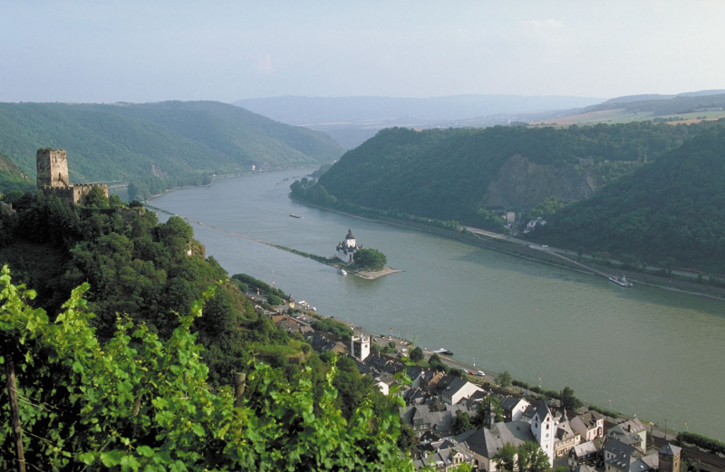
britannica.com -
The second one in Top 9 Longest Rivers in Switzerland that Toplist would like to introduce to you is Rhône. The Rhône is a major river in France and Switzerland that flows west and south through Lake Geneva and southeastern France before emptying into the Mediterranean Sea. The river divides into the Great Rhône (French: le Grand Rhône) and the Little Rhône (le Petit Rhône) near Arles. The Camargue region is formed as a result of the resulting delta.
The Rhône Glacier, on the eastern edge of the Swiss canton of Valais, is the river's source. The glacier is part of the Saint-Gotthard Massif, which is the source of three other major rivers: the Reuss, the Rhine, and the Ticino.
The Rhône has twice the average discharge of the Loire, France's longest river.
The Rhône begins as meltwater from the Rhône Glacier in Valais, in the Swiss Alps, at an elevation of about 2,208 meters (7,244 ft). From there, it flows southwest through Gletsch and the Goms, the Valais' uppermost valley region before Brig. It receives the waters of the Massa from the Aletsch Glacier, the longest glacier in the Alps, in the Brig area, and shortly after, it receives the waters of the Vispa, Valais's longest affluent. After that, it flows through the valley that bears its name, first in a westerly direction for about thirty kilometers to Leuk, then in a southwesterly direction for about fifty kilometers to Martigny.
Length: 813.69 km (505.60 mi- shared with France)
encyclopedie-environnement.org 
istockphoto.com -
The third one in Top 9 Longest Rivers in Switzerland that Toplist would like to introduce to you is Doubs. The Doubs is a river in far eastern France that runs 453 kilometers (281 miles) into western Switzerland. It is a Saône tributary on the left bank. It rises near Mouthe in the western Jura mountains at 946 meters (3,104 feet), and its mouth is at Verdun-sur-le-Doubs, a village and commune in Saône-et-Loire at about 175 meters (574 feet). It is France's tenth-longest river.
Besançon, the basin's most populous settlement, is located on its banks. Its path includes a small waterfall and a 4-kilometer-long (2.5-mile-long) narrow lake.
It flows northeast from its headwaters in Mouthe, first a few kilometers north of the French-Swiss border, then for a shorter distance, about 40 kilometers, to form the border. It turns west then south west just north of the Swiss town of Saint-Ursanne. It takes a southwest striation or fault of the Jura Mountains south of Montbéliard, flowing over a greater distance than the previous flow. It then empties into the Saône at Verdun-sur-le-Doubs, which is about 20 kilometers (12 miles) northeast of Chalon-sur-Saône.
The course is shaped like a terrier sitting upright and leaning right, with the upper part of a northeastern corner "ear" being the only zone in Switzerland, reaching Saint-Ursanne. It borders or crosses the cantons of Jura and Neuchâtel in that country.
Length: 453 kilometres (281 mi- shared with France)
en.wikipedia.org 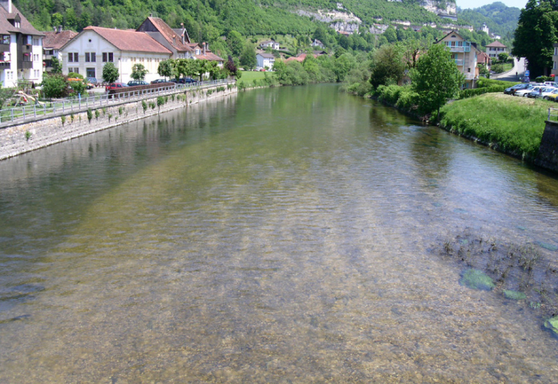
czechnymph.com -
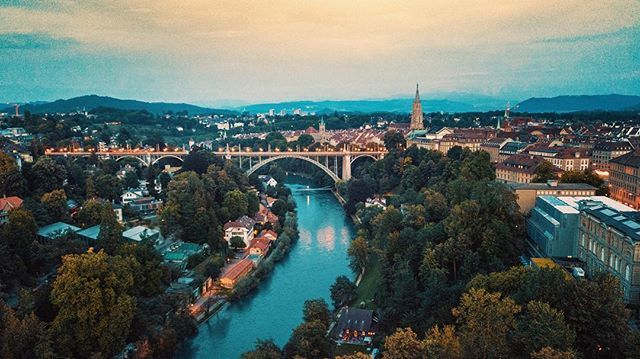
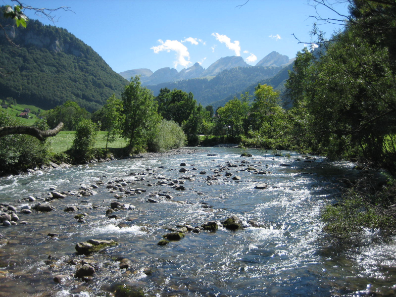
The fourth one in Top 9 Longest Rivers in Switzerland that Toplist would like to introduce to you is Aare. The Aare, also known as the Aar, is a tributary of the High Rhine and the longest river that originates and flows entirely within Switzerland.
Its total length from its headwaters to its confluence with the Rhine is approximately 295 kilometers (183 miles), during which time it descends 1,565 meters (5,135 feet), draining an area of 17,779 km2 (6,865 square miles), almost entirely within Switzerland, and accounting for nearly half of the country, including all of Central Switzerland.
Along the Aare, there are more than 40 hydroelectric plants.
The Aare rises in the Bernese Alps' great Aargletschers (Aare Glaciers), in the canton of Bern, west of the Grimsel Pass. The Finsteraargletscher and Lauteraargletscher join to form the Unteraargletscher (Lower Aar Glacier), which is the Grimselsee's main source of water (Lake of Grimsel). The Oberaargletscher (Upper Aar Glacier) feeds the Oberaarsee, which in turn feeds the Grimselsee. The Aare flows northwest through the Haslital, forming the magnificent Handegg Waterfall, 46 m (151 ft), past Guttannen, after leaving the Grimselsee just to the east to the Grimsel Hospiz, below the Grimsel Pass.
Length: 291.5 kilometres (181.1 mi)
twitter.com 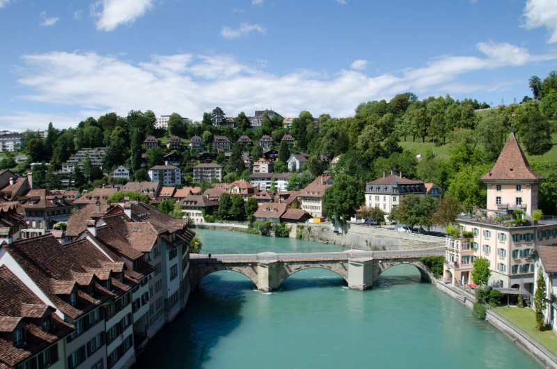
https://commons.wikimedia.org/ -
The fifth one in Top 9 Longest Rivers in Switzerland that Toplist would like to introduce to you is Ticino. The Ticino is Po's most important perennial left-bank tributary. It is named after the Swiss canton through which it flows in its upper reaches.
Along with the Rhône, Reuss, and Rhine, Ticino is one of four major rivers that originate in the Gotthard region.
The river rises in Switzerland's Val Bedretto at the border between the cantons of Valais and Ticino, is fed by Alps glaciers, and flows through Lake Maggiore before entering Italy. A few kilometers downstream (along the Ticino) from Pavia, the Ticino joins the Po. It is approximately 248 kilometers (154 miles) long. The drainage basin's highest point, at 4,618 meters, is the summit of Grenzgipfel (a subpeak of Monte Rosa) (15,151 ft). The Anza, a Ticino right-bank tributary, flows beneath it.
The river is dammed in Switzerland to generate hydroelectricity, whereas it is primarily used for irrigation in Italy.
Length: 248 km (154 mi- shared with Italy)
en.wikipedia.org 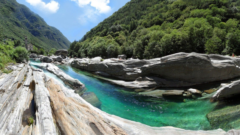
pinterest.com -
The Reuss is a Swiss river. With a length of 164 kilometers (102 miles) and a drainage basin of 3,426 square kilometers (1,323 square miles), it is Switzerland's fourth largest river (after the Rhine, Aare, and Rhône). The upper Reuss is the main valley of the Uri canton. The lower Reuss flows from Lake Lucerne to the Aare River's confluence at Brugg and Windisch.
Along with the Rhine, Ticino, and Rhône, the Reuss is one of four major rivers that originate in the Gotthard region.
The Gotthardreuss rises in the Gotthard massif, emerging from the canton of Ticino's Lago di Lucendro (reservoir built in 1947; elevation 2,134 m) and passing into the canton of Uri at Brüggboden (1,910 m).
The Furkareuss rises from Schwärziseeli east of Furka Pass and forms the Urseren valley, passing Realp at 1,540 m. This source is only about 5 kilometers away from and on the same mountain massif as the Rhône's source, but it will eventually lead to the opposite side of the continent.
Length: 164.4 km (102.2 mi)
vi.wikipedia.org 
istockphoto.com -
Thur is a river in north-eastern Switzerland that runs for 131 kilometers (81 miles). Its source is near the mountain Säntis in the canton of St. Gallen's south-east. The canton of St. Gallen, also known as the canton of St. Gall, is a Swiss canton. The canton is located in northeastern Switzerland and has an area of 2,026 km2 (782 sq mi) (5 percent of Switzerland) and a resident population of nearly 500,000 as of 2015. (6 percent of Switzerland). It was founded in 1803 as a merger of the city of St. Gallen, the Abbey of St. Gall, and various former subject territories of the Old Swiss Confederacy.
It runs through the Toggenburg region and the town of Wil in this canton. It flows through the canton of Thurgau and its capital Frauenfeld after Wil. Thur's final 19 kilometers (12 miles) are in the canton of Zürich. It empties into the Rhine River near the German border, south of Schaffhausen.
Length: 131 km (81 mi)
en.wikipedia.org 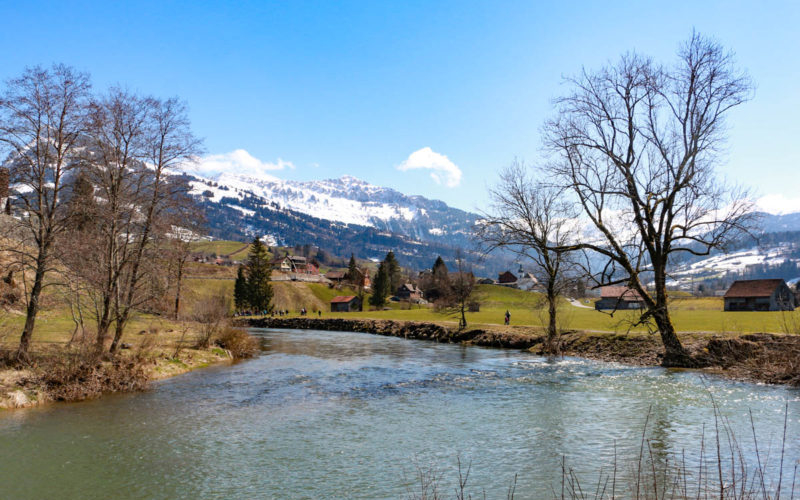
swissfamilyfun.com -
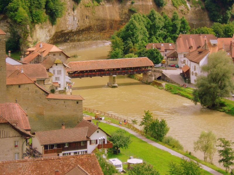
The Sarine or Saane is a major Swiss river. It is 128 kilometers (80 miles) long and has a drainage area of 1,892 kilometers (731 sq mi). It is a branch of the Aare.
The Sarine flows through the Bernese Alps near Sanetschhorn in the Canton of Valais. At 2034 m, it forms the Lac de Sénin reservoir and then enters the Canton of Bern, passing through the Sanetsch falls between 1900 and 1400 m. It then flows through the Obersimmental-Saanen district, forming the westernmost valley of the Bernese Oberland, passing through Gsteig, Gstaad, and Saanen. It enters the Canton of Vaud at 982 m downstream of Saanen, passing Rougemont, Château-d'x, and Rossinière before forming the Lac du Vernex at 859 m. It crosses the Creux de l'Enfer at 833 and enters the Canton of Fribourg, where it forms Lac de Montbovon at 777 meters. From here, it roughly follows the linguistic boundary between French- and German-speaking Switzerland across the bilingual canton of Fribourg (and is frequently identified as the geographical representation of Switzerland's Röstigraben division). It passes through Villars-sur-Mont, Enney, Gruyères, and Broc before arriving at 677 m at Lac de la Gruyère. It then continues in serpentines towards Fribourg, which was founded in 1157 on a peninsula of the Sarine River, protected on three sides by steep cliffs. It widens into the Schiffenensee reservoir at 532 m (built 1963) downstream of Fribourg, and is then channeled to Laupen, where it is joined by the Sense. Flowing north for another 6 kilometers, it eventually joins the Aar just downstream of Wohlensee, at 461 meters, about 15 kilometers (9.3 miles) west of Bern.
Length: 128 km (80 mi)
en.wikipedia.org 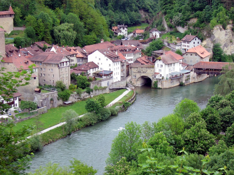
flickr.com -
The Arve is a river in France (Haute-Savoie département) and Switzerland (canton of Geneva). It is a 108 km (67 mi) long left tributary of the Rhône, with 9 km in Switzerland. It has a catchment area of 1,976 km2 (763 sq mi), 80 km2 of which is in Switzerland. In Geneva, the average discharge is 79 m3/s (2,800 cu ft/s).
Rising near the Swiss border on the northern side of the Mont Blanc massif in the Alps, it receives water from the many glaciers of the Chamonix valley (primarily the Mer de Glace) before flowing north-west into the Rhône on the west side of Geneva, where its much higher level of silt creates a stark contrast between the two rivers.
Chamonix, Sallanches, Ox, Cluses, Bonneville, Annemasse, and Geneva are all served by the Arve. From source to mouth, tributaries include: Arveyron, Diosaz, Bon-Nant, Sallanche, Giffre, Borne, Menoge, Foron, Seymaz, and Aire.
Length: 108 km (67 mi- shared with Arve)
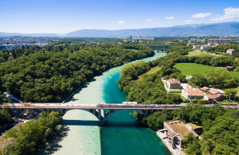
Rhone and Arve rivers junction (Photo: https://www.theactivetimes.com/) 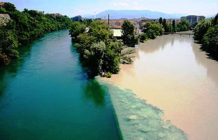
Confluence between the Rhone River (left) and the Arve River (right) (Photo: pinterest.com)


