


Top 10 Longest Rivers in Tanzania

Tanzania is an East African country located along the Indian Ocean's coast between Kenya and Mozambique. The nation has a total land area of 947,300 square ... read more...kilometers. Tanzania's vast countryside is dotted with picturesque lakes and rivers. The Nile, Congo, Rufiji, and Ruvuma rivers are among the major rivers that flow through Tanzania. The Longest Rivers in Tanzania are listed below.
-
The Nile is the Longest River in Tanzania and is a significant river in northeastern Africa that flows north. It eventually empties into the Mediterranean Sea. It is the longest river in Africa and has historically been regarded as the longest river in the world, while research suggests that the Amazon River is somewhat longer. In terms of cubic meters flowing yearly, the Nile is one of the smallest of the world's great rivers. Its drainage basin is approximately 6,650 km (4,130 mi) long and spans eleven countries: Tanzania, Uganda, Rwanda, Burundi, the Democratic Republic of the Congo, Kenya, Ethiopia, Eritrea, South Sudan, the Republic of Sudan, and Egypt. The Nile, in particular, serves as Egypt's, Sudan's, and South Sudan's principal water source. Furthermore, the Nile is a significant economic driver, supporting agriculture and fisheries.
The river travels nearly entirely north across the Sudanese desert to Egypt, where Cairo is built on its huge delta, and then into the Mediterranean Sea at Alexandria. Since ancient times, Egyptian civilization and Sudanese kingdoms have relied on the river and its periodic floods. The majority of Egypt's population and cities are concentrated in the Nile valley north of the Aswan Dam. Almost all of Ancient Egypt's cultural and historical landmarks evolved and may be located near river banks.
Total Length: 4,258 miles

premiumtimesng.com 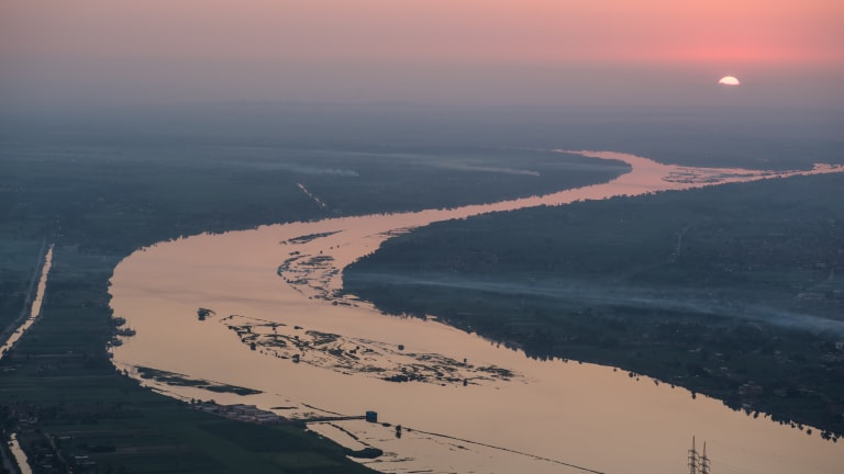
premiumtimesng.com -
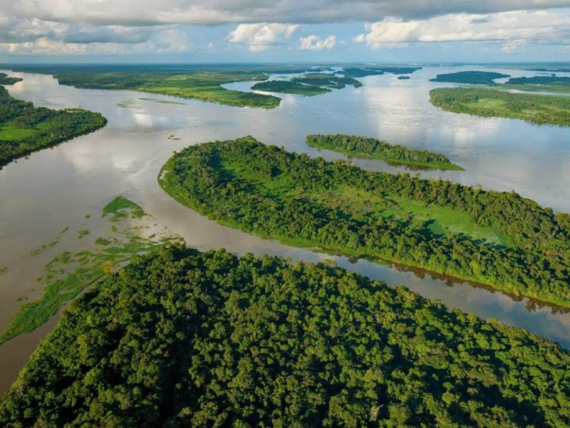
The Congo River is the deepest river in the world, reaching depths of up to 220 meters. It has a length of 2,920 miles, making it Africa's second-longest river. Lake Tanganyika and the Highlands in northern Zambia are its origins. Tributaries of the Congo River go to Zambia, Tanzania, the Central African Republic, and Cameroon. Water snakes, hippos, crocodiles, and tortoises are among the creatures that live in the river basin. The surrounding region is covered in grasslands, which are home to buffaloes, gazelles, and zebras. The Congo River provides for the people that live along its banks. The primary activities along the river basin are fishing and farming. The Congo River is shared by a total of nine countries. Furthermore, the river is well-known for its hydroelectric power output, having over 40 hydroelectric power units located along its length.
The Congo runs northwest from Kisangani, right below the Boyoma Falls, then gradually bends southwest, passing through Mbandaka, joining the Ubangi River, and draining into the Pool Malebo (Stanley Pool). Kinshasa (previously Léopoldville) and Brazzaville lie on opposing banks of the river at the Pool, when the river narrows and descends down a series of cascades in deep gorges (together known as the Livingstone Falls), passing past Matadi and Boma before emptying into the sea at Muanda.
Total Length: 2,920 miles
visapourlimage.com 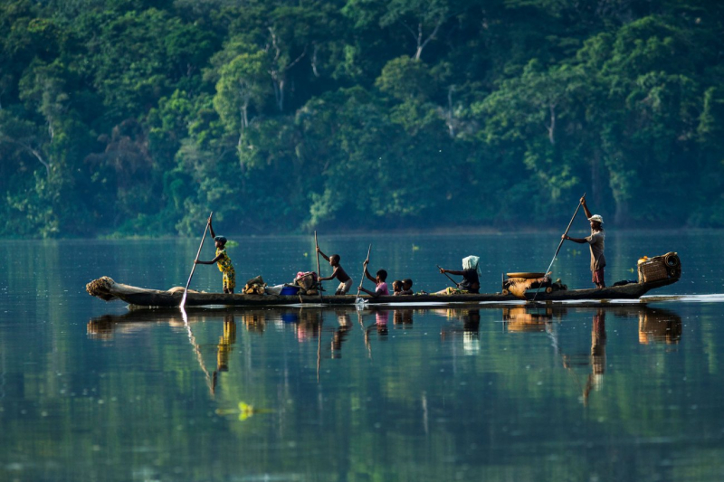
visapourlimage.com -
The White Nile is one of the two primary tributaries of Africa's longest river, the Nile. The river runs from Lake Victoria in Uganda and is 2,299 km long. The Nile's most distant source is considered to be the River Kagera, which flows near Bukoba in Tanzania and empties into Lake Victoria. The White Nile runs north to Sudan, where it joins the Blue Nile to form the world-famous Nile River. The White Nile flows through five nations, whereas the Nile as a whole flows through 10. The river provides a significant source of income for the people who live along its banks.
According to some, the White Nile begins at the junction of the Mountain Nile and the Bahr el Ghazal at Lake No. The 120 kilometers of White Nile flowing east from Lake No to the mouth of the Sobat are extremely gently sloped and home to several wetlands and lagoons. When it floods, the Sobat River tributary transports a substantial amount of silt, which contributes significantly to the White Nile's pale tint. The river flows slowly but not swampily into Sudan and north to Khartoum from South Sudan's second city, Malakal. Kodok, downstream from Malakal, was the location of the 1898 Fashoda Incident, which ended the Scramble for Africa.
Total Length: 2,299 miles
dreamstime.com 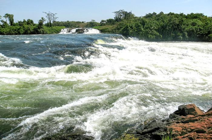
dreamstime.com -
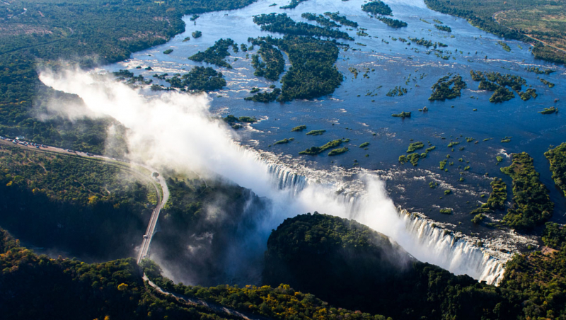
The Zambezi River, usually called Zambesi, is one of the Longest Rivers in Tanzania and is a river that drains most of south-central Africa. It constitutes the continent's fourth biggest river basin when combined with its tributaries. The Zambezi (meaning "Great River" in Tonga) River runs through Zambia and features Victoria Falls, one of the world's most spectacular natural marvels, as well as the Kariba and Cahora Bassa dams, two of Africa's largest hydroelectric projects. The river traverses or forms the borders of six countries—Angola, Zambia, Namibia, Botswana, Zimbabwe, and Mozambique—and its usage is governed by a number of international treaties.
The Zambezi River begins from a marshy bog near Kalene Hill in Zambia and flows for about 20 miles before entering Angola, where it extends for more than 175 miles. More than a dozen tributaries of varying sizes meet the river in this first section of its journey. The river goes over the Chavuma Falls shortly after reentering Zambia and traverses a huge tract of hummocky, sand-covered floodplains, the greatest of which is the Barotse, or Zambezi, Plain. During the summer floods, the area is inundated with fertile alluvial soils. The Kabompo River from the east and the bigger Lungué-Bungo (Lungwebungo) River from the west is the primary tributaries intersecting the river along the plains.
Total Length: 1,599 miles
thenewshawks.com 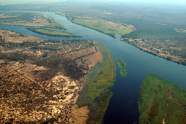
thenewshawks.com -
The Ruvuma River, which runs from southeastern Tanzania into the Indian Ocean, is 497 kilometers long. The river forms part of the boundary between Tanzania and Mozambique. The Lucheringo, Lugenda, Muhuwesi, and Lumesule rivers are among their major tributaries. It runs north along an arid plateau, passing through multiple falls. The Unity Bridge, which spans the river, is built in Mozambique on one end and Tanzania on the other. Its construction began in 1975, but it was halted because of a lack of money. The bridge was finished in 2010. The Ruvuma and Southern Coast Basin Water Board manages the Ruvuma River.
The Ruvuma runs eastward along the foot of an escarpment of a dry sandstone plateau to the north, from which direction the streams that have cut deep channels in the plateau edge have practically all short courses. The opposite bank of the Ruvuma receives, in addition to the Lujenda, the Msinje River and the Luchulingo River, which flow in large valleys from south to north. The Lujenda rises near Lake Chilwa, in the little Lake Chiuta (1,700 ft), with the wetlands to the south divided from Chilwa by a thinly forested hill. The stream that originates in Chiuta flows through a marshy valley into the tiny Lake Amaramba, from which the Lujenda River eventually emerges as a torrent 80 kilometers long.
Lower down, the width varies widely, with several portions including lengthy forested islands that rise above the flood level and are frequently populated. During the dry season, the river may be crossed in several places. It is roughly a mile broad at its mouth. The lower Ruvuma, which is typically a half-mile broad but often shallow, flows through a marshy valley bordered by plateau escarpments that include many tiny river backwaters. The mouth is located around 10° 28' S., 40° 30' E., with the parallel of 10° 40' forming the border along the shore. The Ruvuma is approximately 500 km long (800 km).
Total Length: 497 miles
africageographic.com 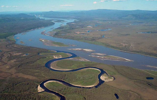
africageographic.com -
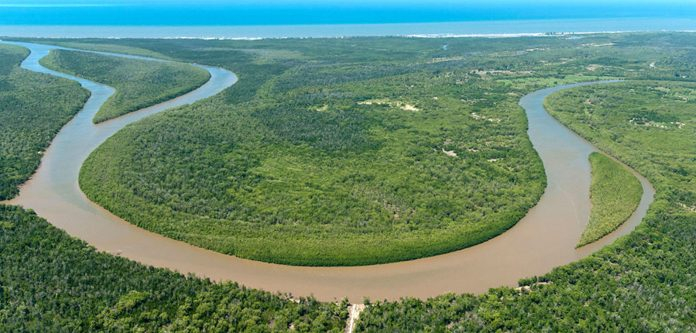
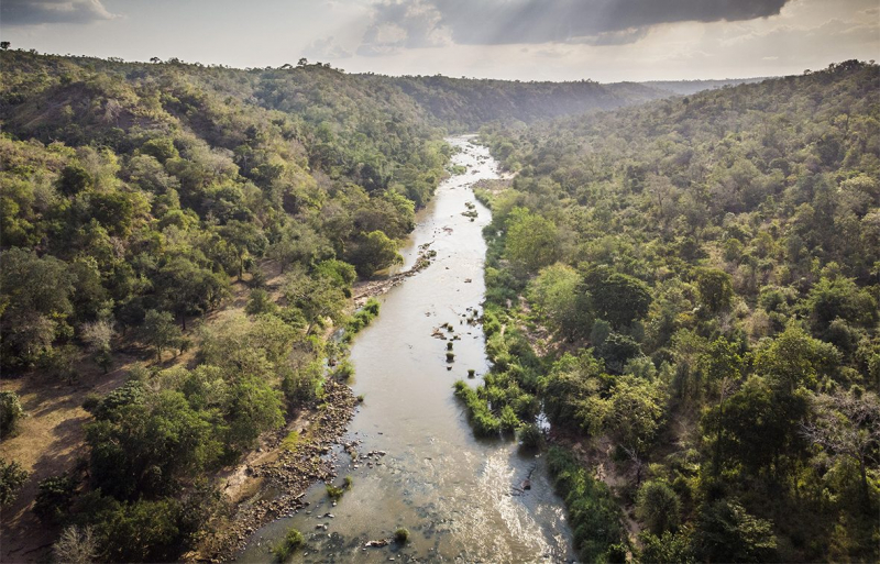
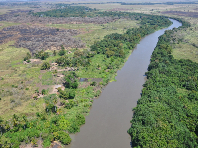
The Rufiji River runs wholly across Tanzania. It is also the country's biggest and longest river. The confluence of the Kilombero and Luwegu rivers forms the river. It is around 600 kilometers (370 miles) long, with its headwaters in southern Tanzania and its mouth in the Indian Ocean opposite Mafia Island across the Mafia Channel in the Pwani Region. The Great Ruaha River is its main tributary. It is navigable for around 100 kilometers (62 mi). The Rufiji River is located around 200 kilometers (120 miles) south of Dar es Salaam. The delta of the river features the biggest mangrove forest in eastern Africa.
According to the Periplus of the Erythraean Sea, a branch of ancient sea routes led down the East African coast called "Azania" by the Greeks and Romans in the first century CE, at least as far as the port known to the Romans as Rhapta, which was probably located in the Rufiji River delta in modern Tanzania. The river delta was the site of a lengthy naval campaign during World War I, from October 1914 to July 1915. These were the Royal Navy's attempts, and eventual success, in neutralizing and destroying the German cruiser Konigsberg.
Total Length: 373 miles
nairobiconvention.org 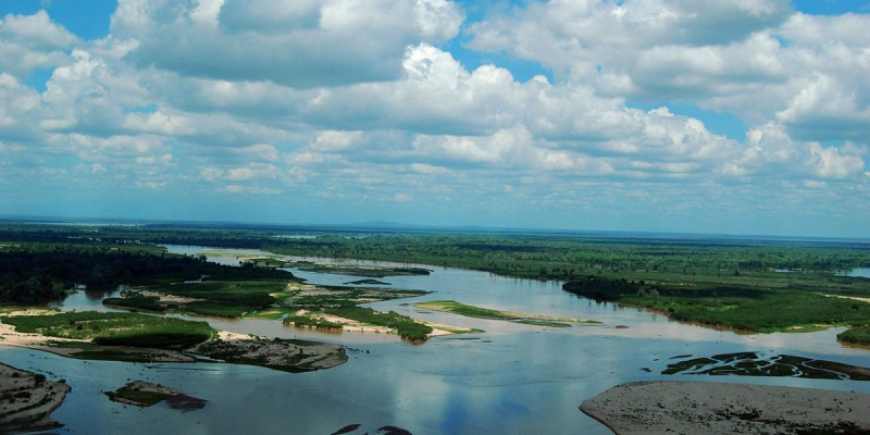
nairobiconvention.org -
The Pangani River (also known as Luffu and Jipe Ruvu in ancient sources, and maybe Rhaptus) is a large river in northeastern Tanzania. It has two main sources: the Ruvu, which rises as Lumi on Kilimanjaro, flows through Lake Jipe, and empties into the Nyumba ya Mungu Reservoir in Kilimanjaro Region, and the Kikuletwa, which flows from the west and is primarily fed by Mount Meru in Arusha Region, and also empties into the Nyumba ya Mungu Reservoir in Kilimanjaro Region. The stream becomes the main Pangani shortly after leaving the reservoir, and it discharges into the Indian Ocean in Tanga Region at the Tangan port town of Pangani.
One of the river's sources is Kilimanjaro, around 120 miles (190 kilometers) from the sea. The Lumi, as it is known in this region, goes through Lake Jipe. The other, known as the Kikuletwa, is located on Mount Meru in the west. Its depth changes with the season, as it does with other African rivers. The river is at its peak in May and its lowest in October.
Total Length: 311 miles
tripsbetter.com 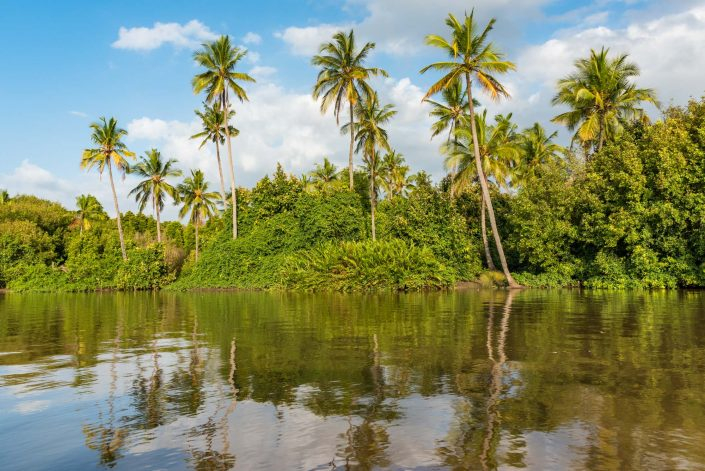
tripsbetter.com -
The Wami River is a river in Tanzania's Pwani Region. The Wami and its tributaries have their origins in the Morogoro Region's the Eastern Arc Mountains. The river then runs northeast through the Pwani Region, eventually emptying into the Indian Ocean west of Zanzibar Island.
The Wami has a catchment area of 43,946 km2. The watershed area encompasses four ecological zones. Coastal woods run the length of the Indian Ocean. Woodlands and periodically flooded grasses characterize the plains of the middle watershed further inland. The Rubeho, Ukakuru, Nguru, and Nguu mountains, which are part of the Eastern Arc range, border these plains to the northwest. The Eastern Arc Mountains receive more rainfall than the surrounding plains because they intercept moisture-laden breezes from the Indian Ocean. The rainy season lasts from November to May, with mist and light rain falling at higher elevations throughout the dry season. The windward eastern and southern sides of the mountains get more rainfall than the northern and western slopes. These rains help to keep alpine forests alive, as well as the Wami's tributary rivers and streams. The Eastern Arc woods have a significant role in both supporting and controlling river flow.Total Length: 304 miles
renature.co 
renature.co -
The Great Ruaha River is a river in south-central Tanzania that runs east into the Rufiji River from the Usangu wetlands and the Ruaha National Park. It runs through and marks the borders of three regions: Iringa, Dodoma, and Morogoro. The basin catchment area of the Great Ruaha River is 83,970 square kilometers. The basin's population is mostly supported by irrigation and water-related occupations like fishing and cattle raising.
Great Ruaha is approximately 475 kilometers (295 miles) long, with a catchment area of 68,000 square kilometers (26,000 square miles) and a mean annual discharge of 140 cubic meters per second. The Great Ruaha River accounts for 22% of the total flow in the Rufiji watershed basin. The Great Ruaha River is home to 38 different kinds of fish.
The Kipengere Range in the west Njombe Region serves as the river's headwaters. The Great Ruaha River then flows down to the Usangu plains, an important location in Tanzania for irrigated agriculture and animals. The river finally flows south to the Kidatu Dam after passing through the Mtera Dam. These two produce almost half of Tanzania's power. The river travels southward through the Selous Game Reserve before joining the Rufiji River. The major rivers that flow into the Great Ruaha River are the Lukosi, Yovi, Kitete, Sanje, Little Ruaha, Kisigo, Mbarali, Kimani, and Chimala, while the minor rivers are the Umrobo, Mkoji, Lunwa, Mlomboji, Ipatagwa, Mambi, and Mswiswi.
Total Length: 295 miles
careclimatechange.org 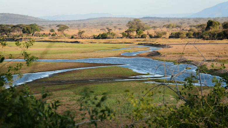
careclimatechange.org -
The Malagarasi River is one of the Longest Rivers in Tanzania, flows through Kigoma Region in western Tanzania, with one of its tributaries coming from southeastern Burundi. The river also serves as the western boundary of Tabora Region, the southern boundary of Kagera (region), and the southwestern boundary of Geita Region. It is Tanzania's second-longest river, after the Rufiji—Great Ruaha, and has the biggest watershed of any river that flows into Lake Tanganyika. The Malagarasi-Muyovozi Wetlands have Ramsar status. The Malagarasi has been dubbed "the river of wicked spirits" by local tribes.
The river's headwaters are near the Tanzania-Burundi border. The river's first 80 kilometers (50 miles) mark the international border between Tanzania and Burundi. Several tributaries from the highlands of Burundi join its right bank. The Malagarasi River enters Tanzania at its confluence with the Lumpungu River, forms around, and discharges into the eastern shore of Lake Tanganyika about 25 miles (40 km) south of Kigoma, near Ilagala. It is a major inflow into the lake. The main tributary is the Moyowosi River, which flows into the Nikongo River; additional tributaries include the Ugalla River, Gombe River, Ruchugi River, Lumpungu River, and Nguya River. It is classified as a low-stream river, having four biotopes in its drainage: marshy regions, river channels, a flowing river with a few mild rapids, and a big double-branched delta.
Total Length: 295 miles
frik21.africa 
frik21.africa


