


Top 3 Longest Rivers in Togo

Togo is a long, narrow West African country sandwiched between Ghana and Benin. It is almost as large as the state of West Virginia, with an area of 56,785 ... read more...square kilometers (21,925 square miles). Toplist has compiled the longest rivers in Togo in this article.
-
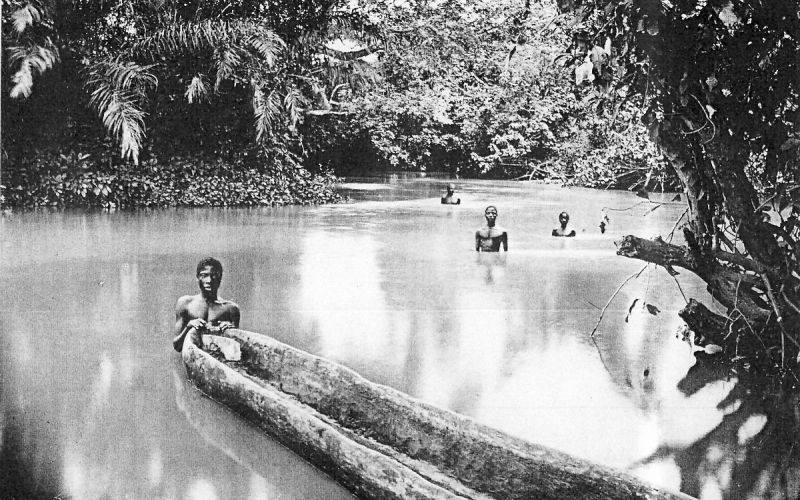
The Oti River, also known as the Pendjari River, is a West African international river. It begins in Benin, flows through Togo, and eventually joins the Volta River in Ghana.
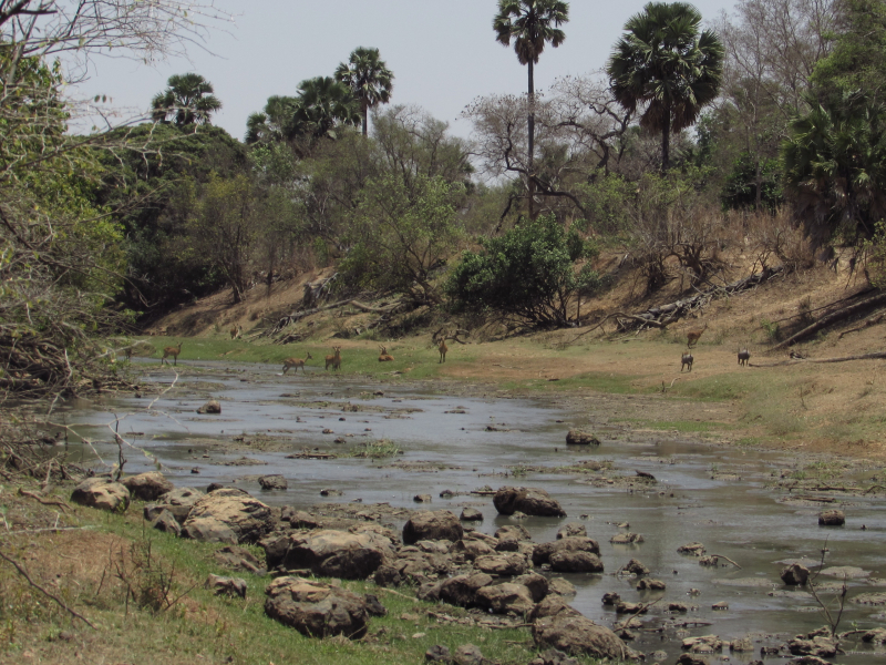
The Oti River is approximately 520 kilometers (323 miles) long. Its headwaters are in Benin and Burkina Faso, and it flows through Benin, Togo, and Ghana before joining the Volta River. Togo's left bank tributaries flow from the Togo Mountains to the south. The Kara River is one of its eastern tributaries, with its confluence on the Ghana–Togo border, where another tributary, the Koumongou River, joins from the south. The Oti River's mouth was once on the Volta River, but it now flows into Ghana's Lake Volta reservoir.
The river runs through the northern part of Togo in a savannah-clad valley 40 to 50 kilometers (25 to 31 miles) wide. Gallery forest grows along the river's banks and floods on a regular basis. The hot, dry Harmattan wind blows from the north during the dry season, which lasts from about November to April. The river's flow is low at this time of year. Both the Oti and the Koumongou rivers have floodplains that are 10 and 4 kilometers (6.2 and 2.5 miles) wide, respectively. During the wet season, these flood extensively, but during the dry season, they become dry, dusty plains with the occasional pond or lake in a depression. During the dry season, cattle graze on the floodplains. There is also some small-scale crop growing and hunting of game.
Length: 520 km (320 mi)
en.wikipedia.org 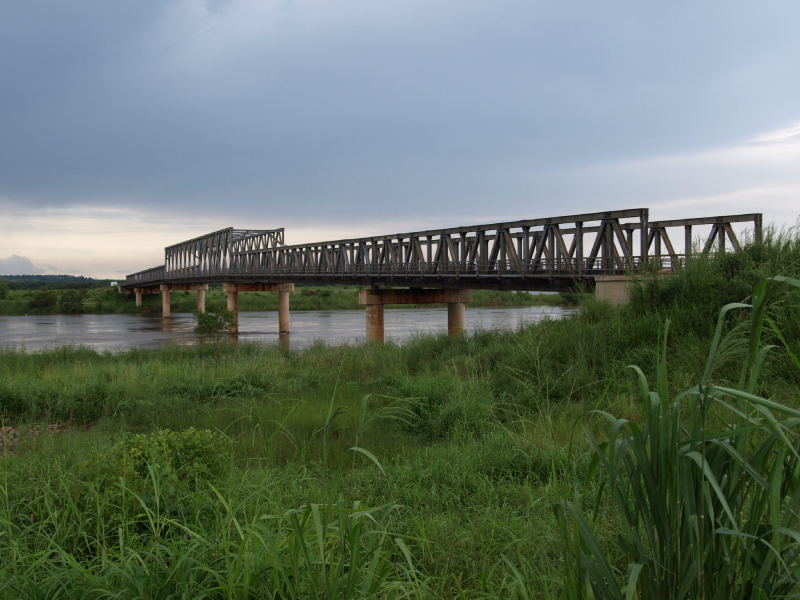
wikimapia.org -
The Mono River is the most important river in eastern Togo.
It rises between the town of Sokodé and the border with Benin, and flows south. It is about 400 km (250 mi) long and drains a basin of about 20,000 km2 (7,700 sq mi). Mono River forms the international border between Togo and Benin along its southern course, all the way to its mouth. The river flows into the Bight of Benin via a vast network of brackish water lagoons and lakes, including Lake Togo. Only the section of the river closest to the mouth is navigable. The upper tableland of the river's basin is primarily cultivated for maize, yams, rice, cotton, and cassava.
The Nangbeto Dam, built in collaboration between Benin and Togo and completed in 1987, dams the river 160 kilometers (99 miles) from its mouth. According to studies, the dam has economic benefits such as tourism and fishing in the lake behind it. The dam's construction, on the other hand, displaced between 7,600 and 10,000 people, and studies show that it has significantly altered the ecology of the lagoon system at the river's mouth by reducing the natural seasonal fluctuations in river flow. Adjarala Dam, a second dam project proposed for the river between Nangbeto and the river's mouth in the 1990s, did not receive funding until 2017, when the China-Africa Development Fund agreed to support the project. The dam's construction is part of the government's plan to increase Benin's domestic power generation capacity from 20% to 70%, as most of Togo and Benin's electricity is currently imported from Ghana's Akosombo Dam.
There are six rapids about 35 kilometers (22 miles) from its mouth. Below this point, the river slows and flows over a swampy floodplain, with a large area of contiguous wetland in both Togo and Benin. The river is home to manatees, crocodiles, and hippopotamus, as well as a dense growth of reeds, sedges, and grasses.
Length: 400 km (250 mi)
en.wikipedia.org 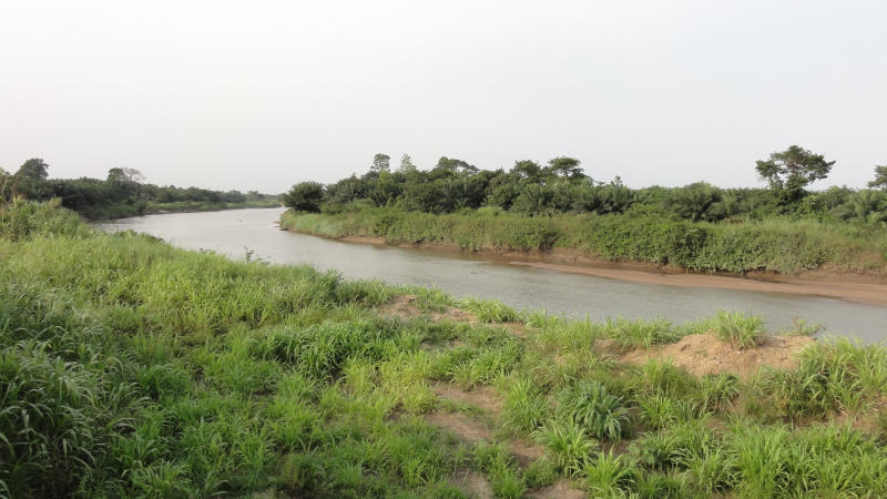
commons.wikimedia.org -
Todzie is a stream in Ghana that forms part of the border with south-west Togo. The terrain elevation above sea level is estimated to be 5 meters. Todzie can also be spelled Todjé, Todje, Toji, Todie, or Todzie in other languages.
The Todzie River's annual runoff is highly variable. The minimum annual runoff (1958) was 79 x 106 m3, while the maximum was 587 x 106 m3 from 1957 to 1968. (1963). The average for the time period was 345 x 106 m3. The catchment area of the Todzie River is 2200 km2. The area commanded by the gauging stations Todzienu and Tove, on the other hand, is slightly smaller and totals 2120 km2. The average annual flow on the Todzie River at Todzienu is estimated to be 11 m3 s-1, with a reliable yield (50-year return period) of about 0.05 m3 s-1. The 100-year flood is estimated to be approximately 140 m3s-1. Given the monthly and annual variability in flow, the Todzie River, as previously reported, could significantly contribute to flooding in the Keta lagoon. When there is no inflow, the estimated capacity of the Keta lagoon is 360 x 106 m3. Figure 7 depicts the average annual flow on the Todzie. Peak flows occur in June and October, as expected, with low flows occurring between November and April. This is low when compared to a mean of 6.6 m3s-1 for November from 1957 to 1968. During the same time period, however, the mean annual flow ranged between 2.5 m3 s-1 and 18.5 m3 s-1. The highest recorded peak flow on the Todzie River was 215 m3 s-1 in 1968. The data were not continuous between 1964 and 1990, but the average discharge for November during that time period was 7.1 m3 s-1.
Length: 267 km (166 mi)
en.wikipedia.org 
czechnymph.com


