


Top 7 Longest Rivers in Turkmenistan

The main rivers of Turkmenistan are in the south and east, while a few minor rivers on the northern slopes of the Kopetdag have been diverted altogether for ... read more...agriculture. Check out the country's longest rivers with the most breathtaking vistas.
-
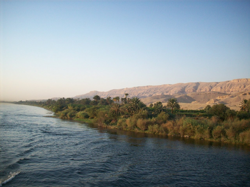
The Atrek River (Persian:, Turkmen: Etrek derasy) is a fast-flowing river that originates in the highlands of north-eastern Iran (37°10′N 59°00′E) and travels 563 kilometers (350 miles) westward until discharging into the south-eastern corner of the Caspian Sea in Turkmenistan.
It only flows into the Caspian when it is in flood level due to the intensive usage of its waters for agriculture. The river defines the boundary between Iran and Turkmenistan, beginning around 37°59′28′′N 55°16′29′′E, when its tributary the Sumbar joins it; this helped keep the area closed during the Cold War years.
The Atrek River is a 669-kilometer (416-mile) river that drains a 27,300-square-kilometer basin (10,500 sq mi). Despite the fact that sturgeons congregate along the Turkmen shore in the Caspian Sea, they do not now migrate into the Atrek River due to its low water level and pollution. Sturgeons no longer spawn in Turkmenistan because the Atrek is the sole Caspian watershed river on the Turkmen coast. This river is one of the longest rivers in Turkmenistan.
Length: 563 km
https://en.wikipedia.org/ 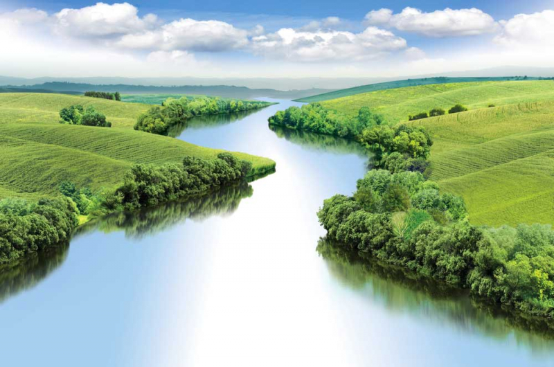
https://en.wikipedia.org/ -
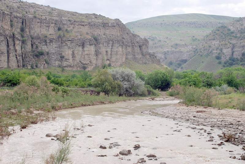
In southern Turkmenistan and northern Iran, the Sumbar River is a fast-flowing river. It's a branch of the Atrek. In Turkic languages, Sari-su refers to golden water, although it also refers to a variety of different rivers. Turkmenistan used to be a haven for Caspian tigers until the last one was slain in January 1954.
The Sumbar River is 245 kilometers long (152 miles) and drains an 8,300-square-kilometer basin (3,200 sq mi). Its source is in Iran's Kopet Dag mountains, and it flows into Turkmenistan. A series of hills known as the Marábeh separates the Sumbar from the Atrek for a lengthy distance before it flows into it.
Mountain routes that run along the plateau, passing past the settlements of Nukhur and Sayvan, go down to the Sumbar river valley via a serpentine path. However, it is preferable to travel along the route through the spectacular vestibule of the valley - the "moon mountains" - at least once. This is one of the southern Kopetdag's most remarkable local attractions.
Length: 245 km
https://turkmenistan.gov.tm/ 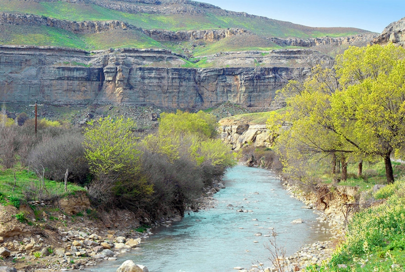
https://turkmenistan.gov.tm/ -
The Uzboy river (sometimes spelled Uzboj) was a distributary of the Amu Darya that ran in Turkmenistan's Karakum Desert until it unexpectedly dried up in the 17th century, eradicating the agricultural community that had prospered along its banks. (It was once part of the ancient Dahistan area.)
The Uzboy river, now a dry river channel and a site for ancient digs, once flowed 750 kilometers (470 miles) from a branch of the Amu Darya River to the Caspian Sea through Sarykamysh Lake. Parthians established their northernmost stronghold on one of Uzboy's steep banks, which formed here a small and attractive canyon, some two thousand years ago, when the river was still full of water and navigable.
Its remains are today known as Igdi-gala. The fort's walls were constructed of flat stone slabs and were defended by direct-angled towers. Igdi-gala was crucial for controlling the rivers from India to the Black Sea, and it played a significant role in relations with nomad steppes and the Parthian empire. This river is one of the longest rivers in Turkmenistan.
Length: 750 km
https://www.turkmenmetbugat.gov.tm/en 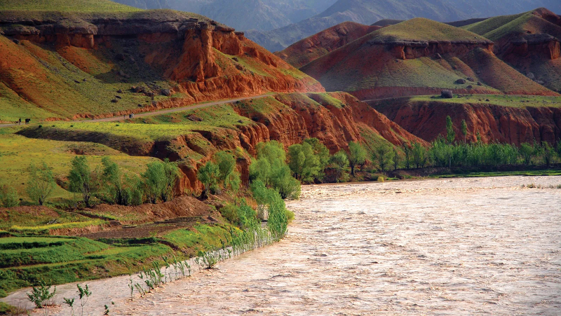
https://www.turkmenmetbugat.gov.tm/en -
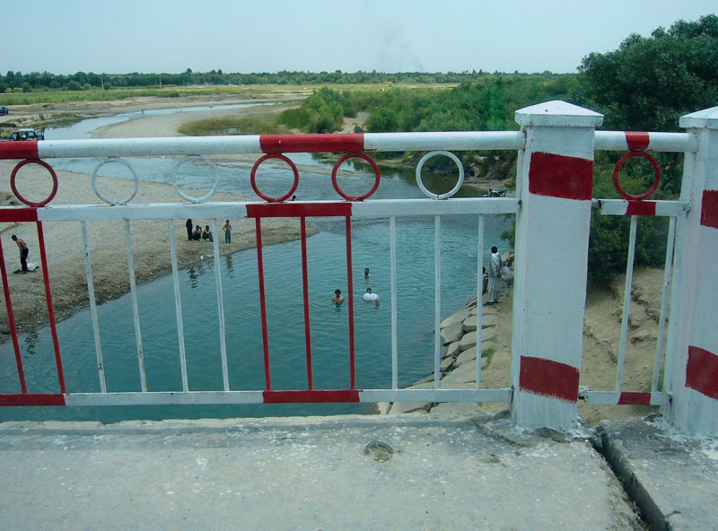
The Hari River (Persian: or Dari:, romanized: Har Rd; Pashto: ) or Herat River is a river that flows 1,100 kilometers (680 miles) from northern Afghanistan to Turkmenistan, where it produces the Tejend oasis before disappearing in the Karakum Desert.
It is known as the Tejen or Tedzhen river in Turkmenistan and flows near to the city of Tedzhen. The Arius was the name given to it by the Ancient Greeks. It was called as the Tarius in Latin. A portion of this river flows through Iran. The river rises in the Baba mountain range, which is part of the Hindu Kush system's expansions, and flows west in a reasonably straight line.
The river meets the Jam River about 200 kilometers (120 miles) upstream from Herat, at the site of the Minaret of Jam, the world's second highest ancient minaret near 65 meters (213 ft).
The Hari river is a river in western Afghanistan that runs south of Herat. The Paropamisus Mountains (Selseleh-ye Safd Kh) on the right side of the river made the region around Herat notable for its fertility and thick vegetation. The river bends northwest, then north beyond Herat, creating the northern section of the Afghan-Iranian border. This river is one of the longest rivers in Turkmenistan.
Length: 1100 km
https://www.britannica.com/place/Harirud 
https://www.britannica.com/place/Harirud -
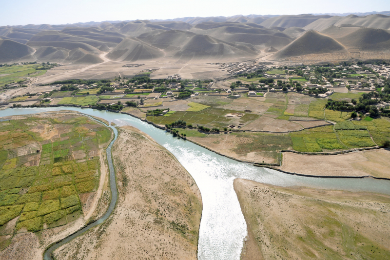
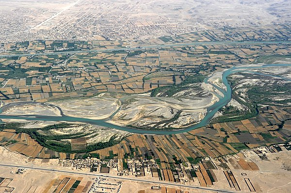
The Marghab River (Persian/Pashto:, Morqâb), once known as the Margiana (Ancient Greek: v, Margian), is a Central Asian river that runs for 850 kilometers (530 miles). It rises in central-western Afghanistan's Paropamisus Mountains (Selseleh-ye Safd Kh), particularly in Marghab District.
The Marghab River gets its name from this area of Ghor province's Marghab District, and it flows north-west to the Bala Murghab. The Murghab debouches into the Karakum Canal, a diversion of water from the Amu Darya, as it reaches the oasis of Mary in Turkmenistan's Karakum Desert. The Murghab River rises in the Marghab District of Ghor province, in central-western Afghanistan, on a plateau between the Paropamisus, Gharjistan, and Band-i Turkestan mountain ranges.
The river travels for around 300 kilometers (190 miles) from east to west, towards Mukhamedkhan, in a small, steep valley that is less than one kilometer wide, with tight gorges in some places. The Murghab River receives the Kashan River from the left bank in Tagtabazar in Turkmenistan, while the Kushk River confluence is 25 kilometers (16 miles) away. When the Murghab reaches Mary's oasis, its waters mix with those of the Karakum Canal, a water diversion from the Amu Darya.
Length: 850 km
https://en.wikipedia.org/wiki 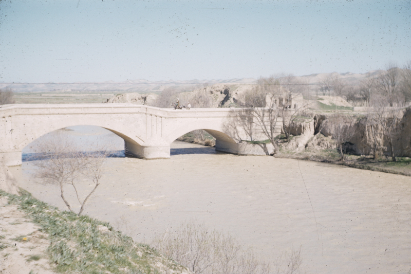
https://en.wikipedia.org/wiki -
The Kushk River (known in Turkmenistan as Guşgy) is a river that marks the border between Afghanistan and Turkmenistan for a section of its length, and also served as the southernmost frontier of the Russian Empire and the Soviet Union.
The Aq Robat and Galleh Chagar rivers in northwestern Afghanistan feed the Kushk. It feeds into the Murghab River after 150 kilometers. A train track runs beneath one of the river's bridges, which was erected in 1960. Toraghundi and Serhetabat are linked. It was afterwards followed by the construction of a road bridge. The Kushk river forms the border between Afghanistan and Turkmenistan for about 16 kilometers.
This Kushk River travels northwest and enters the Moqor River after passing through the settlement of Koshk-e Kohneh. The Chahil Dukhteran Bridge (or 'Pul-i-Kishti') originally crossed it, but it is now in ruins. The Persian leopard once roamed the Kushka River valley. The Caspian tiger and Asiatic cheetah have both been seen here in the past.
Length: 240 km
https://www.wikiwand.com/ 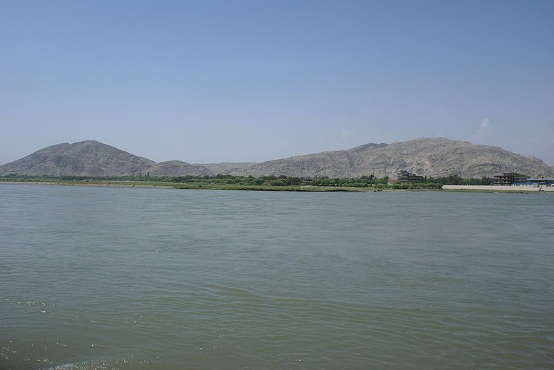
https://www.wikiwand.com/ -
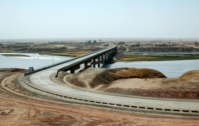
The Amu Darya River (also known as the Amu, Amo River, or Jayhn) is a large river in Central Asia and Afghanistan. It was formerly known by its Latin name Oxus or Greek. The Amu Darya rises in the Pamir Mountains, north of the Hindu Kush, and is produced by the confluence of the Vakhsh and Panj rivers in the Tigrovaya Balka Nature Reserve on the Afghan-Tajikistan border, before flowing north-west into the Aral Sea's southern remains.
The Amu Darya River forms part of Afghanistan's northern border with Tajikistan, Uzbekistan, and Turkmenistan in its higher reaches. The river was once thought to be the border between Greater Iran and "Turan," which approximately matched to modern-day Central Asia. Gozan was noted by Greek, Mongol, Chinese, Persian, Jewish, and Afghan historians as one of the names by which the river was known in Afghanistan in the 19th century by Western visitors. This name, however, is no longer in use. This river is one of the longest rivers in Turkmenistan.
Length: 2620 km
https://en.wikipedia.org/ 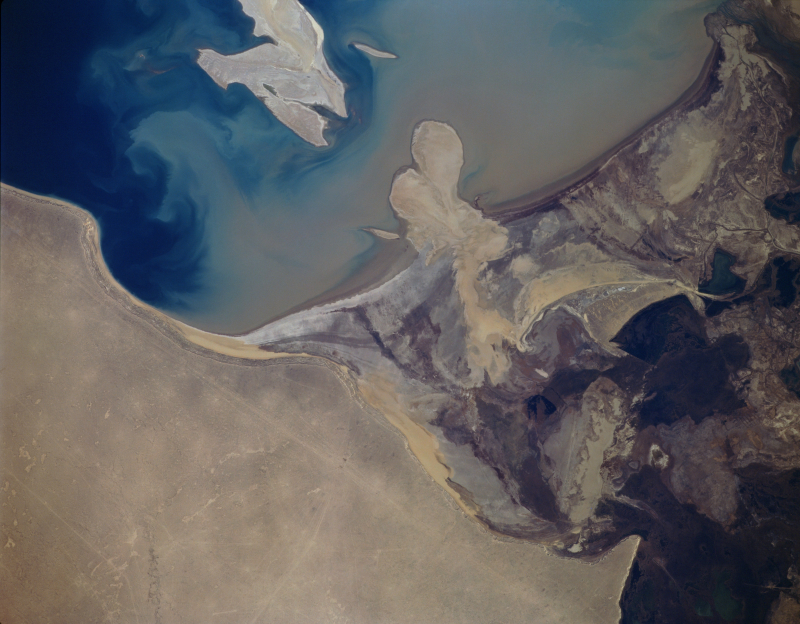
https://en.wikipedia.org/


