


Top 10 Longest Rivers in Ukraine

Ukraine has a total area of 233,062 square miles and is located in Eastern Europe. The country has 1,729 miles of coastline along the Black Sea and the Sea of ... read more...Azov within this area. The country's various regions have a variety of habitats and geographic characteristics, ranging from highlands to lowlands, plains to plateaus. Several rivers run through the entire country. This article looks at some of the longest rivers in Ukraine.
-
The first one in Top 10 Longest Rivers in Ukraine that Toplist would like to introduce to you is Danube. The Danube is Europe's second-longest river, after Russia's Volga. It is the longest river in Ukraine. From the Black Forest to the Black Sea, it runs through much of Central and Southeastern Europe. Breg, the river's longest headstream, rises in Furtwangen im Schwarzwald, while the river bears its name from its source confluence in Donaueschingen onward.
The Danube was once a long-standing Roman Empire frontier and is now the world's longest river, passing through most countries (10; the Nile is second with 9). The Danube flows southeast for 2,850 km (1,770 mi) from its source in Germany, passing through or bordering Austria, Slovakia, Hungary, Croatia, Serbia, Romania, Bulgaria, Moldova, and Ukraine before emptying into the Black Sea. Its drainage basin stretches into nine additional countries. The river's largest cities are Vienna, Budapest, Belgrade, and Bratislava, which are all capitals of their respective countries. The Danube basin contains five more capital cities: Bucharest, Sofia, Zagreb, Ljubljana, and Sarajevo. Munich, the capital of Bavaria, is the fourth-largest city in its basin, located on the Isar River.
Fish species found in the Danube river basin include pike, zander, huchen, Wels catfish, burbot, and tench. It also supports a diverse range of carp and sturgeon, as well as salmon and trout. The Danube Delta and the lower portion of the river are home to a few species of euryhaline fish, including European seabass, mullet, and eel.
The Danube has been a traditional trade route in Europe since antiquity. Today, it is navigable for 2,415 km (1,501 mi) of its total length. The Rhine–Main–Danube Canal, which connects the Danube at Kelheim with the Main at Bamberg, connects the Danube to the North Sea. The river also serves as a significant source of hydropower and drinking water. Many European borders, particularly in the Balkans, are also defined by the Danube's flow.
Length: 2,850 km (1,770 mi- shared with 8 other countries)
en.wikipedia.org 
euneighbours.eu -
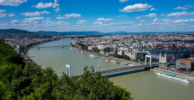
The second one in Top 10 Longest Rivers in Ukraine that Toplist would like to introduce to you is Dnieper. The Dnieper is a major European river that begins in the Valdai Hills near Smolensk, Russia, and flows through Belarus and Ukraine to the Black Sea. It is the longest river in Ukraine and Belarus, as well as the fourth-longest river in Europe, after the Volga, Danube, and Ural. The total length is about 2,200 km (1,400 mi).
The river was once a part of the Amber Road trade routes. During The Ruin, the area was contested by the Polish–Lithuanian Commonwealth and Russia, dividing Ukraine into right and left bank areas. During the Soviet era, the river was known for its large hydroelectric dams and reservoirs. The 1986 Chernobyl disaster occurred on the Pripyat, just above its confluence with the Dnieper. The Dnieper is an important navigable waterway for Ukraine's economy, and it is linked to other waterways in Europe by the Dnieper–Bug Canal.
The river's total length is variously given as 2,145 km (1,333 mi) or 2,201 km (1,368 mi), of which 485 km (301 mi) are in Russia, 700 km (430 mi) in Belarus, and 1,095 km (680 mi) in Ukraine. Its basin spans 504,000 square kilometers (195,000 square miles), with 289,000 km2 (112,000 sq mi) in Ukraine and 118,360 km2 (45,700 sq mi) in Belarus.
The Dnieper River's headwaters are the sedge bogs (Akseninsky Mokh) of the Valdai Hills in central Russia, at an elevation of 220 meters (720 ft). It forms the border between Belarus and Ukraine for 115 kilometers (71 miles). Its estuary, or liman, was once guarded by the powerful fortress of Ochakiv.
Belarus's southernmost point is Brahin Raion on the Dnieper, south of Kamaryn.
Length: 2,201 km (1,368 mi- shared with Belarus and Russia)
en.wikipedia.org 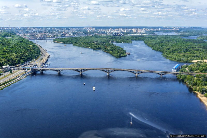
ukrainetrek.com -
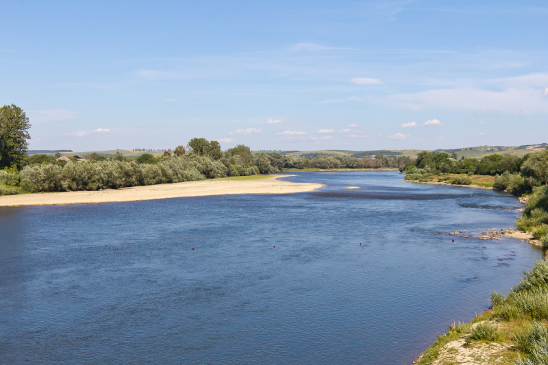
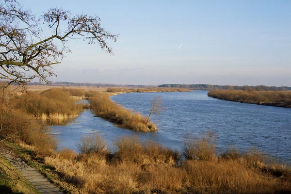
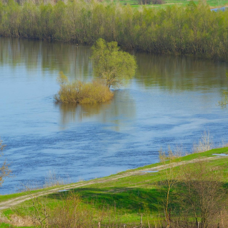
The third one in Top 10 Longest Rivers in Ukraine that Toplist would like to introduce to you is Dniester. The Dniester is an Eastern European river. It flows through Ukraine, then through Moldova (where it more or less separates the breakaway territory of Transnistria), and finally into the Black Sea on Ukrainian territory.
The Dniester River rises in Ukraine near the city of Drohobych, near the Polish border, and flows to the Black Sea. Its path follows a portion of the border between Ukraine and Moldova before flowing through Moldova for 398 kilometers (247 miles), separating Moldova's main territory from its breakaway region Transnistria. It later forms an extension of the Moldova-Ukraine border before flowing through Ukraine to the Black Sea, where its estuary forms the Dniester Liman.
The western bank of the Dniester is high and hilly, while the eastern bank is low and flat. The river de facto marks the end of the Eurasian Steppe. Răut and Bîc are two of its major tributaries.
Length: 1,362 km (846 mi- shared with Moldova)
commons.wikimedia.org 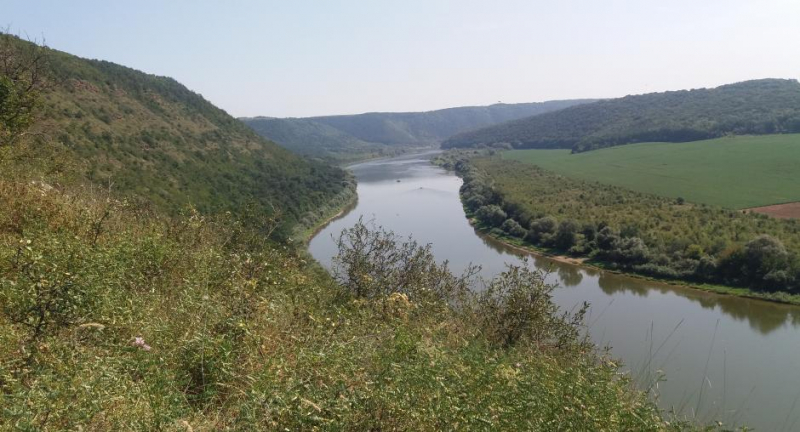
osce.org -
The fourth one in Top 10 Longest Rivers in Ukraine that Toplist would like to introduce to you is Desna. The Desna is a major left-tributary of the Dnieper River in Russia and Ukraine. In the Old East Slavic language, its name means "right hand." It stretches for 1,130 kilometers (702 miles), and its drainage basin covers an area of 88,900 square kilometers (34,324 sq mi).
The river's width in Ukraine ranges from 60 to 250 meters (200 to 820 feet), with an average depth of 3 meters (10 ft). At its mouth, the average annual discharge is 360 m3/s (13,000 cu ft/s). From early December to early April, the river freezes over and is navigable from Novhorod-Siverskyi to its mouth, a distance of about 535 kilometers (332 mi).
In June 2020, the river's water level reached its lowest recorded level in 140 years. This water level was 5 meters (16 feet) lower than normal for the time of year.
The Desna is a Russian river that originates in the Smolensk Heights of the Smolensk Oblast. The river's headwaters are in the Yelninsky District, east-southeast of Smolensk and not far from Yelnya, in a forest near the village of Naleti. The Desna then flows south through a low, swampy valley to Bryansk, where the river's right bank rises.
The river widened after its confluence with the Seym near the Russian-Ukrainian border, splitting into numerous smaller branches. Its right bank drops again near Chernihiv, and again near one of its tributaries, the Oster, where the Desna continues its journey through a low, muddy plain until it reaches the Dnieper River near Kyiv.
Length: 1,130 km (700 mi- shared with Moldova)
vi.wikipedia.org 
commons.wikimedia.org -
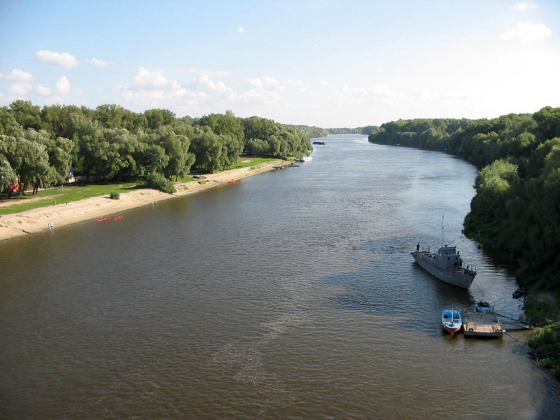
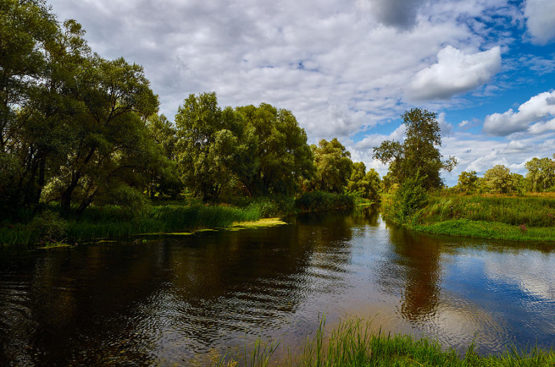
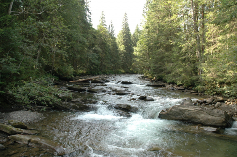
The fifth one in Top 10 Longest Rivers in Ukraine that Toplist would like to introduce to you is Seversky Donets. The Seversky Donets, also known simply as the Donets, is a river located in the south of the East European Plain. It rises in the Central Russian Upland north of Belgorod and flows south-east through Ukraine (Kharkiv, Donetsk, and Luhansk Oblasts) and Russia (Rostov Oblast) to join the Don River about 100 kilometers (62 miles) from the Sea of Azov. The Donets is Ukraine's fourth-longest river and the largest in Eastern Ukraine. It is an important source of fresh water in the country's east. It is the name given to the Donets Basin, also known as the Donbass, an important coal mining region in Ukraine.
The Donets is regarded as one of the most beautiful rivers in the East European Plain, with numerous hiking and biking trails along its banks. Canoe rafting is a popular activity, particularly between Zmiyev and Svyatogorsk. Rafting is the easiest (lowest) level of difficulty. May through September are the busiest months for tourism. The most picturesque area is probably near the town of Izium, which is home to the Holy Mountains National Park. The water is safe for swimming all the way down to Lysychansk, and the shores are lined with sandy beaches. There are several health resorts near Pechenizke Reservoir.
Length: 1,053 km (654 mi- shared with Russia)
fineartamerica.com 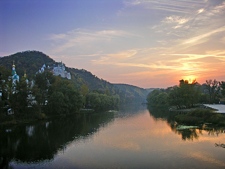
en-academic.com -
The Tisza, also known as the Tysa or Tisa, is a major river in Central and Eastern Europe. It was once known as "the most Hungarian river" because it flowed entirely within the borders of the Kingdom of Hungary. It now spans several national borders.
The Tisza River begins near Rakhiv, Ukraine, at the confluence of the White Tisa and the Black Tisa. The Tisza flows west from there, roughly following Ukraine's borders with Romania and Hungary, then briefly following the border between Slovakia and Hungary, later into Hungary, and finally into Serbia. Tiszabecs is the point at which it enters Hungary. It runs from north to south through Hungary. It enters Serbia a few kilometers south of the Hungarian city of Szeged. Finally, it joins the Danube near the village of Stari Slankamen in the Serbian province of Vojvodina.
The Tisza has a length of 966 kilometers and drains an area of approximately 156,087 km2 (60,266 sq mi) (600 mi). Its average annual discharge ranges from 792 m3/s (28,000 cu ft/s) to 1,050 m3/s (37,000 cu ft/s) seasonally. It accounts for approximately 13% of total Danube runoff.
Attila the Hun is said to have been buried beneath a section of the Tisza River that had been diverted.
The Tisza is home to a diverse range of wildlife. Tiszafüred's bird reserve is home to over 200 different bird species. The flood plains along the river are home to a diverse array of plant and animal life. The yearly "flowering" of the Tisza, in particular, is regarded as a local natural wonder. The blooming attracts a large number of mayflies, which is a well-known sight.
Colonies of magnificent bryozoans were discovered in the river in September 2020.
Length: 966 km (600 mi- shared with Hungary, Romania, Serbia, and Slovakia)
commons.wikimedia.org 
tripadvisor.com.vn -
The Prut is a river in Eastern Europe that runs for 953 kilometers (592 miles). It is a Danube tributary to the left. It forms part of Romania's border with Moldova and Ukraine.
The Prut grows on the eastern slope of Mount Hoverla in Ukraine's Carpathian Mountains (Ivano-Frankivsk Oblast). Initially, the river flows north. It turns northeast near Yaremche and south-east near Kolomyia. When it reaches the Moldova-Romania border, it turns to the south-east, and then to the south. It eventually merges with the Danube near Giurgiulești, east of Galați, and west of Reni.
Between 1918 and 1939, the river flowed through Poland and Greater Romania (Romanian: România Mare). It served as a border between Romania and the Russian Empire prior to World War I. The river once again dominated a border after WWII, this time between Romania and the Soviet Union. It now forms the border between Romania and Ukraine for 31 km (19 mi) and the border between Romania and Moldova for 711 km (442 mi). It has a hydrographic basin of 27,540 km2, of which 10,990 km2 (4,240 sq mi) is in Romania and 7,790 km2 (3,010 sq mi) is in Moldova. Chernivtsi, Ukraine, is the largest city along its banks.
Prut is home to the Stânca-Costești Dam, which is operated jointly by Moldova and Romania. Sniatyn also has a hydroelectric station (Ukraine). Ships travel from the mouth of the river to the port city of Leova (southern Moldova).
The basin's lower reaches are heavily marshy. At its mouth, the average discharge is 110 m3/s (3,900 cu ft/s). In the city of Leova, the average discharge is 69.2 m3/s (2,440 cu ft/s). The river's slope varies from 100 m/km (near the source) to 0.05 m/km (near the mouth). It has a mountainous character in the upper reaches (to Delyatyn), with a steep right bank, and the cross-sectional profile of the channel sometimes takes the form of a ridge. The Probiy waterfall is located near the city of Yaremche.
Length: 953 km (592 mi- shared with Moldova and Romania)
en.wikipedia.org 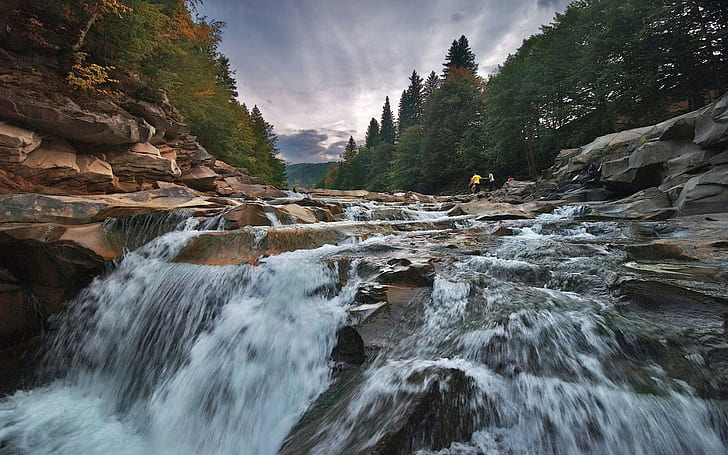
wallpaperflare.com -
The Southern Bug, also known as the Southern Buhand and sometimes as the Boh River, is a navigable river in Ukraine. It is Ukraine's eighth longest river in Ukraine.
The river's headwaters are in western Ukraine, in the Volyn-Podillia Upland, about 145 kilometers (90 miles) from the Polish border, from which it flows southeasterly into the Bug Estuary (Black Sea basin) via the southern steppes. It stretches for 806 kilometers (501 miles) and drains an area of 63,700 square kilometers (24,600 sq mi).
Khmelnytskyi, Khmilnyk, Vinnytsia, Haivoron, Pervomaisk, Voznesensk, and Mykolaiv are major cities on the Southern Bug (listed downstream, i.e. southwards).
During World War II, the Southern Bug formed the border between German-occupied Ukraine and the Romanian-occupied part of Ukraine known as Transnistria. At Khmelnytskyi in October 2020, the Southern Bug was stocked with 350 kilograms of Hungarian carp and 50 kilograms of silver carp.
Length: 806 km (501 mi)
ukrainetrek.com 
en.wikipedia.org -
The Bug, also known as the Western Bug, is a major river in Eastern Europe that flows 774 kilometers through Belarus, Poland, and Ukraine (481 mi).
The Bug, a tributary of the Narew, forms part of the Belarus–Poland border as well as part of the Poland–Ukraine border between Ukraine and Poland for 185 kilometers (115 miles), and between Belarus and Poland for 178 kilometers (111 miles),, and is the fourth longest Polish river.
The Bug is a Narew tributary to the left. It flows from the Lviv Oblast in western Ukraine northwards into the Volyn Oblast, then into Poland, where it follows part of the border between the Masovian and Podlaskie Voivodeships. It merges with the Narew at Serock, a few kilometers upstream of the man-made Zegrze Lake.
This section of the Narew between the confluence and the Vistula is sometimes referred to as the Bugo-Narew, but on December 27, 1962, the Prime Minister of Poland's act abolished the name "Bugo-Narew," shortly after the completion of Zegrze Lake.
The westernmost point of Belarus is located on the Bug, a few kilometers from Vysokaye in the Kamenets District of the Brest Region. The Dnieper-Bug Canal connects it to the Dnieper via the Mukhavets, a right-bank tributary.
Length: 774 km (481 mi- shared with Belarus and Poland)
en.wikipedia.org 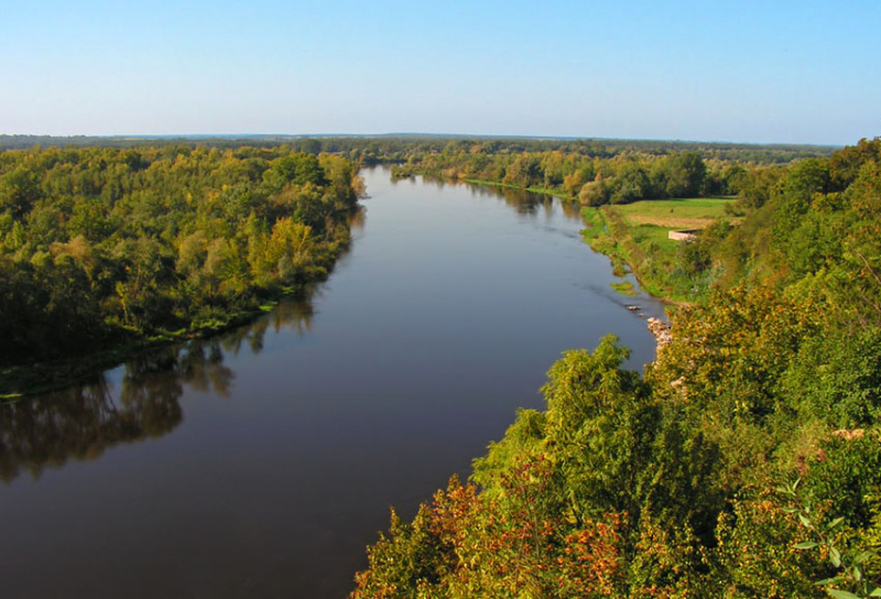
simple.wikipedia.org -
The Seym (also spelled Seim and Sejm) is a river in Russia and Ukraine that flows west. It has a length of 748 kilometers (465 miles) (250 kilometers within Ukraine) and a basin area of approximately 27,500 square kilometers (10,600 sq mi). It is Desna's main tributary. The Desna is a major left-tributary of the Dnieper River in Russia and Ukraine. In the Old East Slavic language, its name means "right hand." It is 1,130 km (702 mi) long and has a drainage basin area of 88,900 km2 (34,324 sq mi). The river's width in Ukraine ranges from 60 to 250 meters (200 to 820 feet), with an average depth of 3 meters (10 ft). At its mouth, the average annual discharge is 360 m3/s (13,000 cu ft/s).
Kursk, Kurchatov, Rylsk, Ukrainian border, Putyvl, Baturin, junction with Desna, which flows west and south past Chernihiv to Kyiv.
Length: 748 km (465 mi- shared with Russia)
tripadvisor.com 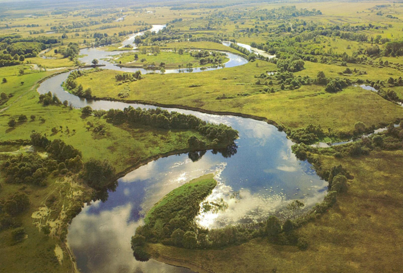
imgur.com


