


Top 4 Highest Mountains In Angola

Angola is situated on the Atlantic coast of southwestern Africa. It shares borders with Namibia, the Republic of the Congo, the Democratic Republic of the ... read more...Congo, and Zambia, with a total area of 481,400 square miles. Coastal lowlands, rainforest, rivers, high plateaus, and mountain ranges make up Angola's landscape. This article takes a look at some of the country's biggest peaks.
-
Moco Mountain is Angola's tallest mountain, rising 8,596 feet above sea level in the country's west-central area. It is 70 kilometers (43 miles) west of Huambo in Huambo Province, in the western portion of the country.
It is located on the inland-facing slopes of the western mountain ranges, and is part of the Angolan montane forest-grassland mosaic ecological zone. Mosaic refers to the fact that they are covered in savanna and small areas of woodland. This area has a wet and dry season, as well as a high risk of grassland fires. The sugar-bush (or protea), a blooming bush, is one of the most prevalent species on this mountain. There are about 233 bird species here, including endangered species like Swierstra's Francolin, Angola Cave Chat, Angola Slaty Flycatcher, and Ludwig's Double-Collared Sunbird.
Although it is not legally protected, the mountain has been designated as an Important Bird Area. This mountain summit was named one of Angola's Seven Wonders in 2014. It is a popular tourist destination as well as a local hangout since it offers good hiking, bird-watching, rappelling, and paragliding options.Location: Huambo Province
Elevation: 2,620 m
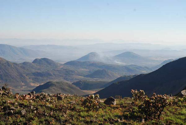
Photo source: MountMoco.org 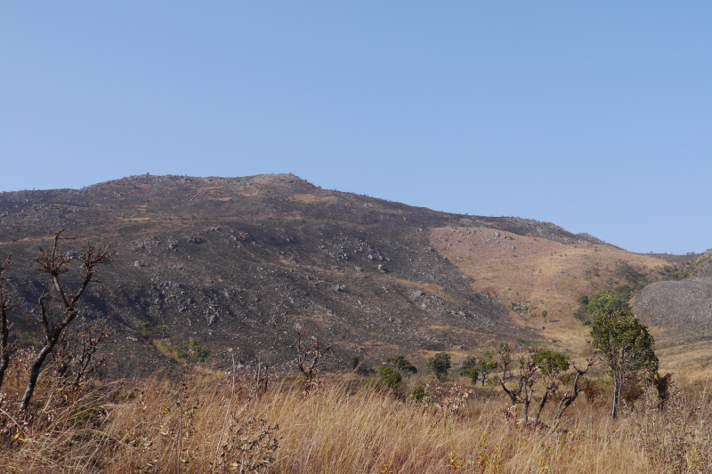
Photo source: Wikipedia -
Lupangue, at 8,379 feet above sea level, is Angola's second tallest peak. Lupangue is a mountain in the northeastern part of Chicolovolo. This peak is near the town of Secreta in the province of Benguela. In terms of flora and fauna, the Lupangue mountain top is similar to Moco due to its location.
It also contains the biological zone of the Angolan montane forest-grassland mosaic.There are wet and dry seasons in this region, as well as a high risk of grassland fires. Mosaic refers to the savanna and little patches of woods that cover them. One of the most common species on this mountain is the sugar-bush (or protea), a flowering bush. Swierstra's Francolin, Angola Cave Chat, Angola Slaty Flycatcher, and Ludwig's Double-Collared Sunbird are among the 233 bird species that call this place home.
Location: the province of Benguela
Elevation: 2,554 m
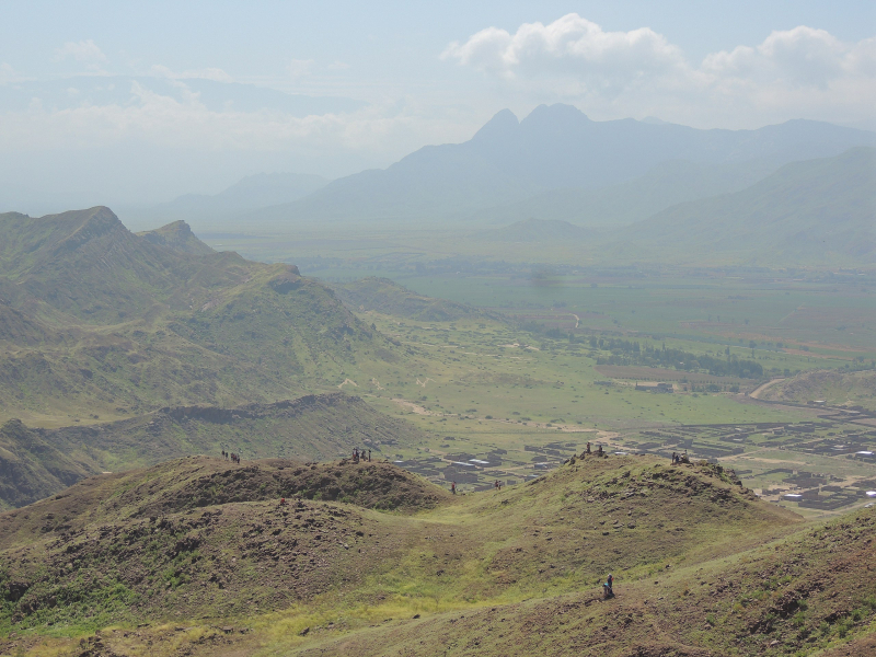
Photo source: Wikipedia Commons 
Photo source: dangerousroads -
Ungungi Mountain is Angola's third highest peak. It is located in the province of Huambo, near the town of Calobombo, at an elevation of 8,238 feet above sea level. This peak is only a short distance from Moco, as noted previously. Sunrise is at 06:03 in the morning and sunset is at 18:02 in the evening at Monte Ungungi. It's getting dark.
Many unusual plants and animals can be found on this peak. Angola's mountains are threatened by a variety of environmental factors. Deforestation is perhaps the most serious of these. Deforestation not only puts local species at risk by eliminating natural habitats, but it also raises the risk of soil erosion. Because this mountain is not designated as a special protected area, these issues are likely to persist.
From May to July, the weather is cooler, and the rainy season begins around September. The mountain also features a diverse forest-grassland mosaic ecological zone, as well as numerous unique plant and animal species that must be protected.
Location: the province of Huambo
Elevation: 2,511 m
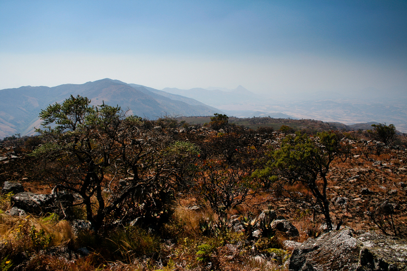
Photo source: Peakery 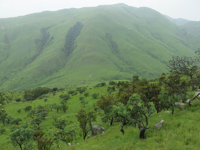
Photo source: Spectacular Mountains -
Monte Mbuindo, also known as Monte Mbuindo, Buindo. At 2,480 meters above sea level, it is the highest point in the area. For proper mapping of Monte Mbuindo Lattidude on your map, the latitude is -12.6713900 and the longitude is 15.4038900. The prominence is 142 meters (466 feet) high.
Deforestation is also a problem on the mountain, which causes the soil to erode. When soil erodes, nutrients are lost, making it harder for plants to thrive, both wild and farmed for agriculture. The soil debris frequently washes into surrounding rivers and other waterways, causing ecosystem degradation.
Monte Mbuindo is ranked sixth out of 172 in Huambo and twelfth out of 2654 in Angola in terms of elevation. Monte Mbuindo is ranked #67 out of 172 in Huambo by prominence. Monte Mbuindo is in the Africa/Luanda time zone, with morning sunrise at 06:03 and evening sunset at 17:59.
Location: Huambo, Angola
Elevation: 2,480 m
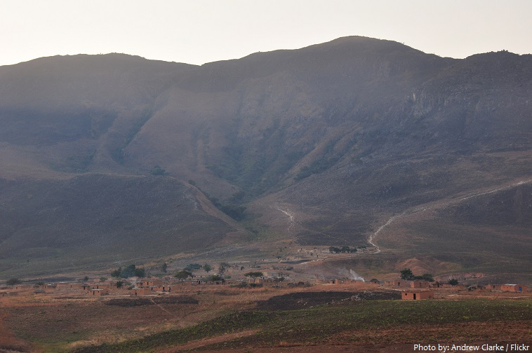
Photo source: http://justfunfacts.com/ 
https://angolafieldgroup.com/


