


Top 7 Highest Mountains In Bhutan

Bhutan is a small country with a rich cultural heritage, located in the Eastern Himalayas between China and India. Bhutan has been safeguarded from foreign ... read more...aggression until the late twentieth century, which explains why the country's natural beauty has not been harmed. Bhutanese architecture is traditional, consisting primarily of sandstone and beautiful woodwork, with no nails or iron bars. Bhutan is home to many exotic animals and over 5400 plant species thanks to its unique biodiversity and the government's earnest conservation efforts. Toplist will take you on a tour of Bhutan's seven tallest peaks in this post.
-
Gangkhar Puensum is Bhutan's highest peak, and at 7,570 meters, it is the world's 40th highest summit. As unexpected as it may seem, Gangkhar Puensum has remained unclimbed for decades, despite the fact that most Himalayan peaks have already been scaled. Although the exact border line between Bhutan and Tibet is contested, Gangkhar Puensum is located on the Bhutan-Tibet border. Other sources have the summit entirely in Bhutan, although Chinese maps place it firmly on the boundary. The region's maps were embarrassingly wrong when the mountain was originally mapped and surveyed in 1922. Until recently, maps of the region depicted the mountain in various positions and at various heights. One of the earliest teams to try the peak was unable to locate the mountain.
Bhutan first allowed mountaineering in 1983 because they thought that lofty mountains were where ghosts lived. A number of excursions were organized when Bhutan finally opened its doors to mountaineering. Four attempts were undertaken between 1985 and 1986, but they all failed. The decision to allow mountaineering as a commercial activity was short-lived. Out of respect for indigenous spiritual beliefs, the government banned climbing mountains which are higher than 6,000 meters in 1994, and mountaineering has been prohibited in the country since 2004. Bhutan has not yet surveyed the summit, and it appears that the country has no plans to do so in the near future. Due to the difficulty in obtaining government permissions and the paucity of rescue backup, it appears that the peak will remain unclimbed for the foreseeable future.
The Chinese Mountaineering Association granted a Japanese group permission to climb Gangkhar Puensum north of Bhutan from the Tibetan side in 1998. However, the licence was eventually cancelled due to a long-standing boundary dispute with Bhutan. Instead, the expedition chose Gangkhar Puensum North, also known as Liankang Kangri, a hitherto unclimbed 7,535 m subsidiary summit of Gangkhar Puensum. The team's notes indicated that if authorized, the excursion to the main peak would have been successful. Surprisingly, unlike previous maps, the expedition's report places Gangkhar Puensum in Tibet rather than Bhutan, with the Tibet–Bhutan border passing through the peak.Elevation: 7,570 m
Location: Bhutan–China border
Mountain range: Himalayas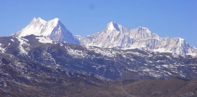
Photo source: Secret - World 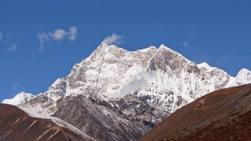
Photo source: Amusing Planet -
Liangkang Kangri (also known as Gangkhar Puensum North and Liankang Kangri) is a Himalayan mountain peak on the Bhutan-China boundary and near the southeastern extremity of territory claimed by both countries. Liangkang Kangri stands at a height of 7,535 meters (24,721 feet). A ridge leads 2 kilometers (1.2 miles) south-southeast to the 7,570-meter (24,840-foot) Gangkhar Puensum. Liangkang Kangri is not considered a separate mountain due to its low saddle height of 234 meters (768 feet). The Chumhari Kang, which rises 6,680-meters (21,920 feet) to the west, is reached via a ridge. The headwaters of the Lhobrak Chhu, a source river of Kuri Chhu, are formed by the Liangkanggletscher on the northwest flank and the Namsanggletscher on the eastern flank of Liangkang Kangri. The Angde Chhu catchment region includes the glacier on the southwest flank.
On 5 May 1999, a 5-member party led by Japanese mountaineer Kiyohiko Suzuki made the first ascent of Liankang Kangri. They claimed Liankang Kangri was the world's second highest unclimbed mountain, after Gangkhar Puensum. "As I cannot disclose an inner narrative behind the sudden cancellation," team member Tamotsu Nakamura told the BBC following the party's triumph, "I write only that the reason why the permit was cancelled was due of a political dispute with [the] Bhutan government." (...) I pity that Liangkang Kangri is not a particularly impressive peak."Elevation: 7,535 m (24,721 ft)
Location: the Bhutan-China boundary
Mountain range: Himalayas
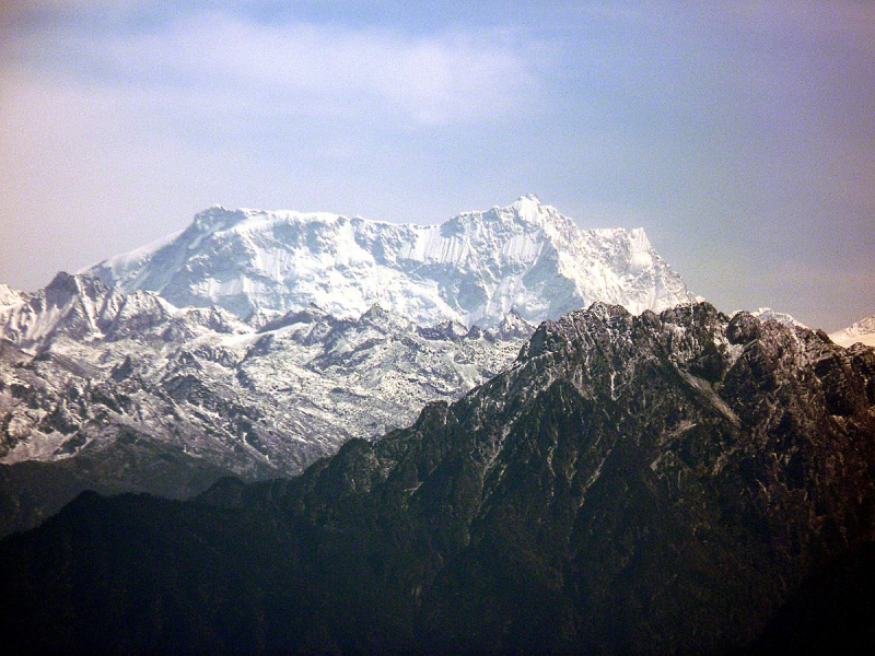
Photo source: Wikipedia 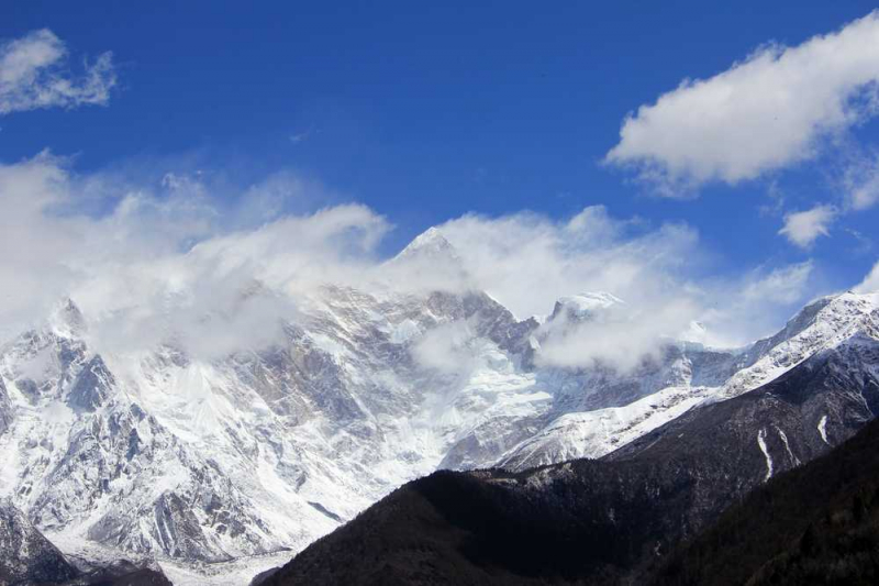
Photo source: Holidify -
Jomolhari or Chomolhari, sometimes known as "the bride of Kangchenjunga," is a Himalayan mountain that straddles the border between Tibet's Yadong County and Bhutan's Paro region. The north face rises above the desolate plains by nearly 2,700 meters (8,900 feet). The mountain is the source of two rivers: the Paro Chu (Paro river) on the south side and the Amo Chu on the north side. After staying in Thimphu and enjoying the picturesque beauty of Paro, you can travel to Jolmolhari. Jolmolhari is a very frigid place, with temperatures as low as -10°C. As a result, it is recommended that you carry warm clothing and, if walking, comfortable sleeping bags. Jolmolhari may be one of your favorite mountains if you are a mountaineer. Because this location is relatively chilly, it is considerably more exciting when the mountain is covered in snow.
Tibetan Buddhists believe the mountain is the home of one of the Five Tsheringma Sisters (jo mo tshe ring mched lnga) – female protector deities (Jomo) of Tibet and Bhutan who were sworn to defend the land, the Buddhist faith, and the local people by Padmasambhava.
Because Jomolhari was sacred and the home of goddesses, many who lived nearby believed that climbing it was impossible and that anyone who went too high would be hurled down.Elevation: 7,326 m
Location: Paro, Bhutan; Tibet Autonomous Region
Parent range: Himalaya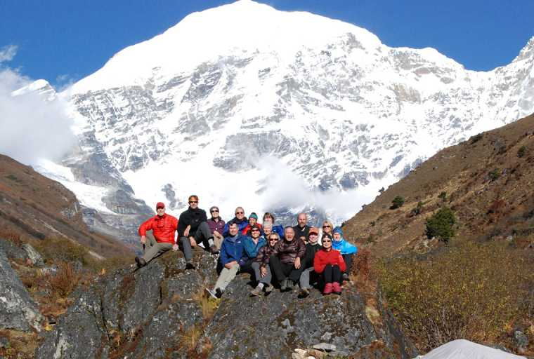
Photo source: Himalayan Trekkers 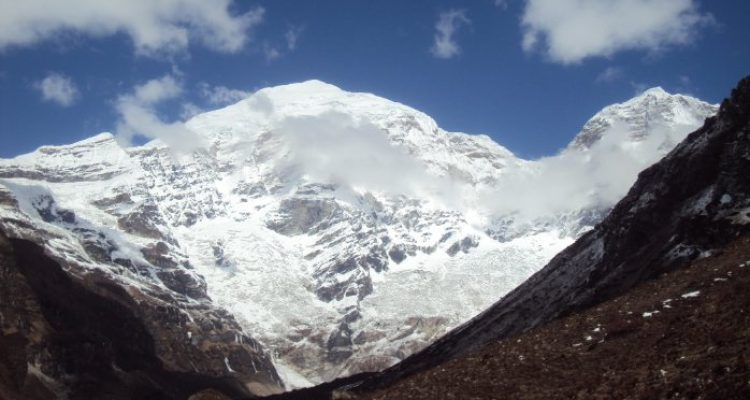
Photo source: Hike In Nepal -
Kangphu Kang, also known as Shimokangri, is a Himalayan mountain. It is the 107th tallest peak in the world, standing at 7,204 meters (23,635 feet) above sea level. The summit is located on the Bhutan-China border (Tibet).
A high ridge that does not dip below 7,000 meters connects the mountain's western and eastern summits. A 15-kilometer north ridge, containing a 6,902-meter top, forks off the main divide from the lower western summit. From the west peak, the main ridge descends sharply to a 6,040 m pass that separates it from Jejekangphu Kang. The main ridge slopes southeast from the east peak to a 6,220 m pass that leads to Kangphu Kang II or Dop Kang on the other side.
A South Korean expedition ascended Kangphu Kang's north face for the first time on September 29, 2002. You can see the gigantic Kangphu Kang at the head of this large, U-shaped valley after crossing the river on a bridge. The Kangphu Kang is a place of incredible natural beauty that you must visit on your visit to Bhutan.
Elevation: 7,204 m
Location: the Bhutan-China border
Range: Himalayas
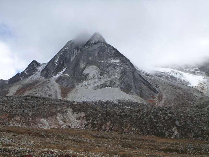
Photo source: MypPaceBase.com 
Photo source: MyPlaceBase.com -
Tongshanjiabu located in the Himalayan mountain. Tongshanjiabu is the world's 103rd highest peak, standing at 7,207 meters (23,645 feet). It is located on Bhutan's and China's disputed border area. Tongshanjiabu has never been climbed on a formal basis. The dangerously steep and, most of the time, snow-covered mountains are the primary cause for Tongshanjiabu's restriction.
On a map from Japanese Alpine News, May 2003, p. 44, the name "Tongshanjiabu" is indicated. The term "Teri Kang" is occasionally used to refer to the region's highest point, however it appears to be the name of a secondary peak.
Elevation: 7,207 m
Location: Bhutan's and China's disputed border area
Range: Himalayas
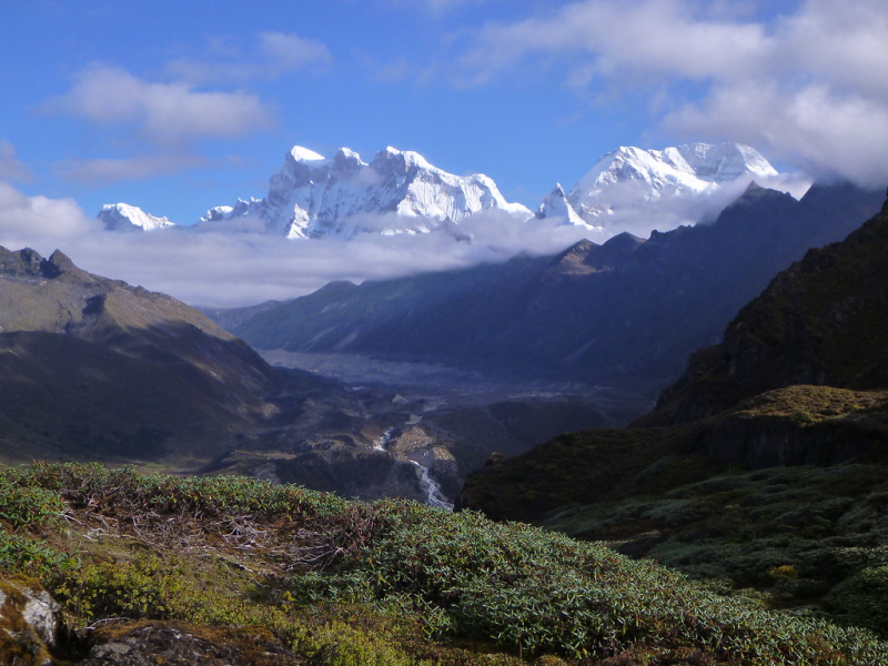
Photo source: MyPlaceBase.com 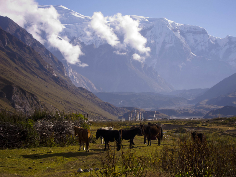
Photo source: MyPlaceBase.com -
Chomolhari Kang is a 7046 m Himalayan peak in Bhutan's Gasa District, near the Tibet-Bhutan border. Its height has been estimated to range from 7034m to 7121m, with 7046m being the most typical figure. A Chinese team that ascended the peak for the first time in 2013 recorded a GPS height of 7,054 meters.
Chomo is a Tibetan word that means "goddess" or "woman." The mountain is frequently described as lying on the border between China and Bhutan.
The first ascent of Chomolhari Kang was made in 2013 by a Chinese team led by Zhou Peng and Li Shuang. There is no prior climbing experience. The Mountaineering Association of Peking University (MAPKU) attempted an ascent in 2016 that terminated at 6600 meters.
Elevation: 7,046 m
Location: the border between China and Bhutan
Range: Himalayas
Photo source: Youtube 
Photo source: http://publications.americanalpineclub.org/ -
Gipmochi (Gyemo Chen or Gamochen, 'The Great Queen') is a mountain in south central Asia's Lower Himalayas. The peak, which rises to a height of 14,523 feet (4,427 meters), is located on the boundary between the Indian state of Sikkim and Bhutan. China claims Gipmochi as the tri-junction point between China, India, and Bhutan. Bhutan and India, on the other hand, maintain the tri-junction is 6.5 kilometers north of Batang La.
Mount Gipmochi is a Himalayan mountain that rises to 14,523 feet (4,427 meters) on the southwestern shoulder of the Doklam plateau, which lies at the crossroads of India (Sikkim), Bhutan, and Tibet (Chumbi Valley). Gipmochi is a curved semicircular formation that is part of the Zompelri ridge (or Jhampelri ridge). The Dongkya Range of mountains, to the north of this ridge, is traditionally regarded to constitute the dividing line between Sikkim and the Chumbi Valley. In current times, the Dongkya Range extends eastward into Sikkim, passing past the Merug La and Sinche La peaks before gently dropping to the plains. The headwaters of the Dichu river are located to the west of Mount Gipmochi and the Doklam plateau (also called Jaldhaka river). The Amo Chu river, which springs in the Chumbi Valley and flows into Bhutan, is located to the northeast of Gipmochi.
A plateau called Dolam or Doklam plateau is formed by the area surrounded by Gipmochi and Batang La, extending about 5 km to the southeast. Prior to official surveys, certain British travel maps from the 19th century label this plateau as "Gipmochi Pk" and illustrate its alignment with the Sinchela pass (on the northern ridge of the plateau). Bhutan had no map of its territory until 1961.Location: the boundary between the Indian state of Sikkim and Bhutan
Elevation: 4,427 m
Range: Himalayas
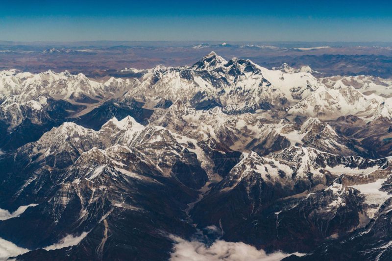
Photo source: blog.untravel.com 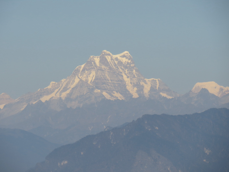
Photo source: hlpearthblog.wordpress.com


