


Top 5 Highest Mountains In Chad

Chad's mountains are one of the country's most beautiful geographical features. This African territory contains a number of mountain ranges. Chad vacation is ... read more...never complete without a visit to the country's mountains. Here are the top 5 highest mountains in Chad.
-
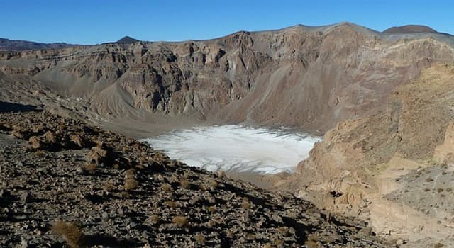
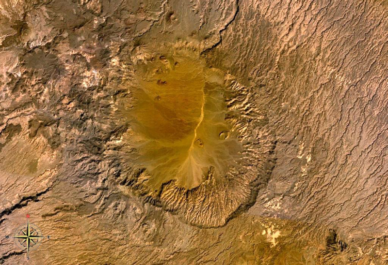
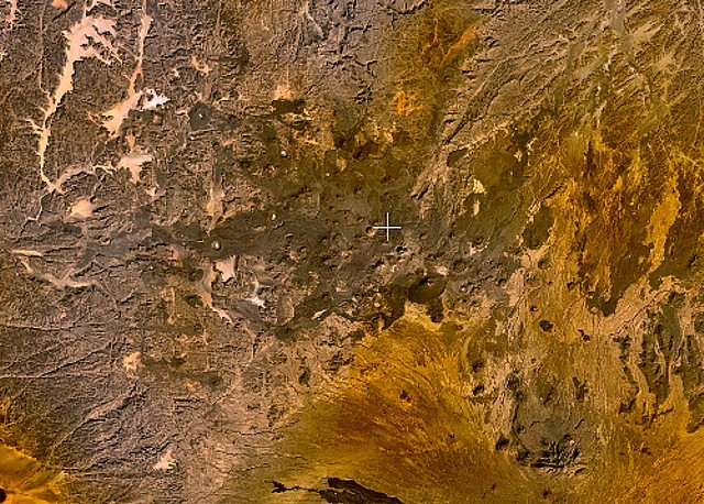
Emi Koussi (also known as Emi Koussou) is a high pyroclastic shield volcano located in the northern Borkou Region of northern Chad, at the southeast end of the Tibesti Mountains in the middle Sahara. The tallest mountain in the Sahara, the volcano is one of three in the Tibesti range, and rises 3 kilometers (1.9 miles) above the surrounding sandstone plains. The volcano has a volume of 2,500 cubic kilometers and a width of 60–70 kilometers (37–43 miles) (600 cu mi).
The volcano is capped by two nested calderas, the largest of which is around 15 by 11 kilometers (9.3 by 6.8 km). On the southeast side, there is a smaller caldera known as Era Kohor, which is about 2 kilometers (1.2 miles) broad and 350 meters (1,150 feet) deep. Within the calderas and along the shield's outer flanks, there are numerous lava domes, cinder cones, maars, and lava flows. Era Kohor possesses trona resources, and Emi Koussi has been examined as a Martian volcano counterpart to Elysium Mons. Emi Koussi was active more than a million years ago, but some eruptions may have occurred recently, and fumarolic and hot spring activity continues.
Location: Northern Chad
Elevation: 3,415 m (11,204 ft)
quizzclub.com 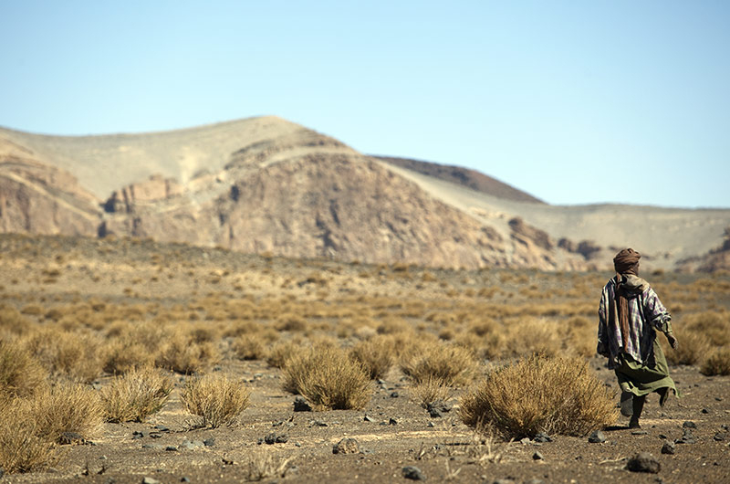
spazidavventura.com -
Pic Toussidé (also Tarso Toussidé) is a Chadian potentially active stratovolcano. Toussidé is located in the Tibesti Mountains, between the enormous Yirrigué caldera and the smaller Trou au Natron and Doon Kidimi craters. It is 3,265 meters (10,712 feet) above sea level. A series of lava flows have flowed westward away from Toussidé and east into the Yirrigué caldera from the volcano.
Trou au Natron, the depression southeast of the volcano, is about 8 by 6 kilometers (5.0 by 3.7 mi) in diameter and 700–1,000 metres (2,300–3,300 ft) deep. It was filled with a lake during the last glacial maximum, or the early-middle Holocene. Within Trou au Natron, a variety of volcanic cones have formed. Signs of volcanic activity at Toussidé include fumarolic activity on the top and geothermal manifestations within Trou au Natron.
The annual temperature range at Trou au Natron is 27–8 °C (81–18 °F), with a daily temperature variation of 8.8 °C (15.8 °F), which is lower than in the lowlands. Frost is possible at higher elevations. Trou au Natron receives 93.3 millimetres (3.67 inches) of precipitation each year. The majority of it falls as frontal precipitation throughout the summer, and it is more abundant than in the lowlands; wadis are formed by the Tibesti mountains. Other, more speculative estimates place Toussidé's annual precipitation at 150–250 millimetres (5.9–9.8 in).
Location: Tibesti Region, Chad
Elevation: 3,265 m (10,712 ft)
flickr.com 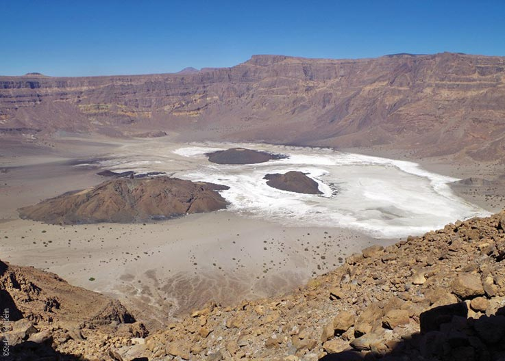
explore-chad.org -
Tarso Voon is a 3,100-metre (10,200-foot) high stratovolcano in the Republic of Chad's northwestern region. It is located in the Tibesti Mountains' western center.
The mountain's peak is dominated by a 14-by-18-kilometer (8.7 mi 11.2 mi) relatively flat crater. Extensive basaltic flows form a 180-degree arc on the northeastern side as a result of the Quaternary's strong activity. The Ehi Mosgau, a stratovolcano of the same elevation, 3,100 meters (10,200 ft), is nearby in the northern direction. Pyroclastic cloud deposits can be found 15 to 35 kilometers (9.3 to 21.7 miles) around the caldera. The mountain was built on a bedrock of Precambrian schists.
The greatest Solfataric field in the Tibesti Mountains is the well-known Soborom Solfataric field, which is located about 5 kilometers (3.1 miles) west of the summit rim. The Tibesti visit the active fumaroles, mud pots, and hot springs for medicinal purposes.
Location: Northern tip of Chad
Elevation: 3,100 m (10,200 ft)
wikipedia.org 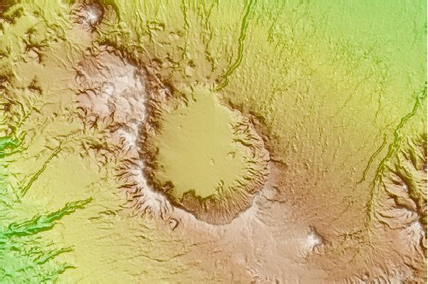
mountain-forecast.com -
Tarso Yega is a stratovolcano in Tibesti with a peak caldera that is 19 by 20 kilometers (12 by 12 miles) broad and 300 metres (980 feet) deep. The volcano's summit rises to a height of 2,972 meters (9,751 feet), and its caldera is the Tibesti's largest. Doudriki to the east, Ehi Dosoatou to the south, and Ehi Fodoboro to the southwest are nearby volcanoes. The Enneri Yega river drains the caldera westward and then southward before joining the Enneri Debarsar; the rivers once reached Lake Chad (Holocene).
The eruption of the volcano is marked by the emission of tephra, with the downsagging of the caldera floor causing a depression. Basaltic vents and lava domes were formed within this crater, and an intrusion known as Ehi Yodé formed 3 kilometers (1.9 miles) to the south.
The caldera has been badly eroded, with practically the whole southern side swept away, and the younger Voon ignimbrite has been emplaced within it; it belongs to a distinct volcano, Tarso Voon. The caldera has been exploited for irrigated agriculture by humans.Location: Chad
Elevation: 2,972 m (9,751 ft)
wikipedia.org 
wikipedia.org -
Tarso Toon (sometimes spelled Tarso Toh; "Tarso" means "high plateau") is a volcano in the Tibesti Mountains' central region. The volcano has a maximum elevation of 2,575 meters (8,448 feet) and a breadth of 21 by 19 kilometers (13 km 12 mi), covering a surface area of 600 square kilometers (230 sq mi). It also has a caldera that is 11 by 12 kilometers (6.8 km 7.5 mi) broad, with a gap on the northern side.
It was active throughout the Miocene, forming over older ignimbrites with tholeiitic rocks. Later, felsic volcanic rocks were emplaced within the caldera, and parts of the tholeiite were buried by the Voon ignimbrite.
Begour crater is located on the mountain. It is around 800 metres (0.5 mi) broad and generally dry, with the exception of few tiny ponds and a ring of diatom- and mollusc-containing sediments that forms a ring terrace inside the crater. Radiocarbon dating of sediments at Begour has produced ages of 8,300 300 years ago, and Tarso Toh is thought to be a Holocene volcano.
Location: Chad
Elevation: 2,000 m (6,600 ft)
wikipedia.org 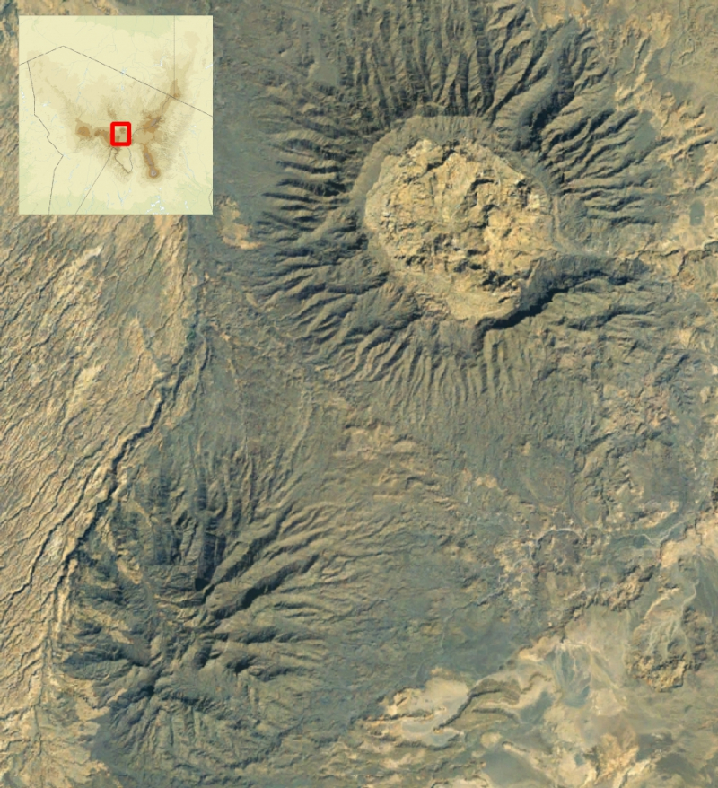
wikidata.org


