


Top 8 Longest Rivers in Afghanistan

Afghanistan is a Central Asian country bordered by Pakistan's northern and western areas, as well as Iran's eastern sections. China, Iran, Pakistan, ... read more...Tajikistan, Turkmenistan, and Uzbekistan are all neighbors. The Amu Darya is the longest river in Afghanistan, whereas the Helmand is the longest river entirely within the nation. Tajikistan, Uzbekistan, and Turkmenistan are also served by the Amu Darya. During the dry season, Afghanistan's hot heat dries out the rivers. The rivers are supported by the country's highlands and mountain streams. Because of the melting ice, the river flow is constant during the winter. Depending on the river's path, it drains in different spots. The shared rivers have also resulted in territorial conflicts, which have been settled through water treaties signed by specific nations. The Longest Rivers in Afghanistan are listed below.
-
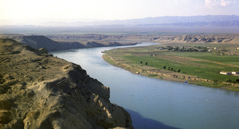
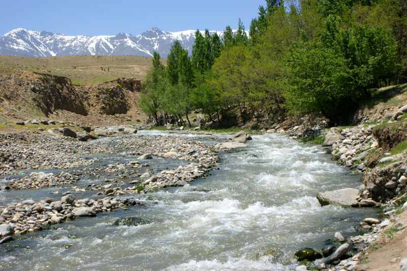
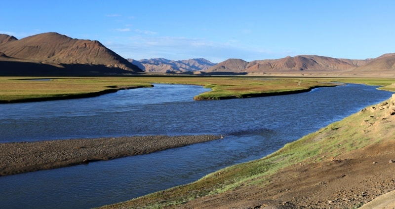
The Amu Darya River stretches for 879 kilometers and is the Longest River in Afghanistan. The river gets its water from Qal'eh'ye Panjeh in Afghanistan, where the Vakhsg and Panj rivers meet. It then flows northwest, draining the remnants to the Aral Sea or disappearing in the deserts. The river's basin covers 534,739 square kilometers. Because greater evaporation decreases river water downstream, the high mountains offer the essential precipitation to keep the flow going. The river supplies irrigation water. People who settled along the river's path exploited its waters for irrigation and the building of villages and cities in the fifth century. Historically, the river served as Greater Iran's geographical barrier from Turan.
Prior to 1970, the river split into several tributaries, forming a delta before flowing into the Aral Sea. The Soviet Union began diverting enormous volumes of water that had been put up to irrigate cotton and other crops in the river's lowland section in the 1950s. By 1960, the Karakum Canal had been constructed, carrying water from Turkmenistan to Mary and Ashgabat. This diversion reduced the amount of river water that flowed into the sea. As irrigation grew on the hot, dry floodplains, the river salinity rose and the soils became unproductive. The river no longer emptied into the Aral Sea by the twenty-first century. Poplars, Jupiters, and blackberries grow along the river's mountainside. Willows, buckthorns, and oleasters predominate in the lower sections. Trees that are resistant to salt and drought thrive at the lowest levels. There are no fish or birds in the river.
Total Length: 879 miles
en.wikipedia.org 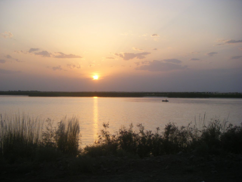
en.wikipedia.org -
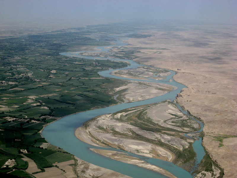
The Helmand River flows wholly within Afghanistan's boundaries for 715 km. The river begins in the Baba Range in East-Central Afghanistan, runs southwestward into the country, changes course to a brief northward flow, and empties in the Helmand marshes on the state's southwest border with Eastern Iran. The Tarnak and Arghandab are two of the river's many tributaries. A reservoir was created along with the river's flow at Kajak to provide water for agricultural programs and to manage floods. Another dam directs the flow of water to a canal.
The river provides an ideal habitat for a huge number of migrating birds. The main threat to the river is Afghanistan's pursuit of water resource development projects. The building of the Kamal Khan Dam on the river's lower sections, as well as the renovation of the Kajaki Dam, are damaging the river's natural flow and contaminating it.
The Avesta refers to the Helmand valley region as the Aryan realm of Haetumant, one of the first centers of the Zoroastrian faith in what is now Afghanistan. However, by the late first century BC and early first millennium AD, the predominance of Hindu and Buddhist populations in the Helmand and Kabul valleys had caused Parthians to refer to it as White-India.
Total Length: 715 miles
thegroundtruthproject.org 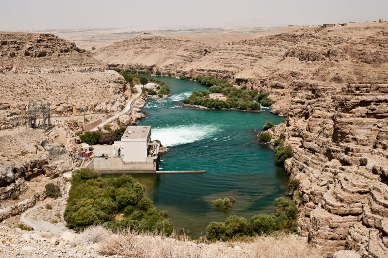
thegroundtruthproject.org -
The Hari River gets its water from the western slopes of the Selseleh-ye Kuh-e Baba Range in Central Afghanistan, which are outliers of the Hindu Kush Mountains. The river then runs west via Chaghcharan and Herat, an old city, before turning north and disappearing into the Karakum Desert. The Jam River meets the Hari River near the Minaret of Jam, some 120 kilometers upstream from Herat. The Hari River, with a length of 684 miles, supplies water for irrigation of some of Afghanistan's rich fields. The Afghan-India Friendship Project is a hydropower and irrigation dam built-in Heat Province. The river was known in history as the River Sarayu, and it served as a sacred location where Buddhist monks resided and prayed.
Rigveda is supposed to have documented the Harirud as the River Sarayu, according to Western non-Hindu sources. The genuine Sarayu, on the other hand, originates in the Tibetan glaciers near Mt Kailash in the Indian state of Uttar Pradesh. Before entering India, it runs via Nepal. The Avesta also mentions the Haroyu River. During the earliest years of Buddhism's dominance, a Buddhist monastery hand-carved into the bluff of the river Harirud existed. The man-made caverns revealed evidence of Buddhist monks' daily lives.
Total Length: 684 miles
en.wikipedia.org 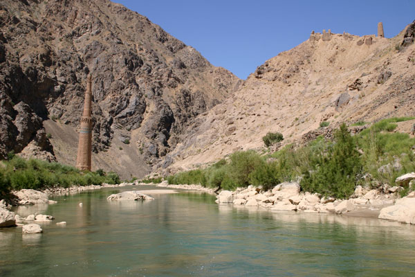
en.wikipedia.org -
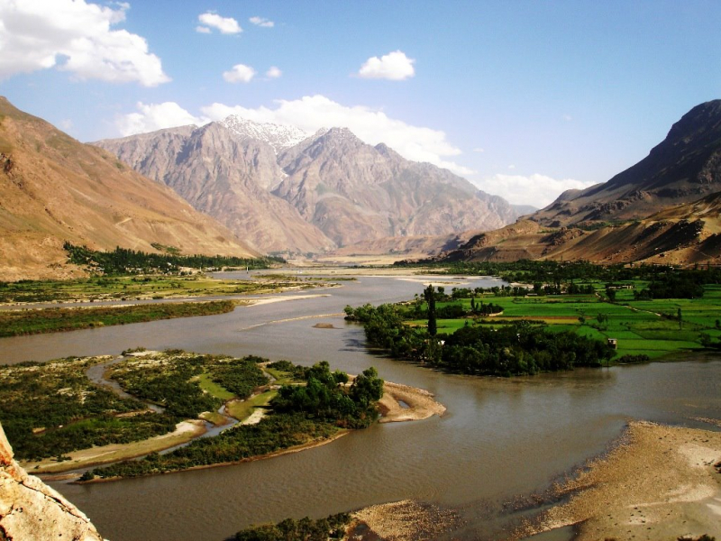
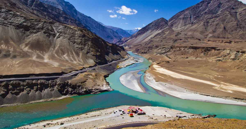
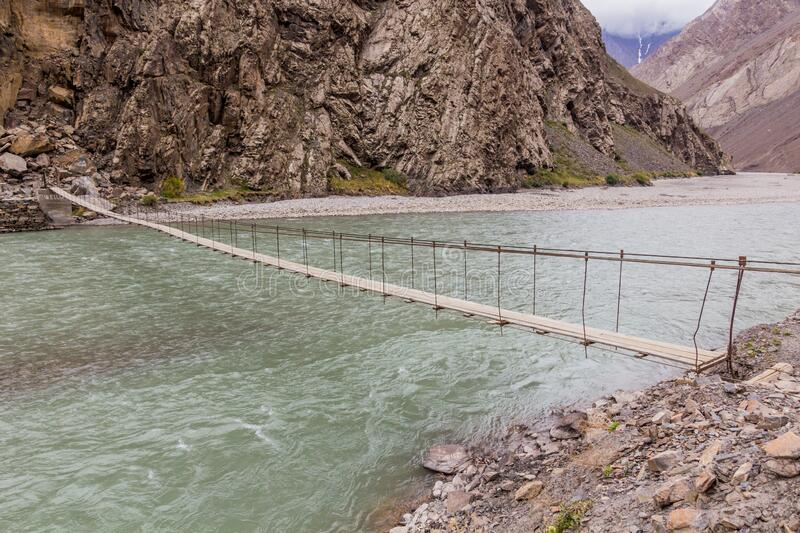
The Panj River is a 572-mile-long tributary of the Amu Darya River, and is one of the Longest Rivers in Afghanistan. The river originates at the confluence of the rivers Pamir and Wakhan in the town of Qila-e Panja. It flows westward from the confluence to create the Tajikistan-Afghanistan boundary. Past the Tajik city of Khorog, the river joins its tributary, the River Bartang, and the combined river flows southwest to join the River Vakhsh, becoming the Amudarya River. The river's strategic location was important in Soviet administration and Soviet military activities in Afghanistan in the late twentieth century. The water contract between the country and the Soviet Union enables Afghanistan to take nine cubic meters, but the country only draws two million since pulling all of the water as per the deal would harm the river's natural flow.
A water contract made in 1946 between the Soviet Union and Afghanistan permits Afghanistan to take 9 million cubic meters of water each year. It presently consumes 2 million cubic meters of water. According to the Panj River Basin Project, environmental harm might be predicted if Afghanistan took the full quantity of water permitted under the treaty from the river.
Total Length: 572 miles
commons.wikimedia.org 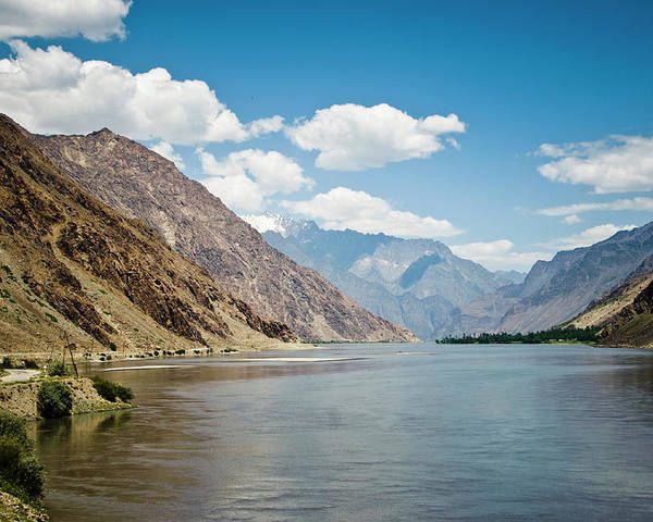
commons.wikimedia.org -
The Murghab River is a Central Asian river that runs for 850 kilometers (530 miles). It rises in the Paropamisus Mountains in central-western Afghanistan, particularly in the Murghab district. The river gets its name from the Marghab District in Ghor province and flows northwest towards the Bala Murghab. When the Murghab reaches the oasis of Mary in Turkmenistan's Karakum Desert, it debouches into the Karakum Canal, a diversion of water from the Amu Darya.
The Murghab River rises in central-western Afghanistan in the Murghab District of Ghor province, on a plateau surrounded by the Paropamisus, Gharjistan, and Band-i Turkestan mountain ranges. The river flows from east to west, towards Mukhamedkhan, for around 300 kilometers (190 miles) in a small, steep valley less than one kilometer wide, with tight gorges in certain places.
The flow of the Murghab was monitored for 50 years (1936–85) in Tagtabazar, Turkmenistan, some 30 kilometers (19 mi) after the Murghab exits Afghan territory and a score of kilometers upstream of the Kushk. At Tagtabazar, the average annual flow recorded throughout this time was 48.7 cubic meters per second over an observed surface area of 34,700 square kilometers (13,400 sq mi), accounting for 74% of the entire catchment area of the river. The regionally averaged hydrometric flow traveling through this section of the basin, which is by far the most important in terms of flow, therefore reached a number of 44.3 millimeters per year, which is highly significant in this very dry area.
Total Length: 528 miles
silkadv.com 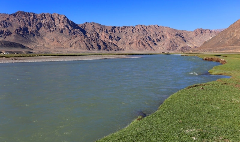
silkadv.com -
The Kabul River is a 700-kilometer-long (430-mile) river in South Asia that originates in Afghanistan's Sanglakh Range of the Hindu Kush mountains and is separated from the Helmand River's basin by the Unai Pass. Near Attock, Pakistan, the Kabul River falls into the Indus River. It is the main river in eastern Afghanistan and Pakistan's Khyber Pakhtunkhwa region.
The Kabul River, which is 700 kilometers long, flows through Kabul, Surobi, and Jalalabad in Afghanistan and forms large drainage of the eastern provinces of Nangarhr, Kunar, Lamn, Lgar, Kabul, Kpis, Parvn, Panjr, and Bmin before entering Khyber Pakhtunkhwa in Pakistan about 25 kilometers (16 mi) north of the Durand Line border crossing at Torkham. The river runs through Peshawar, Charsadda, and Nowshera in Khyber Pakhtunkhwa. It is known as the Sarchashma in its higher reaches. The Logar, Panjshir, Alingar, Surkhab, Kunar, Bara, and Swat rivers are important tributaries of the Kabul River.
For most of the year, the Kabul River is nothing more than a trickle, but it surges in summer due to melting snows in the Hindu Kush Range. Its main tributary is the Kunar River, which originates as the Mastuj River and flows from the Chiantar glacier in the Brughil valley in Chitral, Pakistan, before meeting the Bashgal River in Nurestan. Near Jalalabad, the Kunar meets the Kabul. Despite the fact that the Kunar carries more water than the Kabul, the river continues as the Kabul River after this confluence, owing to the name's political and historical importance.
Total Length: 435 miles
globalvillagespace.com 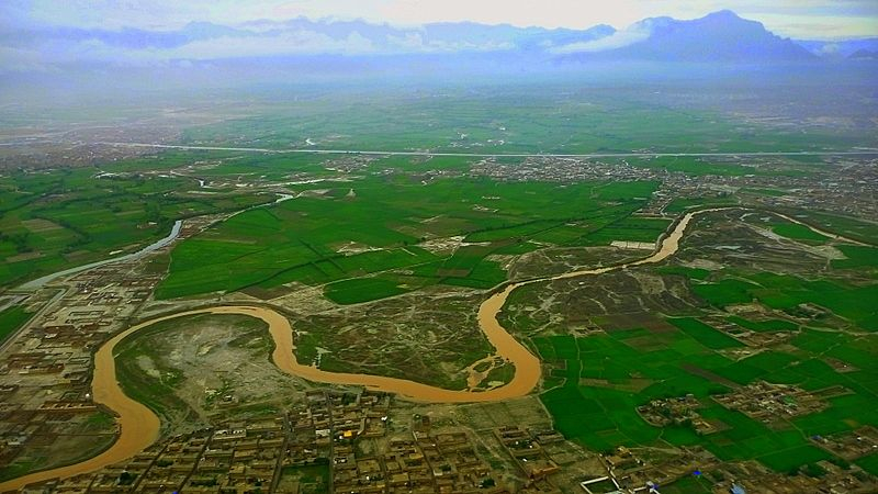
globalvillagespace.com -
The Bartang is a river in Central Asia that is a tributary of the Panj and hence of the Amu Darya. It is also known as the Murghab and Aksu in its higher reaches; it runs through the Wakhan in Afghanistan, then through the Rushon District of Tajikistan's Gorno-Badakhshan autonomous territory. The river is 528 kilometers (328 miles) long (133 kilometers if Aksu and Murghab are excluded) and has a basin size of 24,700 square kilometers.
The river begins at Chaqmaqtin Lake in the Little Pamir of the Wakhan and is known as the Aksu or Oksu ("white water"). It then runs east into Tajikistan before turning north to the city of Murghab, passing via the town of Shaimak. Sarez Lake, a few kilometers south of Murghab, was constructed by a landslide during the 1911 Sarez earthquake, which also created the world's highest natural dam, Usoi Dam.
The Ghudara River joins the river immediately beyond Sarez Lake. The river is called the Bartang after the intersection. The Bartang flows 132 kilometers (82 miles) down the western Pamir Mountains before becoming a tributary of the Panj on the Tajik-Afghan border. Tajik National Park encompasses a large portion of the river. The Bartang is mostly supplied by glacier and snow runoff. It is the only river that runs from east to west across Gorno-Badakhshan.Total Length: 328 miles
dreamstime.com 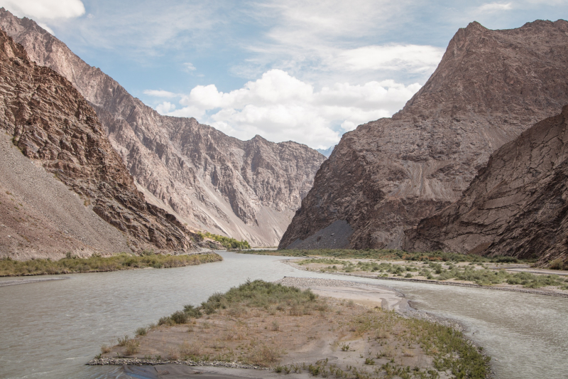
dreamstime.com -
The Kūnaṛ River, also known as the Mastuj, Chitral, or Kama River in its upper stages, is roughly 480 kilometers (300 miles) long and is located in eastern Afghanistan (Nuristan, Kunar, and Nangarhar) and northern Pakistan (Khyber Pakhtunkhwa). It emerges immediately south of the Broghil Pass, in the upper section of Khyber Pakhtunkhwa's Chitral District, near the Afghan border. The melting glaciers and snow of the Hindu Kush mountains feed the river system. The Kunar River is a tributary of the Kabul River, which is a branch of the Indus River.
The river originates in Pakistan's far north glaciated Hindu Kush mountains of Chitral, Khyber Pakhtunkhwa. From the village of Mastuj downstream until its confluence with the Lotkoh River just north of the key regional capital of Chitral, it is known as the "Mastuj River." It is then known as the "Chitral River" before flowing south into Afghanistan's upper Kunar Valley. It meets the Pech River at Asadabad, originally Chaga Sarai, and eventually drains into the Kabul River just east of the Afghan city of Jalalabad. The united rivers then flow eastward into Pakistan, roughly following the Grand Trunk Road via the Khyber Pass until rejoining the Indus River near the city of Attock.
Total Length: 298 miles
flickr.com 
flickr.com


