


Top 5 Longest Rivers in Armenia

Armenia is a nation in West Asia, located in Eurasia's South Caucasus area. The nation has a land area of around 11,484 square miles and a population of ... read more...approximately 2,924,816 people. Armenia is a landlocked nation bordered by Turkey, Georgia, Iran, and Azerbaijan, with mostly hilly terrain and fast-flowing rivers. Armenia was formerly known as Nairi, which means "land of lakes and rivers" in Assyrian. Armenia, as the name implies, has a variety of freshwater lakes and rivers. The Aras River is Armenia's longest river. The Longest Rivers in Armenia are listed below.
-
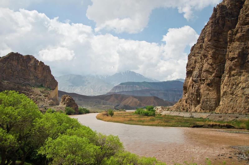
The Aras is the Longest River in Armenia and one of the longest in the Caucasus. The river has a total length of 1,072 kilometers and a basin area of 102,000 square kilometers. The Aras River begins in Turkey and travels through the Armenia-Turkey border, the Turkey-Azerbaijan border, Iran's borders with Armenia and Azerbaijan, and then through Azerbaijan to the Kura River. The Aras River drains the southern Lesser Caucasus Mountains, and its main branches include the Meghri, Voghji, Kasagh, Akhurian, Vorotan, Arpa, Azat, and Hrazdan rivers.
The Aras River begins near Erzurum, Turkey, and joins the Akhuryan River southeast of Digor. It flows from Digor along the Armenia–Turkey border and then near the corridor connecting Turkey to Azerbaijan's Nakhchivan exclave. It then follows the Iranian-Armenian and Iranian-Azerbaijan borders.
The river is named for Arast, a great-grandson of the mythical Armenian patriarch Haik, according to Armenian folklore. The name was then Hellenized to Araxes and used for the Kura-Araxes civilization, an ancient people who thrived in the Kura and Aras valleys. The river is also referenced as "mad at the bridge" in the last chapter of Virgil's Aeneid VIII since the Romans built a bridge over it and thereby subjugated it. The biblical rivers Gihon and Pishon have been linked to the Aras. Aras was defined by Robert H. Hewsen as Armenia's only "real river" and as "Mother Araxes," a source of pride for the Armenian people.
Length: 1,072 km
commons.wikimedia.org 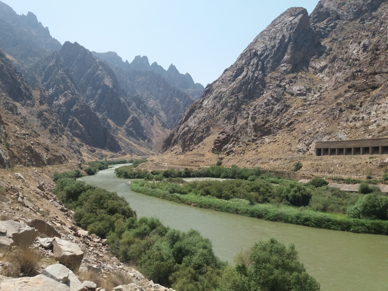
commons.wikimedia.org -
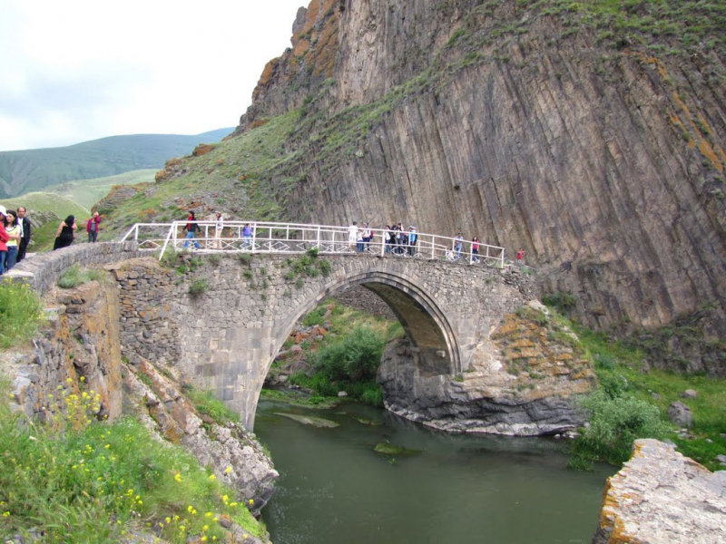
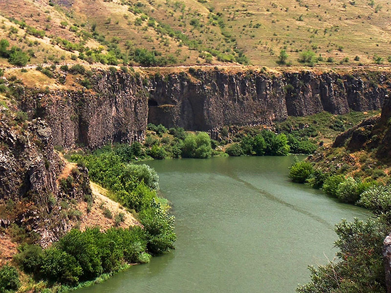
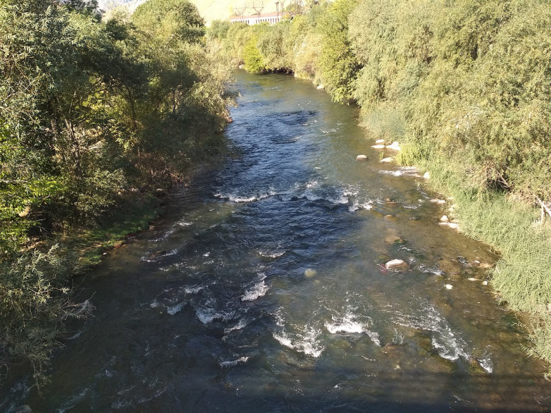
The Akhurian River is a river in the South Caucasus that runs for 205 kilometers and has a basin area of 9,500 square kilometers. The river runs from Lake Arpi in Armenia, crosses the Armenia-Turkey border, and empties into the Aras River. The Akhurian River passes through many cities, including Yerazgavors, Yervandashat, Bagaran, Ani, and Gyumri.
When the Byzantine army landed in Shirak in 1041, local Armenian nobility (nakharars) banded together to fight them under the direction of Pahlavuni commander Vahram Pahlavouni. Vahram then chose a force of 30,000 infantry and 20,000 horse to fight the Byzantines in three divisions. The invaders were beaten with tremendous death in the ensuing fight. The conflict was so intense that the effusion of blood that flowed into the Akhurian River is supposed to have turned its waters totally scarlet. The Byzantines left 21,000 dead in their wake. This victory enabled Vahram Pahlavuni and Catholicos Petros Guedadarts to anoint Gagik II king of Armenia and conquer the citadel of Ani, which had previously been held by Vest Sarkis.
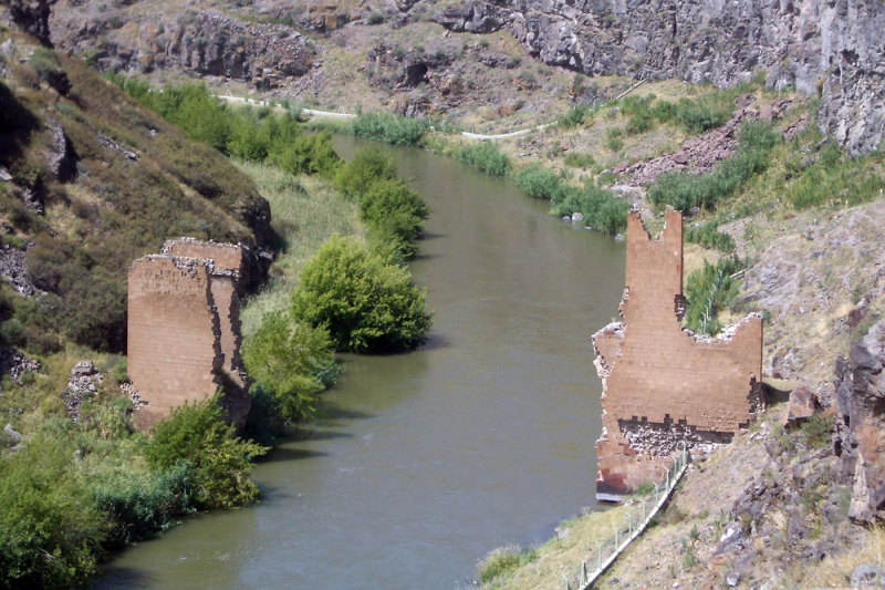
Several medieval bridges previously crossed the Akhuryan River. The bridge in Ani may have been built during the Bagratuni Dynasty. It is most likely to be from the thirteenth century. An inscription discovered nearby said that construction on the bridge's approach began in the early fourteenth century. The bridge's single arch has collapsed, leaving only towering abutments, maybe part of a defended gate. Travelers in the nineteenth century remembered a guardhouse near the bridge, but it has since vanished.
Length: 205 km
eurasianet.org 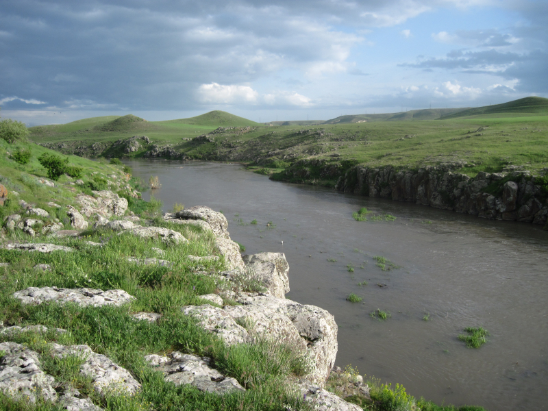
eurasianet.org -
The Vorotan River is one of the Longest Rivers in Armenia and is a river in the South Caucasus that runs for 179 kilometers and has a basin size of 5,650 square kilometers. The river begins in the Syunik Province in South Armenia, runs 119 kilometers through Armenia, another 59 kilometers through the Nagorno-Karabakh territory, and eventually empties into the Aras River. The Vorotan River flows through several steep gorges and hilly regions of Armenia, and it contains three reservoirs and an adjacent hydroelectric station built during the Soviet period. The Votoran River is a left tributary of the Aras River.
The river generally runs across steep terrain, forming deep gorges in various locations. Along its path are the cities of Sisian and Qubadli. The river generates a waterfall six kilometers from Sisian, known as the "Shaki Waterfall." Near Tatev Monastery, the river forms a natural landmark known as the "Devil's Bridge." Mineral ponds may be found at the base of the travertine arch.
Three reservoirs that make up the Vorotan Cascade were built during the Soviet era. They provide Armenia with hydroelectric power and agricultural water. To boost the volume of water in Lake Sevan, a 21.6-kilometer (13.4-mile) tunnel was built to convey some of Vorotan's waters to the lake. Work began in the 1980s but was halted in 1988, with just 18 km (11 mi) finished, due to the commencement of the First Nagorno-Karabakh War. In 2003, the Armenian government finished the Vorotan tunnel. A second tunnel, known as the "Arpa–Sevan," was built in 1981. The water from the Arpa River is diverted to Lake Sevan as a result of this project. The water level in the lake has risen as a result of the water flowing through the two tunnels.
Length: 179 km
reddit.com 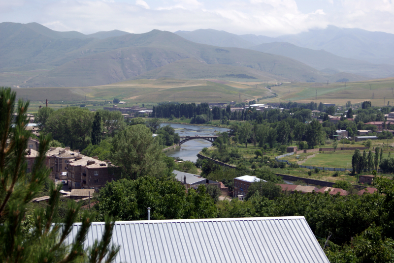
reddit.com -
With a length of 146 kilometers and a basin size of 2,560 square kilometers, the Hrazdan River is one of Armenia's major rivers. The river travels from the northernmost section of Armenia's Lake Sevan through the Kotayk Province, the capital city of Yerevan, and onto the Ararat plain, where it unites with the Aras River. Hrazdan water is used to irrigate fields and power hydroelectric projects.
The river flows from a lake at an elevation of 1,900 meters (6,200 ft). The river that runs south from the lake travels through a steep valley as it arrives on the western side of Yerevan and then debauches into the Aras River on the city's southern side. The river's geological formations are made up of lava flows (existing as basalts) created by three volcanoes in the Gegham range. The lava surfaces portray habitats such as "lakes, river channels, and floodplains." The landscape chronology of the uppermost layer of basalts reveals an age of 200,000 years.
Effluent flows from agricultural, commercial, industrial, and residential growth damage the river water, but untreated wastewater from Yerevan is particularly damaging. This has an impact on the river's water quality, with dissolved oxygen (DO) levels (less than 5% of the saturated dissolved oxygen level) lingering far below the allowable limits. According to a 2008 research, a 16-kilometer length of the river, from 2 kilometers upstream of the Yerevan wastewater outfalls to 14 kilometers downstream, is insufficiently aerated to provide a healthy habitat for aquatic life.
Length: 146 km
araratour.com 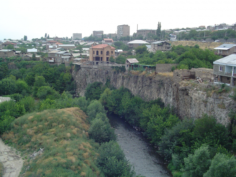
araratour.com -
The Arpa is a 126-kilometer-long river that is a left tributary of the Aras River. The river begins in Armenia's Vayots Dzor Province and runs through the nation as well as Azerbaijan's enclave of Nakhichevan. The Arpa River also runs through a number of cities and towns, as well as the Spandaryan Reservoir.
During the spring flood, the absolute maximum flow occurs in the Arpa river's Jermuk section line. From 1957 to 2020, the absolute maximum flow values were observed during the spring flood in all years. They were found in 1.6 percent of cases along the Yeghegnadzor and Areni section lines. Maximum flow values increase downstream of the Arpa River, reaching high levels at the Areni outlet. There is a decrease in the main characteristics of the peak flood discharge from 1981 to 2020 when compared to 1957-1980. For the period 1957-1980, the series variation coefficient of absolute peak discharge values varies within a small range, from 0.46 to 0.40; the asymmetry coefficient varies within a relatively large range, from 1.05 to 1.72 for the Yeghegnadzor and Areni section lines of the Arpa River. The absolute peak discharge values for the flood period on the Arpa river in Yeghegnadzor and Areni section lines have been discovered to be correlated, which can be used to calculate and forecast peak flood run-off.
Length: 126 km
commons.wikimedia.org 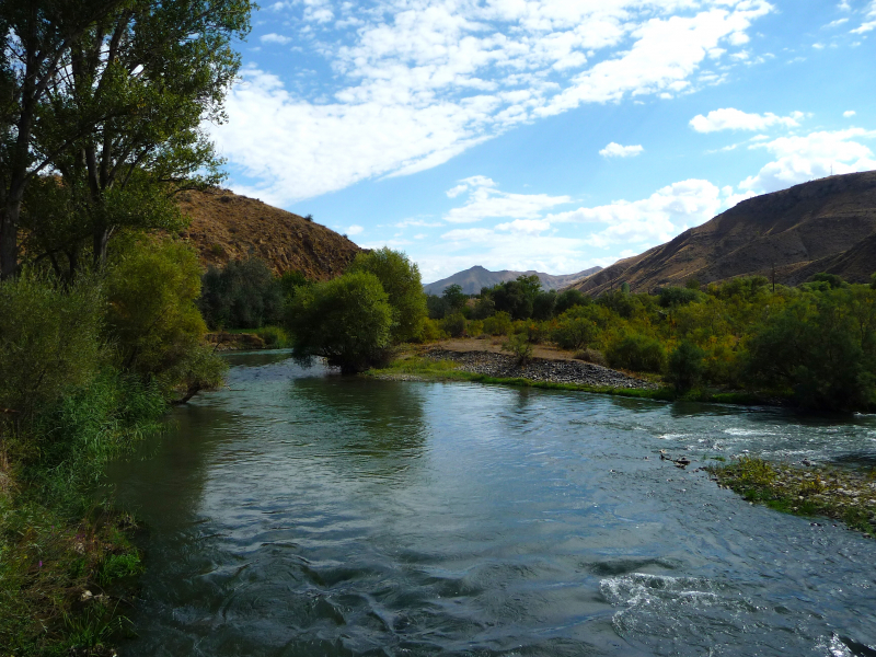
commons.wikimedia.org


