


Top 12 Longest Rivers in Germany

Germany is a country in northern Europe that lies between the Baltic and North Seas, as well as the Alps. It is Europe's second-most populous country ... read more...(following Russia). The natural beauty, history, culture, and cuisine of Germany attract a large number of visitors. Tall mountains in the south, sandy undulating hills in the north, forested hills in the urbanized west, and plains in the agricultural east make up Germany's diverse landscapes and natural sites. It also features one of the world's most developed river networks. Let's take a look at 12 of the longest rivers in Germany.
-
The Danube River is 1,777 miles long, making it Central and Western Europe's largest river. It is the longest river in Germany and the second longest in Europe (following the Volga in Russia). It rises in the Black Forest in Donaueschingen, Germany, and flows into the Black Sea through Ukraine and Romania's Danube Delta.
The Danube passes through or along the boundaries of ten nations, more than any other river on the planet: Germany, Austria, Slovakia, Hungary, Croatia, Serbia, Romania, Bulgaria, Moldova, and Ukraine, to name a few.
The Danube played an important role in the settlement and development of Central and Southeast Europe. Its water functioned as a crossroads for trade between countries. It also serves as a source of water for millions of people. Zander, pike, Wels catfish, tench, huchen, burbot, carp, sturgeon, salmon, trout, European seabass, mullet, and eel are among the fish found in the Danube River basin.
Length: 2850 km
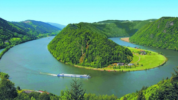
Photo: traveller 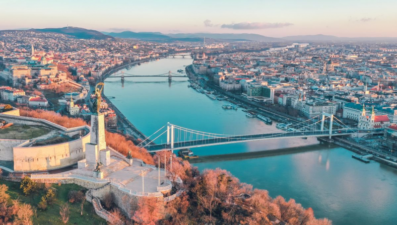
Photo: mundycruising -
The Rhine is one of Europe's major rivers. The river starts in the Swiss canton of Graubünden in the southeastern Swiss Alps, passes across the Swiss-Liechtenstein, Swiss-Austrian, Swiss-German, and then Franco-German borders, then flows largely north through the German Rhineland and the Netherlands until emptying into the North Sea. With a length of around 1,230 km (760 mi) and an average discharge of about 2,900 m3/s (100,000 cu ft/s), it is the second-longest river in Central and Western Europe (after the Danube).
The Rhine and the Danube formed a large part of the Roman Empire's northern inland border, and the Rhine has long been a major navigable waterway for moving trade and supplies deep inland. Its importance as a waterway in the Holy Roman Empire is evidenced by the numerous castles and fortifications built along it. Cologne, Düsseldorf, Rotterdam, Strasbourg, and Basel are among the Rhine's largest and most important cities.
The Rhine River is also a symbol of German culture. In the nineteenth century, it was a significant emblem of German nationalism. The Rhine was the scene for Das Rheingold, the first opera of Richard Wagner's iconic three-part epic, Der Ring des Nibelungen (you may be familiar with the song "Ride of the Valkyries" from this epic-opera). The Rhine River is where the Rhinemaidens guard their gold hoard in Wagner's opera.
Length: 1230 km
Photo: viator 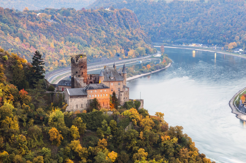
Photo: tripsavvy -
The Elbe is one of Central Europe's major rivers. It begins in the northern Czech Republic's Giant Mountains and flows through much of Bohemia (the western part of the Czech Republic), Germany, and into the North Sea near Cuxhaven, 110 kilometers (68 miles) northwest of Hamburg. It has a total length of 1,094 kilometers (680 mi) and it is one of the longest rivers of the country. The rivers Vltava, Saale, Havel, Mulde, Schwarze Elster, and Ohe are among the Elbe's significant tributaries.
The Elbe river basin, which includes the Elbe and its tributaries, covers 148,268 square kilometers (57,247 square miles), making it Europe's eleventh largest. The basin encompasses four nations, but it is almost fully contained inside two of them: Germany (65.5%) and the Czech Republic (33.7%), which account for about two-thirds of the state's total area. The basin also spreads to Austria (0.6 percent) and Poland on the outskirts (0.2 percent ). The Elbe catchment region has a population of 24.4 million people, with Berlin, Hamburg, Prague, Dresden, and Leipzig as the largest cities.
The majority of the Elbe River has mostly remained untouched by humanity, with lush landscapes, wetlands, and woodlands. The Elbe River runs through the Middle Elbe Biosphere Reserve. Many wildlife species, such as red and black kites, cranes, and storks, thrive here.
Length: 1165 km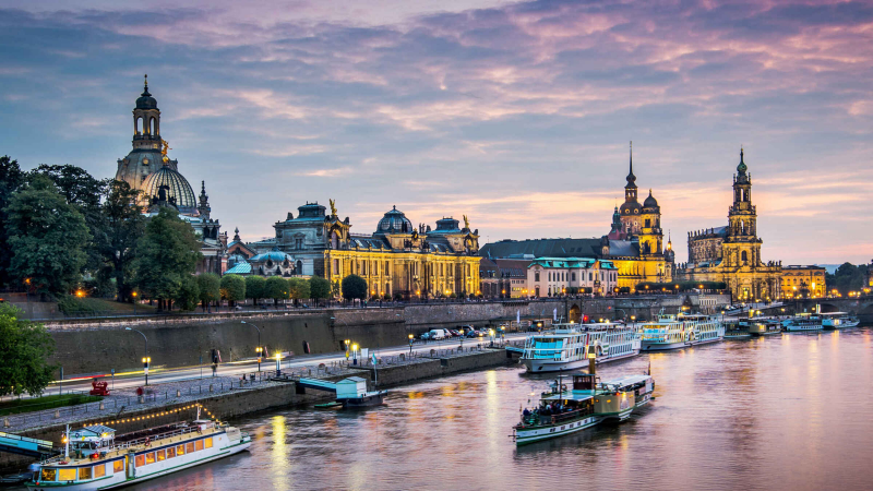
Photo: getyourguide 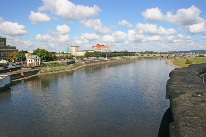
Photo: trip -
The Oder is a river that flows through Central Europe. The Oder begins in the Czech Republic and flows through western Poland for 742 kilometers (461 miles), eventually forming part of the Oder–Neisse line, which runs 187 kilometers (116 miles) between Poland and Germany. The river eventually empties into the Szczecin Lagoon north of Szczecin, where it splits into three branches (the Dziwna, Wina, and Peene) that discharge into the Baltic Sea's Bay of Pomerania. Following WWII, the Oder became Germany's far eastern boundary.
The Oder is navigable for a substantial portion of its course, all the way upstream to the town of Kole, where it meets the Gliwice Canal. The river's upstream section has been canalized, allowing larger barges (up to CEMT Class IV) to transit between the Wrocaw area's industrial enterprises.
The river is free-flowing farther downstream, passing through Eisenhüttenstadt and Frankfurt am Oder (where the Oder–Spree Canal connects the river to the Spree in Berlin). For smaller vessels, the river Warta forms a navigable connection between Pozna and Bydgoszcz downstream of Frankfurt. The Oder–Havel Canal re-joins the Berlin waterways in Hohensaaten.Length: 854 km
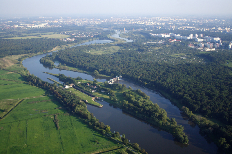
Photo: wikipedia 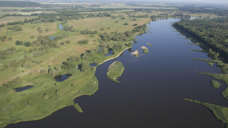
Photo: igb-berlin.de -
The Moselle is a river that originates in the Vosges mountains and flows through northern France, Luxembourg, and Western Germany. It is a Rhine tributary on the left bank, joining the Rhine at Koblenz. Its basin encompasses a small portion of Belgium, including the Sauer and the Our rivers.
The Moselle River today flows through a landscape of castles, ruins, and vineyards. Visitors can cycle and run alongside the rushing stream, as well as indulge in water activities such as canoeing, in this attractive setting. The Moselle River valley is regarded as one of Germany's most beautiful. The Moselle River valley is covered in vineyards and Rieslings (a white wine variety), charming villages, castles, and lush scenery.Length: 545 km
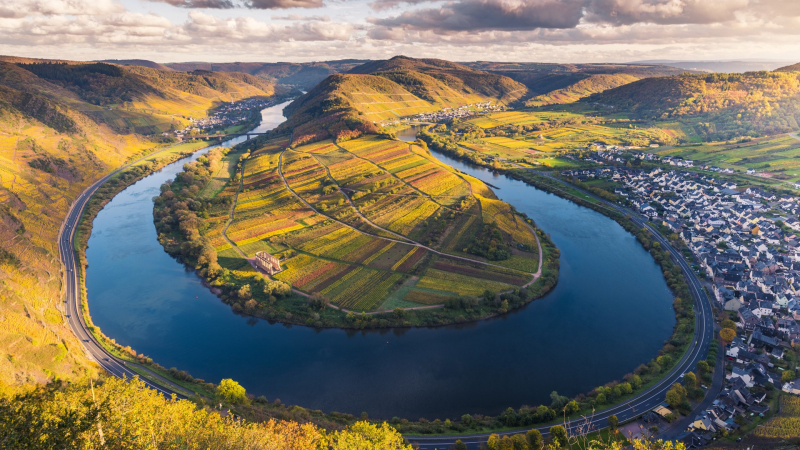
Photo: windows10spotlight 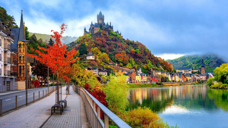
Photo: planetofhotels -
The Main River is Germany's longest river that never flows into another country. The Main River is 326 miles long, commencing in the Fichtel Mountains of northern Bavaria as the White Main River. It runs west through central Germany, eventually meeting the Rhine River just below Rüsselsheim am Main. With medieval villages, old castles, and lovely cottages bordering the riverbanks, the landscape along the river embodies much of Germany's history and culture. Frankfurt am Main, Offenbach am Main, and Würzburg are the three major cities on the Main.
There are several big inland ports in the Frankfurt area. Because many of the upper portions of the river are somewhat narrow, navigation with larger vessels and push convoys needs a great deal of skill. The river has grown in prominence as a key component of European "Corridor VII," the inland waterway that connects the North Sea and the Black Sea.
Length: 524.9 km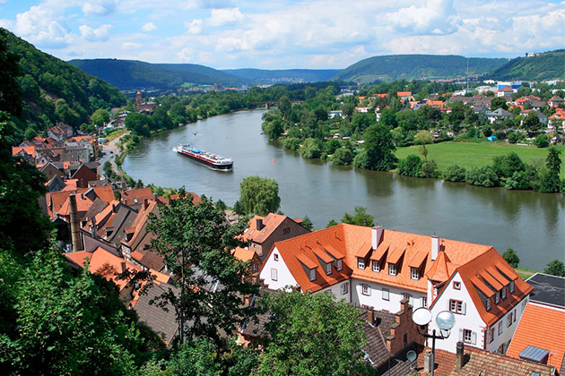
Photo: cruisecritic 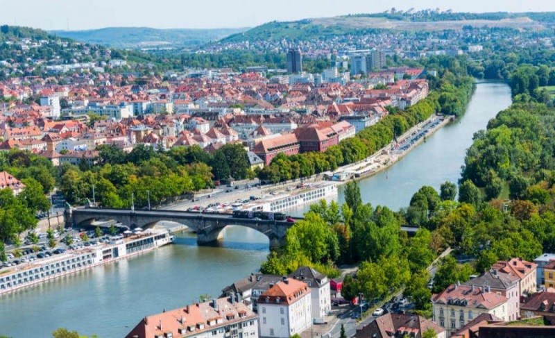
Photo: rivieratravel -
The Inn River begins in the Swiss Alps and runs for 317 km. It flows across western Austria and southern Germany to the northeast. Through the state of Bavaria, the Inn enters Germany. The Inn River runs along Bavaria's border and finally drains into the Danube, establishing the German-Austrian boundary. The top of Piz Bernina, at 4,049 meters, is the highest point in its drainage basin (13,284 ft). The Engadine, or En Valley, is the only Swiss valley with water that flows into the Black Sea (via the Danube).
The Inn in Passau discharged 6,820 m3/s (241,000 cu ft/s) on June 3, 2013, and the water levels reached 12.85 m (42.2 ft), the greatest historic flood level since 1501. The historic center of Passau, at the confluence of the Danube, Inn, and Ilz, was seriously flooded. On the Inn, there are currently 24 hydroelectric power units. Verbund AG is in charge of 17 of them.
Length: 518.5 km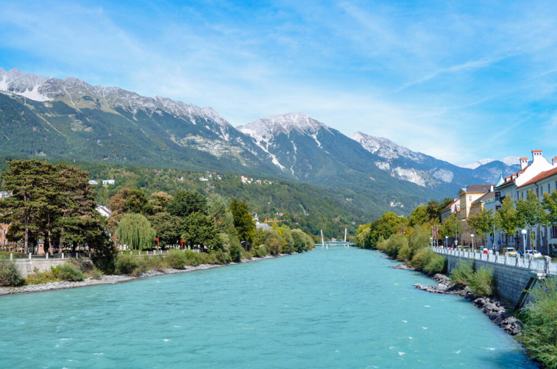
Photo: barrett 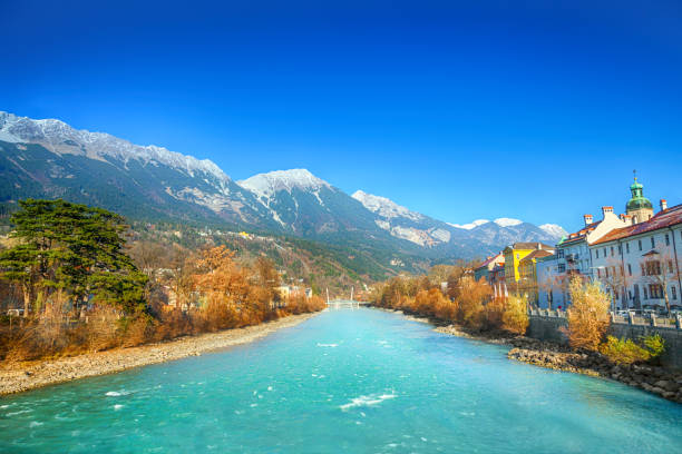
Photo: istock -
The Weser is a river in Lower Saxony, Germany's northwestern state. It starts at Hannoversch Münden and runs through the Werra and Fulda confluence. It runs through Bremen, a Hanseatic city. Its mouth is 50 kilometers (31 miles) north of the Bremerhaven and Nordenham ports. On the Butjadingen Peninsula, the latter is located. It eventually joins with the North Sea via two estuarine outlets that are severely saline. It connects to the east-west canal network that runs over the North German Plain.
Humans have largely canalised the river between Minden and the North Sea, up to a limit of 1,200-ton ships. At the confluence of eight weir streams that make up the river, there are eight hydroelectric dams. The Coastal Canal connects the navigation to the Dortmund–Ems Canal in the west. It is connected to the Elbe in the east at Bremerhaven.
The Edersee, a large reservoir on the Eder, the Fulda's primary tributary, is utilized to provide ample water depth for shipping all year. The dam, which was erected in 1914, was bombed and badly damaged by British planes in May 1943, resulting in massive destruction and the deaths of approximately 70 people downstream. Within four months, it was reconstructed. The reservoir is a popular summer vacation spot. Electricity is generated by turbines powered by the sluices.Length: 452 km
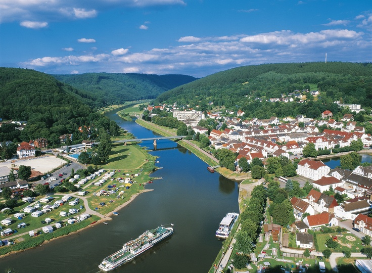
Photo: pinterest 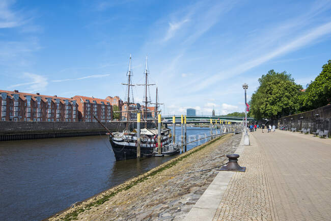
Photo: focusedcollection -
The Proto-Indo-European root séles, which meaning "marsh," is most likely the source of the Saale River's name. It's also possible that it comes from the Indo-European root sal, which means "salt." The Saale River is a 265-mile-long river that originates at an elevation of 728 meters on the slope of the Großer Waldstein mountain near Zell in the Fichtelgebirge of Upper Franconia (Bavaria) (2,388 ft). Currently, this river is in the top 10 longest rivers in Germany. It takes a tortuous route north, passing through the manufacturing town of Hof before entering Thuringia. It flows through the Thuringian Forest's well-wooded low mountains till it enters the Saalfeld valley. The Saale reaches Rudolstadt after leaving Saalfeld. Here it receives the waters of the Schwarza, in whose valley lies the ruined castle of Schwarzburg, the ancestral seat of the formerly ruling House of Schwarzburg.
The Saale is navigable from Naumburg and is planned to be connected by an unfinished canal from Leuna to the White Elster at Leipzig. The soil in the valley's lower reaches is very fertile, producing abundant sugar beet among other crops. On the right bank, the White Elster, Southern and Northern Regnitz, and Orla, while on the left, the Ilm, Unstrut, Salza, Wipper, and Bode. It has a fast upper course. Many castles cap the encircling heights in its valley, which runs all the way down to Merseburg.
Length: 413 km
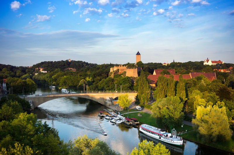
Photo: tourism.de 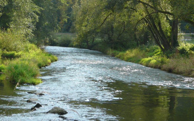
Photo: wallpaperstock -
The Spree River runs for 250 miles, starting in the Lusatian Mountains in northern Bohemia, Czech Republic, just before Neugersdorf, Germany. It flows into Germany's Elbe River before emptying into the North Sea.
The Spree River flows across Germany, and a portion of it creates the Spree Forest, or Spreewald, a marshland forested biosphere reserve. Wetlands with alder forests, sandy dry areas with pine forests, grasslands, and fields make up Spreewald. There are over 18,000 species of flora and wildlife found here.
The Spree River also serves as the site of the Badeschiff ("bathing ship"), a floating public swimming pool in Berlin. The Badeschiff first opened its doors in 2004, providing a safe swimming environment near the river. Spreeinsel, or Spree Island, is also home to the River Spree. On the island, there are five important Berlin museums and one exhibition complex. "Museum Island" is a popular nickname for this area. Museum Island is one of Berlin's most popular tourist destinations.
Length: 403 km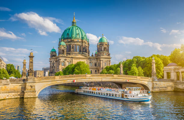
Photo: istock 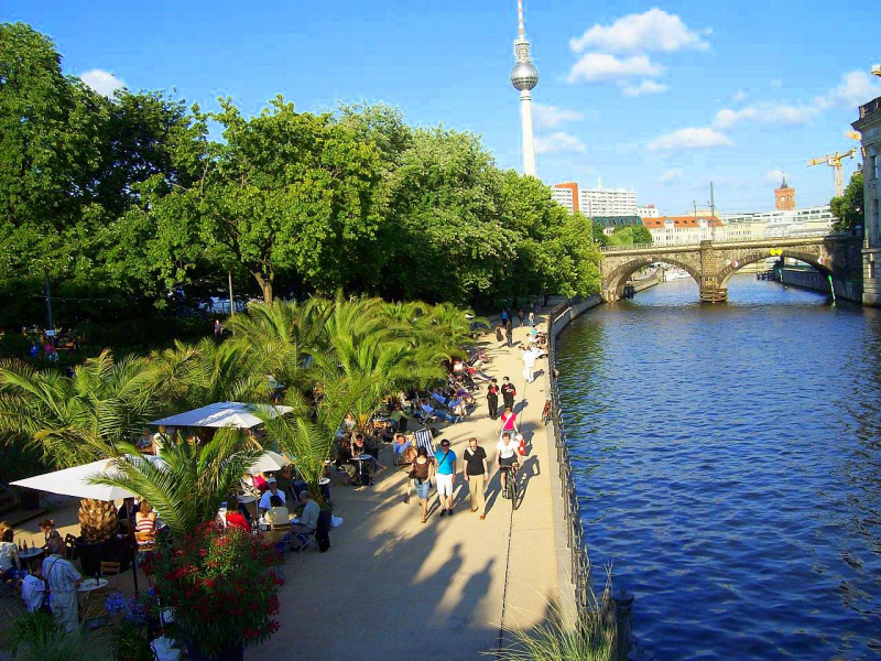
Photo: commons.wikimedia -
The Ems is a river in Germany's northwest. It flows through the states of North Rhine-Westphalia and Lower Saxony before emptying into the Wadden Sea's Dollart Bay. It is 362.4 kilometers long in total (225.2 mi). The Ems estuary serves as the state border between the Lower Saxon region of East Friesland (Germany) and the province of Groningen (Netherlands), the exact course of which was the subject of a border dispute between Germany and the Netherlands (addressed in 2014).
Biking is very popular along the Ems River, with three different long-distanced bicycle routes that run alongside and cross the river: The EmsAuenWeg, the Emsland Route, and the Hase Ems Weg.
Length: 362.4 km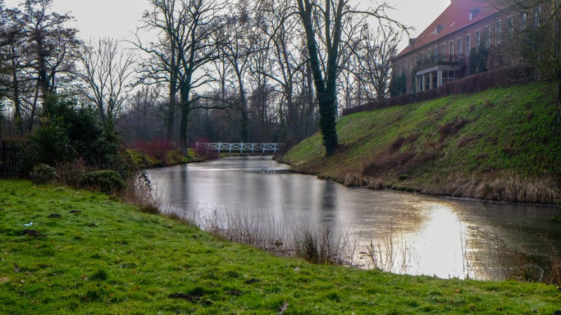
Photo: tourism.de Youtube: Talking Cruise -
The Neckar is a 362-kilometer-long (225-mile) river in Germany that flows primarily through Baden-Württemberg, with a short segment passing through Hesse. The Neckar is a prominent Rhine right tributary. It rises at 706 m (2,316 ft) above sea level in the Schwarzwald-Baar-Kreis near Schwenningen in the Schwenninger Moos conservation area, then passes through Rottweil, Rottenburg am Neckar, Kilchberg, Tübingen, Wernau, Nürtingen, Plochingen, Esslingen, Stuttgart, Ludwigsburg, Marbach, Heilbronn, and Heidelberg, before discharging 145 m3/s. Since 1968, the Neckar has been navigable for cargo ships via 27 locks for about 200 kilometres (120 mi) upstream from Mannheim to the river port of Plochingen, at the confluence with the Fils.
The Neckar valley, which runs from Plochingen to Stuttgart, is densely inhabited and strongly industrialized, with some well-known firms. The Neckar cuts a picturesque, meandering, and in many parts steep-sided valley amid fossiliferous Triassic limestones and Pleistocene travertine between Stuttgart and Lauffen. Many castles can be found in the Neckar's valley in the Odenwald hills, including Hornberg Castle and Guttenberg Castle in Haßmersheim, as well as the now-decommissioned Obrigheim Nuclear Power Plant and the operational Neckarwestheim Nuclear Power Plant.
Length: 362.4 km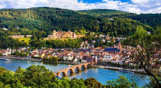
Photo: istock 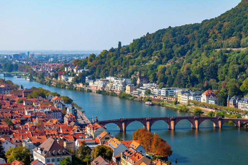
Photo: tourism.de


