Top 7 Longest Rivers in Iraq

Iraq is a Middle Eastern country with a land area of 169,234 square miles. The desert covers the majority of Iraq's area. The Euphrates and Tigris, however, ... read more...are two important rivers that are vital to Iraq. In addition to the two rivers, the country is crossed by other rivers like as the Diyala, Little Zab, and Great Zab.
-
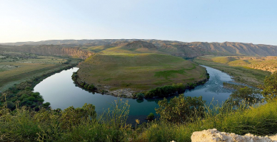
The Euphrates is one of Western Asia's and the Middle East's two most important rivers. With a length of 1,740 miles, it is the region's longest river (2,800 kilometers). The river rises in the Armenian Highlands of Turkey at the confluence of the Kara Su (Western Euphrates) and Murat Su (Eastern Euphrates). It flows through Syria's Taurus Mountains and into Iraq, where it meets the Tigris River to form the Shatt Al-Arab River, which drains into the Persian Gulf. The Euphrates basin is thought to have been inhabited since 450,000 years ago. The riverbanks were lined with ancient cities.
Some resources have been exhausted as a result of the region's long human habitation. Several native plant and animal species, however, have survived to this day. Oaks, plum trees, and pistachio trees can be found in the river's wetland sections. Wheat, oats, and rye are grown in drier areas. The river is home to a variety of fish, including the mangar and other species. The Euphrates basin has been significantly impacted by the construction of hydroelectric power plants and irrigation schemes on the river. Fish in the river have declined due to a drop in water level and the presence of chemical pollutants in the water. Efforts have been undertaken to conserve the natural resources that remain.
Length: 1,740 miles (shared with Syria and Turkey)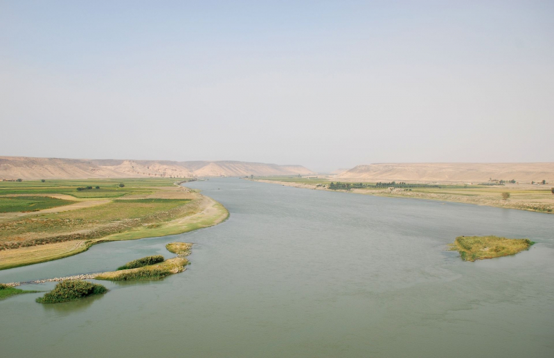
https://sco.wikipedia.org/ 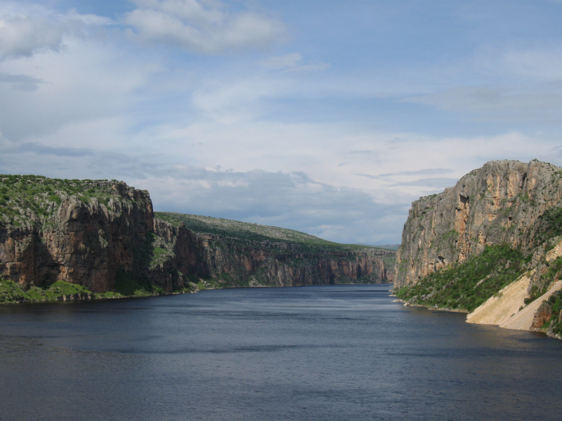
https://www.duhoctrungquoc.vn/ -
Tigris is the easternmost of Mesopotamia's two river systems, the Euphrates is the other. The river travels south from the Armenian Highlands mountains, via Syria and the Arabian Deserts, and into the Persian Gulf.
The Tigris is 1,750 kilometers long, rising in the Taurus Mountains of eastern Turkey around 25 kilometers southeast of Elazig and 30 kilometers from the Euphrates' headwaters. The river then flows through Southeastern Turkey for 400 kilometers until joining the Syria-Turkey border. The only segment of the river that runs through Syria is this 44-kilometer stretch. Garzan, Anbarçayi, Batman, and the Great and Little Zab are among its affluence.
The Tigris divides into multiple channels at its confluence with the Euphrates. The artificial Shatt al-Hayy is the first to split off, joining the Euphrates near Nasiriyah. Second, the Central Marshes are fed by the Shatt al-Muminah and Majar al-Kabir. Two further distributary waterways branch off further downstream to supply the Hawizeh Marshes. The Al-Kassarah, which drains the Hawizeh Marshes, joins the main river as it proceeds south. Finally, near al-Qurnah, the Tigris joins the Euphrates to form the Shatt-al-Arab. Pliny and other ancient historians claim that the Euphrates once had a separate outlet into the sea from the Tigris.
Length: 1,150 miles (shared with Syria and Turkey)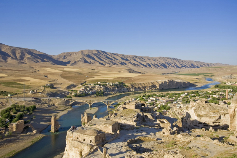
https://www.nationalgeographic.org/ 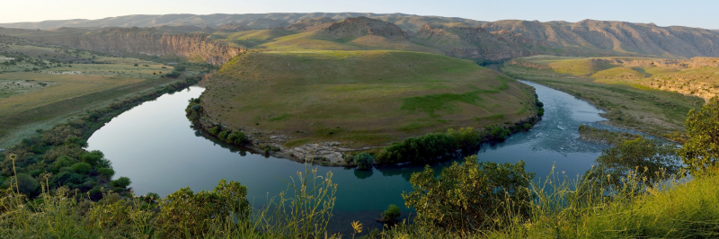
https://gody.vn/ -
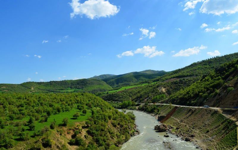
The Tigris River has a tributary, the Diyala River. Near the Sulaymaniyah Governorate of Northern Iraq, it is formed by the confluence of the Sirwan and Tanjaro rivers in Darbandikhan Dam. It has a total length of 445 kilometers.
It rises in Iran's Zagros Mountains near Hamadan. It then falls into the highlands, forming the border between the two countries for 32 kilometers. It eventually empties into the Tigris River beneath Baghdad. Because of its shallow defiles, navigation of the upper sections of the Diyala is impossible, but the river's valley serves as an important commercial route between Iran and Iraq.
Its Aramaic name is "Diyalas," and its Kurdish name is "Sirwan," which means "roaring sea" or "shouting river." The Nahrawan Canal ran along the lower channel of the river during the early Islamic period. The river Diyala is the name of the governorate in Iraq.
The Diyala River produced a form of pottery known as 'Scarlet Ware,' a brilliantly colored ceramic with graphical motifs. It was created approximately 2800 BC, and it is related to the Jemdet Nasr ware from central Mesopotamia at the time. Haematite paint was mostly used to obtain the red color. The Early Dynastic I and II periods are represented by scarlet ware. One of the most major trade routes connecting south Mesopotamia and the Iranian plateau runs through the Diyala. Scarlet porcelain was also popular in Luristan's Pusht-i Kuh, and it was traded to Susa under the reign of Susa II.
Length: 277 miles (shared with Iran)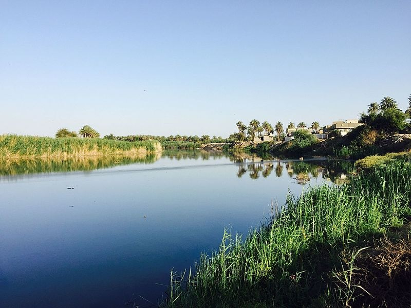
https://commons.wikimedia.org/ 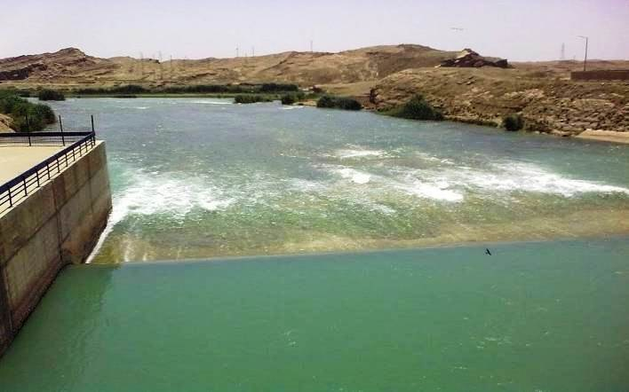
https://shafaq.com/ -
Lower Zab, also known as the Little Zab, is an Iranian river that flows into the Tigris just south of Al Zab in Iraq's Kurdistan region. It stretches for around 400 kilometers and drains a total area of nearly 22,000 square kilometers. Rainfall and snowmelt feed the river, resulting in a peak discharge in the spring and low water in the summer and early fall. On the Little Zab, two dams have been built to control river flow, provide irrigation water, and generate hydroelectricity. The Zagros Mountains have been inhabited since the Lower Palaeolithic, while Barda Balka, the earliest archaeological site in the Little Zab basin, dates from the Middle Palaeolithic. Since then, the human occupation of the Little Zab basin has been documented at various times.
At an elevation of around 3,000 meters, the Little Zab rises in Iran's Zagros Mountains. The orientation of the major mountain systems that make up the Zagros determines the flow of the Little Zab in its higher reaches. As a result, the river travels through basins that are primarily lined along a northwest-southeast axis, parallel to the major mountain chains of the Zagros, before abruptly changing course where it cuts through these chains in tiny gorges. The Baneh River and the Qala Chulan are the two biggest tributaries that join the Little Zab upstream from Dukan.Length: 249 miles (shared with Iran)
https://mapcarta.com/ 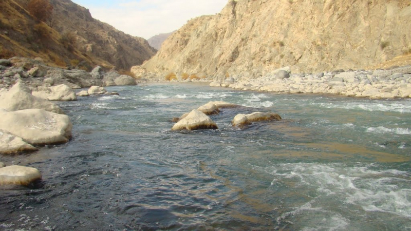
https://mapio.net/ -
Great Zab, also known as Upper Zab, is a 400-kilometer-long river that runs between Turkey and Iraq. It begins in Turkey at Lake Van and flows into Iraq south of Mosul, where it joins the Tigris. The Great Zab's drainage basin comprises around 40,300 square kilometers, and the rivers absorb water from various tributaries along the way. Rainfall and snowmelt are the primary sources of water for the river and its tributaries, which causes discharge to vary greatly throughout the year. On the Great Zab and its tributaries, at least six dams have been proposed, but only one, the Bekhme Dam, has begun construction but was halted following the Gulf War.
The Zagros Mountains have been inhabited since the Lower Palaeolithic, and the archaeological site of Shanidar Cave contains evidence of Neanderthal settlement of the Great Zab basin. From the end of the third millennium BCE onward, historical documents for the region are known. The Great Zab provided water for irrigation for the area surrounding Nimrud's capital city during the Neo-Assyrian period. Near a tributary of the Great Zab, the Battle of the Zab ended the Umayyad Caliphate, and the river's valleys provided refuge for refugees fleeing the Mongol conquest of Iraq. During the 19th and 20th centuries, local Kurdish groups seeking autonomy staged several uprisings in the Great Zab basin.
Length: 249 miles (shared with Turkey)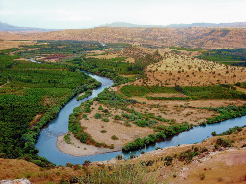
https://en.wikipedia.org/ The Great Zab River -
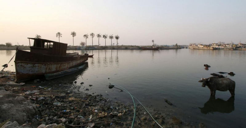
Shatt al-Arab is a 200-kilometer-long river that originates at the junction of the Euphrates and Tigris rivers in the Basra Governorate of southern Iraq's town of al-Qurnah. The river's southern end forms the Iran – Iraq border all the way to its mouth, where it empties into the Persian Gulf. The breadth of the Shatt al-Arab varies from 232 meters in Basra to 800 meters at its mouth. The waterway is assumed to have formed very recently in geological time, as the Tigris and Euphrates used to drain into the Persian Gulf via a passage further to the west. The Karun, a tributary that joins the waterway from the Iranian side, dumps a lot of sediment into the river, requiring constant dredging to keep it navigable.
The area used to be home to the world's largest date palm forest. The region had 17–18 million date palms in the mid-1970s, accounting for around one-fifth of the world's 90 million palm trees. By 2002, however, more than 14 million palms had been killed out by a combination of conflict, salt, and pests; this number includes around 9 million palms in Iraq and 5 million in Iran. Many of the 3 – 4 million trees that remain are in terrible condition.Length: 124 miles (shared with Iran)
https://www.al-monitor.com/ 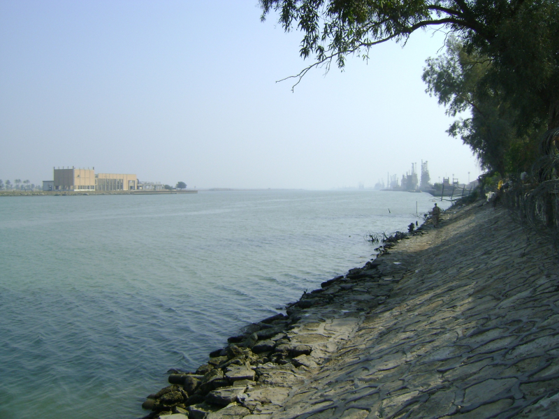
https://en.wikipedia.org/ -
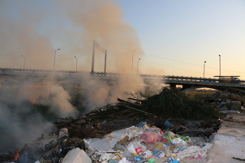
The Khasa River is a winter-fed river that flows through the northern Iraqi city of Kirkuk. It dries up completely in the summer, but in the winter, it transforms into a furious river that can overflow its banks, as it did in the 1950s. For the residents of the city, the river has a symbolic meaning.
The history of Kirkuk is represented by the Khasa River. The original goal of constructing a dam was to store water in the dam and allow water to flow into the mentioned river in Kirkuk during droughts. However, as you can see, it has devolved into a dump. It used to be a rushing river. It is now a landfill and a parking lot. The water in the seasonal river, a tributary of the Tigris River, is stagnant and full of trash, creating an environmental concern and a threat to the area's natural habitat.Length: 118 miles
https://kirkuknow.com/ 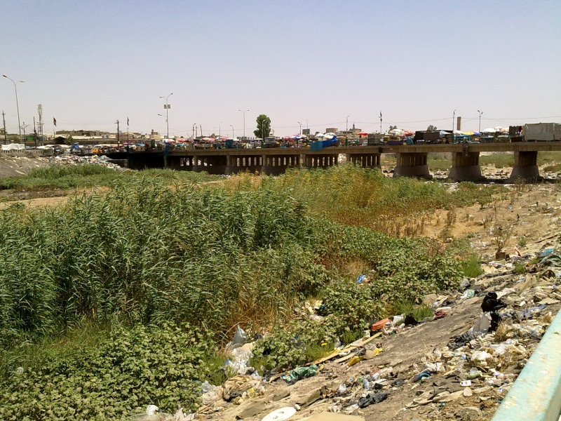
https://kirkuknow.com/