


Top 10 Longest Rivers in Turkey

The Republic of Turkey is proud to have parts of two of the most important Biblical and historical rivers running through its territory. These strong rivers ... read more...originate in Turkey's highlands to the south and east. The rivers meander through Turkish territory before entering foreign territory. In this article, we will let you know the longest rivers in Turkey.
-
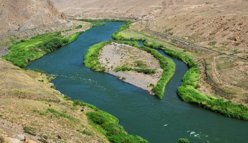
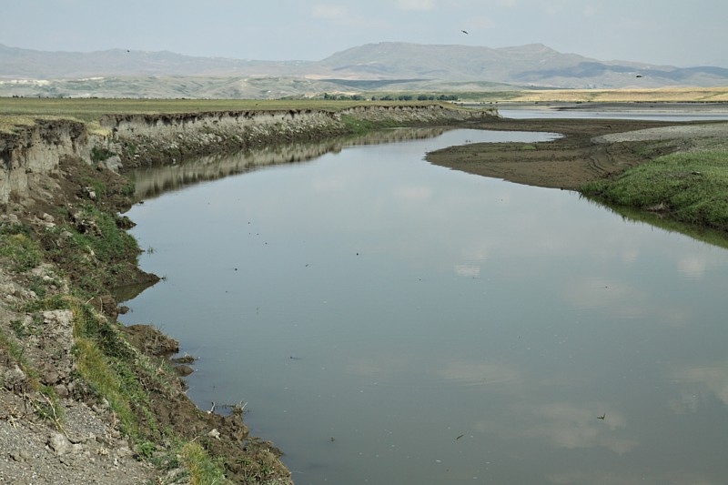
The Euphrates is known as the Firat Nehri by Turks. With a length of 1,740 miles, it is the longest in Southwest Asia. The river originates in Turkey's Armenian highlands at the confluence of the Karasu and Murat Rivers. It travels southeast to the Syrian Plateau and across Iraq, where it joins the Tigris, becoming the Shatt-Al-Arab and draining into the Persian Gulf. The river flows through xeric woods in Turkey's mountains.
Oaks, Rosaceae, and pistachio trees thrive in damp areas. Cereals such as einkorn wheat, oat, rye, and emmer wheat grow in the drier areas. To the south of the xeric forest, mixed woodland with steppe plants grows.
The Euphrates enters Iraq through a real desert where no flora grows due to severe human meddling with a natural water source. During the biblical period and the civilizations that followed along its course, the river provided irrigation water and fed the inhabitants. Overgrazing by residents has always posed a threat to the river and its ecosystem. The installation of dams and irrigation along the river's banks also alters the river's discharge regime. Furthermore, because of Turkey's high evaporation rates, reservoirs restrict the amount of river water available to the people.
Length: 1,740 miles (shared with Iraq and Syria)
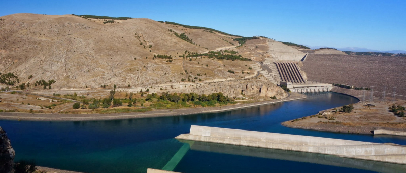
Euphrates (photo: https://www.ispionline.it/) 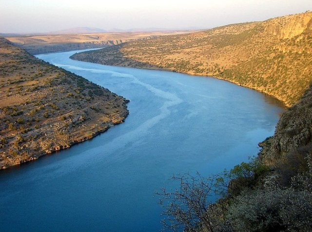
Euphrates (photo: https://www.wikidata.org/) -
The Tigris River is the second-longest river in Turkey. It originates in the Taurus Mountains, 30 kilometers east of the Euphrates River's sources. The Tigris River flows for 1,150 kilometers before joining the Euphrates and spilling into the Persian Gulf. The river travels for 400 kilometers through Turkey before establishing the border between Syria and Turkey.
For millennia, civilizations and urbanism have sprung up along the Euphrates' banks. The Sumerian civilization received water from the Tigris River's banks. Along the riverbanks, the cities of Nineveh, Seleucia, and Ctesiphon thrived. Basra's port is located on the Shatt-al-Arab. Baghdad, Iraq, is built on the river's banks.
The Tigris River also serves as a transportation route in Turkey's desert country. The river was utilized to supply General Townsend's Army right before the Ottoman Empire fell in World War I. Dams have been built on both the Iraqi and Turkish sides of the river. The dams provide water for irrigation systems in the two countries' arid and semi-arid regions. The dams manage flooding in Iraq, particularly during April, when the snow in the Turkish highlands melts.
Length: 1,150 miles (shared with Iraq and Syria)
Tigris (photo: https://www.wikidata.org/) 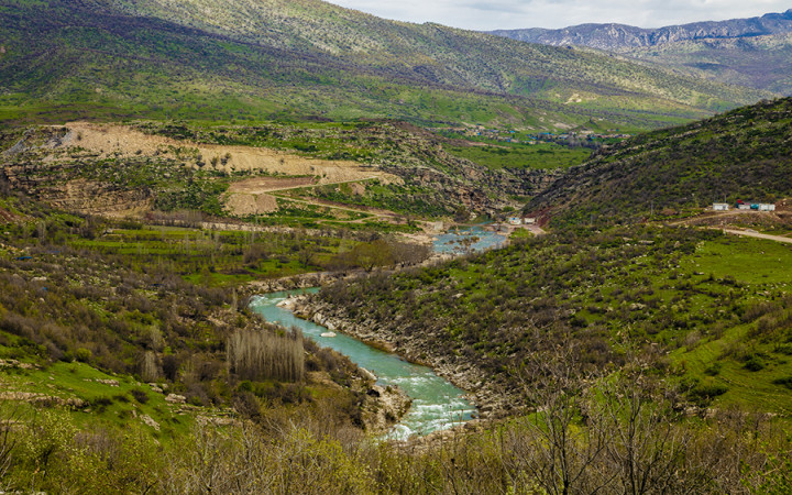
Tigris (photo: https://wonderopolis.org/) -
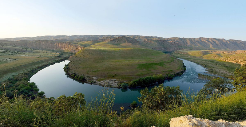
The Kura River, also known as the Kurucay in Turkish, is the largest in Transcaucasia. It is also the third-longest river in Turkey. River Kura rises on the slopes of Mount Kisirindagi in Eastern Turkey and travels to Georgia and Azerbaijan, where it meets its main tributary river Aras before emptying into the Caspian Sea. The Rivers run for a total of 941 miles. The arid areas of the River Kura are characterized by steppe vegetation, while the alpine areas are dominated by meadows. The cover is limited due to the course's location in the desert woods. Kura's waters are dominated by approximately 60 kinds of loach, bleak, trout, and several indigenous fish species.
Dams, reservoirs, and hydropower stations have been built along the Kura River's banks, as has been done with other major rivers in Asia. The Kura River has provided water for agriculture in the Kura Valley for thousands of years. Natural calamities and foreign invasions have destroyed large civilizations that sprang up on the banks of the Kura. Throughout the twentieth century, human activities harmed the watershed woods and grassland, contributing to severe floods in the Kura River's lower reaches.
Length: 941 miles (shared with Azerbaijan and Georgia)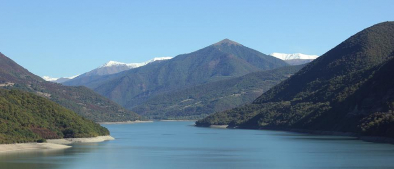
Kura (photo: https://kura-river.org/) 
Kura (photo: https://mapcarta.com/) -
The Kizilirmak is Turkey's fourth longest river, running wholly within its borders. The "Red River," Kizilirmak in Turkish, begins in Eastern Anatolia and flows for 842 kilometers west and southwest, then northeast past Lake Tuz, then north and back to the northeast to meet the Delice River. From there, it flows northwest to meet the Devrez River before returning to the northeast to join the Gökrmak. It runs into the Black Sea as a lovely delta from here.
The Boyabat, Derbent, and Altnkaya dams were built along Kizilirmak's banks. Before 585 BC, the river defined the western limit of Hatti, the capital of the Hittite Empire. It also served as a border between Asia and Asia Minor, as well as between Paphlogania and Pontos. During the Battle of Halys on May 28, 585 BC, it divided Lydia from Media. In some parts, the river is now used to grow rice or to support water buffalo husbandry. The river is not navigable, but it serves as a source of hydroelectric power.
Length: 842 miles
Kizilirmak (Halys) (photo: sedat yıldız) 
Kizilirmak (Halys) (photo: https://commons.wikimedia.org/) -
The Aras River is a Caucasus river. It begins in eastern Turkey and travels along the boundaries of Turkey and Armenia, Turkey and the Azerbaijani exclave of Nakhchivan, Iran and both Azerbaijan and Armenia, and eventually through Azerbaijan to the Kura River. It drains the south side of the Lesser Caucasus Mountains, whereas the Kura drains the north side. The river's overall length is 1,072 kilometers (666 miles), and its watershed area is 102,000 square kilometers (39,000 square miles). The Aras is the fifth-longest river in Turkey.
The Aras became significant as a geographic political barrier in modern history. The river was designated as the border between the Russian Empire and Qajar Iran under the conditions of the Treaty of Gulistan and the Treaty of Turkmenchay, as the latter was obliged to yield its Caucasian lands to Russia. Because of these 19th-century border revisions, one current, but not widely recognized, the system designates the Aras River as the continental dividing line between Europe and Asia.
Length: 666 miles (shared with Armenia, Azerbaijan, and Iran)
Aras (photo: https://www.tehrantimes.com/) 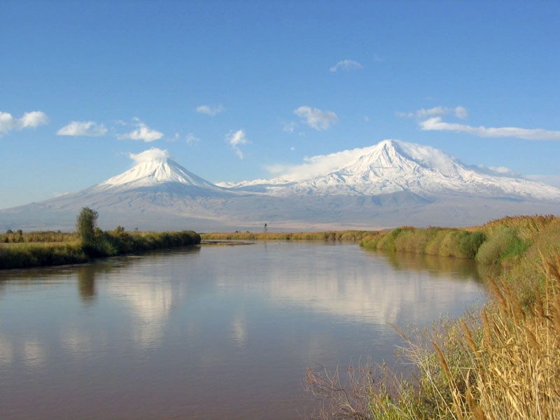
Aras (photo: https://araratour.com/) -
The Sakarya is Turkey's sixth-longest river. The river's overall length is 512 miles. It passes through Phrygia, a location known in antiquity as Phrygia. In classical antiquity, it was regarded as one of the major rivers of Asia Minor (Anatolia), and it is mentioned in the Iliad and Theogony.
The river's source is the Bayat Yaylası, which is located northeast of Afyon. The river is joined by the Porsuk Çayı (Porsuk Creek) near the town of Polatlı and runs through the Adapazarı Ovası (Adapazar Plains) before reaching the Black Sea. The Sakarya has four dams from downstream to upstream: Akçay, Yenice, Gökçekaya, and Saryar.
The Sakarya Valley was part of the border between the Byzantine Empire and the home of the Söğüt tribe in the 13th century. By 1280, Byzantine Emperor Michael VIII had built a series of fortifications along the river to dominate the area, but a flood in 1302 shifted the channel of the river, rendering the walls ineffective. The Söğüt tribe crossed the river and went on to form the Ottoman Empire.
Length: 512 miles
Sakarya (photo: https://www.alaturka.info/) 
Sakarya (photo: https://en.wikipedia.org/) -
The seventh longest river in Turkey is Murat. It is commonly known as the Eastern Euphrates, which is an important tributary of the Euphrates. The river was also known as Arsanias by the Ancient Greeks and Romans.
It begins at Mount Ararat, north of Lake Van in Eastern Turkey, and runs westward for 722 kilometers (449 miles) across mountainous terrain. Before the construction of the Keban Dam, the Murat River joined the Karasu River, also known as the Western Euphrates, 10 kilometers (6.2 miles) north of the dam site and 13 kilometers (8.1 miles) north of Keban.
The Alpaslan-1 Dam, completed in 2009, cuts the river in Muş Province. The Alpaslan-2 Dam, located downstream of Alpaslan-1, was finished in 2021. The Murat River flows into the reservoir of the Keban Dam, Turkey's largest dam at the time, which was built in 1974 and supplies electrical power.
Length: 449 miles
Murat (photo: https://www.pbase.com/) 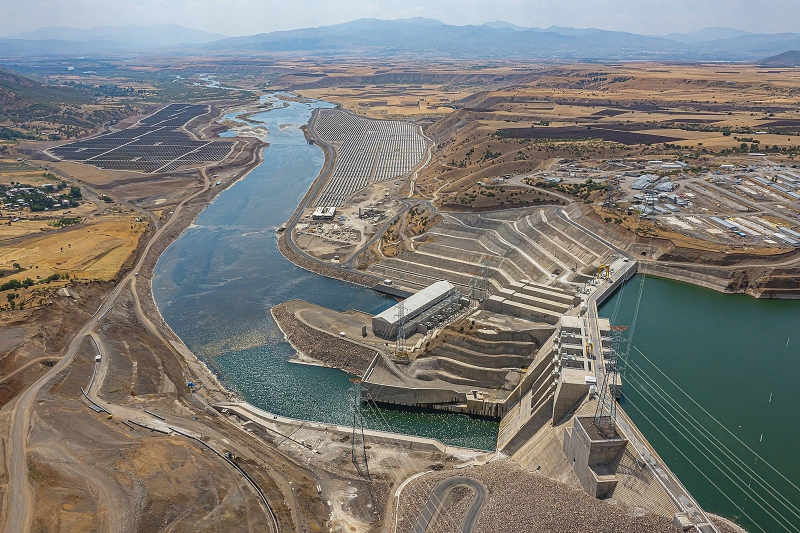
Murat (photo: https://www.dailysabah.com/) -
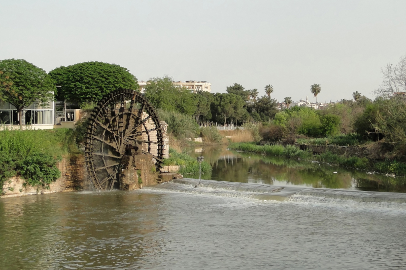
The Orontes, or Asi, is a 571 km (355 miles) long river in Western Asia that begins in Lebanon and flows north through Syria before entering the Mediterranean Sea near Samanda in Turkey. It is known as the eighth-longest river in Turkey.
The Orontes, as the main river of the northern Levant, was the site of several great wars. Homs, Hama, Jisr al-Shughur, and Antakya are among the most important cities on the river (the ancient Antioch, which was also known as "Antioch on the Orontes").
The river is claimed to have been named after Orontes, an Indian military chief who committed suicide and plunged into the river after losing single combat to Dionysus in the Greek epic poem Dionysiaca (approximately 400 CE). According to the Greek geographer Strabo (in Geographica, circa 20 CE), the river was originally named Typhon because Zeus was said to have struck the dragon Typhon down from the sky with thunder, and the river formed where Typhon's body had fallen; however, the river was later renamed Orontes after a man named Orontes built a bridge on it.
Length: 355 miles (shared with Syria and Lebanon)
Orontes (photo: https://en.wikipedia.org/) 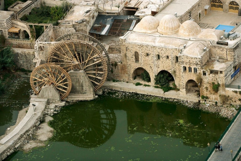
Orontes (photo: Jeh (J. E.) Bruce) -
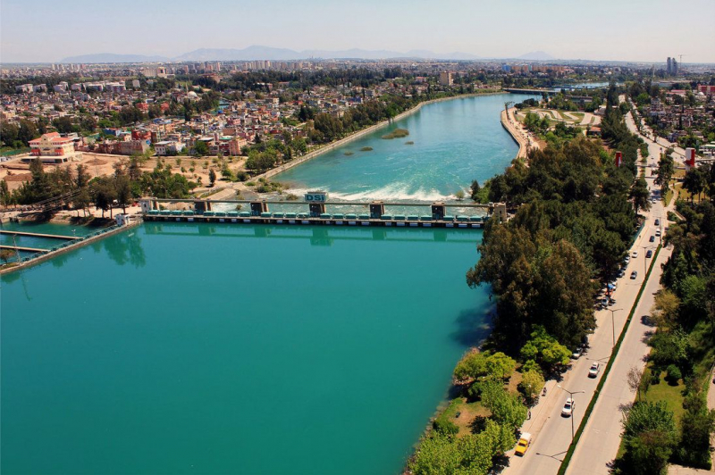
The Seyhan River is Turkey's ninth-longest river that runs into the Mediterranean Sea. The river is 560 kilometers long and flows southwest from its sources in the Tahtal-Mountains (in the provinces of Sivas and Kayseri) in the Anti-Taurus Mountains to the Mediterranean Sea via a large delta.
Its sources were said to be in Cataonia's Taurus Mountains. It ran through Cappadocia near Comana, then through Cilicia. The Seyhan River flows through Adana, the river's lone settlement, 50 kilometers from its mouth. Adana's river is crossed by several bridges and footbridges, notably the Stone Bridge, a 2nd-century Roman bridge. The ancient city of Augusta was also located on the river, which corresponds to the east side of the Çatalan reservoir today. At Cape Deli, the river meets the Mediterranean Sea.
The massive Seyhan Dam, located upstream of Adana, is used for irrigation, hydroelectric power generation, and flood control. Other dams on the Seyhan River that serve the same purpose are Yedigöze, Çatalan, and Kavşak Bendi. The river is currently being developed extensively for hydroelectric generation and irrigation.
Length: 348 miles
Seyhan (photo: jenna-rose.deviantart.com) 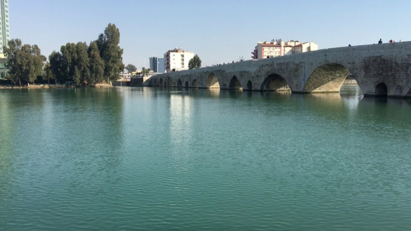
Seyhan (photo: Youtube) -
The Buyuk Menderes River is the tenth-longest river located in southern Turkey. It begins in west-central Turkey at Dinar and flows west through the Buyuk Menderes graben till it reaches the Aegean Sea near the ancient Ionian city Miletus. The term "meander" refers to a winding pattern named after the river.
The Buyuk Menderes was a well-known river in Asia Minor. It first appears in Homer's Iliad in the Catalog of Trojans, alongside Miletus and Mycale.
The Buyuk Menderes is a deep but narrow river. In several places, its depth equals its breadth, making it only accessible by small ships. It frequently overflows its banks, and as a result of the amount of mud it deposits at its mouth, the coast has been pushed around 20 or 30 stadia further into the sea, and numerous small islands off the coast have joined the mainland.
Length: 341 miles
Buyuk Menderes (photo: Jalag / Bossemeyer, Klaus) 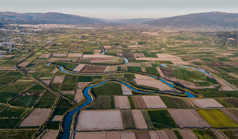
Buyuk Menderes (photo: https://www.suyunyolculugu.org.tr/)


