


Top 10 Longest Rivers in Ireland

Ireland, Europe's "emerald" is a destination that attracts many tourists today. Ireland has the ingress of countless rivers into different seas such as the ... read more...Irish Sea, the Celtic Sea and the Atlantic Ocean. The longest rivers in Ireland all have different attractive features.
-
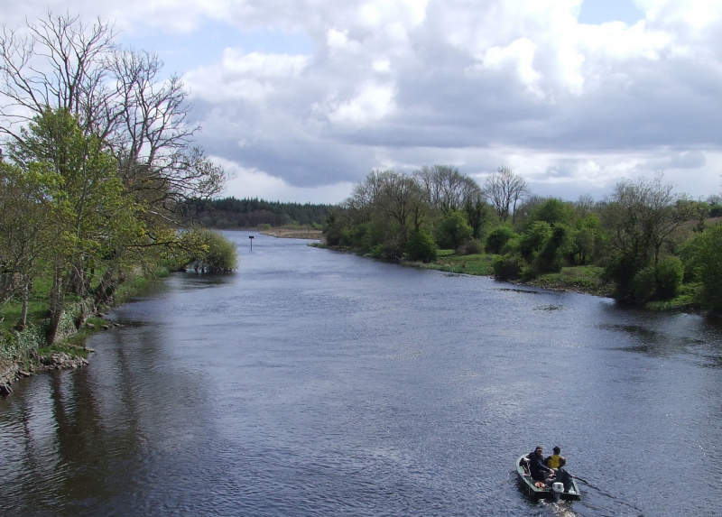
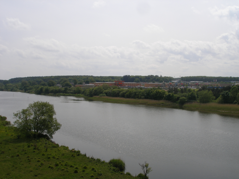
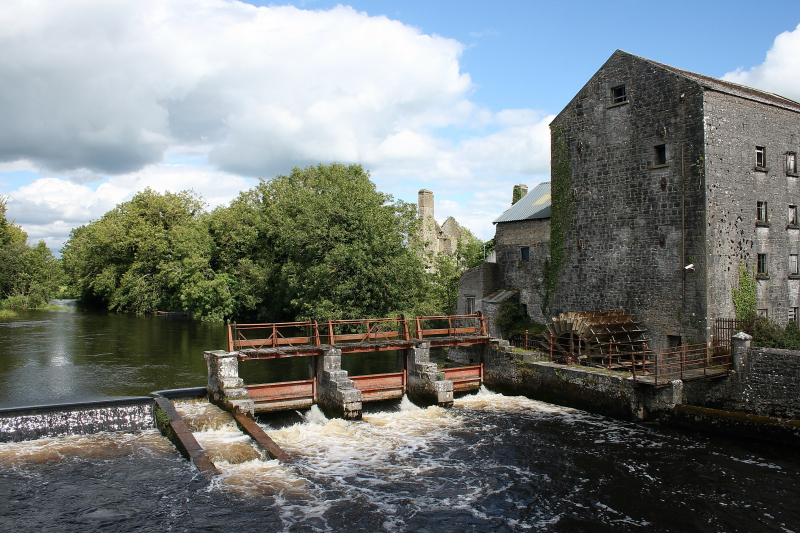
The River Shannon (Irish: Abhainn na Sionainne, an tSionainn, an tSionna) is the longest river in the British Isles, measuring 360.5 kilometers (224 miles). It drains the Shannon River Basin, which covers 16,865 km2 (6,512 sq mi) and accounts for one-fifth of the island's total area.
The River Shannon separates the west (mostly the province of Connacht) from the east and south of Ireland (Leinster and most of Munster). (The exception is County Clare, which is west of the Shannon yet falls within the Munster province.) With fewer than thirty-five crossing sites between Limerick city in the south and the town of Dowra in the north, the river serves as a major physical barrier between east and west.
The Shannon has long been regarded as a major river, and it first appears on maps by the Graeco-Egyptian geographer Ptolemy (c. 100 – c. 170 AD). The river runs south from the Shannon Pot in County Cavan before turning west and flowing into the Atlantic Ocean through the Shannon Estuary, which is 102.1 km (63.4 mi) long. Limerick is located at the confluence of the river and the estuary's sea water. The Shannon is tidal east of Limerick up to the Ardnacrusha dam's base. It is considered one of the longest rivers in Ireland.
Length: 360.5 km
https://en.wikipedia.org/wiki/River_Shannon 
https://en.wikipedia.org/wiki/River_Shannon -
In Ireland, there is River Barrow (Irish: An Bhear). It is one of The Three Sisters, with the River Suir and the River Nore being the other two. The Barrow is the longest of the three rivers, with a length of 192 kilometers (120 miles), making it Ireland's second-largest river after the Shannon.
The River Barrow has a catchment area of 3,067 km2 before the River Nore joins it a little over 20 kilometers before its mouth. Before being joined by River Nore, the river's long-term average flow rate was 37.4 cubic metres per second. It has a catchment area of almost 5,500 km2 and a discharge of around 80 m3/s when it merges with the River Suir.
Glenbarrow, in the Slieve Bloom Mountains of County Laois, is the source of the River Barrow. Portarlington, Monasterevin, Athy, Carlow/Graiguecullen, Muine Bheag (Bagenalstown), Goresbridge, Graiguenamanagh, and New Ross are among the places that the River Barrow flows through on its route to the sea beyond Waterford. The river creates a natural boundary between counties Kilkenny and Waterford on the right bank and Carlow and Wexford on the left bank. It is considered one of the longest rivers in Ireland.
Length: 192 km
https://en.wikipedia.org/wiki/River_Barrow 
https://en.wikipedia.org/wiki/River_Barrow -
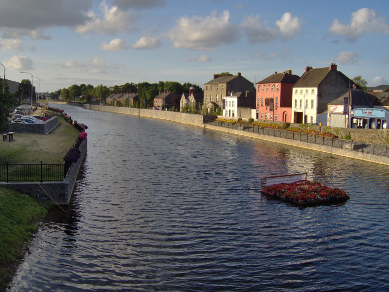
The River Suir is an Irish river that drains into the Atlantic Ocean after a 185-kilometer journey through Waterford (115 mi). The Suir has a catchment area of 3,610 km2. It has a long-term average flow rate of 76.9 cubic metres per second (m3/s), which is almost double the flow of either the River Barrow (37.4 m3/s) or the River Nore (42.9 m3/s) before they connect, but somewhat less than the Barrow's flow when it reaches the Suir 20 km downstream (nearly 80 m3/s).
The River Suir is spelled Sir in Irish, and the current English form with the u and I reversed is regarded to be a mistake. As a result, some individuals believe that the English spelling should be Siur, and this spelling is occasionally observed. It is considered one of the longest rivers in Ireland.
In his writings during the Elizabethan time while residing in County Cork, Edmund Spenser (1552–1599), author of The Fairie Queene, refers to the "gentle Shure," most likely a most precise spelling and the most phonetically correct of the period. The remnants of a major Viking village were discovered near a bend in the river at Woodstown, just upstream from Waterford, in the early years of the twenty-first century.
Length: 185 km
https://en.wikipedia.org/wiki/River_Suir 
https://en.wikipedia.org/wiki/River_Suir -
The Blackwater, also known as the Munster Blackwater (Irish: An Abhainn Mhór, meaning "Big River"), is a river in Ireland that flows through the counties of Kerry, Cork, and Waterford. It springs in County Kerry's Mullaghareirk Mountains and flows eastward into County Cork, passing through Mallow and Fermoy.
It then runs through Lismore in County Waterford before abruptly turning south at Cappoquin and ultimately pouring into the Celtic Sea at Youghal Harbour. The Blackwater is 169 kilometers (105 miles) long in all. The River Blackwater has a total catchment area of 3,324 km2. The River Blackwater's long-term average flow rate is 89.1 cubic metres per second (m3/s).
The Munster Blackwater is known as one of the top salmon-fishing rivers in the United States. Salmon stocks have plummeted in recent years, as they have in many Irish and British rivers, although the Irish government outlawed commercial salmon netting off the coast of Ireland in November 2006.
On June 11, 1996, the Blackwater Estuary was included to the Ramsar List of Wetlands of International Importance. It is also a Special Protection Area (SPA) under the European Union's Birds Directive, extending from Youghal New Bridge to the peninsula of Ferry Point, at the river's outflow to the sea.
Length: 169 km
https://en.wikipedia.org/wiki/Munster_Blackwater 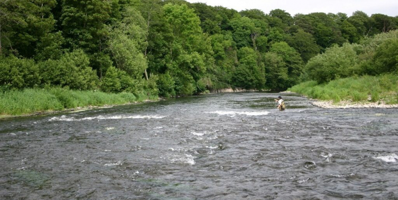
https://en.wikipedia.org/wiki/Munster_Blackwater -
The River Bann (from Irish: An Bhanna, meaning "the goddess"; Ulster-Scots: Bann Wattèr) is one of Northern Ireland's longest rivers, measuring 129 kilometers when the Upper and Lower Banns are combined (80 mi). The River Bann's overall length, including its journey through the 30 km (19 mi) large Lough Neagh, is 159 km (99 mi).
Another estimate of the River Bann's length is 90 miles. The river flows from Northern Ireland's southeast corner to the northwest coast, halting in the middle to widen into the massive Lough Neagh. The catchment area of the River Bann is 5,775 km2. The average discharge rate of the River Bann is 92 m3/s.
The River Bann's most important economic aspects are today's salmon and eel fisheries. The river is frequently utilized as a dividing line between Northern Ireland's eastern and western regions, known as the "Bann split." West of the Bann, towns, municipalities, and enterprises are frequently perceived as having less investment and government spending than those to the east.
It is also perceived as a religious, economic, and political split, with Catholics and Irish nationalists in the west and Ulster Protestants and unionists in the east; and with Greater Belfast as the financial and industrial hub to the east, and the Bann Valley as more agricultural and rural.
Length: 129 km
https://en.wikipedia.org/wiki/River_Bann 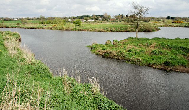
https://en.wikipedia.org/wiki/River_Bann -
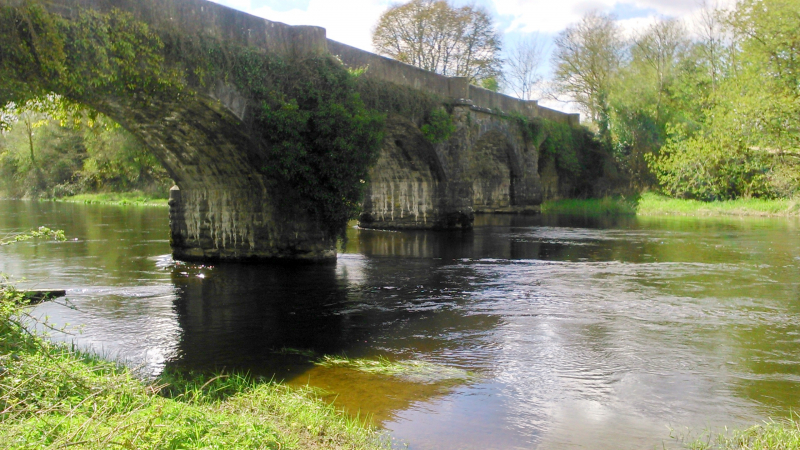
The River Nore, together with the River Suir and the River Barrow, is one of Ireland's major rivers in the south-east region. The 140-kilometer-long (87-mile) river drains 2,530 square kilometers (977 square miles) of Leinster and Munster, which includes sections of three counties (Tipperary, Laois, Kilkenny). It is one of the Three Sisters rivers, along with the River Suir and the River Barrow.
Starting in County Tipperary's Devil's Bit Mountain, the river travels southeast, then south, until meeting the River Barrow at Ringwood and the Barrow railway bridge at Drumdowney, County Kilkenny, before emptying into the Celtic Sea at Waterford Harbour, Waterford. The River Nore's long-term average flow rate is 42.9 cubic metres per second (m3/s).
The River Nore is home to the critically endangered Nore freshwater pearl mussel's only known existing population, and much of its length is designated as a Special Area of Conservation. In the townland of Borrisnoe, County Tipperary, the Nore rises on the eastern slopes of the Devil's Bit Mountain.
It produces a lovely V-shaped river valley farther south, notably near the tidal limit settlement of Inistioge. The Dinan, the Breagagh near Kilkenny City, the King's River, the Little Arrigle, and the Black Water are all major tributaries of the Nore.
Length: 140 km
https://en.wikipedia.org/wiki/River_Nore 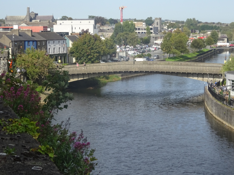
https://en.wikipedia.org/wiki/River_Nore -
The River Suck (Irish: An tSuca [n tk]) is a 133 km (82.5 mi) long river in the Shannon River Basin in Ireland. It is the River Shannon's primary tributary. It meets the Shannon about a kilometer south of Shannonbridge. The River Suck drains 1,599 square kilometers of land (617 sq mi).
River Suck flows along the western side of County Roscommon, forming part of the border between County Roscommon and County Galway. It forms the long, thin shape of southern County Roscommon when joined to the Shannon on the east. The river flows through unspoiled terrain with moorland, water meadows, and pastureland, and the water is clear and unpolluted.
Some sections move quickly, while others are languid and meandering. Bream, rudd, and tench are prevalent in some areas, while perch and pike are also frequent. In 1885, a weir was built just above the four-arch bridge to avoid flooding at Ballinasloe, with draw-doors that may be lifted when a flood is coming. It is considered one of the longest rivers in Ireland.
Length: 133 km
https://www.activeme.ie/ 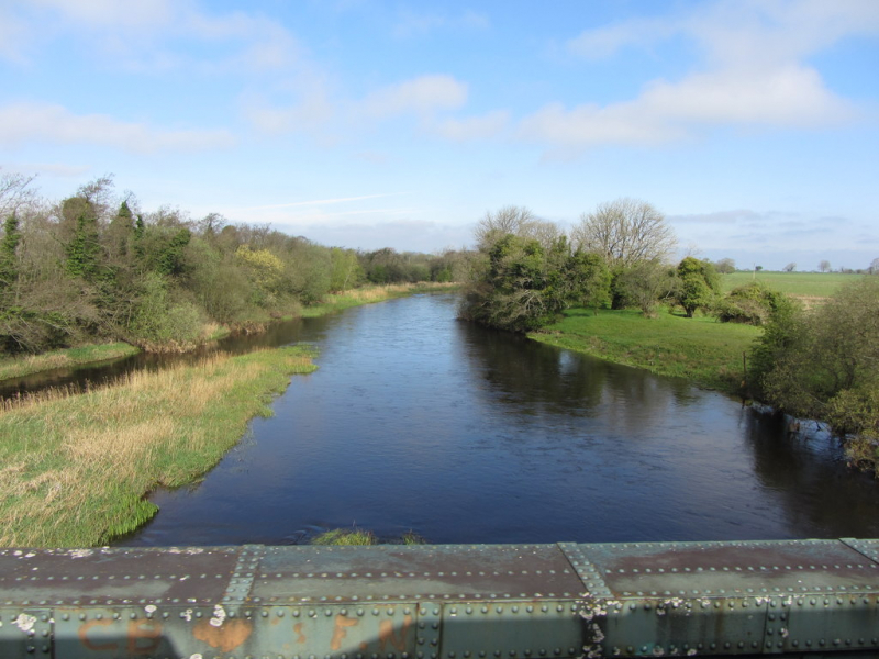
https://www.activeme.ie/ -
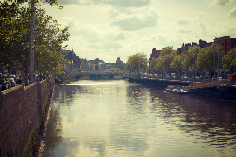
The River Liffey (Irish: An Life, previously An Ruirthe(a)ch) is a river in eastern Ireland that eventually runs through Dublin and into Dublin Bay. The River Dodder, the River Poddle, and the River Camac are among its significant tributaries.
The River Liffey provides much of Dublin's water as well as providing a variety of leisure opportunities. The River Liffey in Dublin city has been utilized for trade for centuries, from the city's Viking roots to the present day. The Grand Canal and the Royal Canal connect it to the River Shannon. In current times, there is no substantial navigation on the river itself above the East-Link bridge, although ships used to approach Dublin city centre, with important docking places all the way up to St James' Gate.
Around 60% of the Liffey's flow is diverted for drinking water and industrial use. After being purified at wastewater treatment plants, most of this finds its way back into the river. Despite the popular belief that the Guinness brewery is one of these business users, the plant uses Wicklow Mountains water. It is considered one of the longest rivers in Ireland.
Length: 132 km
https://en.wikipedia.org/wiki/River_Liffey 
https://en.wikipedia.org/wiki/River_Liffey -
The River Erne (/rn/ AIRN, Irish: Abhainn na hÉirne or An Éirne), which flows between Northern Ireland and the Republic of Ireland and forms part of their border, is the second-longest river in Ulster. The Erne begins three miles south of Cavan in County Cavan, Republic of Ireland, and runs 80 miles (129 kilometers) past Lough Gowna, Lough Oughter, and Upper and Lower Lough Erne, County Fermanagh, Northern Ireland, to the sea at Ballyshannon, County Donegal, Republic of Ireland.
The River Erne is 120 kilometers long and has a variety of fisheries along the river and its tributaries for fly fishing for trout and salmon. Between Upper and Lower Lough Erne, Enniskillen is largely situated on an island in the river. The Shannon–Erne Waterway connects it to the River Shannon. Several spots along the Erne river, including Belturbet, Knockniny, Carrybridge, Bellanaleck, Enniskillen, and Killadeas, provide live-aboard pleasure cruisers.
Sections of the Erne are utilized for water skiing, bank fishing, trolling, jet skiing, and scuba diving, in addition to live aboard boating vacations. The Northern Ireland Tourist Board warns boaters that Upper Lough Erne is a tangle of tiny islands that need cautious navigation, while Lower Lough Erne waves can reach "open-sea dimensions."
Length: 129 km
https://en.wikipedia.org/wiki/River_Erne 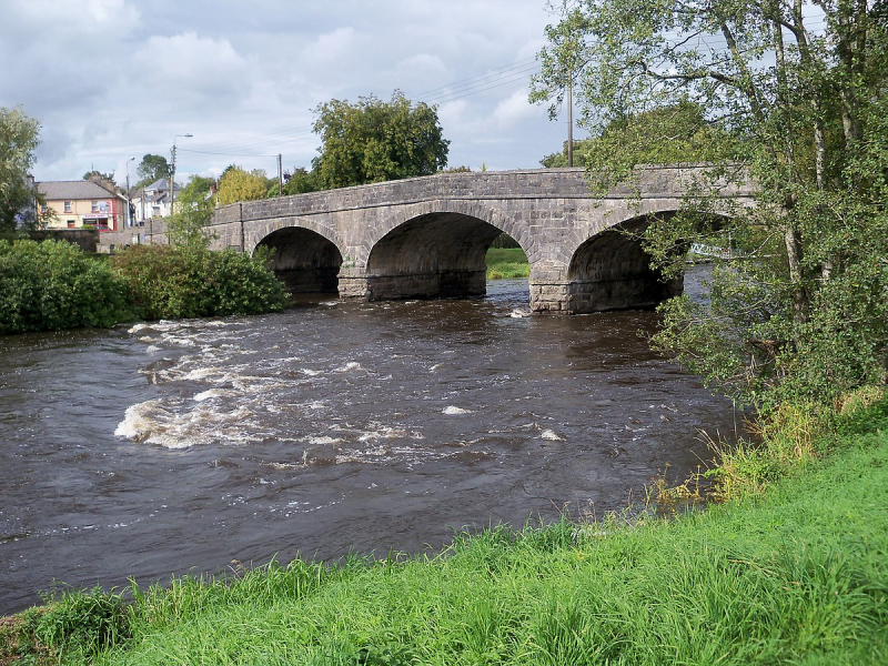
https://en.wikipedia.org/wiki/River_Erne -
The River Foyle runs from the junction of the rivers Finn and Mourne near the towns of Lifford in County Donegal, Republic of Ireland, and Strabane in County Tyrone, Northern Ireland, in west Ulster, in the northwest of the island of Ireland.
River Foyle runs from here to Derry, where it empties into Lough Foyle and, eventually, the Atlantic Ocean. The River Foyle is 129 kilometers long (80 mi). Portions of County Donegal and parts of County Londonderry and County Tyrone are separated by the river.
The Laggan is a historic name for the Donegal territory that borders the western bank of the River Foyle. The River Foyle is also Europe's fastest-flowing river relative to its size, making bridge building problematic. There are three bridges in Derry, the primary crossing point.
The oldest of the three bridges, the Craigavon Bridge, is Europe's sole road traffic double-decker bridge (occasionally referred to colloquially as the Blue Bridge). The Foyle Bridge, the city's northernmost bridge, is a considerably bigger structure that was created to handle tall ships at a period when it was anticipated that the city would need to do so.
Length: 129 km
https://en.wikipedia.org/wiki/River_Foyle 
https://en.wikipedia.org/wiki/River_Foyle


