


Top 12 Longest Rivers in Romania

Nearly halfway between the North Pole and the Equator is Romania. Plains, hills, and mountains are roughly evenly distributed across the landscape. Romania's ... read more...rivers primarily run west, east, and south from the Carpathian mountain ranges' central crown. The rivers are supplied by melting snow and rainfall, which causes their flow to fluctuate, resulting in disastrous floods on occasion. The Danube River is one of the most important waterways in the country. The Danube is Romania's most important river, not only for hydroelectric power generation, but also for transportation. Almost all of Romania's rivers are tributaries of the Danube. This is the list of 12 longest rivers of Romania which entirely or partially flow through Romania. The length represents only the part of the river that flows in Romania.
-
The Danube, also known as the Danube in other languages) is Europe's second-longest river, after the Volga, and the European Union's longest river. It's in the Central and Eastern European region.
The Danube was originally a long-standing Roman Empire border, and today it runs through more countries than any other river in the world, passing through ten of them. The Danube runs southeast from Germany for 2,860 kilometers (1,780 miles), passing through or touching the borders of Austria, Slovakia, Hungary, Croatia, Serbia, Romania, Bulgaria, Moldova, and Ukraine before emptying into the Black Sea. Its drainage basin encompasses nine other countries.Fish species such as pike, zander, huchen, Wels catfish, burbot, and tench can be found in the Danube river basin. It also supports a diverse population of carp, sturgeon, salmon, and trout. The Danube Delta and the lower stretch of the river are home to a few species of euryhaline fish, including European seabass, mullet, and eel.
Length: 1.075 km
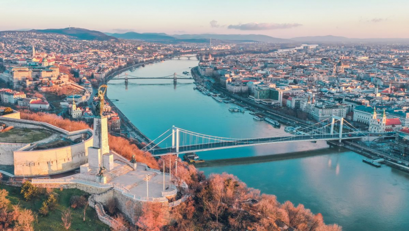
Photo: Mundycruising 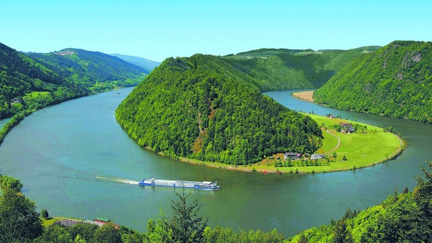
Photo: Traveller -
The Mureș is a river in Eastern Europe that runs over 789 kilometers (490 miles). Its drainage basin is 30,332 square kilometers (11,711 sq mi). It rises at the headwaters of the Olt River in Romania's Hăşmașu Mare Range, and enters the Tisza at Szeged in northeastern Hungary. The Mureș River runs through Romanian counties Harghita, Mureș, Alba, Hunedoara, Arad, and Timiș, as well as Hungary's Csongrád county. Târgu Mureș, Alba Iulia, Deva, and Arad in Romania, and Szeged in Hungary, are the largest cities on the Mureș/Maros.
In ancient times, the Mureș was known as the Marisus River. Due to Transylvanian Saxon populations and past Austrian Habsburg administration, it was also known as the Mieresch and Marosch in German. In medieval times, enormous rafts were utilized to trade salt on the river.
As far as the state border is concerned, the Hungarian reaches of the Mureș are 73 kilometers (45 miles) long. The Körös-Maros National Park protects an area of 28.5 km2 (11.0 sq mi) on the river's northern bank. Gallery trees, floodplain meadows, and 0.6 km2 (0.23 sq mi) of forest reserve near Szeged make up the Maros Floodplain Protected Area.
Length: 761 km
Photo: flickr 
Photo: wikitionary -
The Prut is a river in Eastern Europe that runs for 953 kilometers (592 miles). It runs through Romania, forming part of the country's border with Moldova and Ukraine. The Pyretus was the name given to it in antiquity. It comes from the eastern slope of Mount Hoverla in Ukraine's Carpathian Mountains. The Prut flows southeast before merging with the Danube near Giurgiulești, east of Galați.
It was partly in Poland and partly in Greater Romania between 1918 and 1939. It became virtually completely Romanian during the German invasion of Poland in 1939. It functioned as a frontier between Romania and the Russian Empire prior to World War I. The river once again marked a border after WWII, this time between Romania and the Soviet Union.
It now forms the border between Romania and Moldova for 695 kilometers. It covers a total area of 27,500 km2, with 10,990 km2 in Romania and 7,790 km2 in Moldova. Chernivtsi, Ukraine, is the largest city along its banks.
The Pruth is home to the Stânca-Costești Dam, which is jointly operated by Moldova and Romania. In Snyatyn, there is also a Hydro-Electric Station (Ukraine). Ships pass from the mouth of the river to Leova (southern Moldova). The river Probiy in Yaremche forms the eight-meter-high Probiy waterfall, which has a nearly 45-degree slope.
Length: 742 km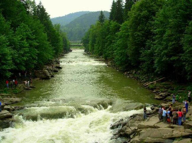
Photo: tripadvisor Video: Unbelivable Air -
The Olt is a Romanian river. It has a length of 615 kilometers (382 miles) and a basin area of 24,050 kilometers2 (9,290 sq mi). It is the world's longest river that runs entirely across Romania. Its source is in the eastern Carpathian Mountains' Hășmaș Mountains, near Bălan, where it rises near the Mureș River's sources. Harghita, Covasna, Brașov, Sibiu, Vâlcea, and Olt are the Romanian counties through which it runs. In Roman times, the river was known as Alutus or Aluta. The river is named after Olt County and the historical province of Oltenia.
On the Olt River, the principal cities are Sfântu Gheorghe, Râmnicu Vâlcea, and Slatina. Near Turnu Măgurele, the Olt empties into the Danube.Length: 615 km
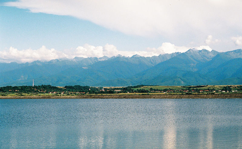
Photo: wikipedia Video: Andy Passions -
The Siret, sometimes known as the Sireth, is a river that originates in the Carpathians in Ukraine's Northern Bukovina region and runs south into Romania before joining the Danube. It has a length of 647 kilometers (402 miles), with 559 kilometers (347 miles) in Romania, and a basin area of 44,811 kilometers (17,302 square miles), with 42,890 kilometers (16,560 square miles) in Romania. It has a discharge rate of 250 m3/s (8,800 cu ft/s) on average. Hierasus was the name given to it in ancient times.
From source to mouth, the river Siret passes through the cities and villages of Berehomet, Storozhynets, Siret, Grămești, Zvoriştea, Liteni, Dolhasca, Paşcani, Stolniceni-Prăjescu, Roman, Bacău, Adjud, Mărășești, Galaţi.
Leghth: 559 km
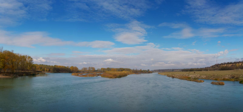
Photo: dreamstime 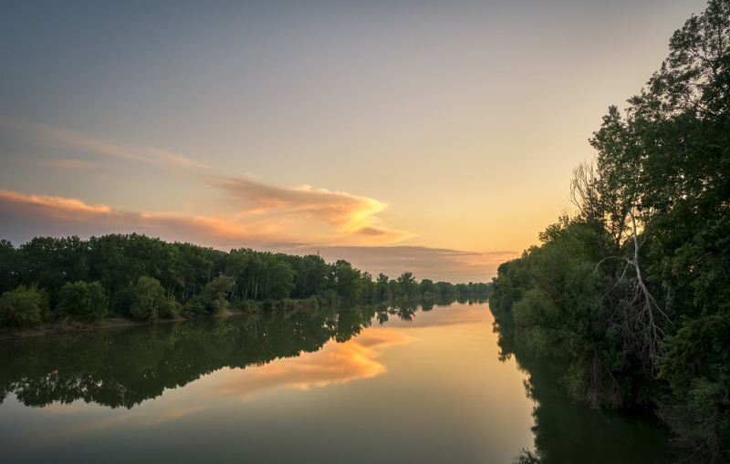
Photo: flickr -
The Ialomița is a Romanian river in the south. It rises in the Carpathians from the Bucegi Mountains. In Giurgeni, it empties into the Danube's Borcea branch. It has a length of 417 kilometres (259 mi) and a basin size of 10,350 km2 (4,000 sq mi). This river is named after the county of Ialomița. Valea Obârșiei or Obârșia Ialomiței are two names for the river's upper reaches.
From source to mouth, the river Ialomița passes through the following towns: Moroeni, Pietroșița, Fieni, Pucioasa, Doicești, Aninoasa, Târgoviște, Răzvad, Comișani, Băleni, Finta, Cojasca, Poienarii Burchii, Fierbinți-Târg, Dridu, Urziceni, Manasia, Alexeni, Ion Roată, Sfăntu Gheorghe, Balaciu, Căzănești, Ciochina, Andrășești, Perieți, Slobozia, Cosâmbești, Bucu, Sudiți and Țăndărei. The largest cities along the Ialomița are Târgoviște and Slobozia.
Leghth: 417 km
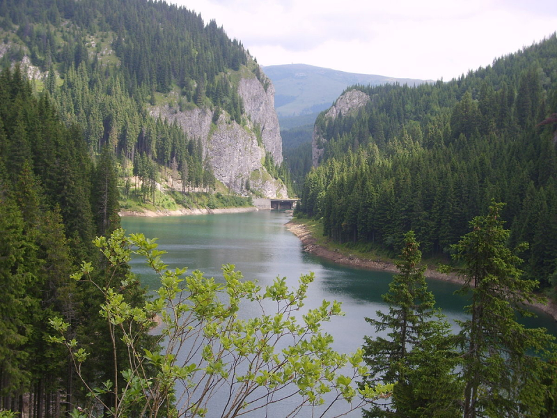
Photo: wikidata 
Photo: dreamstime -
The Someș is a left tributary of the Tisza in Hungary, located in northern Romania. It stretches for 415 kilometers (258 miles) (including the source river Someșul Mare), 50 kilometers of which are in Hungary. The Someș is Romania's fifth-longest and most-debtuous river. The junction of the Someșul Mare and Someșul Mic rivers at Mica, a commune about 4 km upstream of Dej, defines the hydrographic basin. The Apuseni Mountains give rise to Someșul Mic (created by the confluence of Someșul Rece and Someșul Cald), while the Rodna Mountains give rise to Someșul Mare. Someșul Mare is 130 kilometers long and 5,033 kilometers wide, with a small asymmetry in favor of the left side of the basin.
Between Dej and Ardusat, the asymmetry on the left gets more extreme, changing in the other way after getting the Lăpuș River on the right side. The auriferous alluvium in the Someșul Mare valley was brought to the surface using traditional methods until the early twentieth century. According to experts, gold grains weighing 21 carats were discovered in the Someșul Mare.
The Someș is dammed in the lower course to prevent flooding. The Someș flooded part of Satu Mare and the neighboring plains in the spring of 1970 due to torrential rains. In comparison to the year's average of 210 m3/s, the debit exceeded 3,300 m3/s.
Leghth: 376 km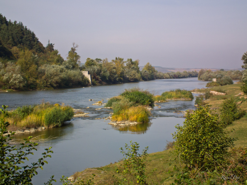
Photo: raoulpop Video: Galaxy Art Media -
The Argeș is a river in Romania's south. It has a length of 350 kilometers (220 miles) and a basin area of 12,550 kilometers2 (4,850 sq mi). Its source is in the Southern Carpathians' Făgăraş Mountains, and it drains into the Danube at Oltenița.
Pitești is the main city on the Argeș. It is held back upstream by the Vidraru Dam, which formed Lake Vidraru. Capra is the name given to the upper flow of the river, which runs upstream from Lake Vidraru. The river is thought to be the same as Ordessus, a name referenced by Herodotus, an Ancient Greek historian.
Hydropower is generated by the Argeș River and some of its tributaries. Several dams, lakes, tunnel, and power plants make up the hydroelectrical system. Vidraru, Oiești, Cerbureni, Curtea de Argeş, Zigoneni, Merişani, Budeasa, Bascov, Pitești, Călineşti (or Golești), Zăvoiu (near Mătăsaru), Ogrezeni, and Mihăilești are the lakes formed on the Argeş River. On its tributaries, there are other dams.
Leghth: 350 km
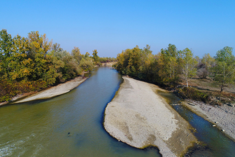
Photo: flickr Video: Lucian lonescu -
The Jiu is a river in Romania's south. The confluence of the streams Jiul de Vest and Jiul de Est forms it near Petroșani. It flows south through Romanian counties Hunedoara, Gorj, and Dolj until entering the Danube a few kilometers upstream from Oryahovo, Bulgaria, 339 kilometers from its source. It has a 10,080 km2 basin. Romania's main coal mining region is in the upper Jiu Valley, around Petroșani and Lupeni.
The Dacians called the Jiu River Rhabon in the past. Petroșani (Jiul de Est), Lupeni (Jiul de Vest), Bumbești-Jiu, Târgu Jiu, Turceni, Filiași, Craiova is the towns along the Jiu river from source to mouth.
Leghth: 339 km
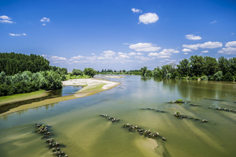
Photo: wikipedia Video: Gr0ps -
The Buzău is a tributary of the Siret River in eastern Romania. It has a total length of 302 kilometers. Its source lies east of Brașov, in the south-eastern Carpathian Mountains. The Buzău is a river in Romania that goes through the counties of Brașov, Covasna, Buzău, and Brăila. It empties into the Siret near the Danube's confluence west of Galați.
The Buzău River is named after two urban municipalities in Covasna County: the city of Buzău (the county seat) and the town of Întorsura Buzăului. The name Intorsura Buzăului (which means Buzău's Turning in Romanian) comes from its location near a huge river turn. It flows northwards at first, but towards the town, it takes a sharp bend to the south-east.
Leghth: 302 km
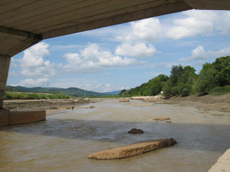
Photo: flickr Youtube: AMotion -
Dâmbovița is a Romanian river. Its origins can be found on the Curmătura Oticu in the Făgăraş Mountains. Izvorul Oticului River or Oticu River is the name given to the upper reaches of the rivers upstream of their confluence with the Boarcășu River. It flows into the Argeș River 286 kilometers from its source in Călărași County, passing through Bucharest. The river Dâmboviţa is the name of the county.
The Dâmbovița gets its name from the Slavic word db, which means "oak," because it used to run through the Wallachian Plain's oak trees. The river flows through the following communes, towns and cities: Rucăr, Dragoslavele, Stoenești, Malu cu Flori, Cândești, VulcanaBăi, Voinești, Mănești, Dragomirești, Lucieni, Nucet, Conțești, Lungulețu, Chiajna, Bucharest (city), Plătărești, Vasilați, Budești (town).
Leghth: 286 km
Photo: flickr 
Photo: archive.danielkorzeniewskiphoto. -
The Bistrița (also known as Bistrița Moldoveană) is a river in Romania's Maramureș, Bukovina, and Moldavia regions (most of its length). It is a tributary of the river Siret on the right bank. It empties into the Siret at Bacău. The Rodna Mountains, at the foot of the Gârgalău peak, are its source. It runs through Bistrița-Năsăud, Suceava, Neamț, and Bacău counties. Along the Bistrița are the towns of Vatra Dornei, Bicaz, Piatra Neamț, Roznov, Buhuși, and Bacău. The Bistrița is 283 kilometers long, with a basin size of 7039 kilometers2.
Bistrița Aurie is another name for the upper reaches (German: Goldene Bistritz). On the Bistrița River, the following dams have been built: Topoliceni, Izvorul Muntelui, Pângărați, Vaduri, Piatra Neamț, Reconstrucția, Racova, Gârleni, Lilieci, Bacău
Leghth: 283 km
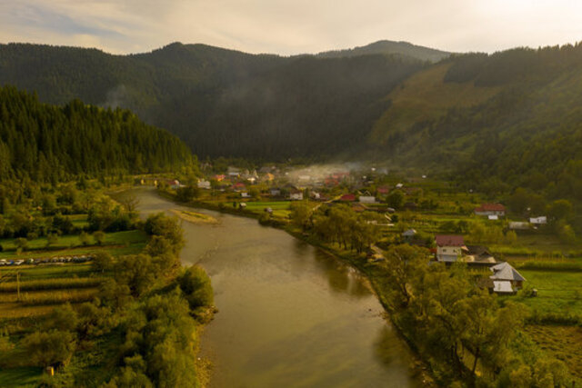
Photo: stock.adobe 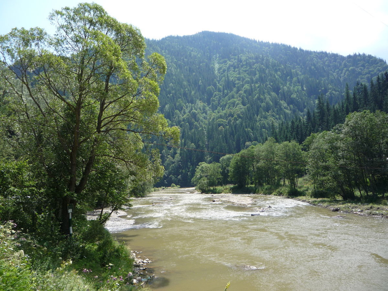
Photo: wikimediacommon


