


Top 10 Longest Rivers in Singapore

The country's tropical climate and heavy rainfall required a very comprehensive network of natural drainage systems, much of which became a concrete system as ... read more...urbanization spread across the island. Let's explore the longest rivers in Singapore.
-
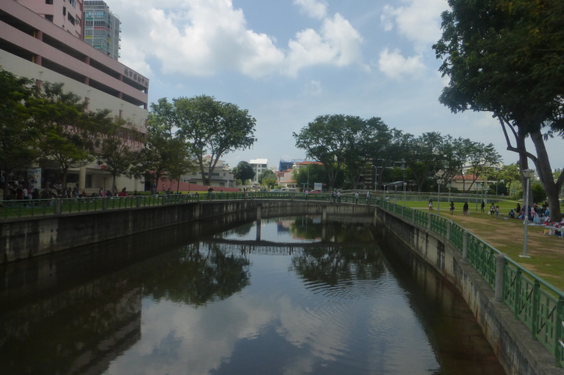
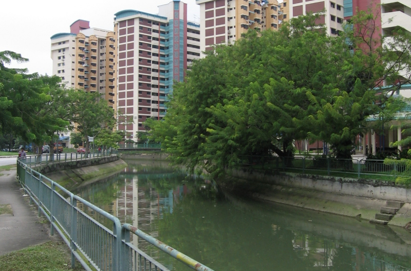
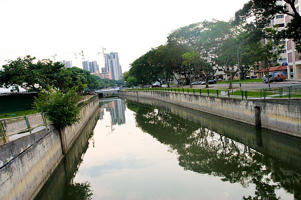
The Geylang River is a canalised river in Singapore's Central Region that runs from Geylang to Kallang. The river is currently a component of the Marina Reservoir, which was formed with the completion of the Marina Barrage in 2008.
Geylang River starts at Ubi as Geylang Canal, flows south under Eunos Road 5 and Sims Avenue, turns west after Geylang Road and Lorong 40 Geylang, but flows south again near Guillemard Road, before turning west again after the junction of Old Airport Road and Dunman Road, through Mountbatten Road and Stadium Way.
The river ultimately drains into the Kallang Basin near Tanjong Rhu, near the Tanjong Rhu Suspension Bridge, in the southern portion of Kallang. The Public Utilities Board (PUB) initiative revitalized the waterway while maintaining the unique legacy of the districts surrounding Geylang River, which was officially inaugurated by Guest-of-Honour Associate Professor Fatimah Lateef, Member of Parliament for Marine Parade Group Representation Constituency.
Geylang River was also deepened and broadened as part of the renovation to boost capacity and flood protection. A natural rain garden, which treats surface runoff using plants and soil, was also built up as part of Paya Lebar Quarter's Active, Beautiful, and Clean (ABC) Waters initiative to improve the river's water quality. It is one of the longest rivers in Singapore.
Length: 20 km
https://en.wikipedia.org/wiki/Geylang_River 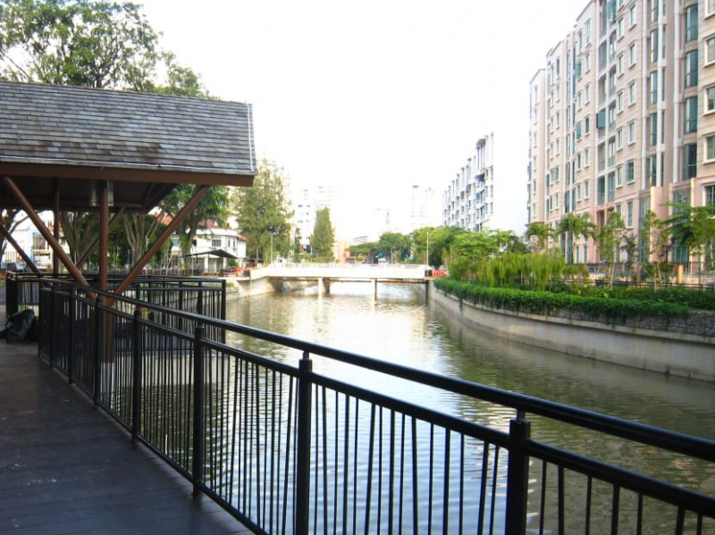
https://en.wikipedia.org/wiki/Geylang_River -
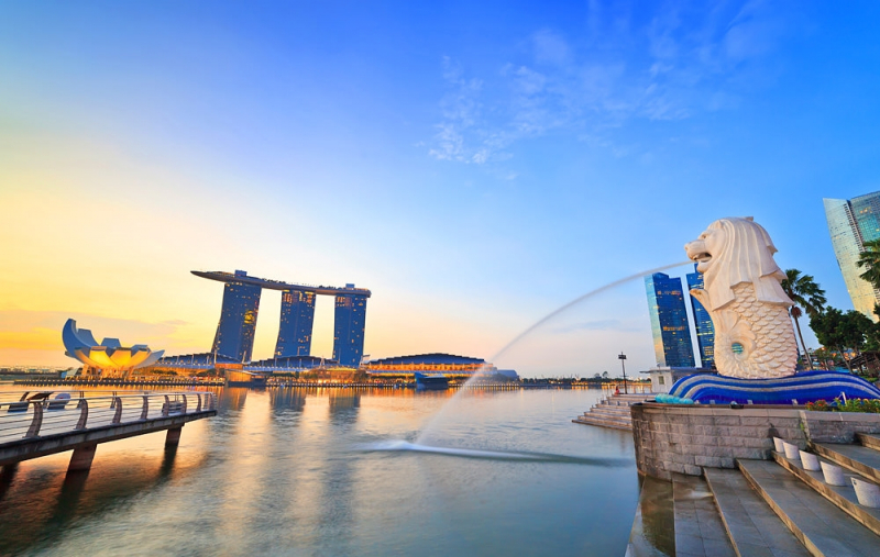
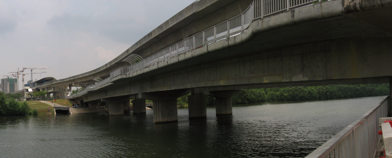
The Kallang River flows for 10 kilometers from the Lower Peirce Reservoir (formerly titled "Kallang River Reservoir") to the Kallang Basin, making it Singapore's longest river. Its source is in the Central Water Catchment planning region, and it runs southeast via Bishan and Toa Payoh before reaching at Kallang.
The Kallang River used to discharge into the Singapore Straits at the Kallang Basin, near where Merdeka Bridge now stands, prior to major land reclamation along Singapore's southeastern shore. The Marina Channel now connects the Kallang River to the open sea. Sungei Whampoa, the Pelton Canal, and the Bukit Timah Second Diversion Canal are all tributaries of the Kallang River. The Geylang River and the Rochor River, in addition to the Kallang River, empty into the Kallang Basin. As a result of the Marina Barrage, all of the aforementioned streams have become part of the Marina Reservoir.
The Park Connector Network's (PCN) Kallang Park Connector runs roughly parallel to the Kallang River, providing a stretch of recreational area along the water's edge. Near the river's mouth, the Kallang Riverside Park crosses both banks of the Kallang River. It is one of the longest rivers in Singapore.
Length: 10 km
https://en.wikipedia.org/wiki/Kallang_River 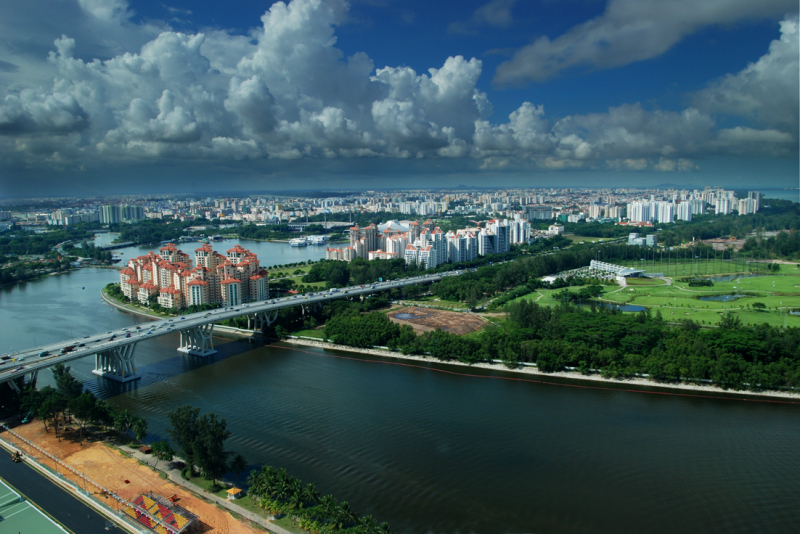
https://en.wikipedia.org/wiki/Kallang_River -
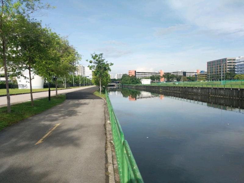
The Pelton Canal River is a canalised watercourse that runs from Ubi to Kallang through MacPherson and the Kallang River. It is one of the Kallang River's several tributaries. This is a small river in Singapore that flows through a cluster of residential areas.
The Pelton Canal River is small, so people around often have activities such as fishing and sightseeing. Next to the river is a park with green trees running straight. The Pelton Canal is followed by a stretch of the subterranean Kallang-Paya Lebar Expressway (KPE). It runs from Braddell Road to Lorong 8 Toa Payoh, passing through Toa Payoh North and Lorong 6 Toa Payoh before meeting the Kallang River.
Reservoirs and canals are public places that are used by a variety of people. Lower Pierce Reservoir is the source of the Kallang River, which drains nearly one-sixth of the island's land area when coupled with its tributaries, the Geylang River, Rochor River, Sungei Whampoa, and the Pelton Canal. It is one of the longest rivers in Singapore.
Length: 14 km
https://en.wikipedia.org/ 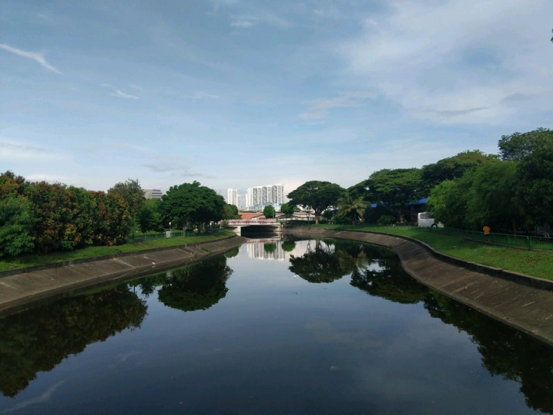
https://en.wikipedia.org/ -
The Rochor River is a canalized river in Singapore's Central Region, located near Kallang. The river is approximately 0.8 kilometers long. The Rochor River, which originates beneath Victoria Bridge and drains into the Kallang Basin, is a continuation of the Rochor Canal.
The Rochor Canal extends upstream to the intersection of Jalan Jurong Kechil and Upper Bukit Timah Road; the Rochor River's source is Beauty World MRT station, which has a canal that goes to the Kranji Reservoir and may be extended to Tengah as part of the Deep Tunnel Sewerage System. The term "Rochor Canal" is also the name of a subzone inside Rochor's planning area.
The Rochor River has been managed and widened by canals in the past to control floods in Bukit Timah. While the Rochor River is clearly the lower channel, the Victoria Bridge upstream uses the names Rochor Canal or - even farther upstream - Bukit Timah Canal, as shown on numerous maps. The canal has been cleaned and rebuilt several times throughout the years.
Because this was ineffective, the Singapore National Water Agency PUB's Bukit Timah Flood Alleviation Scheme (BTFAS) (constructed in the 1960s) added two more service channels: the Bukit Timah First Diversion Canal and the Bukit Timah Second Diversion Canal (1990s, 4.4 km long, to Kallang Basin). They are partly subterranean, running through tunnels.
Length: 800 m
https://en.wikipedia.org/ 
https://en.wikipedia.org/ -
The Singapore River flows parallel to Alexandra Road and empties into the Marina Reservoir in Singapore's southern region. Although the western section of the watershed is classed under the River Valley planning region, the immediate upper watershed of the Singapore River is recognized as the Singapore River Planning Area.
According to the Urban Redevelopment Authority, the Singapore River planning area is located inside the Central Area of Singapore's Central Region. The planning area is bordered on the south by River Valley and Museum, on the west by Tanglin and Bukit Merah, on the south by Outram, and on the east by the Downtown Core.
From its beginning at Kim Seng Bridge to where it empties into Marina Bay, the Singapore River is roughly 3.2 kilometers long; the river continues more than two kilometers beyond its original source at Kim Seng Bridge as Alexandra Canal, as far as the Commonwealth Avenue intersection.
The original Port of Singapore was located near the mouth of the Singapore River, which was naturally protected by the southern islands. The city of Singapore sprang up around the port, and the river mouth became the center of trade, business, and banking.
Length: 3 km
https://en.wikipedia.org/ 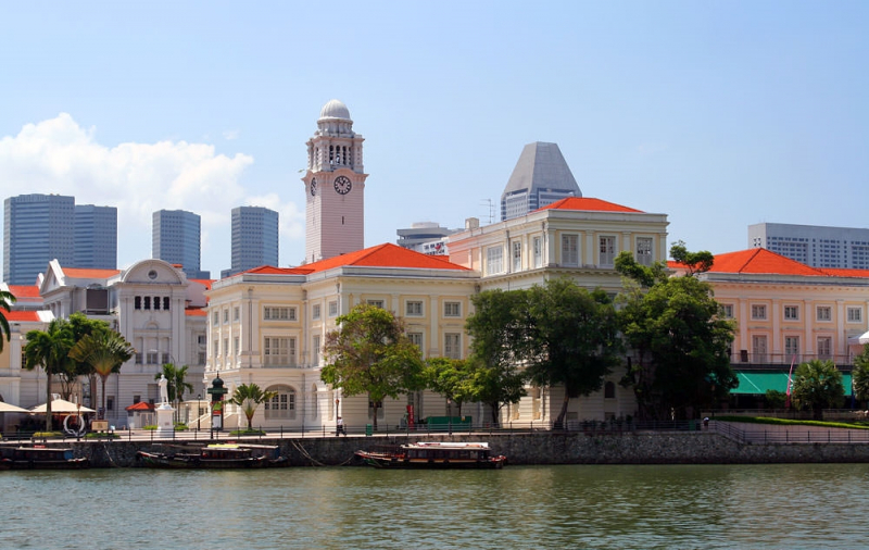
https://en.wikipedia.org/ -
Sungei Jurong (sometimes referred to as the Jurong River) is a river in Singapore's Jurong East district.
This river is crossed by the Jurong River subzone. The Ayer Rajah Expressway, Jurong Port Road, Jalan Buroh, and Penjuru Road all run through the subzone. Across the river is a bridge with the same name as the river. This is the ideal tourist destination for tourists.
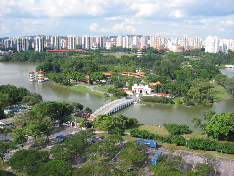
People can come Sungei Jurong for a walk, fishing, snacking, sightseeing. The scene here is generally very crowded and bustling. Inside the city there are also countless attractions worth visiting. Characterized as an island nation, around the river are residential clusters with an oasis shape. Both sides are luxuriant green trees. Residents here can easily travel by boat to move between this area and the other area. The Jurong River first appeared on maps in 1828, and it served as a marker for many early immigrants and communities. Three man-made islands were built once the river was dammed, containing the Chinese Garden and Japanese Garden.
The Chinese Garden was constructed between 1971 and 1975, and its architectural ideas were inspired by Song Dynasty imperial buildings in northern China. Ornate bridges, pavilions, and a seven-story pagoda are among the main attractions, some of which were inspired by Beijing's Summer Palace.
The Japanese Garden, also known as Seiwaen, was created in the style of Japanese gardens from the Muromachi and Momoyama periods. There are Japanese stone walkways and Toro stone lanterns, as well as rock waterfalls and a flowing stream, in the garden. It is one of the longest rivers in Singapore.
Length: 12 km
https://yeoweij.files.wordpress.com/ 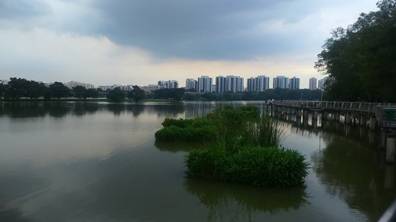
https://yeoweij.files.wordpress.com/ -
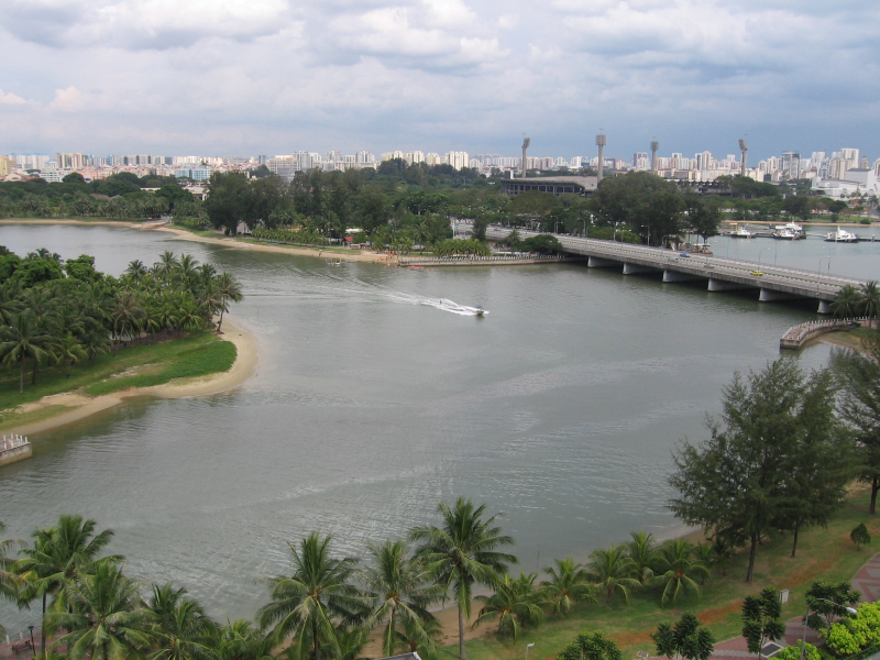
The Sungei Punggol River is located in Singapore's North-East Region. Apart from Punggol New Town, the river passes through seven additional settlements. Much of the riverbank along Sungei Punggol has now been reclaimed, and the river has been canalised.
It has been a component of the Punggol Reservoir since 2011. Kampong Tongkang Pecah was also located along Sungei Punggol. A network of green links has been developed along the banks of Sungei Punggol to better serve the recreational requirements of residents of Sengkang New Town. These connections connect the new town's housing precincts to neighborhood parks, the town park, and the Sengkang Sports Centre.
These park connections also connect to Punggol New Town's Coney Island Park and Hougang's existing Punggol Park. In the Sengkang section of the river, an artificial man-made floating island has been built in the middle of the river. The Sungei Punggol is bordered by the Sengkang Riverside Park, which opened in November 2008. Sungei Punggol's estuary was also dammed to build a reservoir in 2011, together with Sungei Serangoon.
Length: 5 km
https://en.wikipedia.org/wiki/Sungei_Punggol 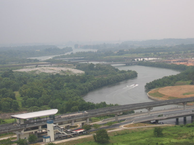
https://en.wikipedia.org/wiki/Sungei_Punggol -
Sungei Serangoon is a river in Singapore's northeastern region. The 8-kilometer river begins as a canal at Tampines Road and travels through Hougang, where it is joined by stream Sungei Pinang right before Sengkang, before continuing on to Lorong Halus, where it is joined by another tributary, Sungei Blukar, before emptying into Serangoon Harbour.
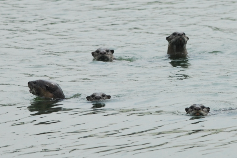
The Sungei Serangoon Estuary is another name for the river. The river has been turned into a reservoir, Serangoon Reservoir, since 2011. Despite the fact that portions of the river have been canalized at Hougang and Lorong Halus, the river's fauna has been mostly undisturbed. Herons, terns, and kingfishers may still be seen along the river. The area near Lorong Halus is regarded as one of Singapore's premier bird-watching places. Near the banks, monitor lizards and occasionally otters can be spotted.
A 2.2-kilometer jogging track (known as the Serangoon Park Connector) runs along the river's western bank at Hougang. Despite its proximity to residential areas, this stretch of ground is home to a variety of garden, grassland, and estuary birds.
Sungei Serangoon has completed a number of development projects, including the building of an overhead bridge connecting Old Tampines Road and the KPE expressway to Sengkang and a metal bridge connecting Punggol East and Lorong Halus. It is one of the longest rivers in Singapore.
Length: 8 km
https://en.wikipedia.org/wiki 
https://en.wikipedia.org/wiki -
Sungei Whampoa (Malay meaning "Whampoa River) runs from Whampoa near Jalan Rajah to Kallang, where it meets the Kallang River. The Balestier precinct, like much of Singapore in the early 1800s, was a wooded area. The region was bisected by a tiny river, first known as Balestier River and then renamed Sungei Whampoa, which empties into the Kallang River Basin.
Sungei Whampoa was nourished by streams that flowed from the Bukit Brown, Mount Pleasant, and Thomson Road areas. Thomson Road Reservoir was built west of Thomson Road in the 1860s, and was renamed MacRitchie Reservoir in 1922 after city engineer James MacRitchie. Sungei Whampoa is still mostly sourced from MacRitchie Reservoir.Hills and wetlands to the north of Sungei Whampoa were known as Toa Payoh ("great swamp" in Hokkien, payoh coming from paya, Malay for "swamp"). Meanwhile, the southern side of Balestier Road was a steep terrain that ultimately became home to a Teochew cemetery and Tan Tock Seng Hospital.
Length: 312 m
https://mycreamsandpotions.files.wordpress.com/ 
https://mycreamsandpotions.files.wordpress.com/ -
Siglap Canal River has a drainage area in Bedok, Marine Parade. The Siglap Canal River is a lush, gorgeous body of water. A communal deck and rain gardens will be added to parts of the 3.2-kilometer canal. A 150-meter piece adjacent to the Kampong Kembangan Community Club will be decked up to accommodate activities like line dance and taiji.
PUB, the country's water agency, will collaborate with Telok Kurau Primary School to create a rain garden and a rooftop garden upstream. These aid in the cleaning of rainwater runoff before it enters the canal. It's also constructing a detention tank to assist minimize peak rainwater flows into the drainage system.
These additional elements were introduced during the project's groundbreaking event, which was attended by four of Marine Parade GRC's five MPs, including Emeritus Senior Minister Goh Chok Tong and Acting Manpower Minister Tan Chuan-Jin, who was the guest of honor. Between Bedok Reservoir Road and the sea near East Coast Beach is the Siglap Canal River. It is one of the longest rivers in Singapore.
Length: 3.2 km
https://en.wikipedia.org/ 
https://en.wikipedia.org/


