


Top 8 Longest Rivers In Iceland

The great majority of rivers in Iceland are fed by the country's most famous long-term residents: glaciers. On its way to the Atlantic, the runoff has etched ... read more...its way through the youthful landscape, shaping valleys, cliffsides, and mountain ridges. Today, Iceland's river systems provide tourists with the opportunity to witness this natural process in action, providing a more in-depth understanding of both the country's natural history and its geological future. These are the top 8 longest rivers in Iceland.
-
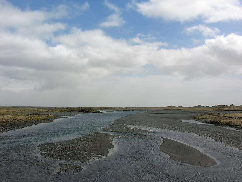
The longest and second most voluminous river in Iceland, coming from the glacier Hofsjökull, may be found in the south of Iceland. The beautiful Thjórsá ('The River of Bulls') runs an astonishing 230 kilometers and serves as a dividing line between two of the country's chartered counties, Rangárvallassla, and rnesssla. This river is ranked 1st on the list of the longest rivers in Iceland.
This river's movement toward the ocean is aided by another river, Tungnaá, which joins it downstream in the lowlands as it passes through the narrow crags of the highlands. The river flows through the breathtakingly picturesque jórsárdalur valley, past the old farmstead Stöng, before flowing along the eastern edge of the jórsá lava field.
The islets of jórsá are renowned for their size, the largest of which are Hagaey and rnes. Historically, a governing body presided over by the region's law speakers, stood on the latter. The round remnants of this assembly can still be seen by visitors to the island, albeit they have been designated inviolable and preserved.
The presence of the ing has given the island's features titles such as Parliament Hill and Gallows Rock (this was the location for numerous executions.) The county rnesssla is, of course, named for this island.Length: 230 km (140 mi)
guidetoiceland.is 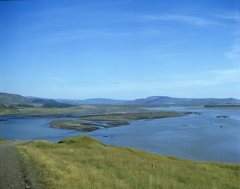
-
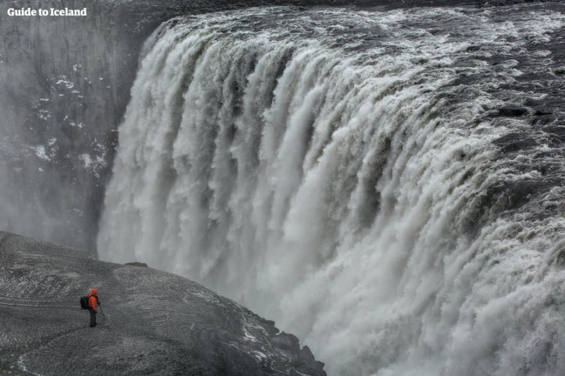
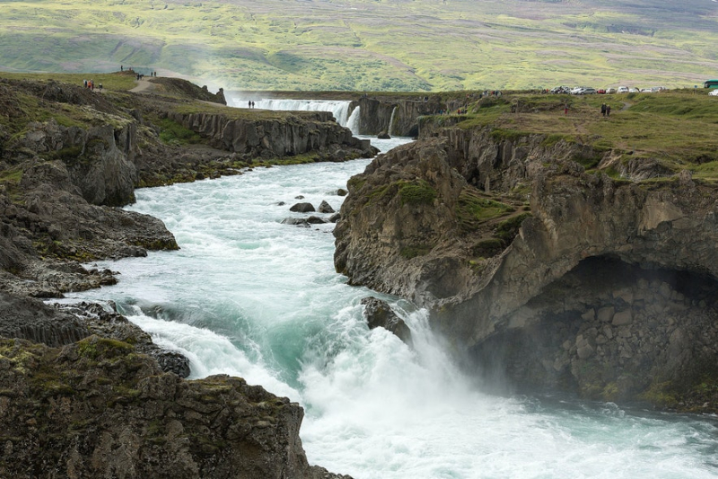
The 2nd place in the list of the longest rivers in Iceland is Jökulsá á Fjöllum ('The Glacial Mountain River'). This river, which flows from the giant glacier Vatnajökull, is regarded as Iceland's second-largest river and the source of several of the country's most frequented cascades, including Dettifoss, Europe's most powerful waterfall.
Jökulsá á Fjöllum is located in the country's northeastern part, serving as the eastern border to the open lava field, dáahraun, before emptying into the Greenland Sea. Jökulsá á Fjöllum has a 7,380km catchment basin, which is one of the numerous reasons why the river has been subject to spectacular glacier flooding ("jökulhlaups") throughout history.
During the Holocene epoch, the biggest glacial floods in Iceland occurred along Jökulsá á Fjöllum between 7000 and 2000 BC. These floods would have happened as a result of an explosion beneath the Vatnajökull glacier. The subsequent discharge is estimated to be roughly 900,000 cubic metres of water per second—the Amazon River has a flow that is only one-fifth of this.
Length: 206 km (128 mi)
guidetoiceland.is 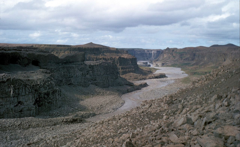
wikipedia.org -
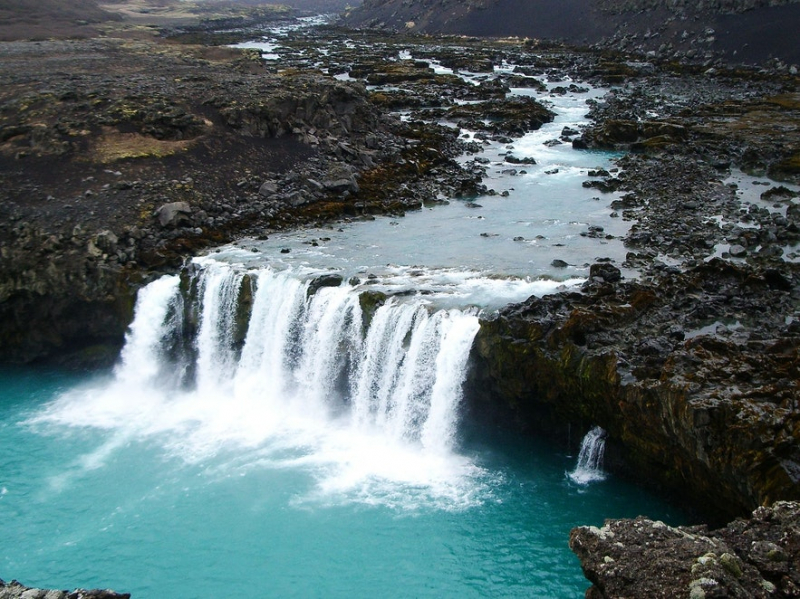
The Skjálfandafljót River (Icelandic pronunciation: [scaulvantafljout]) flows in northern Iceland. Skjálfandafljót is Iceland's fourth longest river, measuring 178 kilometers (111 miles). Its source is on the northeastern edge of Iceland's icecap Vatnajökull in the Highlands. From there, it flows north, parallel to the Sprengisandur Highland road, till it reaches Skjálfandi bay.
Many waterfalls may be seen by following the river from its source in the Vatnajökull glacier all the way to its mouth at Skjálfandi beach. Skjálfandafljót is home to several waterfalls, including Goafoss. Hrafnabjargafoss, Aldeyjarfoss, Barnafoss, and Ullarfoss are some of Skjálfandafljót's other well-known waterfalls. A crew from the University of Sheffield (UK) was the first to descend it by kayak in 1989. The river drops 10 meters over Aldeyjarfoss at the northern end of the Sprengisandur road. Goafoss is located in the lowlands, close to Route 1.
Length: 178 km (111 miles)
guidetoiceland.is 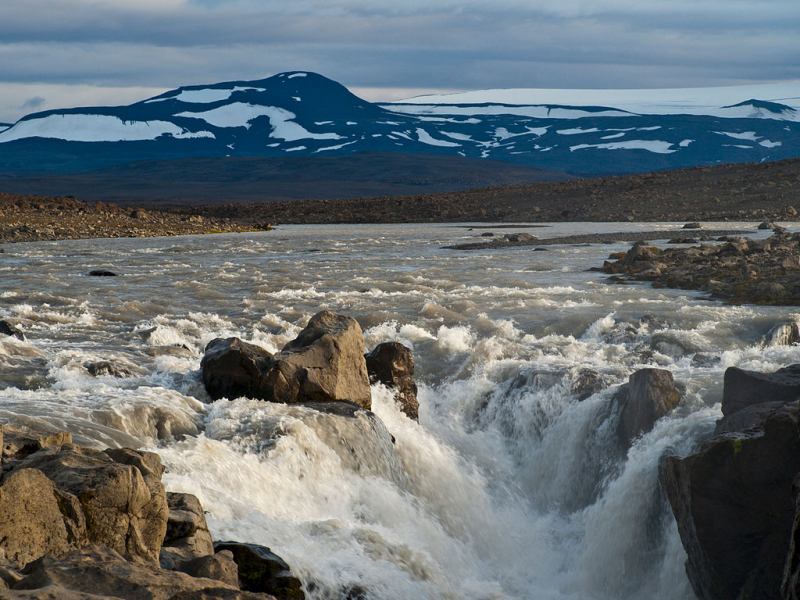
wikipedia.org -
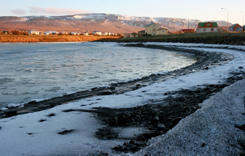
Jökulsá á Dal ('Glacial River of the Vale') is a 150-kilometer-long river in Iceland's northeastern area. This river, also known as Jökulsá á Br or Jökla, is well recognized in Iceland due to its history and energy use.
It is not possible to ford the river due to its raging currents. The first bridge across the Jökulsá á Dal was built in 1625. The Route 1 bridge was built in 1994, however the original bridge can still be seen downstream. Another photograph by Frederick W.W. Howell, shown below, depicts a rope bridge built over the river. The river has been at the center of national polarization and controversy in recent years due to the development of the Kárahnjkar Hydropower Plant, Europe's largest of its kind.
Environmentalists are in one camp, and they have rightly claimed that the plant will not only severely harm the untouched eastern ecosystem, but will also be indicative of persistent attempts to sell the country to heavy industry.Length: 150 km (93 mi)
guidetoiceland.is 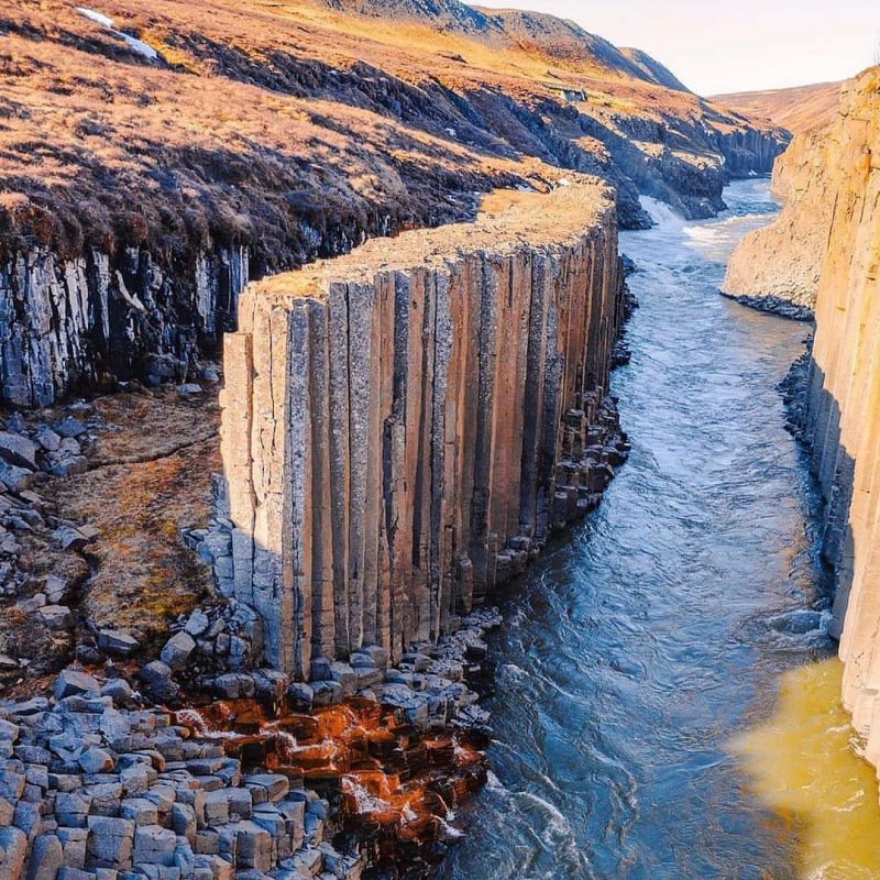
facebook.com -
Blanda ('Mixture') is the largest river in north-west Iceland, flowing for 125 kilometers from its source, the Hofsjökull glacier, to Hnaflói bay, near the village of Blönduós.
Blanda is well-known for its salmon fishing; one year, the catch nearly topped 3000 fish! The fishing season on the Blanda River runs from June to September, and guests can expect to catch fish weighing between 10 and 18 pounds. Having said that, it is not uncommon to catch fish weighing more than 20 pounds, giving a thrill and challenge to fishing in these waters.
Because the rapids require more strength from the fish, the fish in Blanda is said to be larger than typical. The river is typically between 30m and 50m wide and 1m to 2m deep, making it ideal for fishing with a double-handed rod. The drainage basin of the river is estimated to be 2370 km2.
Length: 125 km (78 mi)
nat.is 
pinterest.com -
Fnjóská ('The River of Dry Wood') is Iceland's eighth-largest river, stretching for 117 kilometers. It is located about 10 kilometers east of Akureyri, running down the Fnjóskardalur valley, which runs parallel to Eyjafjörur. The river's course runs through Vaglaskógur, Iceland's second-largest forest (300 acres), only adding to the river's splendor. Icelanders are also familiar with the river's estuaries, which are noted for their scenic beauty and chirping birdlife.
Fnjóská is a fast-flowing, rocky river that demands anglers to wade up to their waist in order to find the ideal fishing area. Because the river is quite cold, Atlantic Salmon can be difficult to find, but Arctic Char, weighing between 2 and 10 pounds, are abundant. Once again, this is the type of river where a double-handed rod is ideal. For all of these reasons, this river is regarded as one of the greatest in Iceland for fly fishing.
Length: 117 km (73 mi)
guidetoiceland.is 
nat.is -
The 115km Kadafljót, one of Iceland's largest glacial rivers, may be located in the south of the country. On its way to the Atlantic, the river flows from Mrdalsjökull via the Skaftátunga area and the black sand desert of Mrdalssandur.
According to The Book of Settlements, the river was named after some of Skaftátunga's earliest immigrants, who landed aboard a ship called Ki. The river was commonly regarded as treacherous, with violent currents and hidden quicksand.
Even still, travelers would risk their lives crossing the river again and again, frequently relying on the strength and resolve of their horses to traverse the shallowest spots.
That is not to suggest that navigating was simple. Until the 1950s, the southeast coast of Iceland was well known as a ship cemetery, with numerous French fishing vessels moored there. Between 1850 and 1914, up to 5000 men would travel from Brittany to harvest the Icelandic coastal waters, establishing a seasonal base in Fáskrsfjörur.Length: 115 km (71 mi)
nat.is 
pinterest.com -
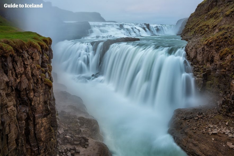
The Hvitá River (White River) is one of the rivers you are likely to see during your visit to Iceland because its path is interrupted by one of Iceland's most renowned attractions, Gullfoss waterfall, one of the three sites on the highly regarded Golden Circle viewing circuit.
The river's source is the Langjökull glacier in the highlands, namely the Hvtárvatn glacier lake. Hvtá is a 185-kilometer-long river that begins with a 40-kilometer trek to Gullfoss, where it dips into a tight gorge. It then cuts directly through the districts of Biskupstungur and Hrunamannahreppur. The river's volume doubles as it joins three others: the Tungufljót, the Brará, and the Stóra-Laxá. From here, the river flows gently through the lowlands beside Grmsness, past Ingólfsfjall mountain before joining the Sogi River in Selfoss.
The Hvitá river is a favorite among river rafters and kayakers. According to the International Scale of River Difficulty, the river is classified as Class 2, which means it has moderate drops, rocks, and quick flow and necessitates maneuverability and skill on the side of the rafter.
Taking to the river by boat allows you to get up close and personal with Brarhlö canyon, a relic of the glacial inundation that occurred in the area centuries ago. Despite its potential for fun and adventure, the Hvitá river has a reputation for being Iceland's most dangerous river. This is owing to the previous flooding, which has been exacerbated by Iceland's relatively strong rainfall.Length: 40 km (25 mi)
guidetoiceland.is 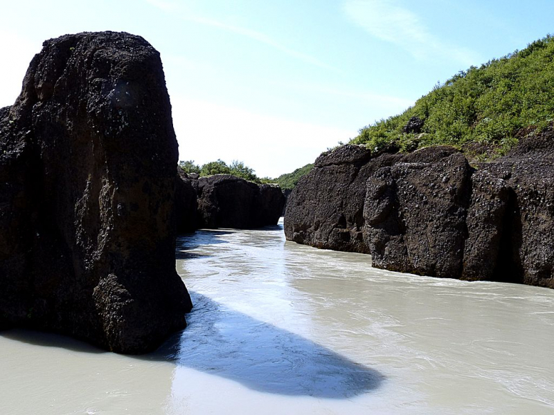
wikipedia.org


