


Top 10 Longest Rivers in Laos

It seems that to compensate for the lack of sea, the Creator favors the "Land of a million elephants" with picturesque rivers. Majestic rivers with rapids and ... read more...blue water. The following article will list the longest rivers in Laos.
-
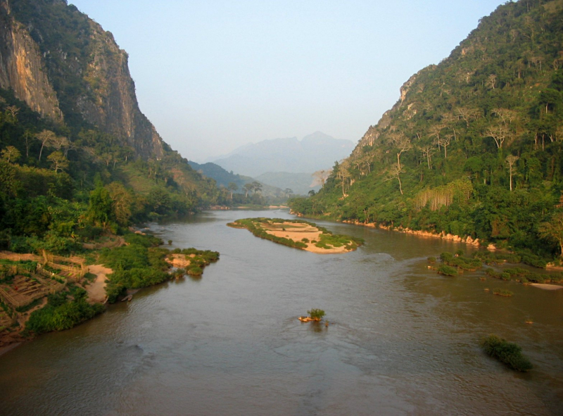
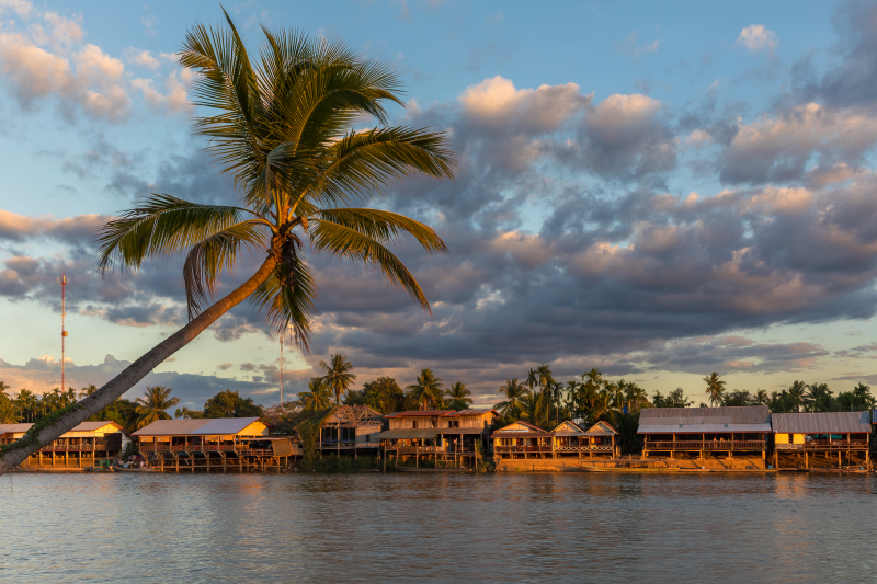
The Mekong River, sometimes known as the Mekong, is a transboundary river that runs across East and Southeast Asia. It is Asia's third-longest river and the world's twelfth-longest river. It drains an area of 795,000 km2 (307,000 sq mi) and discharges 475 km3 (114 cu mi) of water yearly, with an estimated length of 4,909 km (3,050 mi).
The river flows through China, Myanmar, Laos, Thailand, Cambodia, and Vietnam, beginning on the Tibetan Plateau and ending in Vietnam. The Mekong's navigation is complicated by its high seasonal flow changes and the presence of rapids and waterfalls. Despite this, the Mekong river serves as a vital commerce corridor connecting western China and Southeast Asia.
The Mekong's economically significant fish species are split into two categories: "black fish," which live in low-oxygen, slow-moving, shallow waters, and "white fish," which live in well-oxygenated, fast-moving, deeper waters. More aquatic animals (OAAs) such as freshwater crabs, prawns, snakes, turtles, and frogs provide many other sources of food and income to those living along the Mekong River system. This is one of longest Rivers in Laos.
Length: 4,350 km
https://en.wikipedia.org/wiki/Mekong 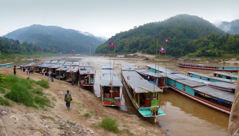
https://en.wikipedia.org/wiki/Mekong -
In northeastern Laos, the Xe Kaman River (also written Sekaman, Xekaman) is a major tributary of the Sekong. The Dak P'Lo stream in Dak P'Lo commune, Dak Glei district, Kon Tum province, Vietnam, is the source of the Se Kaman.
The Xe Kaman River runs through Muang Dak Cheung, Sekong province, and meets the Se Kong at Muang Xaysetha, Attapeu, including the Dong Ampham National Biodiversity Conservation Area. According to documentation, dugongs have been seen in this Conservation area on Se Kaman.
On Se Kaman, the Lao government has constructed a variety of hydropower and irrigation projects. The Xekaman 1 Hydropower Plant, for example, has been operational since 2014. Dolphins have been spotted in the river in the past. A dam being erected on the river is destroying the region. The town of Ban Hin Dam is located on the river and is the starting point for boat tours.
Length: 130km
https://wwf.panda.org/ 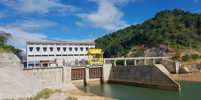
https://wwf.panda.org/ -
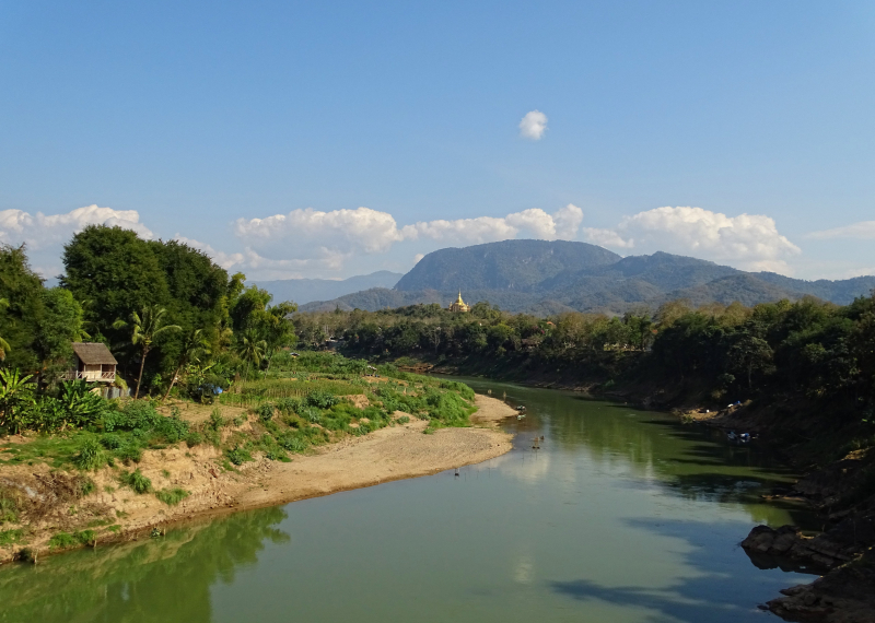
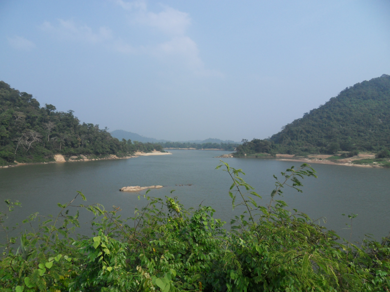
The Nam Ou River is the longest in Lao PDR's northern area. It begins near the Lao-China border in Ban Lantoug Gnai Village and flows south. To the point where it meets the Mekong River, it stretches for 390 kilometers. Phongsaly province, one-third of Uodomxay province, and one-half of Loang Prabang province make up the total drainage area of 25,000 km2. The discharge is 12,276,964,800 m3 per year.
Nam Ou River rises in the highlands at the Laos-China border in Phongsali province and runs north-south through northern Laos' mountains and basins. In Pak Ou district, about 15 kilometers northeast of Luang Prabang, it enters the Mekong River.
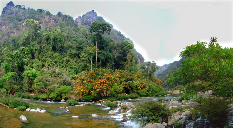
Nam Ou, like the Mekong River, is a natural watercourse suited for big canoe transit. The Pak Ou (Tham Thing and Tham Theung) caves, located near the Mekong River's confluence, are known for its Buddha sculptures. Various ethnic minority communities with generations of history are situated along the river and rely on it for survival. This involves gathering resources for revenue, food, and spiritual rituals from the river and neighboring woodlands. Hikers, tour groups, and kayakers have made the river and adjacent villages popular tourist sites. It is one of longest Rivers in Laos.Length: 448 km
https://upload.wikimedia.org/ 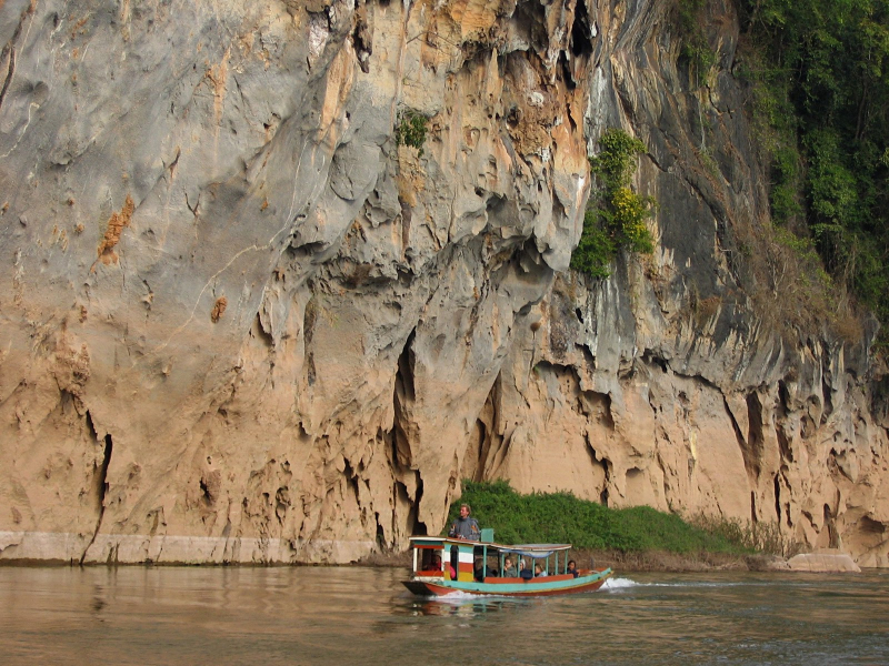
https://upload.wikimedia.org/ -
The Nam Suang River, which has a length of 150 kilometers with a source at 1,482 meters at Ban Sopkok Village, runs south-west for about 50 kilometers before turning west and eventually south-west to meet the Mekong River.
The drainage area is 5,800 km2, with mountainous areas accounting for 76.4 percent of the catchment and hilly areas accounting for 22.9 percent. The discharge is 3,654,076,320 m3 per year. The drainage system at Ban Sibounhom, 8 km from the mouth of the river, is 5,800 km2, with mountains accounting for 76.4 percent of the catchment and hills accounting for 22.9 percent.
The climate in Nam Suang River is tropical, with 1,349 mm of annual precipitation. Subsistence agriculture is practiced in the basin, with changing slash and burn forest farming. Because this type of agriculture has a negative impact on the natural environment and endangered species' habitats, conservation measures have been put in place to ban logging, burning, and hunting. Changes in land usage and conventional agricultural techniques, on the other hand, are difficult to implement and will take time.
Length: 150 km
https://wwf.panda.org/ 
https://wwf.panda.org/ -
The Nam Khane River, which has a length of 935 kilometers, begins in Phou Nam Pa at an elevation of 1,828 meters. It runs east-west down a steep hill to meet the Mekong River about 300 meters above sea level in Luang Prabang City. The drainage area is 6,100 square meters. The discharge volume is 29,454,624,000 m3 per year.
Tiny native type canoes or longboats propelled by a small motor and paddle are used to go down the Nam Khan River to the small settlements tucked on its banks. It allows you to tour local villages and go to those out-of-the-way areas. The guide will pick you up from your accommodation between 8.30 and 9.00 a.m. and drive you roughly 40 minutes to the town of Ban Ann, where the boat ride will begin.
The Tad Xae waterfall, a sequence of limestone falls and a favorite local riverbank picnic place, is a short distance downstream. Continue on to Ban Xieng Lom, which was formerly famed for producing local tobacco and cigarettes, but now relies primarily on fishing and stone and sand mining for its income due to the tendency of smoking customized western style cigarettes. It is one of longest Rivers in Laos.
Length: 262 km
https://en.wikipedia.org/wiki/Nam_Khan 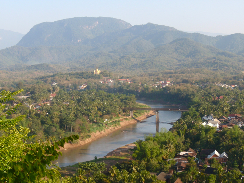
https://upload.wikimedia.org/ -
With a length of 1,403 km and a drainage area of 17,000 km2, the Nam Ngum River is the main river in the provinces of Xiengkhouang and Vientiane, as well as one of the major tributaries of the Mekong in Lao PDR. The river's source is roughly 1,000-1,100 meters above sea level on the Plain of Jars.
After joining the Nam Lik, the Nam Ngum runs south through the Vientiane Plain for about 80 kilometers to Tha Ngone, and then east for another 80 kilometers to Pak Ngum District, where it joins the Mekong River. The discharge is 23,021,280,000 m3 per year.
The Nam Ngum River's water flow to the Mekong River is 700 m3/s. Forest covers thirty percent of the river basin. Watershed management, water resource management, water regulation, and river basin organizations are all aided by various international organizations and financial institutions for the most efficient use of water resources and protection of watersheds. The Nam Ngum River Basin Development Sector Projects, for example, has been in operation since 2002.
Length: 354 km
https://en.wikipedia.org/wiki 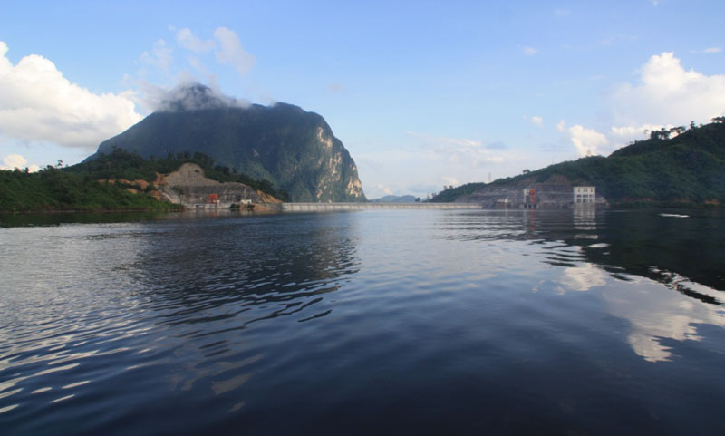
https://www.sinhcafetravel.com -
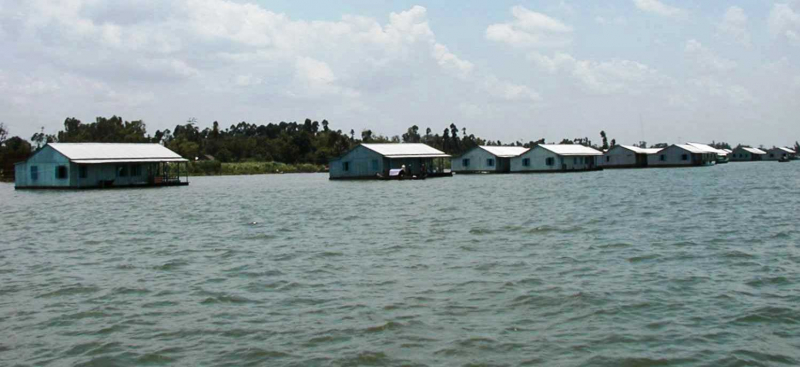
The Nam Nhiep River gets its name from a Vietnamese word that means "calm river." It rises at a height of 1,050 meters above sea level in Phonesavanh Village on the Xiengkhuang plateau, runs south to meet a major tributary named Nam Siam near Ban Xiangkhong Village, then turns southeast to meet another tributary, Nam Chian.
The river runs southerly for roughly 95 kilometers from this point to its outflow in Paksan City. Nam Nhiep is 156 kilometers long and has a catchment area of 4,270 square kilometers. The discharge is 5,885,248,320 m3 per year. Nam Nhiep River is filled with coconut shade and interlaced canals.
The floating houses on the water with a unique way of living will certainly attract visitors. In the afternoon, visitors can go along Nam Nhiep River to watch the sunset by rented or borrowed boats from local people. The people here are extremely hospitable and friendly. It is one of longest Rivers in Laos.
Length: 220km
https://vi.m.wikipedia.org/wiki 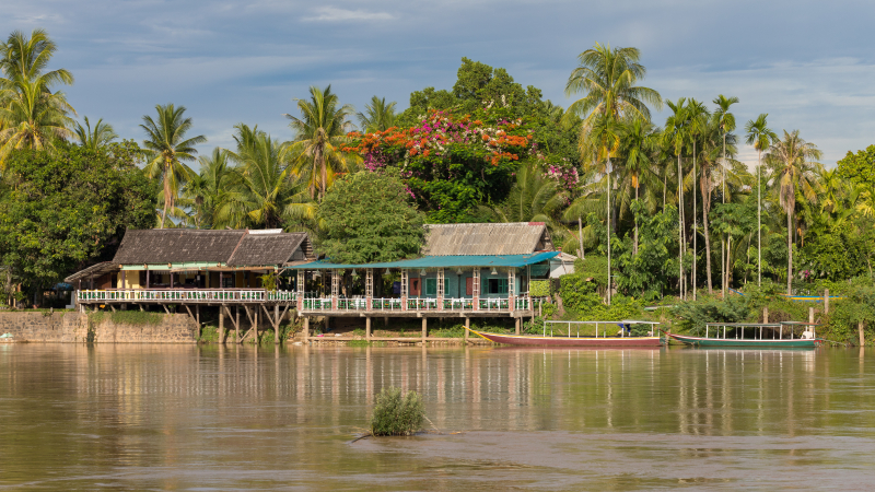
https://vi.m.wikipedia.org/wiki -
Nam Theun river is a river in Laos that flows through the provinces of Khammouane and Bolikhamsai. It has a total length of 138 km (86 mi) [a] and drains an area of 2,800 km2 with its tributaries Nam One, Nam Noy, and Nam Theun (1,100 sq mi).
Nam Theun River also refers to three dam alternatives on the same river: Nam Theun 1, Nam Theun 1-2, and Nam Theun 2. Nam Theun 2, the most cost-effective of the three choices, is now operational. A 62,000-hectare national park, part of the river corridor, is one of Laos' protected places. The Nakai-Nam Theun Biodiversity Conservation Area (NBCA), located upstream of South Theun, is one of Southeast Asia's most pristine areas.
The Truong Son mountain range and the Nakai Plateau are part of the Nakai-Nam Theun region, which spans 3,445 kilometers in Khammouan and Bolikhamxai provinces. This location is close to Vietnam's Vu Quang National Park. The management headquarters are situated in Muang Nakai's capital city. In the South Kading National Reserve in Laos, a 62,000-hectare river corridor was built in 1993.
Length: 138 km
https://upload.wikimedia.org/ 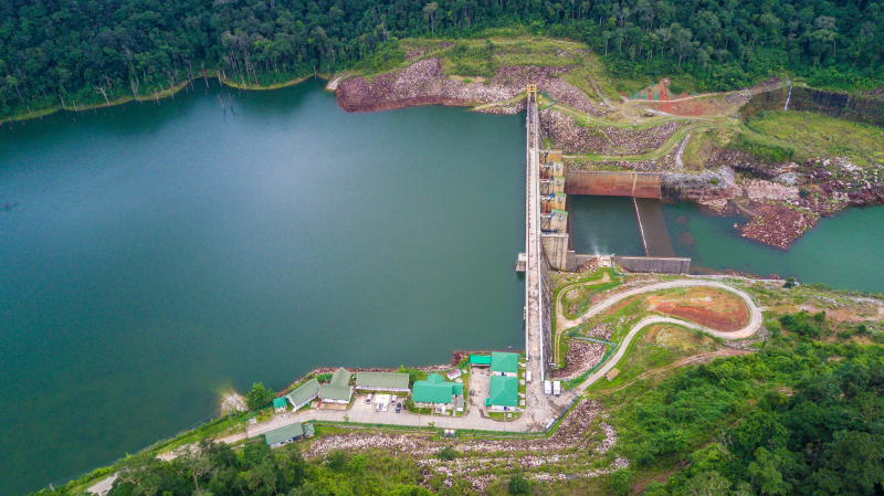
https://upload.wikimedia.org/ -
The Xe Bang Fai River is a hilly river with several peaks above 1,500 meters. Flat ground exists in the Mahaxay District of Khammoune province, where the Nam Gong/kathang, a 38.5-kilometer-long tributary, flows into Gnommalath District.
A potential agricultural land area of up to 70,000 hectares occurs downstream of the Sebangfay Bridge, with wetlands of roughly 125 km2 consisting of freshwater lakes, rivers, ponds, rice paddy, and some freshwater marshes. The steady year-round discharge of 13,623,552,000 m3 from Nam Theun powerhouse is expected to alter the river morphology of the Sebangfay from Mahaxay to the Mekong's confluence. The Nam Xebangfai (Xe Bang Fai River) is a river in Laos. Its source is the Annamite Range, located at 17°3′′′N 106°20′54′′E on the Laos-Vietnam border. It runs through the provinces of Khammouane and Savannakhet.
The Xe Bang Fai River Cave is located in Khammouane Province's Hin Namno National Park. It is thought to be one of the world's largest river caves, with tunnels measuring 120 meters tall and 200 meters wide and a seven-kilometer-long underground canal.
Length: 103.34km
https://en.wikipedia.org/ 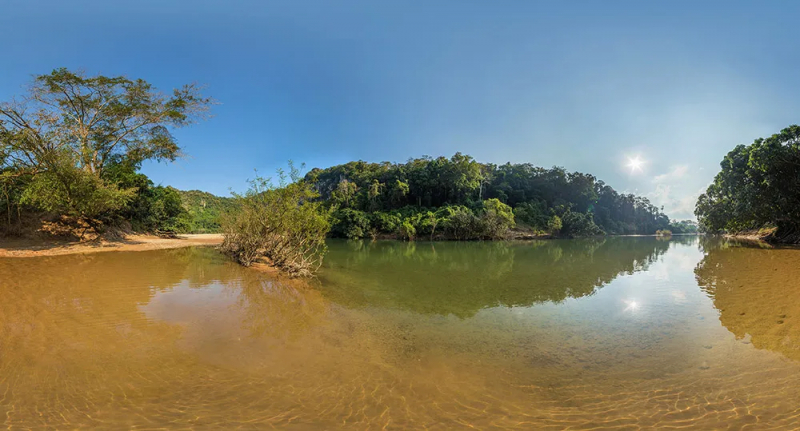
https://www.explorationjunkie.com/ -
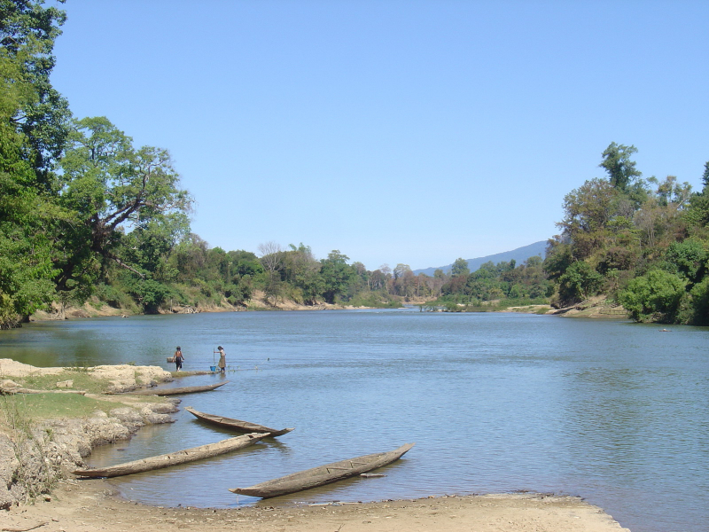
The Sekong River is a river in Southeast Asia. The river begins in Central Vietnam's Tha Thien–Hu Province and runs through southern Laos and eastern Cambodia for 480 kilometers (300 miles). It meets the Mekong River near the Cambodian town of Stung Treng. The international border between Laos and Cambodia is formed by a section of the river.
Sekong comes from the Truong Son mountainous region in Thua Thien Hue province, in the west of A Luoi district. Se Asap is the name of the first section, which is currently known in Vietnam as A Sap River. The Sekong River runs through the provinces of Sekong, Saravane, and Attapeu in Laos. Banbak, Lam Mam, and Attapeu are Laotian settlements on the Sekong.
The Sekong river takes water from a major tributary in Laos, the Se Kaman (or Xe Kaman). The Dak P'Lo stream in Dak P'Lo commune, Dak Glei district, Kon Tum province, Vietnam, is the source of Se Kaman. On Se Kaman, the Lao government has constructed a variety of hydropower and irrigation projects. The Xekaman 3 Hydropower Plant, for example, has been operational since 2013. It is the longest Rivers in Laos.
Length: 480 km
https://ethancrowley.files.wordpress.com/ 
https://upload.wikimedia.org/


